
Ultimate Drone Guide to FAA Authorizations/Waivers. Drones have become an increasingly popular tool for various industries, but navigating the regulations and authorizations set by the FAA can be complex. This article provides an in-depth guide to FAA authorizations and waivers for drone operations. From Part 107 waivers to UAS facility maps and advanced operations, we will cover everything you need to know to operate drones within the legal framework. Let’s dive in!
Key Takeaways
- Understanding the process of obtaining a Part 107 waiver is essential for advanced drone operations.
- UAS facility maps are valuable for identifying airspace restrictions and planning drone flights.
- Public safety and government entities have specific regulations and requirements for drone operations.
- Educational users can benefit from the UAS Collegiate Training Initiative and other educational resources provided by the FAA.
- Advanced operations, such as package delivery and emergencies, require thorough certification and compliance with FAA regulations.
FAA Authorizations and Waivers

Overview of Part 107 Waiver
After obtaining my Part 107 waiver, I’ve learned that it’s crucial to understand the responsibilities it entails. The Responsible Person is the linchpin of safe drone operations under the waiver. They must ensure that the remote Pilot in Command (PIC), manipulators of the controls, and Visual Observers (VOs) are informed about the waiver’s terms and strictly adhere to them. This includes being well-versed in Part 107 regulations.
Before any drone flight, the Responsible Person must file a Notice to Airmen (NOTAM) within a specific timeframe. Here’s a quick rundown of the steps:
- Inform and ensure the team understands waiver terms.
- Document evidence of compliance.
- File a NOTAM between 24 and 72 hours before the operation.
It’s imperative to document all compliance efforts and be ready to present them if requested by the FAA or an authorized representative. This proactive approach not only ensures legality but also enhances safety.
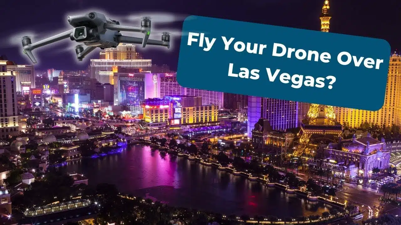
As someone who’s gone through the process, I can attest to the importance of these protocols. They are not just bureaucratic hurdles but measures that protect the operator and the public. For instance, aerial photography in Las Vegas requires diligence to capture the city’s grandeur without compromising safety or legality.
UAS Facility Maps
Navigating the skies with a drone in urban environments can be tricky, especially when understanding the various flight modes. Operating drones in urban areas requires understanding flight modes. ATTI mode is beneficial in cities, as it allows for manual control and helps prevent crashes when GPS signals are unreliable or interrupted.
UAS Facility Maps are a critical tool for drone pilots, providing essential information on airspace restrictions and requirements. These maps indicate areas where drone flight is controlled, and FAA authorizations are necessary. For instance, areas near airports are often marked with specific altitude limits. Here’s a simple breakdown of what you might find on a UAS Facility Map:
- Maximum altitude allowed for drone flight
- Boundaries of controlled airspace
- Locations requiring special FAA authorization
Understanding these maps is crucial for hobbyists and commercial operators to ensure safe and legal drone operations.
It’s important to remember that while UAS Facility Maps provide valuable guidance, they are not the sole resource for airspace information. Always cross-reference with other tools and resources to maintain situational awareness and comply with all regulations.
Public Safety and Government
As a drone enthusiast and researcher, I’ve come to understand the critical importance of drones in public safety and government operations. Drones are transforming how emergency services and government agencies respond to incidents, offering rapid aerial surveillance and situational awareness that can be crucial in life-threatening situations.
For instance, drones are used extensively for search and rescue missions, where time is of the essence. They provide a bird’s-eye view that can help locate missing persons or survey disaster areas without risking further loss of life. Additionally, drones play a significant role in law enforcement, aiding crowd monitoring and crime scene analysis.
It’s essential to recognize the balance between the benefits of drone technology and the need to respect privacy laws. Drones and privacy laws are a growing concern. Commercial and personal drone use raises privacy issues, and regulations are evolving to address these challenges.
The FAA has established specific guidelines for public safety and government drone operations, which include:
- The ability to operate in restricted airspace with proper authorization
- Special provisions for emergencies
- Requirements for certification and training
Understanding these regulations is crucial for any entity that leverages drones for public service. The FAA’s commitment to integrating drones safely into the national airspace system while respecting privacy concerns is evident in its ongoing policy development and enforcement efforts.
Educational Users
As an avid drone enthusiast and educator, I’ve found that the FAA provides specific pathways for educational users to integrate drones into their curriculum. Academic institutions can apply for authorizations and waivers that allow them to conduct operations that would otherwise require a Part 107 certificate.
Educational users encompass a wide range of entities, from primary schools to universities. These institutions often engage in research, hands-on training, and community outreach activities. To support these efforts, the FAA has established the UAS Collegiate Training Initiative, which outlines the requirements and resources available to educational users.
The key to successfully integrating drones into educational programs is understanding the regulatory framework and leveraging the available resources to ensure compliance and safety.
Here’s a quick overview of the process for educational users seeking FAA authorizations:
- Determine the type of operation and if it falls under the scope of educational use.
- Review the UAS Facility Maps to identify any airspace restrictions.
- Submit a Certificate of Waiver or Authorization (COA) application through the FAADroneZone portal.
- Await approval from the FAA, which may require additional documentation or clarification.
Remember, while the process may seem daunting, the FAA is committed to supporting educational initiatives that promote the safe integration of drones into the national airspace.
Advanced Operations
When we engage in advanced drone operations, precision and expertise are paramount. Safety is the cornerstone of these operations, often involving complex maneuvers or challenging environments. To ensure safety and compliance, I always follow drone safety tips, such as communicating with people and respecting private property.
Advanced operations may require special authorizations or waivers from the FAA, especially when they involve:
- Flights in controlled airspace
- Operations near airports
- Night flights
- Flights over people
Understanding the specific requirements and processes for obtaining these authorizations is crucial. For instance, the LAANC (UAS Data Exchange) provides a streamlined application process for airspace authorizations. At the same time, the UAS BEYOND program explores the expansion of drone operations beyond the visual line of sight (BVLOS).
In the context of advanced drone operations, continuous learning and staying updated with the latest FAA regulations and technological advancements is not just recommended, it’s essential.
Advanced drone operations are paving the way for innovative applications for commercial, environmental, or public safety purposes. They’re transforming industries and enhancing capabilities in ways that were once unimaginable.
Conclusion
In conclusion, the Ultimate Drone Guide to FAA Authorizations and Waivers provides a comprehensive overview of the regulations, processes, and considerations for drone pilots seeking FAA authorizations and waivers. From Part 107 waivers to UAS facility maps and airspace authorizations, this guide covers a range of essential topics for drone operators. This guide offers valuable insights and resources for public safety, government, or advanced drone operations. With a focus on legal compliance, safety, and best practices, drone pilots can confidently navigate the complex landscape of FAA authorizations and waivers. This guide is invaluable for novice and experienced drone pilots, equipping them with the knowledge and tools to operate drones responsibly and legally within the FAA’s regulatory framework.
Frequently Asked Questions
What is a Part 107 Waiver?
Part 107 Waiver allows drone operators to deviate from certain operational rules under Part 107 for specific purposes.
How can I obtain UAS Facility Maps?
UAS Facility Maps can be obtained through the FAA’s UAS Data Exchange website or other authorized sources.
What are the requirements for Public Safety and Government drone operations?
Public Safety and Government drone operations must adhere to specific regulations and may require additional authorizations or waivers.
How can Educational Users utilize drones?
Educational Users can utilize drones for educational and research purposes, provided they follow the applicable regulations and guidelines.
What are considered Advanced Operations for drones?
Advanced drone Operations include package delivery, emergency response, and other complex operations requiring special authorizations or waivers.
How do I apply for Part 107 Airspace Authorizations?
Part 107 Airspace Authorizations can be applied through the FAA’s online portal. The process involves specifying the desired airspace and operational details.


Comments are closed.