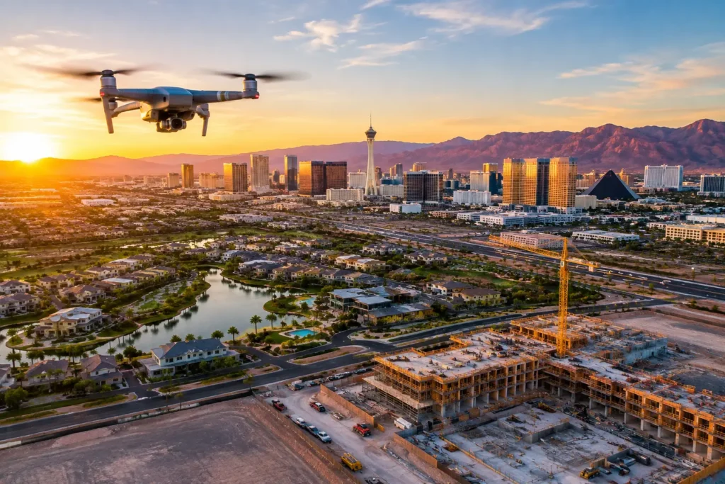
Drone Construction Progress Monitoring in Las Vegas: The Ultimate Guide
Drones are revolutionizing construction project management in Las Vegas. From the bustling Strip to expanding residential developments, high-resolution aerial data helps contractors, project managers, and investors keep projects on schedule and under budget.
This guide breaks down how drone construction progress monitoring in Las Vegas boosts efficiency, improves site safety, and delivers actionable aerial insights.
Key Takeaways
-
Real-Time Site Tracking: High-resolution drone photos, videos, and orthomosaic mapping make visual progress tracking effortless.
-
Enhanced Team Communication: Precise visual data aligns contractors, project managers, and stakeholders.
-
AI & Next-Gen Capabilities: Integration with AI and machine learning automates progress reporting and hazard detection.
-
Jobsite Safety & Compliance: Aerial inspections reduce the need for hazardous site walk-throughs and ensure regulatory compliance.
-
Selecting Las Vegas Drone Providers: Partnering with licensed, FAA-certified local experts guarantees high-quality, fully insured deliverables.
The Role of Drones in Modern Construction Projects
1. High-Resolution Imagery and Real-Time Data
Commercial drones provide construction teams with up-to-date aerial imagery and real-time data feeds. This allows managers to monitor daily on-site activity, verify contractor work, and make fast, informed decisions.
2. Precise 3D Modeling and Photogrammetry
Using photogrammetry software, aerial datasets are transformed into interactive 3D mesh models and point clouds. These models aid in volumetric measurements (cut/fill analysis), site visualization, and keeping remote stakeholders informed.
3. Comprehensive Site Surveys and Mapping
Drones survey vast construction sites in a fraction of the time it takes traditional ground crews. Accurate aerial orthomosaic maps help teams identify potential site issues early, preventing costly rework down the line.
Key Benefits of Aerial Progress Monitoring
Boosting Project Efficiency
Eliminate lengthy site walks and manual status reports. Drones capture extensive job-site data rapidly, delivering accurate visual proof of progress directly to your project management dashboard.
Streamlining Stakeholder Communication
Avoid miscommunication between on-site contractors and off-site executives. Clear aerial visuals keep investors, developers, and prime contractors aligned on major milestones.
Improving Site Safety and Risk Mitigation
Inspecting elevated structures, deep excavations, or hazardous site conditions on foot carries inherent risks. Flying a drone remotely enables safe inspections while maintaining full regulatory oversight.
Las Vegas Case Studies: Drones in Action
-
Allegiant Stadium (Raiders Stadium): Drone mapping and periodic flyovers were instrumental in tracking structural steel progress, ensuring spatial accuracy, and maintaining rigorous safety standards.
-
T-Mobile Arena: Aerial imaging provided key stakeholders with clear milestone updates throughout every phase of vertical construction.
-
Circa Resort & Casino: Utilizing recurring drone flights enabled project leaders to coordinate tightly packed downtown logistics while sharing real-time progress visuals with prospective clients.
Future Trends in Construction Drone Technology
-
AI-Powered Analytics: Machine learning algorithms will automatically cross-reference drone point clouds with BIM (Building Information Modeling) files to detect design deviations.
-
Autonomous Drone Docks: “Drone-in-a-box” technology will enable scheduled, fully automated flight paths across job sites with zero human intervention.
-
Integrated IoT Sensors: Combining aerial views with site-wide IoT environmental sensors will streamline sustainability tracking and environmental compliance.
Regulatory and Safety Requirements
FAA Part 107 Compliance
Commercial drone pilots in Las Vegas must hold an active FAA Part 107 Remote Pilot Certificate. Flights near controlled airspace (such as Harry Reid International Airport or Nellis Air Force Base) require proper LAANC airspace authorizations.
Commercial Insurance Coverage
Reputable drone vendors carry Aviation Commercial General Liability policies (typically $1M to $5M) to cover potential liabilities, protecting both property owners and general contractors.
How to Get Started with Drone Monitoring
-
Project Scope & Consultation: Define key deliverables—whether you need simple progress photos, weekly video recaps, 2D orthomosaics, or 3D point clouds.
-
Select Certified Pilots: Hire experienced, FAA-certified local drone services that understand Las Vegas airspace restrictions.
-
Establish Flight Schedules: Set biweekly or monthly flight schedules to maintain consistent, comparable progress tracking.
Implementation Checklist
| Step | Core Action | Key Deliverable |
|---|---|---|
| 1. Planning | Identify project goals & airspace constraints | Pre-flight authorization plan |
| 2. Selection | Choose high-resolution RTK/PPK drone hardware | Sub-centimeter spatial accuracy |
| 3. Operations | Hire licensed, FAA Part 107 commercial pilots | Raw image & telemetry data capture |
| 4. Analysis | Process outputs into 2D maps / 3D models | Actionable progress report for stakeholders |
Frequently Asked Questions
What deliverables can construction drones capture?
Drones gather high-resolution photos, 4K video recaps, 2D orthomosaic maps, contour maps, thermal imaging, and 3D point cloud models for BIM integration.
How do drones improve team communication?
They offer an objective, single source of truth. High-definition aerial imagery can be shared digitally in real time, keeping remote investors and site managers on the same page.
Do I need airspace permission to fly a drone on a Las Vegas jobsite?
Yes. Much of the Las Vegas Valley falls within controlled airspace around Harry Reid International Airport, Henderson Executive Airport, or Nellis AFB. All commercial flights must obtain proper FAA LAANC authorization prior to flight.
Optimize Your Las Vegas Construction Site Today
Implementing aerial progress monitoring gives your project the competitive edge it needs. Partner with certified Las Vegas drone experts to enhance safety, reduce overhead costs, and keep your site running smoothly.