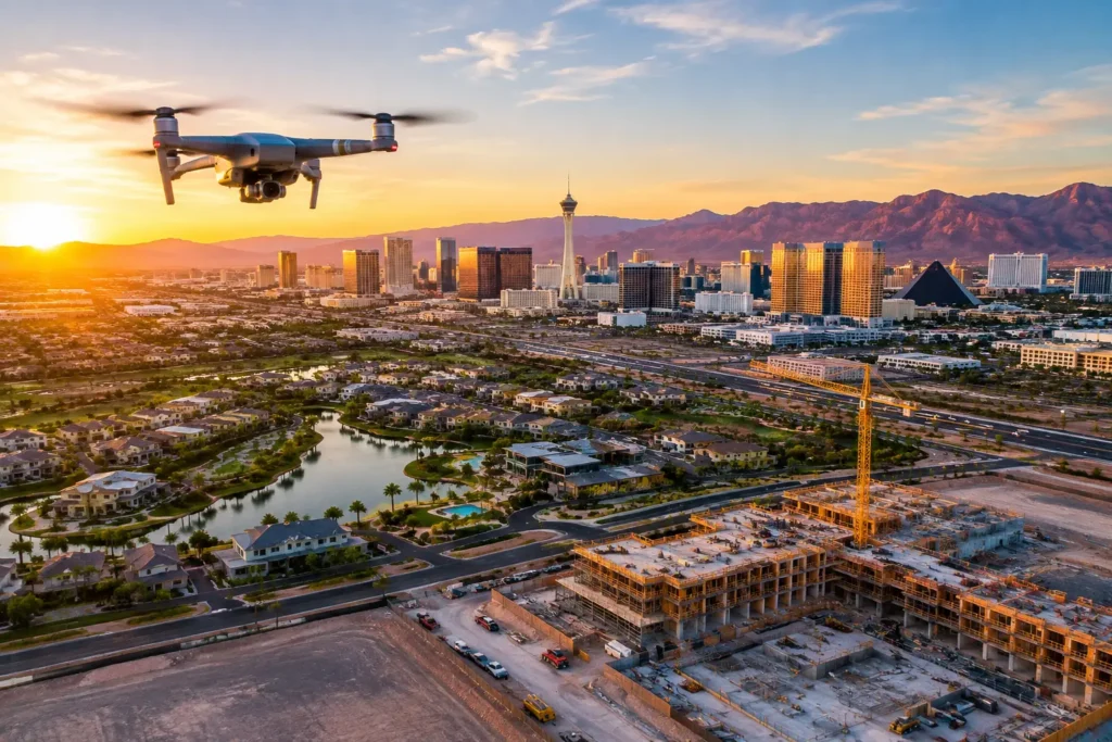
A construction site can change dramatically in 30 days. Steel rises, utilities disappear below grade, exterior finishes transform a structure, and access routes shift without warning. If those changes are captured only through scattered phone photos, teams lose the broad perspective needed to communicate clearly with owners, investors, lenders, and subcontractors.
Knowing how to document construction progress by drone turns aerial imagery into a practical record of the work. The objective is not simply to collect impressive flyover footage. It is to create a consistent, date-stamped visual archive that shows what was built, where the project stands, and what stakeholders need to see next.
Start With the Decisions Your Documentation Must Support
Before scheduling a flight, establish who will use the imagery and what they need from it. A developer may need to provide monthly progress updates to investors. A project manager may need a clear site overview for coordination meetings. A leasing team may want polished visuals as a commercial project approaches completion. These are related goals, but they do not require the same deliverables.
For many Las Vegas projects, construction drone documentation serves several purposes at once: progress verification, stakeholder reporting, marketing preparation, and a long-term visual record. Defining the priority at the start prevents a common problem: receiving attractive aerial footage that does not show the areas that matter most.
A useful project brief identifies the construction phase, the buildings or work zones to prioritize, the intended audience, and the reporting cadence. It should also call out any areas that are difficult or unsafe to photograph from the ground, such as roofing, grading, elevated structural work, large parcels, or perimeter improvements.
Build a Repeatable Flight Plan
Consistency is what makes drone progress documentation valuable over time. A single aerial shoot can establish context. Repeated flights from comparable positions reveal measurable change.
The pilot should establish a repeatable flight plan during the first visit. That typically includes the same key viewpoints, similar camera angles, planned altitudes, and defined paths around the site. A wide establishing shot may show the project within its surrounding roads, neighboring developments, and amenities. Lower oblique images can document building elevations, laydown yards, access points, and active work areas. Straight-down imagery can be especially useful for tracking site grading, foundations, roof progress, parking layouts, and utility corridors.
Exact replication is not always possible. Cranes, temporary fencing, weather, construction activity, and changing site access can alter a flight path. The goal is not to force the drone into an unsafe route. It is to maintain sufficient visual consistency so stakeholders can compare each reporting period with confidence.
Capture the Right Mix of Still Photography and Video
High-resolution still photos are usually the backbone of construction documentation. They are easy to review in a report, share in a project update, compare side-by-side, and archive by date. Still images also give teams time to inspect details that may be missed in motion.
Video adds value when the project needs a broader context or a more persuasive stakeholder presentation. A concise aerial video can show site scale, circulation, proximity to major roads, and the visible relationship between construction phases. It is particularly effective for investor presentations, development announcements, and leasing or sales materials as the property begins to take shape.
The best approach is often both: a disciplined set of repeatable stills for the project record, plus selective video captures for high-impact updates. Not every monthly visit needs a cinematic edit. The right mix depends on the project stage and who needs the information.
Set a Documentation Schedule That Matches the Build
Monthly flights work well for many commercial and residential developments because they create a readable timeline without producing unnecessary volume. Faster-moving phases may justify biweekly documentation, particularly during site preparation, concrete work, structural erection, exterior enclosure, or major infrastructure installation.
A milestone-based schedule can be more useful than a calendar-only schedule. Consider documenting the site before mobilization, after grading, at foundation completion, during framing or steel erection, after roofing, at exterior completion, and before final turnover. These milestones create a compelling record for owners while preserving evidence of progress that may be valuable long after the project is complete.
Weather and lighting also matter in Las Vegas. Clear skies are common, but harsh midday sun can create deep shadows that obscure work areas. Early morning or late-afternoon flights often provide more dimension across a site. Still, consistency can matter more than perfect light for pure documentation. If the purpose is comparison, using a similar time of day across visits can make changes easier to evaluate.
Make Compliance Part of the Workflow, Not an Afterthought
Construction teams have enough operational risk without adding unplanned drone activity to the site. Commercial construction drone flights must be performed by an FAA-certified pilot, and the operator must plan for airspace, temporary flight restrictions, local conditions, site safety, and active crews below.
This is especially significant in Las Vegas, where projects may fall within controlled or sensitive airspace associated with Harry Reid International Airport, Nellis Air Force Base, or other aviation activity. A flight that appears simple from the ground may require airspace authorization, altitude limitations, or additional coordination before launch.
Professional operators also carry appropriate insurance and conduct site-specific risk assessments. That includes determining safe launch and landing areas, maintaining a clear operational perimeter, avoiding interference with cranes and equipment, and coordinating with the site superintendent. The safest flight is not always the closest flight. A skilled pilot can often capture the needed perspective while maintaining appropriate separation from people, machinery, and active work zones.
Organize Every Deliverable for Fast Review
Aerial images lose value when they arrive as an unorganized batch of files. Construction documentation should be delivered in a structure that makes each flight easy to locate and compare.
Use a consistent naming convention that includes the project name, capture date, and image sequence or viewpoint. Organizing deliverables by date makes it easier to find the correct reporting period months later. A curated set of labeled images is often more useful to an owner or lender than hundreds of unfiltered files.
For larger projects, consider creating a recurring visual report that pairs a site overview with key observations from each flight. The drone pilot should not replace the superintendent or provide technical construction conclusions outside their role. However, clearly labeled imagery can help the project team highlight completed areas, upcoming work, changes in access, and portions of the site that warrant closer review.
If the documentation will support marketing later, request a separate set of polished hero images. Progress photos need to be factual and consistent. Marketing images can be more selective, using the best light, angles, and framing to present the development at its strongest.
Avoid the Common Mistakes That Weaken the Record
The biggest mistake is treating every flight as a one-off photo session. Without planned viewpoints and a reliable schedule, images become difficult to compare. The site may be well photographed, yet the progression of the build remains unclear.
Another mistake is relying on a hobbyist or internal team member without commercial flight experience. Operating near active construction, controlled airspace, or high-value commercial property requires more than owning a drone. The costs of delays, missing documentation, insurance gaps, or noncompliant flight activity can quickly outweigh the apparent savings.
Teams should also avoid asking for too much from one flight. A 100-acre site, a tight urban infill project, and a multi-building development each require different coverage. The right flight plan balances comprehensive documentation with practical review time. More images do not automatically create more clarity.
When to Bring in a Professional Drone Partner
Outsourcing makes particular sense when a project needs recurring coverage, polished investor-facing media, an operation near regulated airspace, or a dependable archive without adding equipment and training responsibilities to the internal team. A professional provider manages pre-flight planning, FAA requirements, insurance documentation, site coordination, image capture, and post-production.
Sky View LV provides this level of construction-site aerial imaging with FAA-certified drone pilots, insurance coverage tailored to commercial requirements, and experience operating in the complex Las Vegas airspace. The result is not just a better view of the jobsite. It is a dependable visual asset that supports the people responsible for funding, building, selling, and managing the property.
A well-timed drone flight can answer a question before it becomes a meeting, give an investor confidence before the next site visit, and preserve a project story that ground-level photos cannot fully tell. Start with a clear flight plan, keep the coverage consistent, and let each new capture make the progress visible.