Las Vegas Drone Photography Services
High-Impact Las Vegas Drone Photography Services
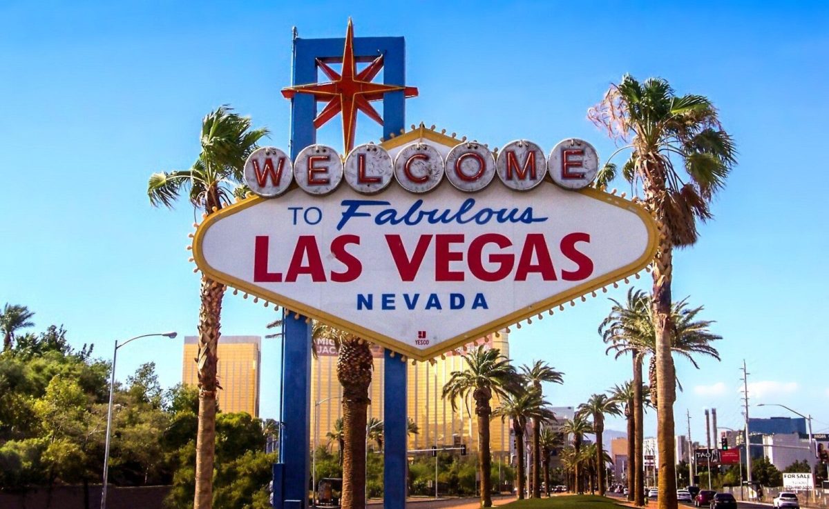
Las Vegas isn’t just about bright lights and iconic casinos—it’s a vibrant hotspot for professional drone photography. With a unique mix of high-rise urban landscapes and striking desert topography, capturing aerial views in Southern Nevada offers a dramatic visual edge.
Whether you need aerial media for commercial real estate, construction monitoring, or film production, hiring a top-tier Las Vegas drone photography service adds a compelling, high-definition dimension to your visual marketing.
Key Takeaways
-
Versatile Landscapes: Las Vegas offers a dynamic backdrop, combining the iconic Strip skyline with rugged desert scenery such as Red Rock Canyon.
-
Cross-Industry Utility: Drone services deliver measurable ROI across real estate, construction, site inspections, and live-event media.
-
FAA Compliance: Hiring a licensed FAA Part 107 drone pilot ensures airspace clearance, legal compliance, and safe operations in busy airspace.
-
End-to-End Production: Top drone companies offer comprehensive packages that include 4K/8K RAW capture, HDR processing, and advanced video editing.
Why Las Vegas Is Unique for Aerial Photography
Las Vegas offers a rare blend of dense urban architecture and expansive natural scenery, making it ideal for visual storytelling.
                  ┌─────────────────────────────────────────┐
                  │   Las Vegas Aerial Media Advantages     │
                  └────────────────────┬────────────────────┘
                                       │
         ┌─────────────────────────────┼─────────────────────────────┐
         ▼                             ▼                             ▼
┌─────────────────┐           ┌──────────────────┐          ┌─────────────────┐
│ Dynamic Contrast│           │ Predictable Sun  │          │ High Production │
│ Urban Strip vs. │           │  300+ sunny days │          │ Visual value for│
│ Desert Horizons │           │ for optimal light│          │ marketing media │
└─────────────────┘           └──────────────────┘          └─────────────────┘
-
Distinctive Environments: Capture sweeping contrast between ultra-modern architecture along the Strip and natural red-rock horizons.
-
Optimal Flying Weather: With over 300 sunny days per year, Las Vegas provides consistent lighting and dependable scheduling for aerial shoots.
-
Unmatched Visual Scale: High-altitude perspectives reveal property layouts, proximity to landmarks, and geographic advantages that ground photos fail to capture.
Primary Applications of Las Vegas Drone Services
┌──────────────────────────────────────────────────────────────────────────┐
│                   Core Industries Using Drone Services                   │
├──────────────────────┬─────────────────────┬─────────────────────────────┤
│   Real Estate        │    Construction     │     Media & Events          │
├──────────────────────┼─────────────────────┼─────────────────────────────┤
│ • Virtual 3D Tours   │ • Site Progress     │ • Cinematic Film & TV       │
│ • Lot Boundary Overlays│ • Thermal Inspections│ • Live Event Coverage       │
│ • Proximity Mapping  │ • Volumetric Data   │ • Commercial Ad Captures    │
└──────────────────────┴─────────────────────┴─────────────────────────────┘
1. Commercial & Residential Real Estate
Aerial drone photography has transformed real estate marketing. Drones allow listing agents to showcase entire property footprints, acreage, luxury amenities, and neighborly surroundings in a single frame.
2. Construction Monitoring & Site Surveys
Project managers rely on drones for regular progress tracking, pre-construction topographic mapping, high-risk roof inspections, and volumetric calculations without compromising worker safety.
3. Media, Film, and Live Events
From high-budget commercial shoots along Las Vegas Boulevard to outdoor festivals, drones deliver dynamic cinematic movement and dynamic angles impossible with traditional camera rigs or costly helicopter rentals.
How to Choose the Best Drone Photography Company in Las Vegas
Selecting the right drone operator requires vetting technical capabilities, licensing, and portfolio quality.
Critical Vetting Criteria
-
FAA Part 107 Certification: Never hire an uncertified operator. Remote pilots must hold a valid FAA certification to legally operate drones for commercial purposes in the U.S.
-
Comprehensive Insurance Coverage: Ensure the company carries commercial drone liability insurance (typically $1M to $5M depending on project requirements).
-
Tailored Portfolios: Review past work relevant to your specific industry—real estate photography requires different skill sets than mapping or rapid-action event filming.
-
Professional Post-Production Capabilities: Raw drone footage often requires specialized software processing (Adobe Premiere, Photoshop, Pix4D, or DaVinci Resolve) for color grading, orthomosaic stitching, and stabilization.
Key Questions to Ask Before Hiring
-
Are you cleared to fly in Class B or restricted airspace near Harry Reid International Airport?
-
What backup redundancies do you have for bad weather or equipment failures?
-
Does the package price include color correction, licensing rights, and revisions?
-
What is your standard turnaround time for raw footage vs. fully edited video reels?
Cutting-Edge Drone Equipment and Imaging Technology
To achieve crisp, cinema-grade results, professional drone pilots utilize state-of-the-art hardware and specialized post-processing software:
-
High-Resolution Hardware: Utilization of industry-standard drones (such as the DJI Mavic 3 Cine, Phantom 4 RTK, or Inspire series) capable of capturing 4K and 8K video, high-res stills, and utilizing omnidirectional obstacle avoidance.
-
Thermal & Mapping Sensors: Specialized payload options including thermal cameras for energy audits and roof inspections.
-
Advanced Post-Processing: Application of High Dynamic Range (HDR) exposure bracketing, panoramic stitching, 3D photogrammetry, and custom color grading to transform raw drone imagery into polished visuals.
Case Studies: Drone Photography in Action Across Las Vegas
High-End Luxury Real Estate
A prominent real estate agency used aerial drone video to launch a multi-million-dollar residential estate near the Strip. By capturing sunset views of the city skyline and detailed parcel outlines, the listing generated dynamic visual interest, resulting in a swift, high-value transaction.
Major Commercial Construction Monitoring
A regional developer overseeing a major casino-hotel expansion deployed scheduled bi-weekly drone sweeps. The high-resolution aerial orthomosaics provided project managers with real-time site updates, streamlined subcontractor workflows, and improved safety compliance.
Emerging Trends in Aerial Drone Services
-
Autonomous Flight & AI Integration: Automated waypoint mapping and AI-driven framing facilitate hyper-consistent progress tracking over months or years.
-
Expanded Demand Across Industries: Drones are increasingly deployed for solar panel array inspections, infrastructure safety audits, and dynamic LED drone light show visual productions.
-
Higher Bitrate & Resolution: Rapid adoption of 8K sensors and ProRes recording options enables seamless blending of drone footage into high-end film and TV workflows.
Work With Las Vegas’s Aerial Photography Experts
Ready to elevate your project visuals? Whether you need sharp imagery for real estate listings, regular construction progress updates, or captivating media content, professional drone services deliver unmatched quality and compliance.
Explore Sky View LV Drone Services or schedule a free project consultation today to bring your vision to life from above.
Frequently Asked Questions (FAQ)
What types of drone services are available in Las Vegas?
Professional drone companies offer aerial real estate photography, construction progress tracking, commercial video production, 3D photogrammetry mapping, thermal inspections, and event filming.
Why should I hire an FAA Part 107-certified drone pilot?
Federal law requires commercial drone operators to hold an FAA Part 107 license. Certified pilots understand airspace restrictions, hold required waivers for controlled zones (like the Strip), carry liability insurance, and guarantee safe operations.
How much do drone photography services cost in Las Vegas?
Pricing depends on project complexity, location/airspace authorization needs, flight duration, and post-production editing requirements. Packages range from single-location photo shoots to comprehensive multi-day video productions.
Are drones allowed to fly anywhere in Las Vegas?
No. Much of the airspace surrounding Las Vegas involves controlled airspace due to Harry Reid International Airport, Nellis Air Force Base, and Henderson Executive Airport. Certified drone pilots use LAANC (Low Altitude Authorization and Notification Capability) to acquire legal authorization before flying.
Popular Posts
August 20, 2026
August 19, 2026
August 18, 2026
August 17, 2026
August 16, 2026
August 15, 2026
Comments are closed.