The Importance of Photography in Construction-Aerial Photography
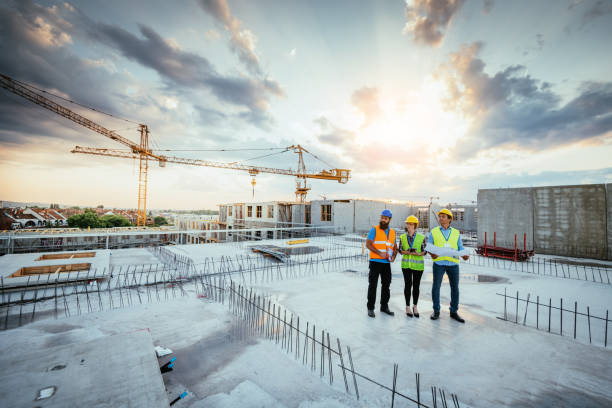
The Importance of Photography in Construction: Aerial Insights & Applications
In the modern construction sector, aerial photography has evolved from a visual novelty into a fundamental operational tool. By leveraging unmanned aerial vehicles (drones), construction firms can efficiently monitor job-site progress, ensure strict compliance with safety regulations, and create high-converting marketing assets.
Understanding the multifaceted role of aerial imagery helps project managers enhance operational efficiency, reduce overhead, and elevate client communications.
Key Benefits of Drones in Construction
-
Accurate Data & Site Planning: Drones capture high-resolution imagery essential for site measurements, spatial analysis, and initial planning.
-
Real-Time Site Oversight: Instant aerial data empowers project managers to make timely, informed decisions directly on-site.
-
Enhanced Safety Standards: Remote visual inspections detect potential hazards early without placing workers in hazardous environments.
-
Substantial Cost Savings: Drones dramatically decrease operational costs compared to traditional helicopter or manual inspection methods.
-
High-Impact Visual Marketing: Dynamic aerial views showcase the scope and quality of projects to capture stakeholder and prospective client attention.
Enhancing Construction Site Management & Operations
Aerial photography provides project managers with comprehensive oversight throughout a project’s lifecycle. High-resolution orthomosaic mapping and aerial data improve day-to-day operations across four core areas:
1. Progress Tracking & Documentation
Regular flight paths capture detailed snapshots at every milestone. This visual timeline enables project teams to evaluate actual progress against planned schedules, providing transparent proof of work for stakeholders.
2. Design & Site Analysis
Bird’s-eye views assist civil engineers and architects in evaluating site topography, design feasibility, and surrounding infrastructure before heavy equipment arrives on-site.
3. As-Built vs. As-Designed Verification
By overlaying aerial photos onto initial BIM (Building Information Modeling) schematics, engineers can rapidly spot structural discrepancies early, preventing costly mid-build rework.
4. Hazard Identification & Quality Control
High-angle cameras inspect hard-to-reach locations—such as roofs, cranes, and high-rise structures—to verify building code compliance and structural integrity.
Cost-Effectiveness: Drones vs. Traditional Methods
Adopting drone technology significantly cuts site management overhead while expediting data collection schedules.
Why Drone Photography Saves Money:
-
Lower Labor & Equipment Costs: Eliminates the need to rent heavy equipment, scaffolding, or manned aircraft.
-
Minimizing Site Downtime: Rapid aerial sweeps cover hundreds of acres in minutes, keeping ground teams focused without interrupting active site work.
-
Safely Accessing Hazardous Areas: Inspecting steep inclines or elevated frameworks remotely eliminates the dangers and setup time associated with ladders and harnesses.
-
Preventing Schedule Delays: Early hazard and error detection ensures minor misalignments don’t escalate into multi-week project delays.
Cost & Efficiency Comparison
| Metric / Aspect | Drone Inspections | Helicopter Surveys | Traditional Ground Methods |
| Average Cost per Site | ~$500 | ~$2,500 | ~$1,000 |
| Data Capture Time | ~1 Hour | ~3 Hours | ~2 Hours |
| Site Accessibility | High (Unlimited Reach) | Medium | Low |
| Safety Risk Level | Low | Low | High |
Driving Sales & Client Engagement Through Visual Content
Aerial photography serves as an exceptional business development asset. High-impact visuals help construction brands differentiate their services in competitive markets:
-
High-Impact Marketing Assets: Showcase the grand scope, scale, and craftsmanship of completed builds for websites, pitch decks, and social media.
-
Stakeholder Transparency: Build trust with remote investors and developers by sending routine, high-resolution progress updates directly to their inboxes.
-
Winning Bid Proposals: Elevate competitive proposals by integrating 3D models and context-rich aerial site surveys that demonstrate a proactive approach.
Elevating On-Site Safety and Regulatory Compliance
Worker safety remains a top priority across the construction industry. Drones significantly reduce human exposure to dangerous environments.
Safety Advantages:
-
Identifying unmapped hazards, unstable footing, or structural risks from a safe distance.
-
Conducting roof and high-rise structural assessments without scaffolding.
-
Streamlining OSHA (Occupational Safety and Health Administration) audit compliance by timestamping and archiving site documentation.
Conclusion
Aerial photography is a high-return investment for modern construction firms. By combining rapid data collection, reduced inspection costs, improved hazard detection, and high-quality marketing collateral, drone technology streamlines the full building lifecycle. As the construction industry continues to embrace digital transformation, aerial imagery will remain a cornerstone of site safety, operational efficiency, and revenue growth.
Frequently Asked Questions (FAQ)
What is aerial photography in construction?
Aerial photography in construction uses specialized drones to capture high-resolution imagery, 3D mapping data, and video footage of building sites from above.
How does aerial drone data improve job site management?
It delivers immediate visual context, accurate measurements, and spatial data that help project managers track progress, manage site logistics, and address delays early.
Are drones more cost-effective than helicopter photography?
Yes. Drone surveys typically cost a fraction of traditional helicopter rentals (~$500 vs. ~$2,500), take significantly less setup time, and offer closer, more detailed imaging angles.
How do drones enhance worker safety on construction sites?
Drones conduct remote visual inspections of hazardous, elevated, or hard-to-reach areas, keeping workers on the ground safe and off dangerous ladders or staging.
How can construction companies use aerial photography for marketing?
Firms use high-definition aerial footage in project proposals, social media campaigns, pitch decks, and website portfolios to highlight modern capabilities and project scope to prospective clients.
Popular Posts

September 04, 2026
September 04, 2026
September 03, 2026

September 02, 2026
September 01, 2026

August 31, 2026
Comments are closed.