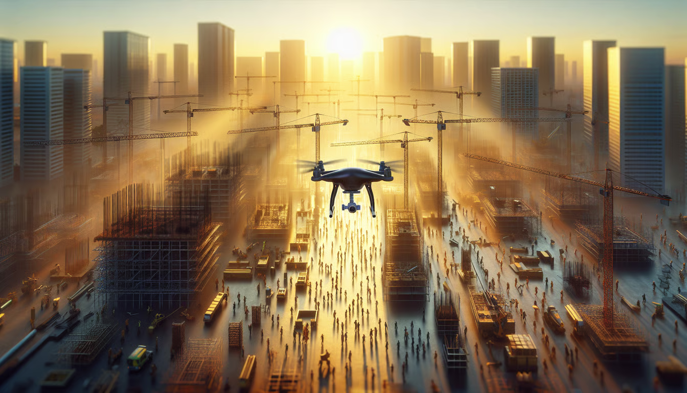
Top Professional Aerial Photography Services
Top Professional Aerial Photography Services. Due to their growing popularity, top professional photography services are increasingly utilized in industries such as estate and inspection services. These services use drones to capture images and videos that offer perspectives not possible with traditional photography. This article will explore the benefits and practical applications of aerial photography services today, highlighting their advantages.
1. Drone Photography Services
Drone photography enables professionals to capture stunning aerial photos, offering beautiful, unique perspectives of landscapes or properties. Here’s what you can expect from professional drone photography services:
- High-Resolution Images: Get clear, detailed photos for marketing or personal keepsakes.
- Versatile Angles: Drones can fly at various heights and angles, enabling creative shots that traditional photography cannot achieve.
- Quick Turnaround: Many services offer fast editing and delivery to prepare your images quickly.
Drone photography serves two primary purposes: it enhances your marketing performance and provides new insights for your projects.
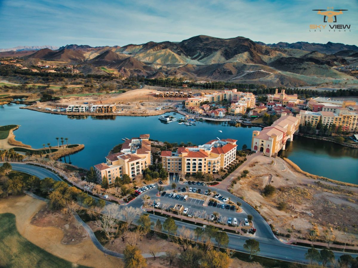
Drone Photography Services in Las Vegas
Professional service hire ensures you receive optimal results when you need images for real estate marketing, event photography, or inspection purposes. Through droners.io, you can connect with drone pilots licensed for aerial photography and videography. Thousands of clients have achieved success with their services, which deliver rapid results for their vision.
2. Drone Cinematography Services

Drone cinematography is revolutionizing video production, driving significant change. Modern filmmakers now have access to advanced technology that enables them to capture breathtaking aerial footage previously unattainable. The service delivers exceptional results for commercial, film, and event productions.
Key Features of Drone Cinematography:
- High-Quality Footage: Our drone services utilize top-notch cameras to deliver cinematic-quality footage.
- Unique Perspectives: Drones can fly in ways traditional cameras cannot, offering fresh angles.
- Versatile Applications: Ideal for real estate, weddings, and promotional videos.
Benefits of Using Drone Cinematography:
- Cost-Effective: Reduces reliance on expensive equipment, such as cranes or helicopters.
- Quick Setup: Drones can be deployed rapidly, saving time on shoots.
- Creative Freedom: Filmmakers can experiment with different shots and movements.
Drone cinematography opens up a world of possibilities, allowing creators to tell their stories in exciting new ways.
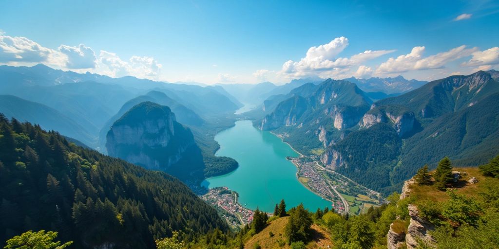
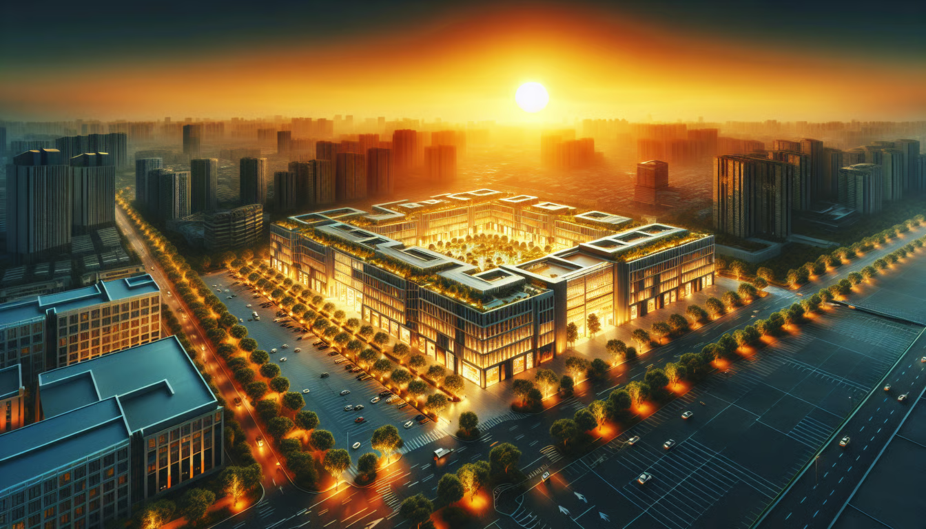
3. Residential Real Estate Photography
The use of aerial photography transforms the way homes are presented to potential buyers. Using drones lets you capture breathtaking photographs that highlight your property’s finest features. The visual quality of aerial images makes properties more attractive to buyers while giving real estate agents a competitive advantage in their market.
Benefits of Aerial Photography for Real Estate
- Unique Perspectives: Drones can capture photos from angles that traditional photography cannot.
- Showcase Surroundings: Aerial shots can display nearby parks, schools, and amenities, giving buyers a sense of the neighborhood.
- Faster Sales: Properties with high-quality aerial images tend to sell more quickly because they capture potential buyers’ attention online.
- Aerial photography adds depth to listings while creating emotional connections with potential buyers through visual storytelling.
Your marketing efforts will see substantial improvement in attracting serious buyers by implementing aerial photography. Take advantage of this opportunity to improve the quality of your real estate listings.
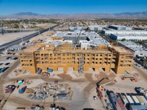
4. Commercial Property Photography
The presentation of commercial properties is revolutionized by photography, as high-quality drone images offer perspectives that traditional photography cannot match, thereby attracting more potential clients and investors.
- Advantages of Using Aerial Photography for Business Properties
- Visibility: Aerial photographs provide a distinct perspective that highlights the property’s setting and environment.
- Display Prominent Attributes: Present the property’s design, including parking areas, entrances, and nearby amenities.
- Capturing Interest: Eye-catching imagery can draw attention to your listings in a market.
Key Factors to Think About When Taking Photos of Commercial Real Estate
- Before you start your photography session, remember these key points: When selecting a drone, choose one with a high-definition camera that supports high-resolution output.
- Plan the drone route in detail to ensure complete coverage of the property.
- All drone operations must comply with applicable local regulations.
- The combination of excellent aerial photographs and your marketing materials enables potential property buyers to see the property’s full extent.
- Adding high-quality aerial photographs to your property listings has a lasting positive impact on potential clients, who will view your investment more favorably.
Enhancing your property listings with high-quality aerial photography can leave a lasting impact on potential clients and elevate the overall appeal of your investment.
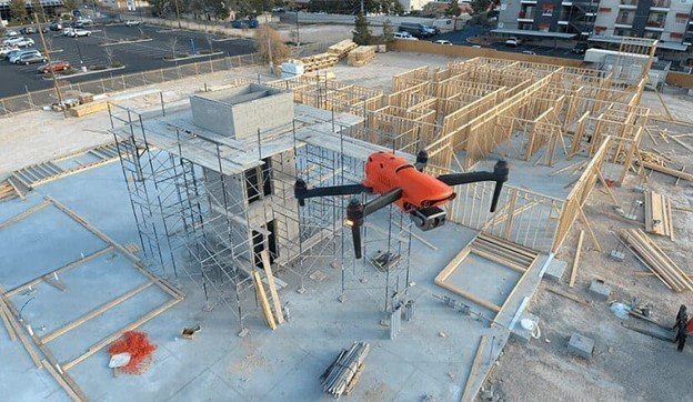
5. Drone Inspection Services
Drone inspection services have become vital to numerous industries worldwide. Drones provide a quick, precise way to inspect areas that manual inspection cannot reach.
Benefits of Drone Inspections
- The primary benefit of drones is safe access to locations, which protects workers from hazardous conditions.
- Drone operations reduce both costs and inspection duration compared with traditional methods.
- High-Quality Data: Drones capture detailed images and videos, providing valuable insights.
Common Applications
- Roof Inspections: Drones can quickly survey roofs for damage or wear.
- Infrastructure Inspections: Bridges, power lines, and pipelines can be monitored effectively to ensure their integrity and safety.
- Energy Sector: Drones are used to inspect solar panels and wind turbines.
Drone inspection services provide both enhanced safety and better data collection efficiency. The drone inspection method has revolutionized the way industries inspect their assets by providing faster and more reliable inspection results.
6. Aerial Survey & Mapping
Aerial surveys and mapping services play a crucial role in extracting accurate data from aerial positions. These services offer comprehensive geospatial solutions that enable businesses and organizations to make informed decisions. Drone technology equipped with advanced capabilities allows rapid mapping through high-definition imagery collection.
Benefits of Aerial Survey & Mapping
- Speed: Drones can cover large areas quickly, reducing the time needed for traditional surveying methods.
- Accuracy: High-resolution images ensure precise data collection, which is crucial for planning and analysis.
- Cost-Effective: Aerial surveys can be more cost-effective than ground surveys, saving businesses money.
Applications
- Construction: Monitor site progress and ensure compliance with plans.
- Agriculture: Assess crop health and optimize farming practices to enhance yield and productivity.
- Environmental Studies: Collect data for conservation efforts and land management.
Aerial surveys are revolutionizing how we gather and analyze data, making it easier to visualize and understand complex information.

7. Industrial Drone Inspection Services
Industrial drone inspection services offer innovative methods for companies to track and maintain their equipment assets. Our drone system uses advanced sensors and imaging to monitor and detect environmental and structural conditions. This technology helps identify issues before they become significant problems.
Benefits of Industrial Drone Inspections
- The use of scaffolding or cranes becomes unnecessary because this method proves cost-effective.
- The method enables workers to avoid hazardous areas, thereby minimizing their exposure to risk.
- Speed: Inspections can be completed much more quickly than with traditional methods.
- Common Applications
- Roof Inspections: Quickly assess roof condition without putting anyone at risk.
- Infrastructure Monitoring: Regular checks on bridges, towers, and pipelines.
- Energy Sector: Inspect wind turbines and solar panels efficiently and effectively.
Drone inspections create a safer inspection system, providing faster, more accurate results for monitoring industrial sites. The combination of drone inspections enables businesses to reduce costs, enhance safety measures, and meet all requirements.
Final Thoughts on Aerial Photography Services
Your project will benefit significantly from selecting an exceptional aerial photography service. Choosing the right team requires identifying professionals who can deliver top-quality images and videos while meeting your specific needs. Your needs for stunning property images, event footage, or detailed inspections can be met through professional drone services. Your project vision can reach its full potential through collaboration with expert pilots and their advanced equipment. Invest time researching different options until you find the aerial photography service that meets your objectives.
Frequently Asked Questions
What is drone photography?
The process of drone photography involves capturing aerial photographs using drone technology. Drone photography enables users to capture exclusive views and details that are inaccessible from the ground.
How much does Drone photography cost?
Aerial photography costs depend on each project’s specific requirements. A service provider should be contacted to obtain the most precise pricing information.
Are drones safe to use for photography?
The safe operation of drones requires trained professionals. The operators must adhere to strict flight rules to ensure safety during their missions.
Can drones be used for real estate photography?
Absolutely! The use of drones in real estate is an excellent way to showcase properties from different perspectives and show their surroundings.
How long does it take to get the photos after a shoot?
The service provides edited photos to clients within 24 to 48 hours of the photo shoot.
Do I need special permission to use drone services?
In most cases, the drone service provider will obtain all necessary permissions and comply with relevant regulations for your drone operations.
Popular Posts
April 03, 2026
February 11, 2026
February 11, 2026
January 23, 2026
January 22, 2026
November 14, 2025
Comments are closed.