Vegas Pictures-Aerial Photographer
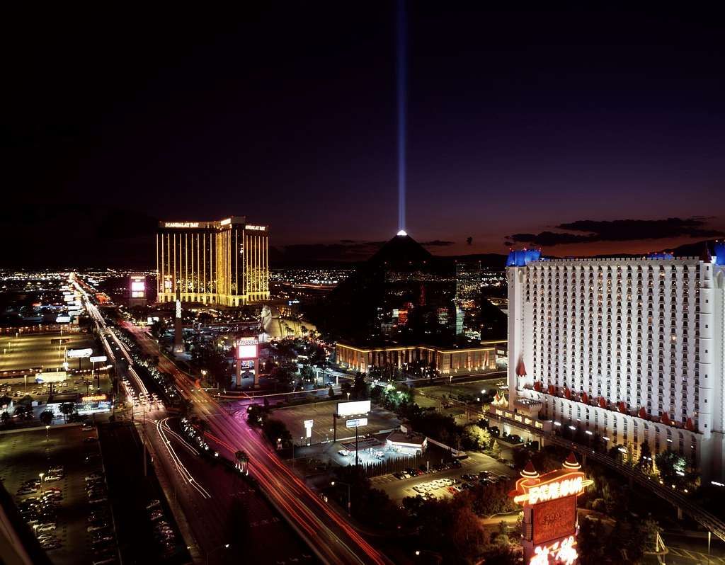
Mastering Las Vegas Aerial Photography: Gear, Techniques, and Flight Tips
Aerial photography has revolutionized how we view the world, offering striking perspectives that ground-based photography cannot match. From showcasing luxury real estate on the Strip to capturing Nevada’s surrounding desert landscapes, capturing photos from above provides an unrivaled perspective.
Whether you are looking to start drone photography as a hobby or launch a professional career, this comprehensive guide covers everything you need to know—from selecting the right gear and securing airspace permissions to mastering composition and editing your final shots.
Why Choose Aerial Photography in Las Vegas?
What is Aerial Photography?
Aerial photography is the practice of capturing high-resolution photos and video from an elevated position using drones or aircraft. It allows photographers to highlight scale, geometry, and location in ways ground photography cannot, making it a powerful tool for visual storytelling.
Key Applications & Industry Benefits
-
Real Estate Marketing: Highlight a property’s full layout, surrounding acreage, and proximity to major landmarks or local amenities.
-
Construction Site Monitoring: Track project progress, perform aerial surveys, and conduct structural inspections safely.
-
Land & Agricultural Surveying: Utilize thermal and multispectral mapping to evaluate topography, land use, and site boundaries.
-
Tourism & Event Media: Showcase city skylines, outdoor sports, and large-scale public events from dramatic vantage points.
Essential Gear for Aerial Drone Photography
Having the right equipment ensures your safety, stability, and image sharpness in the field.
Key Equipment Checklist
-
High-Resolution Drones: Choose a drone with a reliable 4K or 5K camera sensor, obstacle avoidance, and mechanical shutter options.
-
Camera Stabilization Gimbals: A 3-axis gimbal is essential to eliminate camera shake and wind resistance.
-
Remote Controllers & Smart Displays: High-brightness displays allow clear viewing under the bright Las Vegas sun.
-
Batteries & Memory Cards: Always carry spare high-capacity batteries and fast UHS-II/V30 SD cards for uninterrupted shooting.
Pre-Flight Planning and Las Vegas Airspace Compliance
Thorough preparation guarantees both a successful shoot and strict legal compliance.
1. Researching Locations & Flight Paths
Before heading out, examine satellite maps to study your location’s topography, vantage points, and potential hazard zones. Identify focal points—such as iconic architecture or natural rock formations—to map out efficient flight routes.
2. Securing Permits & FAA Compliance
Operating in regulated airspace requires proper authorization:
-
FAA Part 107 Certification: Commercial operations in the U.S. require a Part 107 Remote Pilot Certificate. Learn more on the Federal Aviation Administration (FAA) official site.
-
LAANC Authorizations: Much of Las Vegas falls under controlled Class B airspace near Harry Reid International Airport. Use LAANC (Low Altitude Authorization and Notification Capability) to secure near-instant flight approvals.
-
Local Flight Guidelines: Check the City of Las Vegas FLYSAFE Portal for real-time risk advisories and local airspace restrictions.
3. Weather & Wind Factors
-
Wind Speed: High desert winds destabilize drones and drain battery life fast. Avoid flying in high-gust conditions.
-
Extreme Heat: Las Vegas summer temperatures can cause equipment to overheat and reduce battery efficiency.
-
Lighting Conditions: Shoot during Golden Hour (early morning or late afternoon) for soft, warm lighting and longer dramatic shadows.
Composition & Camera Settings for Sharp Aerial Shots
Composition Techniques
-
Rule of Thirds: Divide your frame into a 3×3 grid to place key elements along grid lines or intersections.
-
Leading Lines: Utilize roads, highways, rivers, or architectural lines to lead the viewer’s eye toward the focal point.
-
Symmetry & Patterns: Look straight down (orthomosaic view) to capture repeating grid lines, building tops, and geometric land patterns.
Recommended Camera Settings
-
Shutter Speed: Use a fast shutter speed ( or higher) to freeze movement and cancel out motor vibration.
-
ISO: Keep ISO at the lowest baseline setting ( or ) to eliminate image noise.
-
Aperture: Set your lens sweet spot (typically to 2.8-) for peak edge-to-edge sharpness.
Editing & Post-Processing Aerial Images
Post-processing refines colors, corrects lens distortion, and enhances shadow detail.
Key Post-Processing Steps
-
Horizon Correction: Straighten tilted horizons caused by camera tilt or wind pitch.
-
Dynamic Range Adjustment: Lift shadows without blowing out highlights in the sunny sky.
-
Dehaze & Sharpening: Apply light dehazing to clear up desert haze or atmospheric dust.
Marketing and Showcasing Your Aerial Portfolio
To convert your aerial photography into a business or build an audience:
-
Build an Online Portfolio: Feature high-impact visuals organized by category (Real Estate, Commercial, Construction, Landscapes).
-
Leverage Social Media: Post crisp visuals on Instagram, Facebook, and LinkedIn with geotags and industry-relevant hashtags.
-
Collaborate Locally: Network with realtors, construction managers, event planners, and fellow media professionals.
Elevate Your Visuals with Professional Drone Services
Capturing professional-grade aerial media requires high-end equipment, FAA compliance, and expert piloting skills.
you are looking for top-tier drone photography or videography for your commercial or real estate project, explore our custom solutions at Sky View LV. Our team delivers high-impact aerial visual assets tailored to elevate your business presentation.
Frequently Asked Questions
Do I need a license to fly a drone commercially in Las Vegas?
Yes. Flying a drone for business or commercial purposes requires an FAA Part 107 Remote Pilot Certificate in the United States.
How high can I legally fly a drone?
Under Part 107 regulations, the maximum allowable altitude is 400 feet Above Ground Level (AGL) unless operating within a 400-foot radius of a structure.
Can I fly a drone near the Las Vegas Strip?
Flights near the Strip often overlap with controlled airspace because of the airport’s proximity. Prior FAA authorization via LAANC or DroneZone is required before taking off.
Popular Posts
September 06, 2026
September 04, 2026
September 04, 2026
September 03, 2026
September 02, 2026
September 01, 2026
Comments are closed.