Drones: The Future of Aerial Inspection
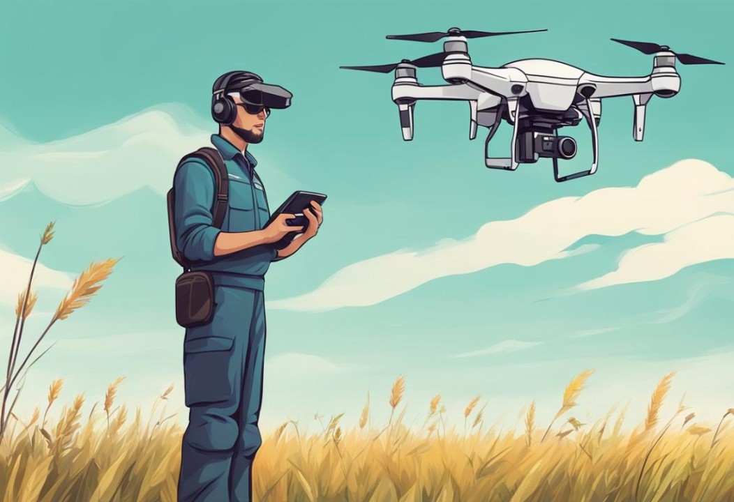
Drones: The Future of Aerial Inspection
Unmanned Aerial Vehicles (UAVs) are fundamentally changing how we inspect critical infrastructure. By replacing manual inspection methods across bridges, high-rise buildings, power grids, and pipelines, commercial drones make field assessments safer, faster, and significantly more cost-effective.
Equipped with advanced cameras and specialized sensors, modern inspection drones capture actionable data that traditional visual methods miss.
Key Takeaways
-
Enhanced Safety: Keeps human inspectors out of high-risk, hard-to-reach environments.
-
Cost & Time Savings: Completes detailed asset evaluations in hours rather than days or weeks, avoiding expensive scaffolding or crane rentals.
-
Advanced Data Collection: Integrates high-resolution RGB cameras, LiDAR, and thermal imaging to detect hidden structural defects early.
-
Predictive Maintenance: Archives visual and spatial data over time to build digital historical footprints of physical assets.
How Drones Are Transforming Infrastructure Inspection
Commercial drones are setting new standards for asset management and safety compliance across industries.
   TRADITIONAL INSPECTIONS               DRONE AERIAL INSPECTIONS
   -----------------------               ------------------------
   • High worker injury risk             • Ground-operated safety
   • Heavy machinery/scaffolding         • Rapid deployment
   • Multi-day operational downtime      • Completed in hours
   • Manual visual logs                  • Digital & 3D thermal mapping
1. Safer Inspection Practices
Traditional inspections frequently require technicians to work at dangerous heights, climb confined spaces, or operate near hazardous materials. Drones allow operators to gather close-range, high-resolution imagery from a safe distance, eliminating the primary causes of job-site accidents.
2. Maximum Efficiency & Cost Reduction
Setting up scaffolding, bucket trucks, or rope access equipment takes considerable time and capital. Drones can be deployed within minutes, rapidly covering expansive areas while capturing real-time telemetry. This drastically reduces operational downtime for critical utilities.
3. Precision High-Resolution Imaging
Modern UAV payloads capture crisp, sub-millimeter visual data. By zooming in on micro-cracks, rust, and minor signs of material fatigue early on, maintenance teams can intervene before small issues turn into costly structural failures.
Advanced Payload & Sensor Technologies
The power of modern aerial inspection lies in the multi-sensor payloads attached to the aircraft.
LiDAR Technology (Light Detection and Ranging)
LiDAR sensors emit rapid laser pulses to construct precise 3D point clouds and topographical models. Highly utilized on platforms like the DJI Matrice 300 RTK, LiDAR is vital for structural deformation monitoring, geological mapping, and precise volumetric calculations.
Thermal Imaging
Thermal payloads detect heat signatures and micro-temperature variations across surfaces. Thermal cameras excel at discovering hidden problems invisible to the naked eye, including:
-
Subsurface moisture intrusion under roofing membranes.
-
Electrical hot spots on transmission lines and solar arrays.
-
Insulation breakdowns and structural energy leaks.
Gas Detection & Environmental Monitoring
Beyond visual light, specialized UAV payloads can monitor air quality and detect gas leaks (such as methane) along miles of pipeline, providing comprehensive environmental assessments without risking human exposure.
Critical Applications Across Key Industries
| Industry | Primary Drone Use Case | Key Benefits |
| Civil Infrastructure | Bridges, tunnels, dams, high-rises | Micro-crack identification, reduced traffic disruption |
| Energy & Utilities | High-voltage power lines, wind turbines | Remote thermal fault detection, live-line safety |
| Oil & Gas | Pipeline corridors, storage tanks, flares | Rapid leak detection, minimal shutdown periods |
| Urban Planning | Roads, transit corridors, municipal assets | 3D city modeling, data-backed maintenance planning |
Regulatory Compliance and Urban Integration
As commercial drone flights become more common, navigating airspace compliance is essential:
-
Evolving FAA & Aviation Rules: Operators must adhere to strict guidelines regarding Beyond Visual Line of Sight (BVLOS) operations, flight over people, and night flights.
-
Safety & Security Standards: Robust cybersecurity controls and strict data management protocols are required when surveying critical state or industrial infrastructure.
-
Urban Airspace Integration: Widespread adoption in dense urban areas relies heavily on public education regarding privacy standards, sound mitigation, and strict risk management.
Future Trends Driving the UAV Sector
      HYDRON & BATTERY            SMART CITY           AI & AUTONOMOUS
        INNOVATION                INTEGRATION             NAVIGATION
   --------------------      -------------------     -------------------
   Longer flight times &     Real-time traffic &     Self-docking stations
   higher payload capacity    urban asset tracking    & automated analysis
-
Extended Flight Times: Innovations in hydrogen fuel cells and battery density will allow drones to cover hundreds of linear miles in a single trip.
-
Autonomous Docking Stations: Drones will increasingly operate from autonomous “drone-in-a-box” stations—charging, launching, and uploading data automatically on set schedules.
-
AI-Driven Data Analytics: Artificial intelligence algorithms will automatically flag structural defects in captured images, accelerating the time from flight to repair strategy.
Overcoming Drone Inspection Challenges
-
Weather Constraints: Extreme winds, rain, and cold temperatures can restrict flight windows. Heavy-weather-rated industrial UAVs are steadily solving this limitation.
-
Battery Endurance: Flight times generally range from 25 to 55 minutes per battery set. Teams manage this through hot-swappable battery stations during field operations.
-
Evolving Regulations: Obtaining airspace authorizations (e.g., LAANC in the US) requires proper pilot certification (e.g., FAA Part 107) and regulatory-compliance software.
Conclusion
Commercial drones are no longer just a trend—they are an essential technology for modern asset integrity management. By combining high-definition imagery with LiDAR, thermal sensors, and AI analytics, aerial inspections offer an unprecedented balance of safety, speed, and accuracy.
Frequently Asked Questions
What are the main benefits of using drones for inspections?
Drones make inspections significantly safer, faster, and more cost-effective. They access hazardous areas remotely and capture precise data to spot structural issues early.
What sensors do inspection drones carry?
In addition to high-resolution visual cameras, drones carry LiDAR sensors for 3D mapping, thermal imaging cameras for heat and moisture detection, and specialized sensors for chemical or gas leak detection.
How do drones improve worker safety?
Drones conduct close-up visual assessments of high-voltage lines, tall towers, and unstable structures, allowing human inspectors to remain safely on the ground.
Popular Posts
August 20, 2026
August 19, 2026

August 18, 2026
August 17, 2026
August 16, 2026
August 15, 2026
Comments are closed.