Aerial Drone Services for Commercial Properties in Las Vegas
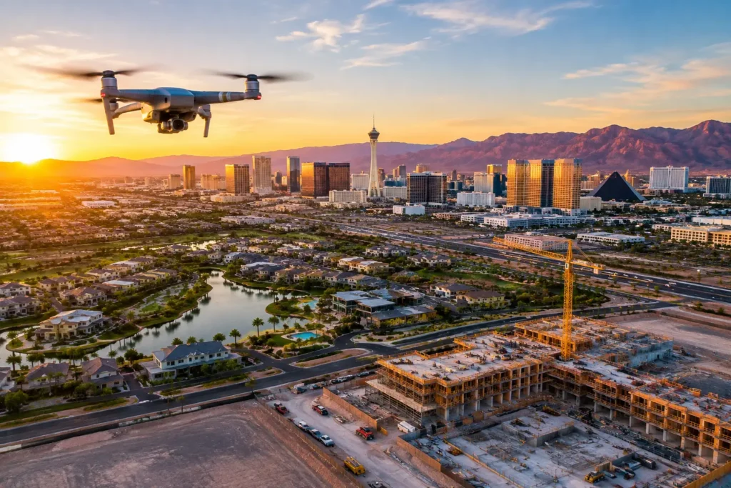
Aerial drone services are revolutionizing commercial operations across Southern Nevada. By pairing high-resolution aerial imagery with advanced spatial data, professional drone operators provide actionable insights across real estate, construction, surveying, and site safety management.
Key Takeaways
Elevated Marketing: High-definition aerial photography drives faster engagements and sales for commercial real estate listings.
Streamlined Site Operations: Real-time drone monitoring boosts efficiency and safety during construction inspections.
Specialized Data Collection: Thermal imaging, 3D mapping, and topographic surveys streamline planning and facility management.
Regulatory Compliance: Hiring FAA Part 107 certified remote pilots mitigates risk and ensures legal flight operations.
The Rise of Commercial Drone Technology in Las Vegas
Overview of Commercial Drone Solutions
Modern commercial drones go beyond simple photography. Equipped with high-resolution sensors, thermal cameras, and GPS mapping systems, enterprise drone fleets deliver precise spatial data and broadcast-quality visual media that traditional ground photography cannot replicate.
Core Commercial Applications
Commercial Real Estate: Highlighting building footprints, traffic access, adjacent amenities, and overall lot dimensions.
Construction Management: Tracking daily site progress, inventory stockpiles, and structural development.
Infrastructure Inspections: Checking rooftops, towers, and solar arrays safely without specialized rigging or staging.
Event & Media Coverage: Capturing high-impact dynamic aerial footage for marketing campaigns.
Transforming Commercial Real Estate Marketing & Development
                  ┌─────────────────────────────────────────┐
                  │   COMMERCIAL REAL ESTATE ADVANTAGES     │
                  └────────────────────┬────────────────────┘
                                       │
         ┌─────────────────────────────┼─────────────────────────────┐
         ▼                             ▼                             ▼
┌───────────────────┐        ┌───────────────────┐        ┌───────────────────┐
│ High-Impact Views │        │ Cost Efficiencies │        │ Stakeholder Data  │
│  Property Bounds  │        │ Combined Imagery  │        │ Progress Tracking │
│  Traffic Corridors│        │ Multi-Use Asset   │        │ Site Planning     │
└───────────────────┘        └───────────────────┘        └───────────────────┘
Enhancing Property Listings
Stand out in competitive commercial markets. Aerial footage offers perspective on crucial listing details, including:
Ingress/egress routes and nearby highway connectivity.
Surrounding anchor tenants and land usage.
Overall roof condition and site perimeter.
Virtual Tours & Interactive Media
Incorporating aerial drone footage into your commercial real estate marketing strategy allows prospective buyers and tenants to conduct virtual site visits—saving time and driving faster deal closures.
Construction Monitoring & Infrastructure Inspection
Real-Time Progress Tracking
Drones give project managers, general contractors, and off-site stakeholders bird’s-eye updates on site activities.
Enhanced Safety: Reduces the need for workers to physically scale scaffolding or inspect hazardous areas.
Improved Communication: Provides verifiable progress photos for sub-contractors, lenders, and investors.
Schedule Verification: Identifies site bottlenecks before they cause project delays.
Advanced Thermal & Site Inspections
Thermal imaging sensors detect unseen structural and electrical anomalies across job sites:
Building Envelopes: Identifying insulation leaks and HVAC energy loss.
Roofing Systems: Detecting moisture intrusion under membrane roofs.
Solar Systems: Pinpointing dead or malfunctioning photovoltaic cells.
Specialized Drone Solutions Across Industries
| Industry | Specialized Drone Application | Business Value |
|---|---|---|
| Construction | 3D Photogrammetry & Volumetric Surveys | Accurate stockpile and site earthwork calculations. |
| Land Surveying | Topographic Mapping & CAD Overlays | Fast site mapping prior to ground development. |
| Agriculture & Turf | Multispectral Crop & Grass Health Checks | Optimized irrigation and vegetation health management. |
| Facilities Management | Thermal Envelope & Roof Inspections | Preventative maintenance, identifying heat/moisture leaks. |
Risk Management, Safety, and FAA Compliance
Operating drones commercially requires strict adherence to federal and local regulations to minimize liability.
Key Regulatory Requirements
-
FAA Part 107 Certification: Commercial pilots must hold an active FAA Remote Pilot Certificate.
-
Airspace Authorizations (LAANC): Essential for legal flights in restricted airspace, especially around Harry Reid International Airport (LAS) and North Las Vegas Airport (VGT).
-
Comprehensive Insurance Coverage: Enterprise operations require adequate liability policies.
Recommended Insurance Standard
Standard Commercial Coverage:
Commercial UAV Aviation Insurance: $1,000,000+ per occurrence
General Liability & Workers’ Comp: Standard commercial limits
Invasion of Privacy Coverage: Integrated standard liability protection
Choosing the Right Drone Service Provider in Las Vegas
When selecting a commercial drone service provider, evaluate the following criteria:
-
Licensing & Insurance Verification: Always request proof of FAA Part 107 credentials and aviation insurance.
-
Industry-Specific Portfolio: Ensure the pilot has experience in your sector (e.g., thermography, construction monitoring, or commercial real estate).
-
Turnaround Time & Deliverable Quality: Verify that raw data can be processed into required formats (e.g., 4K video, high-res ORTHO maps, CAD files).
Frequently Asked Questions
What FAA credentials are required for commercial drone operations in Las Vegas?
All pilots flying for commercial purposes must hold an FAA Part 107 Remote Pilot Certificate and obtain proper airspace clearance (LAANC) when operating in controlled airspace near Las Vegas airports.
Can drone services assist with construction inspections?
Yes. Drones deliver detailed site imagery, volumetric data, and thermal mapping to track project progress and inspect elevated or hazardous structures without risking site personnel.
How quickly can aerial visual assets be delivered?
Standard aerial photography and video deliverables are typically processed and delivered within 24 to 48 hours following the flight session.
Ready to Elevate Your Commercial Project?
Partner with licensed, insured aerial photography experts tailored to your industry needs.
-
Schedule a Consultation: Visit our Aerial Drone Service Booking Page
-
Direct Line: Call today at (702) 670-1967