A property can have exceptional finishes, a desirable location, or serious development potential and still look ordinary online. A skilled drone photographer in Henderson, NV can help clients make informed decisions by showing the full setting: lot boundaries, nearby amenities, access routes, views, scale, and how a property relates to the surrounding community.
For real estate professionals, developers, landowners, and investors, aerial imaging is not simply an attractive add-on. It is a practical way to answer the questions buyers and stakeholders ask before they schedule a showing, request a site visit, or move a project forward.
Why aerial media matters in Henderson property marketing
Ground photography is essential for showing interiors, curb appeal, finishes, and street-level details. But it cannot show how a hillside home sits above the valley, how a commercial center connects to major roads, or how much usable land surrounds a future development. Aerial photography provides that missing context quickly and clearly.
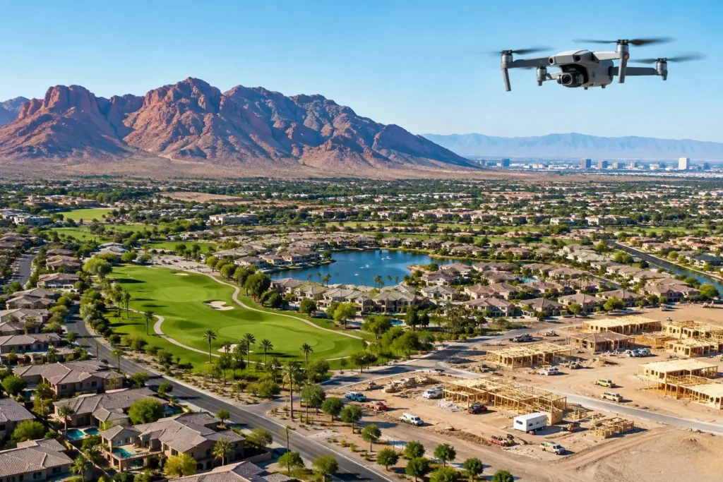
In Henderson, that context often has real marketing value. Homes may offer mountain, city, golf course, or Strip-adjacent views. Commercial properties may benefit from proximity to key corridors, retail centers, schools, and growing residential areas. Vacant land needs more than a wide ground-level shot to communicate its size, topography, access points, and surrounding development activity.
The best aerial images do more than make a listing look impressive. They help a prospective buyer understand the asset. That can lead to more qualified interest, stronger investor conversations, and less time spent explaining a site’s basics.
What a professional drone photographer captures
Professional aerial coverage should be planned around the property’s purpose, not treated as a one-size-fits-all flight. A luxury residence, an industrial building, and a raw land parcel each need a different visual approach.
For residential listings, aerial stills can place the home in its neighborhood, frame outdoor living spaces, and highlight view corridors that disappear in standard photography. Video can create a cinematic progression from the wider community to the property itself, giving buyers a better sense of arrival and location.
For commercial real estate, aerial media can document building footprint, parking capacity, ingress and egress, nearby anchors, and visibility from surrounding roads. These images are particularly useful when a property’s value depends on traffic patterns, access, redevelopment opportunity, or its position within a larger retail or business district.
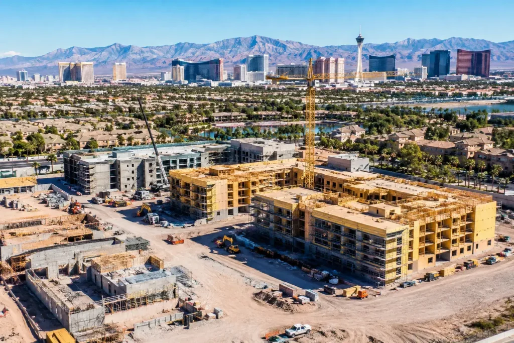
Land and development projects benefit from elevated perspectives that reveal acreage, terrain, adjacent parcels, utility corridors, road access, and construction progress. Aerial photography is not a substitute for a survey or engineering document, but it is an effective visual communication tool for presentations, marketing packages, and investor updates.
Construction teams can also use repeat aerial captures to create a clear record of progress. Consistent viewpoints over time make it easier to communicate milestones to ownership groups, lenders, tenants, and project stakeholders without requiring every decision-maker to visit the site.
FAA compliance is part of the service, not an afterthought
Henderson and the Las Vegas Valley present aviation challenges that should never be ignored. Portions of the region fall within or near controlled airspace connected to Harry Reid International Airport, Nellis AFB, and other operational considerations. A drone flight that appears simple from the ground may require airspace authorization, altitude limitations, careful timing, or a different flight plan.
That is why hiring FAA-certified drone pilots matters. Professional operators know how to evaluate airspace, secure required authorization, identify site-specific risks, and fly within applicable regulations. They also carry appropriate insurance and establish a clear operational plan before arriving on site.
For a client, this means less uncertainty. You are not responsible for learning flight rules, purchasing equipment, monitoring aviation restrictions, or accepting the liability associated with an unqualified operator. The goal is straightforward: get the visual assets you need while protecting the project, the people on site, and your business’s reputation.
Sometimes a requested shot cannot be captured exactly as imagined due to airspace restrictions, weather, temporary flight limitations, or safety concerns. A professional drone photographer should explain those constraints early and recommend a compliant alternative that still supports the marketing objective.
Aerial photography should support a clear business outcome
The strongest drone work starts with a question: what does the audience need to see to move forward? That question shapes flight paths, image selection, editing, and final delivery.
A listing agent may need to show a home’s relationship to a golf course or demonstrate that a backyard has meaningful separation from neighboring properties. A developer may need a series of high-resolution images that make a large parcel understandable in an investor deck. A property manager may need current exterior visuals to market available space or document building conditions.
Generic flyovers can look polished, but they do not always solve the client’s problem. Intentional aerial media tells a visual story with purpose. It establishes the wider setting, highlights the property’s advantages, and then directs attention to the details that matter most.
For example, a wide establishing image may show a property within Henderson’s broader landscape. A lower, angled image can reveal architecture, landscaping, and outdoor amenities. A top-down frame may clarify the lot shape, parking layout, or construction footprint. Together, these images create a more complete and persuasive presentation than any single view could provide.
Choosing a drone photographer in Henderson, NV
When comparing providers, look beyond a highlight reel. Dramatic footage is valuable, but dependable execution requires operational discipline and creative skill.
Start with credentials. The pilot should be FAA-certified, fully insured, and able to explain how they handle airspace authorization and local flight restrictions. If your property is near a controlled area, this is not a minor detail. It can determine whether the flight is legally possible and how the work must be planned.
Next, consider whether the photographer understands your asset type. Real estate marketing requires a different eye than construction documentation, and land marketing demands different coverage than a finished retail property. Ask how the operator plans a shoot around the listing, audience, and intended use of the final assets.
Turnaround and communication also matter. Aerial media is often tied to listing launches, investor meetings, site updates, or time-sensitive campaigns. You need a partner who confirms the scope, communicates weather or airspace changes promptly, and delivers files in formats that work for your marketing channels.
Finally, assess the quality of the final product, not just the flight. High-resolution capture, color consistency, thoughtful composition, and professional editing all affect how the property is perceived. The purpose is to make the asset easier to understand and harder to overlook.
From flight planning to final delivery
A professional aerial project typically begins with a short consultation about the property, desired outcomes, deadline, and any on-site conditions. This is the time to identify the most important selling points, such as views, access, acreage, neighboring development, rooftop features, or construction milestones.
Before the flight, the operator reviews airspace, weather, site conditions, and potential safety considerations. On the day of the shoot, the pilot captures the planned images and footage while adjusting for light, wind, on-site activity, and the visual opportunities available at the property.
After capture, the selected files are edited for clarity, composition, and consistent color. Depending on the project, delivery may include high-resolution aerial photos, cinematic video clips, edited property video, or 360-degree photo spheres. The right combination depends on where the media will be used and how much context the audience needs.
Sky View LV approaches this process as a project-based service built around reliable planning, compliant operations, and high-impact visual storytelling. That matters whether the assignment is a single residential listing or recurring documentation for a major development site.
When aerial media delivers the greatest value
Drone photography is especially effective when a property has a story you can’t tell from the sidewalk. This includes elevated views, large lots, substantial outdoor amenities, proximity to key destinations, commercial access advantages, or visible development progress.
It may be less critical for every small property or routine update. The investment should match the marketing opportunity. If aerial images will clarify a meaningful advantage, strengthen a pitch, or help a decision-maker understand the site faster, they can deliver a clear return. If they add only visual decoration without useful context, a smaller scope may be the smarter choice.
The right aerial perspective gives your audience a faster, more confident understanding of what makes a property worth their attention. Plan the shoot around that story, and every image will have a job to do.