A rooftop issue, site-access constraint, or changing construction condition can be difficult to assess from ground level. Aerial inspection services in Henderson, Nevada, provide property professionals with a clearer visual record without requiring staff, vendors, or owners to climb, rent equipment, or make decisions based on incomplete information. For commercial properties, land, residential communities, and active job sites, the right aerial capture turns hard-to-see conditions into usable visual evidence.
At Sky View LV, FAA-certified drone pilots create high-resolution aerial imagery and video that help clients view a property from the angles that matter. The result is not a substitute for an engineering report, trade inspection, or code determination. It is a precise visual resource that gives decision-makers stronger context before scheduling repairs, updating investors, marketing an asset, or documenting progress.
When Aerial Inspection Services in Henderson, Nevada Make Sense
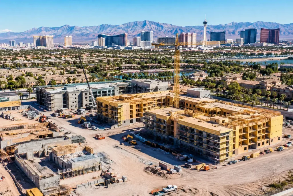
Drone-based visual inspections are especially valuable when a conventional walkthrough cannot tell the whole story. A property manager may need current roof imagery before requesting a contractor proposal. A developer may need an overhead record of grading, access roads, utility staging, and construction progress. A landowner may need to show parcel scale, surrounding development, or boundary-adjacent features to prospective buyers.
The value is often speed combined with perspective. Instead of coordinating ladders, lifts, roof access, or multiple site visits to understand visible conditions, a professional aerial operation can capture targeted viewpoints from above and around the asset. That perspective can reveal debris accumulation, drainage patterns, exterior wear, equipment placement, facade conditions, roof penetrations, and site changes that aren’t apparent in standard ground photography.
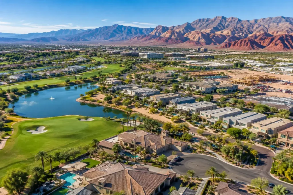
For real estate professionals, aerial inspection imagery can also answer practical buyer questions before they become objections. Is the property near a major roadway? How does the home sit within the neighborhood? What does access look like from the street? How close are nearby commercial uses, golf courses, open land, or development activity? Clear visuals establish context early and help serious prospects evaluate the opportunity with more confidence.
What a Professional Aerial Visual Inspection Can Document
Every assignment begins with the decision the imagery needs to support. A broad commercial property may need a complete exterior overview, while a construction team may only need repeatable progress angles from the same flight plan each month. Defining that purpose upfront keeps the deliverables relevant rather than producing a large collection of attractive but unfocused footage.
Aerial visual documentation can capture:
- Roof surfaces, HVAC equipment areas, drains, flashing zones, skylights, solar arrays, and other visible rooftop features
- Building elevations, facades, signage, parking areas, loading zones, perimeter conditions, and access routes
- Construction milestones, earthwork, material staging, site circulation, and visible changes over time
- Land parcels, neighboring uses, road access, topography cues, and the broader setting around a property
The best deliverable depends on the project. Still images are efficient for maintenance discussions, contractor coordination, listing materials, and reports. Video provides a more complete sense of scale and approach, which can be useful for investor presentations and project updates. A 360-degree photo sphere can give remote stakeholders an interactive reference point when they need to understand a site without traveling to it.
Aerial Imagery Supports Better Decisions, Not Technical Diagnoses
This distinction matters. A drone can document visible conditions from a safe vantage point. Still, it does not replace a licensed roofer, engineer, surveyor, building inspector, or other qualified specialist when a technical diagnosis is required. If imagery shows a potential issue, the next step may be to have the appropriate professional assess the cause, severity, and remedy.
That does not reduce the value of aerial capture. It improves the workflow. A property owner can share current visuals with a contractor before the first visit, helping the contractor arrive prepared. A construction manager can create a timeline of visible progress that supports clearer discussions with ownership. A broker can communicate a property’s setting with far more accuracy than a wide-angle street-level image alone.
The trade-off is straightforward: aerial media gives exceptional visual context, while specialized inspection trades provide technical conclusions. Projects that need both should use the drone capture to inform, document, and accelerate the expert evaluation.
Why Local Airspace Knowledge Changes the Outcome
Henderson and the greater Las Vegas Valley present airspace considerations that should never be treated as an afterthought. Areas near Harry Reid International Airport, Nellis AFB, and other controlled or sensitive locations may require careful flight planning and formal authorization. A pilot who launches without confirming airspace requirements can create delays, legal exposure, or an unsafe operation.
A professional provider handles the operational work before the aircraft leaves the ground. That includes reviewing the site, evaluating airspace, obtaining applicable approvals, planning safe flight paths, checking weather conditions, and setting realistic timing expectations. It also means carrying the appropriate liability insurance and operating under FAA rules.
For clients, this removes a major burden. There is no need to buy equipment, train internal staff, maintain batteries, manage aviation paperwork, or assume the risk of an unqualified operator. The goal is simple: get the aerial assets needed for the project through a dependable, compliant process.
How to Prepare for an Aerial Inspection Project
A clear project brief improves both the flight plan and the final media. Before scheduling, identify the address, preferred date range, and the specific questions the imagery should help answer. If a certain roof section, elevation, construction phase, or parcel feature is a priority, say so. Targeted direction lets the pilot capture the views that serve your actual decision.
It also helps to clarify site access and active conditions. Gated communities, occupied commercial properties, construction zones, and sites with ongoing deliveries may require coordination with a manager, security contact, superintendent, or tenant representative. On a busy job site, the flight may need to avoid areas with cranes, crews, or active equipment movement.
Weather can affect scheduling, particularly high winds, rain, poor visibility, and extreme heat conditions. A reliable aerial provider will prioritize flight safety and image quality over forcing a marginal-weather operation. When conditions are suitable, the work can be completed efficiently and delivered in a format aligned with your intended use.
Choosing the Right Aerial Inspection Partner
Price matters, but it should not be the only deciding factor. Low-cost drone footage can become expensive if it is captured illegally, misses the needed angles, lacks sufficient resolution, or creates a safety issue at an active property. For high-value assets and time-sensitive projects, experience and compliance protect the investment.
Look for FAA certification, current insurance, local airspace competence, and a portfolio that demonstrates more than scenic drone shots. The provider should understand how visual documentation supports real estate marketing, development planning, property management, and construction communication. They should also ask useful questions about your goal rather than offering a one-size-fits-all flight.
Professional aerial imagery is most effective when it is planned around the action it will support. A maintenance team needs close, clearly labeled visual references. An investor may need broad site context and polished presentation footage. A listing agent may need a balanced set of property, neighborhood, and approach angles. Those are different assignments, even when they take place at the same address.
Turn Hard-to-Reach Views Into Useful Project Assets
The strongest aerial inspection work does more than show a building from above. It helps stakeholders see what has changed, understand what is visible, and move the next conversation forward with better information. Whether the need is a one-time property review or recurring documentation across a development timeline, professionally captured aerial media gives your team a clearer view of the asset without adding unnecessary operational overhead.
When visual clarity is the missing piece, begin with the questions your team needs answered. The right flight plan can turn those questions into a practical, shareable record of the property.