Aerial View: The Fascinating World of Aerial Photography
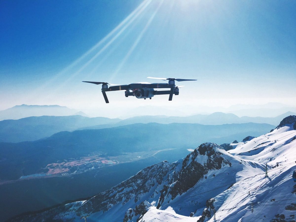
The Evolution of Aerial Photography
Aerial imagery has come a long way since the 19th century. The tools and techniques have shifted dramatically over the decades as human curiosity and technology have evolved.
Balloons (1800s) ➔ Pigeon Cameras & Planes (1900s) ➔ Drones & AI (21st Century)
From Hot Air Balloons to Drones
In the mid-19th century, photographer Gaspard-Félix Tournachon (known as “Nadar”) captured the first-ever aerial photograph from a hot-air balloon over Paris. As aviation advanced in the early 20th century, fixed-wing aircraft became the primary means of capturing large-scale landscapes and mapping terrain.
Pioneers of Aerial Imagery
-
Julius Neubronner: Invented the famous “pigeon camera” in the early 1900s, fitting lightweight cameras onto homing pigeons to capture unique, automated bird’s-eye perspectives.
-
World War I Aviation: Military reconnaissance during WWI turned aerial photography into a critical strategic surveillance tool, forever changing battlefield tactics and mapping.
The Modern Drone Revolution
The adoption of consumer and commercial drones in the 21st century marked a major turning point. Drones have democratized the industry by offering:
-
High-Resolution Imaging: Compact sensor tech allows 4K and 8K photography.
-
Dynamic Angles: Unmatched maneuverability in tight or low-altitude spaces.
-
Safety & Efficiency: Replaces dangerous and expensive manned aircraft missions.
Equipment and Techniques for Drone Aerial Photography
Capturing professional-grade imagery requires a blend of the right hardware and solid camera fundamentals.
How to Choose the Right Drone Camera
When selecting equipment for aerial photos, focus on these critical factors:
-
Sensor & Image Quality: Look for drones featuring larger sensors (such as 1-inch or Micro Four Thirds) for superior dynamic range and low-light performance.
-
Flight Time & Battery Life: Ensure your drone offers at least 25–40 minutes of flight time per charge to allow ample time for framing shots.
-
Gimbal Stabilization: A 3-axis mechanical gimbal is essential for crisp photos and smooth video footage.
Mastering Flight Controls & Camera Settings
-
Shoot in RAW Format: RAW files preserve uncompressed data, giving you greater flexibility during post-processing and color grading.
-
Dial in Manual Exposure: Keep your ISO as low as possible (e.g., ISO 100) to minimize noise, and balance your shutter speed according to wind and speed.
-
Practice in Wide Open Spaces: Build muscle memory with your flight sticks in safe, open environments before attempting complex shots near structures.
Creative Shooting Techniques
Elevate your visual storytelling with these creative drone features:
-
Aerial Panoramas: Stitch multiple high-altitude photos together to capture sweeping landscapes.
-
Follow Me Mode: Utilize subject-tracking algorithms to keep moving vehicles, sports, or people in focus automatically.
-
Time-Lapse & Hyperlapse: Show environmental changes—like moving clouds or traffic—by capturing a sequenced series of photos over time.
💡 Pro Tip: Pay attention to the “Golden Hour” (shortly after sunrise or before sunset). Low-angle sunlight casts soft lighting and dramatic shadows, adding depth to aerial landscapes.
Top Industry Applications of Aerial Photography
Aerial imagery is no longer just an art form—it is an indispensable business tool across major sectors.
┌─────────────────────────────────────────────────────────┐
│              AERIAL PHOTOGRAPHY APPLICATIONS            │
├───────────────────┬───────────────────┬─────────────────┤
│    Real Estate    │    Conservation   │  Filmmaking     │
│ • Property Views  │ • Forest Metrics  │ • Epic Angles   │
│ • Land Limits     │ • Wildlife Tracking│ • Action Scenes │
└───────────────────┴───────────────────┴─────────────────┘
1. Real Estate and Urban Planning
Real estate drone photography gives buyers an immersive view of property boundaries, neighborhood context, and surrounding amenities. Listings featuring aerial visuals consistently generate higher buyer engagement and faster sales.
2. Environmental Conservation and Agriculture
-
Ecosystem Tracking: Monitors deforestation, coastal erosion, and habitat fragmentation.
-
Precision Agriculture: Multispectral drone sensors assess crop health, irrigation efficiency, and soil quality.
3. Filmmaking and Commercial Entertainment
Cinematographers rely on aerial photography to create epic establishers, dynamic chase sequences, and dramatic perspective shifts that were previously only possible with multimillion-dollar helicopter setups.
Future Trends: What’s Next for Aerial Imagery?
Driven by rapid innovation, the global drone photography market is growing rapidly.
-
AI & Machine Learning Integration: Automated framing, real-time object detection, and AI-powered post-processing software are streamlining workflows.
-
Enhanced Autonomy: Longer battery life, improved satellite navigation, and obstacle detection are making solo flying safer.
-
Emerging Markets: Disaster recovery assessment, commercial roof inspections, and virtual reality (VR) tourism are creating new monetization avenues for remote pilots.
Safety Guidelines and Best Practices for Beginners
Before taking to the skies, it is essential to operate responsibly and stay compliant with aviation standards.
[1. Check Regulations] ──> [2. Inspect Hardware] ──> [3. Check Weather] ──> [4. Takeoff]
Essential Checklist for New Pilots
-
Know the Rules & Licensing: Verify your local aviation authority regulations (such as the FAA Part 107 in the US for commercial operations). Respect no-fly zones around airports and government facilities.
-
Perform Pre-Flight Inspections: Check your drone propellers for micro-cracks, verify battery levels, and calibrate the compass.
-
Check Weather Conditions: Avoid flying in high winds, fog, or precipitation to prevent equipment loss.
-
Respect Privacy & Property: Avoid flying closely over private property or large crowds without permission.
Conclusion
From early experiments in hot-air balloons to modern AI-driven drone tech, aerial photography has fundamentally changed how we capture and interact with our world. Whether you want to elevate real estate listings, conduct environmental surveys, or capture scenic landscapes, mastering drone photography opens up limitless creative opportunities.
Ready to start taking stunning drone photos? Practice your flight skills, learn your camera settings, and ensure you remain fully compliant with local laws. Explore our website today for more photography guides, drone gear reviews, and expert tutorials!
Frequently Asked Questions (FAQ)
What is aerial photography?
Aerial photography is the process of capturing photos from an elevated altitude using devices such as drones, airplanes, helicopters, or high-altitude platforms.
Do I need a license to take aerial drone photos?
Recreational flying may only require basic safety registration depending on your country, but operating a drone for commercial purposes (such as selling photos or real estate marketing) typically requires a commercial drone operator license (e.g., FAA Part 107 in the USA).
What is the best camera setting for drone photography?
Shooting in RAW format with a low ISO (100–200) and a shutter speed tailored to lighting conditions provides the highest dynamic range and sharpness for post-processing.
Is drone aerial photography expensive to start?
Not anymore. While commercial setups can cost thousands of dollars, feature-rich beginner drones with stabilized 4K cameras are widely available at accessible price points.
Popular Posts
August 25, 2026
August 24, 2026

August 23, 2026
August 22, 2026
August 20, 2026
August 19, 2026
Comments are closed.