5 Advantages of Aerial Photography & Drone Services

5 Advantages of Aerial Photography and Drone Services. Aerial photography and drone services are transforming our perspective of the world from above. These modern tools offer unique benefits that enable various industries to enhance their operations. This article discusses five key advantages of aerial photography and drone services, highlighting how they can streamline tasks, enhance safety, and foster creativity.
Key Takeaways
- Aerial photography and drone services save time and money by speeding up data collection and reducing the need for expensive Equipment.
- Using drones keeps people safe by allowing inspections in dangerous areas without endangering anyone.
- Drones provide accurate and detailed data, enabling businesses to make informed decisions and gain a deeper understanding of their projects.
- Aerial images capture stunning views that grab people’s attention, making them great for marketing and promotions.
- Drones reduce survey costs and field time, enabling quicker results and smaller teams.
1. Increased Efficiency and Cost Savings
Aerial photography and drone services deliver significant efficiency gains and cost savings across industries. Businesses can collect data quickly and accurately with drones, reducing project timelines. Here are some key points:
- Faster Data Collection: Drones can cover large areas quickly, enabling faster data collection than traditional methods.
- Lower Costs: Using drones eliminates the need for expensive equipment such as helicopters, reducing costs.
- Fewer Labor Costs: Drones require fewer people to operate, reducing labor costs.
| Method | Time Required | Cost |
|---|---|---|
| Traditional Survey | 10 days | $10,000 |
| Drone Survey | 2 days | $2,000 |
Drones not only save time and money but also make aerial photography more accessible to everyone.
In summary, using drones for aerial photography increases efficiency and significantly reduces costs, making them an essential tool for modern businesses.
2. Enhanced Safety and Risk Mitigation

Drones play a crucial role in enhancing safety and mitigating risks across various industries. Businesses can avoid dangerous situations by deploying drones to send people into hazardous areas. Here are some key benefits of using drone services for safety:
- Access to Dangerous Areas: Drones can reach hard-to-reach places, such as tall buildings or remote locations, without endangering anyone.
- Detailed inspections provide clear images of structures, enabling the identification of potential problems before they become serious.
- Reduced Human Risk: Drones enable workers to stay safe on the ground while performing hazardous tasks.
| Benefit | Description |
|---|---|
| Access to Hazardous Areas | Drones can safely inspect dangerous locations without human presence. |
| Improved Inspection Quality | High-resolution images help identify issues that might otherwise be missed. |
| Cost-Effective Solutions | Using drones reduces the need for expensive Equipment and personnel. |
Drones are changing the way we think about safety in the workplace. They allow for thorough inspections without the risks associated with human involvement.
In summary, drone services enhance safety and help businesses manage risks effectively, making them a wise choice for many industries.
3. Improved Data Collection and Analysis

Aerial photography and drone services have transformed how we gather and analyze data. Drones provide accurate, real-time data for a range of applications, including mapping and monitoring environmental changes. Here are some key benefits of using drones for data collection:
- High-Resolution Imagery: Drones capture detailed aerial views that traditional methods cannot match.
- Rapid Data Acquisition: Aerial surveys can be completed much faster than ground-based methods, saving time and resources.
- Diverse Data Formats: The collected data can be represented in various formats, including Digital Terrain Models (DTMs) and orthomosaics.
| Benefit | Description |
|---|---|
| Increased Accuracy | Drones enhance the precision of data collected. |
| Cost-Effective | Reduces the need for expensive Equipment and labor. |
| Comprehensive Coverage | Thousands of data points can be captured during a single flight. |
Using drones allows for a broader perspective, making it easier to track changes over time and make informed decisions.
In summary, using drones for data collection improves accuracy and efficiency, making them a valuable tool across industries.
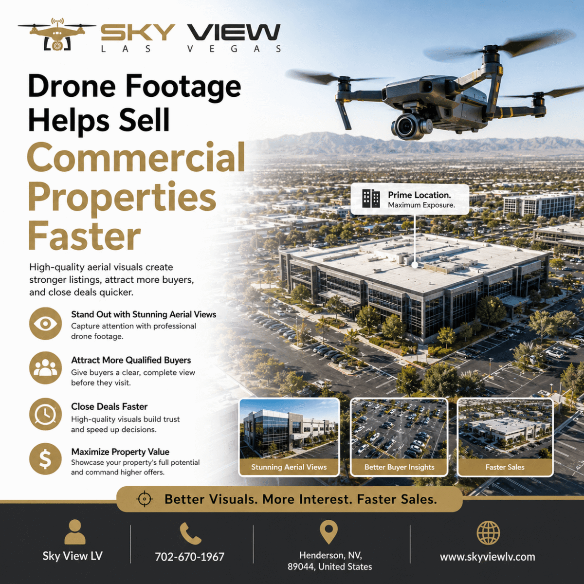
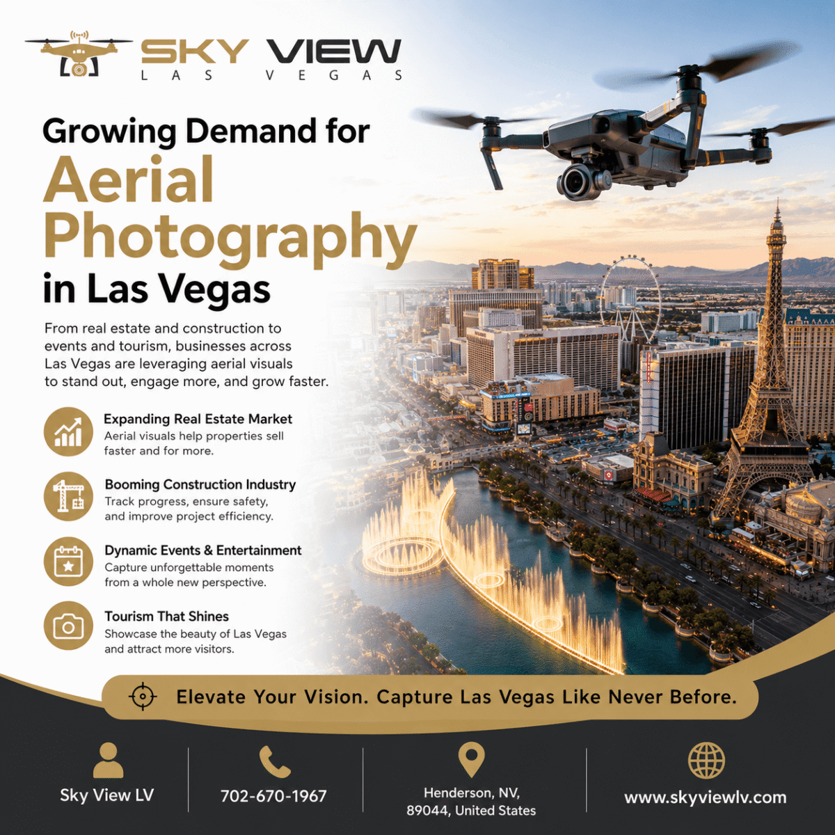
4. Creative and Engaging Visual Content

Aerial photography offers a distinctive way to create eye-catching visuals that enhance your marketing efforts. By capturing images from above, businesses can showcase their products, services, or locations in a way that grabs attention. Here are some key benefits of using aerial photography:
Unique Perspectives
- Dramatic Angles: Aerial shots offer perspectives impossible to capture from the ground.
- Vast Landscapes: Capture expansive areas to highlight large projects or events.
- Detailed Overviews: A comprehensive look at properties or developments, showcasing their scale and features.
Enhanced Storytelling
- Visual Narratives: Aerial images can tell a story, engaging viewers and drawing them into the content.
- Creative Marketing: Use stunning visuals to enhance your marketing strategy and attract customers.
- Brand Identity: Unique aerial shots can help establish a strong brand presence in a crowded market.
Cost-Effective Content Creation
- Affordable Options: Unlike traditional photography, drone services are often more cost-effective.
- Quick Turnaround: Aerial photography can be completed more efficiently, saving time and resources.
- Versatile Applications: Utilize aerial images for a range of purposes, from social media to promotional materials.
Aerial photography is a powerful tool that can help businesses elevate marketing with drone photography. It transforms visuals and strategies, making them more engaging and effective.
5. Reduced Survey Costs and Field Time

Using drones for surveying can significantly lower costs and save time. Drone surveys can be up to 80% faster than traditional methods, reducing on-site time and resource requirements. Here are some key benefits of using drones for surveys:
- Faster Data Collection: Drones can cover large areas quickly, reducing survey time.
- Lower Labor Costs: Aerial surveys require fewer workers than traditional methods, reducing labor costs.
- Less Equipment Needed: Drones eliminate the need for expensive ground control points (GCPs), which can be costly and time-consuming.
| Benefit | Traditional Method | Drone Method |
|---|---|---|
| Time to Complete Survey | 5 days | 1 day |
| Number of Workers Required | 5 | 2 |
| Cost of Equipment | High | Low |
Drones not only speed up the surveying process but also provide accurate and comprehensive data in a single flight, making them a valuable tool for various industries.
Final Thoughts
In conclusion, 5 Advantages of Aerial Photography & Drone Services, aerial photography and drone services offer numerous benefits that can significantly enhance various industries. They save time and money, improve safety, and provide detailed data to support better decisions. The stunning visuals captured from above can also make marketing efforts more effective and engaging. As technology advances, the potential for aerial photography and drone services will continue to grow, making them an increasingly essential tool for businesses seeking to stand out and succeed.
Frequently Asked Questions
What is aerial photography?
Aerial photography is the practice of capturing images from above, typically using drones. This gives a unique view that you can’t get from the ground.
How do drones improve safety?
Drones can reach dangerous places without putting people at risk. They can safely inspect tall buildings or power lines.
What are the cost benefits of using drones?
Using drones is more cost-effective than traditional methods, such as helicopters. They save money and time on projects.
Can drones collect data?
Yes, drones can gather substantial information quickly. This helps map and study areas for different purposes.
Is aerial photography valuable for marketing?
Absolutely! Aerial photos catch people’s attention and help sell properties or promote businesses.
How fast can drones survey land?
Drones can survey land much faster than traditional methods, delivering results more quickly.
Popular Posts
May 11, 2026

May 07, 2026

April 03, 2026

February 11, 2026
Comments are closed.