Drone Regulations for Las Vegas Property Projects
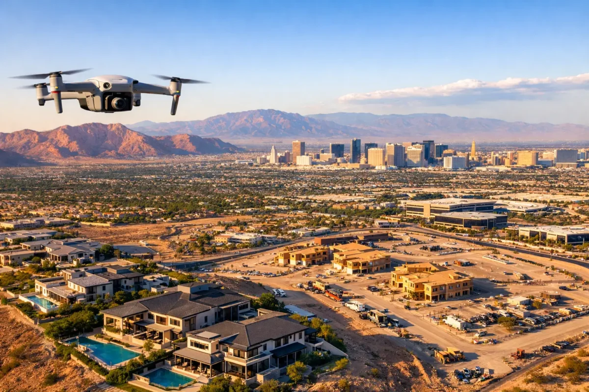
Aerial footage can show a buyer how a home sits against the mountains, give an investor a clear view of access roads and nearby development, or document progress across an active job site in minutes. But in Las Vegas, those same flights can involve complex airspace. Drone regulations are not a box to check after the creative work is complete. They shape where, when, and how a commercial aerial project can happen.
For property professionals, the right drone partner brings more than just a capable camera. A professional operation combines visual planning with FAA certification, airspace awareness, insurance, and a process built to protect the project schedule.
Why drone regulations matter to property marketing
Aerial imaging is a business asset. It gives listings scale, places land in its real-world context, and helps commercial teams communicate the relationship between a property and the roads, amenities, views, or neighboring development that influence value. Aerial construction imagery also creates a consistent visual record for stakeholders who cannot visit the site every week.
That value disappears quickly when a flight is delayed, canceled, or performed outside the rules. A pilot who does not understand the operational requirements may put the client, the property, and the final media at risk. The consequences can range from unusable footage and missed marketing deadlines to FAA enforcement action and insurance complications.
The trade-off is straightforward. A casual operator may appear less expensive at first, but a properly planned commercial flight reduces avoidable uncertainty. For a luxury listing launch, entitlement presentation, investor package, or construction milestone, dependable execution is part of the deliverable.
The FAA rules behind commercial drone work
Most paid aerial photography and videography in the United States fall under the FAA’s Part 107 rules. Whether the assignment is a residential listing, a commercial property flyover, construction documentation, or land marketing, the pilot operating the aircraft generally needs a Remote Pilot Certificate.
Part 107 establishes the basic operating framework for commercial drone flights. It addresses requirements such as pilot responsibility, aircraft registration, visual line of sight, preflight inspection, and safe operations around people and property. It also generally limits flights to daylight or civil twilight conditions, unless the operator meets the applicable requirements for nighttime operations.
The rules are not simply a matter of owning a license. Every flight requires judgment. The pilot must assess weather, visibility, obstacles, site activity, people on the ground, and the airspace above the property. A construction site, for example, may offer generous open space but still require careful coordination with crews, cranes, moving equipment, and active work areas.
Registration, Remote ID, and aircraft readiness
Commercial drones must be registered with the FAA, and most drones operating in U.S. airspace must meet Remote ID requirements. Remote ID broadcasts identification and location information that supports airspace awareness and accountability.
For the client, these details may sound administrative. They are evidence that the operator is treating the flight as a professional aviation activity rather than an impromptu camera shoot. Before takeoff, a qualified pilot also confirms that the aircraft, batteries, camera system, and safety features are ready for the planned mission.
The visual line of sight requirement
A Part 107 pilot must generally keep the drone within visual line of sight. This matters on large parcels, golf communities, industrial properties, and expansive construction sites where the desired route may extend farther than the pilot can safely observe.
A well-designed shot plan solves much of this challenge. Rather than forcing one long flight, a professional team may use multiple takeoff positions, plan a sequence of shorter passes, or capture the property in sections for a polished final edit. The viewer sees one cohesive aerial story, while the operation remains grounded in safe procedures.
Las Vegas airspace changes the planning process
Las Vegas offers dramatic aerial perspectives, but it also has some of the most operationally sensitive airspace in the region. Areas near Harry Reid International Airport, Nellis Air Force Base, and other controlled or restricted zones demand more than a quick check of a generic map.
Controlled airspace does not automatically mean a drone flight is impossible. It means authorization may be required before the flight can proceed, and the approval may include a specific altitude limit or operational conditions. In some locations, authorization can be requested through an approved FAA process. In others, the site, timing, or requested flight profile may require more planning or may not be feasible at all.
This is where property timelines and aviation timelines need to meet early. A broker should not promise next-day aerial footage for a listing near an airport without first confirming the airspace. A developer planning a major investor presentation should schedule aerial capture early enough to allow for location review, authorization, and weather contingencies.
The exact answer depends on the address, the proposed altitude, the date and time of the flight, and current airspace conditions. Temporary flight restrictions, special events, emergency activity, and changing FAA guidance can affect an otherwise workable plan. Experienced pilots check the current conditions for every mission rather than relying on what was approved or available months ago.
What clients should expect from a compliant aerial partner
The easiest way to manage regulations is to hire a provider that owns the compliance process from the start. The client should be able to focus on the property’s goals: which views matter, what audience needs to be persuaded, and where the images will be used.
A professional preflight process begins with the property address and the intended deliverables. Aerial stills for a single-family home require a different approach than cinematic video for a resort-adjacent development or recurring imagery for a construction project. The operator should evaluate the location, airspace, nearby obstacles, site access, and expected activity on the day of the shoot.
Insurance is another practical consideration. Commercial properties, active construction sites, and high-value listings often require documented coverage before a vendor can operate on site. Appropriate insurance protects the client and signals that the provider is prepared for professional assignments. Coverage needs vary by project, which is why it helps to discuss site requirements during the initial consultation.
For sensitive Las Vegas locations, documented authorization and a clear flight plan can be the difference between a productive shoot and a wasted appointment. Sky View LV works with FAA-certified drone pilots and carries insurance coverage from $1 million to $10 million, helping property teams secure aerial media without taking on the operational burden themselves.
Common misconceptions about drone regulations
One common mistake is assuming that permission from a property owner is all that is needed. Owner permission allows access to the site, but it does not override FAA airspace rules. A pilot may have approval to stand on a rooftop, in a parking lot, or on a vacant parcel and still need airspace authorization to fly from that location.
Another misconception is that a small drone has small obligations. Aircraft size can affect certain details, but commercial use still brings regulatory responsibilities. A lightweight drone can capture excellent listing footage, but it must be operated in accordance with applicable regulations.
Clients also sometimes assume that flying close to a building avoids airspace concerns. The FAA regulates the airspace, not just the distance from the property. Buildings, trees, and walls may create physical separation from surrounding activity, but they do not erase the need to follow the flight requirements for that location.
Finally, polished footage alone is not proof of compliance. A dramatic reel may show the creative result, but clients should also ask whether the operator is FAA-certified, insured, experienced with the site type, and prepared to obtain the necessary authorization.
How to keep an aerial project on schedule
The best time to discuss regulations is before photography is booked, not when the listing goes live. Share the exact property address, preferred delivery date, intended shot list, and any site restrictions as early as possible. For construction work, identify site contacts and the hours during which activities can be coordinated safely.
It also helps to build weather flexibility into the schedule. Wind, heat, haze, and summer storms can affect both safety and image quality in Southern Nevada. A professional pilot may recommend a morning, sunset, or alternate-day window based on the property’s orientation and the visual result you want.
For recurring projects, consistency matters. Establishing approved access procedures, safe takeoff areas, and a repeatable shot plan can make monthly progress documentation or ongoing commercial marketing more efficient. The goal is not merely to get a drone in the air. It is to produce reliable visual assets that support decisions, sales, and communication.
Aerial imaging should make a property team look prepared. When the flight is planned around the rules as carefully as it is planned around the view, the final images carry the confidence of a project done right.
Popular Posts
September 04, 2026
September 03, 2026
September 02, 2026
September 01, 2026
August 31, 2026
August 30, 2026
Comments are closed.