Professional Drone Services for Better Listings

A listing can have polished interior photos and still leave buyers, tenants, or investors asking the most important question: what does the property look like in context? Professional drone services answer that question from above, showing the lot, street access, surrounding amenities, views, building footprint, and scale in a way ground photography cannot.
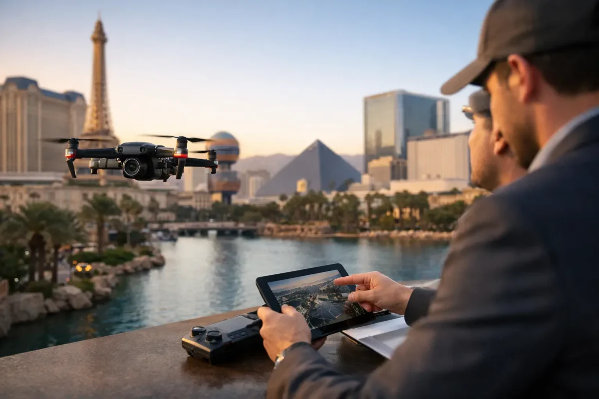
For Las Vegas real estate and commercial property professionals, that perspective is more than visual polish. It can help a buyer understand how close a home is to the Strip, demonstrate a development site’s access to major roads, show a retail center’s parking layout, or put a large parcel of land into practical context. The right aerial media helps qualified prospects see the opportunity before they schedule a call or tour.
Why Professional Drone Services Matter in Real Estate
Aerial photography is often treated as an add-on. For properties with views, acreage, proximity to attractions, complex access, rooftop features, or surrounding development potential, these should be part of the core marketing plan.
A single elevated image can communicate information that may otherwise require several ground-level photographs and a lengthy listing description. Buyers can see the relationship between a backyard and a golf course, a warehouse and nearby transportation routes, or a multifamily property and the surrounding neighborhood. Video adds another layer by guiding viewers through the property’s position in the market, from a wide establishing shot to a closer look at its defining features.
That clarity matters because online listings compete for attention in seconds. Generic images can make a distinctive property look interchangeable. High-resolution aerial stills and cinematic video create a stronger first impression while giving serious prospects useful information.
The best aerial work is not simply a collection of high shots. It is planned around the story a property needs to tell. A luxury home may need to emphasize views, privacy, outdoor living, and neighborhood setting. A commercial listing may need to show visibility, ingress and egress, nearby anchors, parking, and building scale. Land marketing may require a wider view of boundaries, terrain, access points, and adjacent uses.
What a Professional Aerial Production Includes
Commercial drone work involves far more than flying a camera over a site. A qualified provider begins by understanding the purpose of the media, the audience, the property’s defining features, and the final deliverables needed for a listing, pitch deck, website, social campaign, or project archive.
Flight planning comes next. The operator evaluates the site, weather, surrounding obstacles, local operating conditions, and airspace requirements. This is especially relevant in the Las Vegas Valley, where controlled airspace and nearby aviation activity can affect when and how a flight can be conducted. A professional pilot handles the coordination and authorization process appropriate to the operation rather than asking a client to navigate it alone.
On-site, the pilot captures purposeful angles rather than relying on a single overhead view. A typical real estate or commercial shoot may include elevated property portraits, oblique angles that show depth, broad neighborhood context, detail shots of amenities, and video sequences designed for smooth editing. Depending on the project, 360-degree photo spheres can also give remote viewers a more immersive sense of place.
The production continues after the aircraft lands. Color correction, shot selection, video editing, and delivery format all influence whether the final content looks like a premium marketing asset or an unfinished file from a consumer device. Strong editing keeps skies natural, property details clear, motion controlled, and attention focused on what makes the site valuable.
Credentials Protect the Project and the Client
Hiring a friend with a drone may seem convenient until a flight encounters an airspace restriction, an insurance requirement, a safety issue, or a delayed delivery. Commercial aerial imaging requires professional accountability.
FAA-certified drone pilots operate under the rules that apply to commercial work. They understand operational limitations, preflight procedures, weather considerations, and the need to secure authorization when a location falls within controlled airspace. For clients marketing property near Harry Reid International Airport, Nellis Air Force Base, or other sensitive areas, this experience can be the difference between a properly planned project and a shoot that cannot proceed.
Insurance also matters. Property managers, developers, brokers, and construction teams may require proof of coverage before granting access. A fully insured provider gives clients confidence that the flight is being managed as a business operation rather than a casual hobby. Sky View LV offers insurance coverage ranging from $1 million to $10 million, depending on project requirements, to support projects that require higher levels of protection.
Compliance does not limit creativity. It makes dependable creativity possible. When flight planning, permissions, and safety checks are handled correctly, the client can focus on the property and the campaign rather than the operational details behind the camera.
Choosing the Right Deliverables for the Property
Not every project needs the same package. The strongest approach begins with the intended use of the content and works backward from there.
For a residential listing, a focused set of aerial stills may be enough to establish lot size, views, pool areas, nearby parks, or location relative to community features. Add a short cinematic video when the home has an experience to convey, such as a dramatic approach, a large outdoor entertaining area, or a setting that becomes more compelling in motion.
Commercial real estate often benefits from a broader asset set. Aerial photography can document the building and site layout, while video can show access routes, surrounding retail, road exposure, or nearby development. These visuals are useful not only for listing promotion but also for investor presentations, leasing materials, and internal discussions.
Construction and development teams may need recurring imagery rather than a one-time marketing shoot. Regular aerial documentation creates a visual record of progress, supports stakeholder updates, and makes it easier to compare site conditions over time. The appropriate flight frequency depends on the project schedule, the team’s reporting needs, and how quickly the site is changing.
Land is another case where aerial media quickly earns its place. Ground photos can show a portion of a parcel, but aerial imagery helps communicate terrain, nearby infrastructure, access, and the scale of the opportunity. It should not replace surveys, legal boundary documentation, or due diligence. It can, however, make those conversations easier to begin.
How to Prepare for an Aerial Shoot
Clients do not need to be drone experts before booking a shoot, but a little preparation can improve the outcome. Start by identifying the property’s most valuable visual story. Is the goal to show a mountain view, freeway access, a corner location, rooftop amenities, a large lot, or the surrounding commercial corridor? Sharing that priority helps the pilot plan the right shots.
It is also helpful to schedule around property readiness. Vehicles, construction materials, landscaping equipment, temporary signage, and unfinished exterior work can affect the final image. For occupied homes or active sites, coordinate access and let relevant occupants know when the crew will be present.
Timing is another decision with real impact. Early morning and late afternoon often provide more dimensional light and warmer tones, while midday may work better when the priority is a clear, evenly lit overview of a large commercial site. Weather, wind, haze, and airspace conditions can require flexibility. A professional provider will advise when rescheduling is necessary to protect the project’s quality and safety.
The Business Case for Hiring a Specialist
Buying a drone does not automatically create an in-house aerial marketing department. Professional results require an aircraft, backup equipment, current knowledge of FAA requirements, insurance, flight planning, editing skills, storage, maintenance, and the time to manage each stage of production. For most real estate and property teams, outsourcing is the more efficient choice.
The value is not only in the footage. It is in receiving media that is planned for the property, legally captured, professionally edited, and ready to use. That reduces the internal burden on agents, coordinators, developers, and marketing teams while helping them present assets at a higher standard.
Aerial imaging works best when it is considered early, not added after a listing has already gone live. During a free consultation, define the audience, the property’s visual advantages, and the materials that will move the conversation forward. From there, professional drone services become a practical way to show prospects what makes a property worth seeing in person.
Popular Posts
August 24, 2026
August 23, 2026
August 22, 2026
August 20, 2026
August 19, 2026
August 18, 2026
Comments are closed.