Top 5 Frequently Asked Questions About Real Estate Drone Photography

Top 5 Frequently Asked Questions About Real Estate Drone Photography.
Real estate drone photography is gaining popularity, but it can be unclear for those new to the concept. This article answers the top five questions about using drones for real estate. Whether you’re a property owner or a real estate agent, understanding these basics will help you make the most of this technology.
Key Takeaways
- Anyone can use drones for real estate photography, but they must comply with local regulations and obtain the necessary permits.
- The cost of real estate drone photography varies based on project size and the photographer’s experience.
- There are legal restrictions and regulations governing the use of drones in real estate, so it’s essential to familiarize yourself with the laws in your area.
- Drone photography can make commercial properties more attractive by showcasing the entire property and its surroundings.
- Drones can also be used for property inspections, making it easier to spot issues that might be hard to see from the ground.
1. Can anyone use drones for real estate photography?

Yes, anyone can use drones for real estate photography, but there are some important rules to follow. Drone Photography in real estate uses uncrewed aerial vehicles (UAVs), commonly known as drones, equipped with high-resolution cameras to capture aerial images and videos of properties. This technique provides a unique perspective that traditional ground-based photography cannot, offering comprehensive and captivating views of properties.
To legally operate a drone for real estate purposes, you must:
- Obtain the necessary permits and licenses.
- Follow local regulations and guidelines.
- Ensure the drone is registered with the appropriate authorities.
- Maintain a safe distance from people and private property.
It’s crucial to stay updated with the latest rules and regulations to avoid any legal issues.
By adhering to these guidelines, anyone can use drones to enhance their real estate marketing efforts.
2. How much does real estate drone photography cost?
Real Estate Drone Photography costs can vary widely based on several factors. These include the property’s location, size, and project scope. Prices typically range from a few hundred to a few thousand dollars.
Here are some general pricing guidelines:
| Property Type | Price Range |
|---|---|
| Small Homes | $200 – $500 |
| Large Homes | $300 – $6,00 |
| Commercial Properties | $500 – $1,000 |
Several factors influence these prices:
- Location: Properties in high-demand areas may incur higher photography costs.
- Property size: Larger properties require more time and effort, resulting in increased costs.
- Number of Images/Videos: The more images or videos you provide, the higher the price.
It’s important to hire certified and compliant drone operators to ensure quality and adherence to regulations.
3. Are there any legal restrictions or regulations for real estate drone photography?

Yes, there are legal restrictions and regulations governing drone photography in real estate, which can vary by country. Knowing the local rules before flying a drone for real estate purposes is crucial. Here are some standard regulations you might encounter:
- Permits and Licenses: Many places require drone operators to have specific permits or licenses. This ensures that the operator is knowledgeable about safe flying practices.
- Privacy Laws: Drones can capture images and videos from above, potentially infringing on individuals’ privacy. Always respect privacy laws to avoid legal issues.
- Airspace Regulations: Drones must not interfere with human-crewed aircraft. There are often restrictions on flying near airports or in certain airspace zones.
- Safety Measures: Operators should follow safety guidelines to prevent accidents. This includes maintaining a line of sight with the drone and avoiding crowded areas.
Remember, hiring a skilled drone operator can help you navigate these regulations and ensure your property marketing is both effective and compliant.
4. How can drone photography benefit commercial properties in real estate?

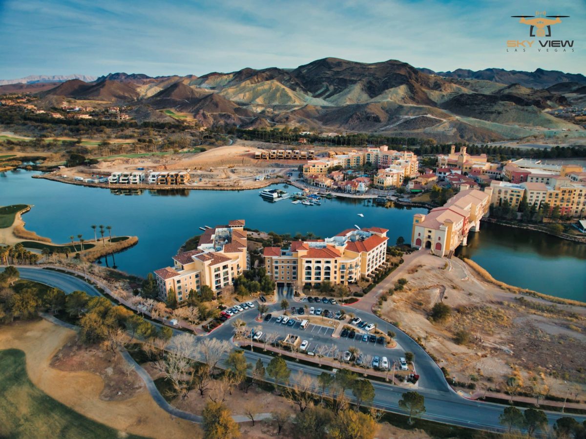
Aerial drone photography revolutionizes real estate by providing an eagle-eye view, highlighting property features, enhancing listings’ appeal, staying ahead of competitors, and offering better accuracy and dynamic visuals. Professional drone services capture detailed photos, attracting clients impressed by authenticity and professionalism. Adopting drone technology sets businesses apart, showcasing dedication and commitment. Drones maximize data collection, provide exact measurements, and attract more customers. Stay ahead in the real estate market with innovative aerial drone photography services.
5. Can drones be used for real estate property inspections?
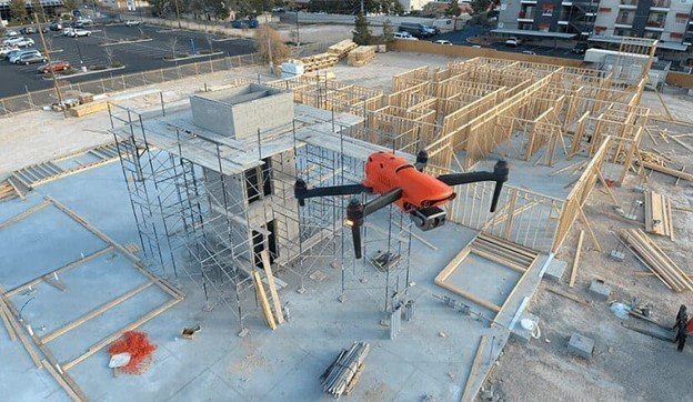
Yes, drones can be used for property inspections in real estate. They are handy for checking hard-to-reach or dangerous areas. Using drones for inspections can save time and reduce risks.
- Drones can inspect roofs, chimneys, and other high areas without the need for ladders or scaffolding.
- They can also quickly assess large properties and provide detailed images and videos.
- Drones help identify issues such as leaks, cracks, or other damage that might be missed from the ground.
Embracing drone services gives a competitive edge in modern real estate marketing. Drones enhance property listings with aerial views, virtual tours, and cost-effective marketing solutions.
Conclusion
Real estate drone photography is a game-changer in the property market. It offers unique views and helps properties stand out from the crowd. As we’ve discussed, there are several essential things to know before getting started, including legal requirements and associated costs. However, with proper preparation, drone photography can significantly boost your real estate business. Whether you’re showcasing a home’s best features or inspecting a property, drones can make a significant difference. If you’re considering using drones, now is a great time to start.
Frequently Asked Questions
Can anyone use drones for real estate photography?
Anyone can use drones for real estate photography, but it is essential to comply with local regulations and obtain the required permits and licenses.
How much does real estate drone photography cost?
The cost of real estate drone photography can vary. It usually depends on the property’s size and the complexity of the shoot. The average price ranges from $150 to $400 per session.
Are there any legal restrictions or regulations for real estate drone photography?
Yes, there are legal restrictions. Drone pilots must follow rules set by the Federal Aviation Administration (FAA) and may require special permits, particularly when operating in specific areas.
How can drone photography benefit commercial properties in real estate?
Drone photography can enhance commercial properties by providing unique, visually appealing views. It can show off the property’s entire layout, surroundings, and special features, making it more attractive to potential buyers or renters.
Can drones be used for real estate property inspections?
Yes, drones can be used for property inspections. They can reach high or hard-to-access areas, providing detailed images and videos to help identify issues that may need repair.
Is real estate drone photography worth it?
Yes, real estate drone photography is worth it. It offers unique views and can make properties look more attractive, helping to attract more buyers.
Level-Up Your Real Estate Performance With Our Professionals!
Marketing can help your business reach new heights if the right strategies are employed and executed effectively. Standard street-level shots of your property help answer your customers’ questions and provide additional details about your property. So, why struggle with sales? Stay ahead with the hottest marketing real estate trends, guided by our professionals. Sky View LV offers affordable real estate drone photography services and related drone services. Visit our website and contact our expert to learn more about our services! Contact us at 702.670.1067
Popular Posts
February 11, 2026
February 11, 2026
January 23, 2026
January 22, 2026
November 14, 2025
November 04, 2025


Comments are closed.