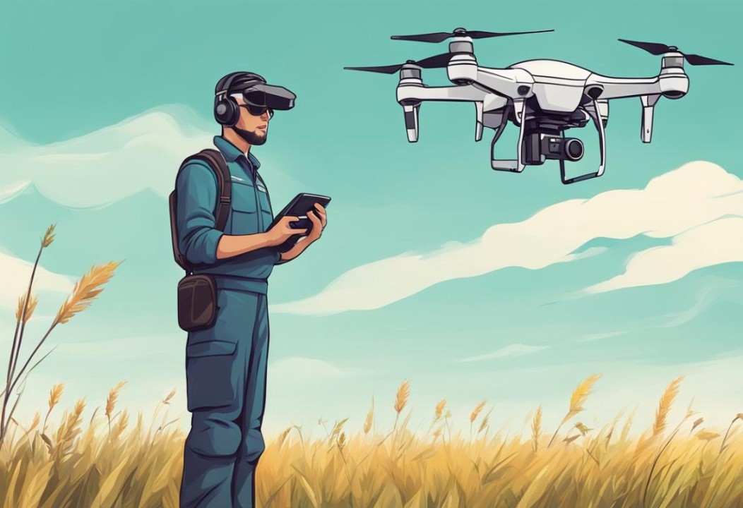
Explore the Top Professional Aerial Photography Services
Aerial photography has taken off—literally. With the rise of drone technology, industries such as real estate, film, construction, and inspections are increasingly relying on these advanced services to complete work faster, more safely, and more creatively. Whether you’re showcasing a home, filming a commercial, or inspecting hard-to-reach infrastructure, drones offer a fresh perspective that traditional photography can’t match.
In this guide, we’ll break down the most popular types of drone photography services, what they offer, and how they can benefit your business or project.
Drone Photography Services
Drones have revolutionized photography by capturing stunning aerial views of landscapes, homes, events, and more. With their ability to hover, maneuver, and shoot from angles previously impossible, they bring a whole new dimension to visual storytelling.
What You Can Expect:
High-Resolution Images: Crisp, clear photos perfect for marketing, portfolios, or personal use.
Creative Angles: Drones can fly high, low, and everywhere in between, offering shots traditional photographers can’t reach.
Fast Delivery: Many providers offer quick editing and turnaround to keep your projects on schedule.
From boosting marketing campaigns to capturing memories in a new way, drone photography is both functional and artistic.
Need aerial photos in Las Vegas? Platforms like droners.io connect you with licensed drone pilots ready to deliver high-quality results for real estate, events, inspections, and more. Thousands of clients have successfully brought their vision to life using these professional services.
Drone Cinematography Services
the drone
Drone cinematography is transforming the video production landscape. Whether you’re working on a film, commercial, or live event, drones provide stunning footage that was once only possible with helicopters or cranes.
Why It Works:
Cinematic Footage: Capture movie-quality video with advanced camera equipment.
Dynamic Angles: Get sweeping shots, dramatic flyovers, and impossible camera movements.
Diverse Uses: Ideal for weddings, real estate videos, promotional content, and more.
Key Benefits:
Cost-Effective: Save money by avoiding the use of cranes or helicopters.
Quick Setup: Get airborne and start filming within minutes.
Creative Flexibility: Freedom to experiment with new angles and movements.
Drone cinematography brings your vision to life with breathtaking impact—without breaking your budget.
Residential Real Estate Photography
Selling a home? Aerial photography helps you stand out in a crowded market. With drone photography, you can showcase not just the home, but the entire property and the surrounding neighborhood.
Real Estate Benefits:
Stand-Out Listings: Unique shots attract more clicks and interest online.
Highlight the Neighborhood: Capture nearby parks, schools, or scenic views.
Faster Sales: Homes with professional aerial photos tend to sell quickly.
Buyers love seeing the whole picture—and drone photography gives them precisely that.
Commercial Property Photography
Commercial real estate is all about presentation. High-quality aerial shots make your listings pop and help investors see the full value of a property at a glance.
Why It Matters:
Improved Visibility: Show the property’s footprint, parking, access points, and surroundings.
Highlight Key Features: Showcase layout, location, and nearby amenities.
Capture Attention: In a competitive market, eye-catching visuals make all the difference.
Before You Shoot:
Choose a drone with high-resolution capabilities.
Plan the flight path to ensure complete coverage of the property.
Always follow local drone regulations.
Professional drone photography gives your listings an edge—and leaves a lasting impression on potential buyers or tenants.
Drone Inspection Services
Need to inspect a hard-to-reach place? Drones make it easier, safer, and faster than traditional methods. They’re being used in everything from construction to utilities to infrastructure monitoring.
Key Advantages:
Enhanced Safety: Inspect dangerous areas without putting workers at risk.
Lower Costs: Reduce the need for scaffolding, lifts, or helicopters.
Detailed Imagery: Get high-resolution data that helps you make better decisions.
Common Uses:
Roof Inspections
Powerline & Pipeline Monitoring
Bridge & Infrastructure Assessments
Solar & Wind Energy Equipment Checks
Drone inspections are efficient and reliable, making them an essential tool for modern asset management.
Aerial Survey & Mapping
Need detailed mapping of a large area? Drones enable faster and more accurate surveying. With advanced GPS and imaging tech, they provide reliable data for a range of industries.
Why Aerial Mapping Works:
Faster Results: Drones cover more ground in less time.
Precision: High-resolution imaging ensures accurate maps and models.
Cost-Effective: Less labor, less time, more value.
Applications Include:
Construction Monitoring
Agricultural Planning
Environmental Studies & Conservation
Aerial mapping helps professionals visualize, analyze, and plan more effectively using high-quality geospatial data.
Industrial Drone Inspections
Industrial sites often present safety hazards and difficult access points. That’s where drone inspections shine. They’re fast, efficient, and safe—perfect for large-scale operations.
Top Benefits:
No Need for Scaffolding or Cranes
Worker Safety: Inspections are done remotely.
Speed & Accuracy: Quickly detect potential issues before they escalate.
Industries That Benefit:
Manufacturing Plants
Energy & Utilities
Infrastructure & Construction
Using drones for industrial inspections means better maintenance, fewer disruptions, and improved safety for your team.
Whether you’re showcasing a property, filming an event, or inspecting industrial assets, aerial photography can bring your vision to life. But to get the best results, you need the right team—professionals with the experience, equipment, and creativity to match your goals.
Take time to explore your options, ask questions, and choose a provider that understands your needs. With the right partnership, aerial photography can elevate your project in ways you never imagined—Aerial Photography in Las Vegas.
Frequently Asked Questions
What is drone photography?
Drone photography captures images or videos from the sky, offering angles and perspectives not possible from the ground.
How much does it cost?
Prices vary depending on project size, location, and complexity. It’s best to contact a provider for a custom quote.
Are drones safe to use?
Yes—when operated by licensed professionals who follow flight regulations and safety protocols.
Can drones be used for real estate?
Absolutely. Drones are one of the most effective tools for showcasing properties and their surroundings.
How long does it take to receive the photos?
Most services deliver final images within 24–48 hours after the shoot.
Do I need permits or approvals?
Your drone service provider will typically handle the required permissions and ensure compliance with local regulations.
Ready to See the World from a New Perspective?
Sky View LV is here to help you unlock the full potential of aerial photography. From breathtaking visuals to technical inspections, we’ve got the expertise to elevate your project.
Why I Started Using Drones in Real Estate (And You Should Too)
Mastering Aerial Photography for Real Estate Success. Three years ago, I was struggling to make my listings stand out in a saturated market. Every property looked the same in photos—same angles, same boring shots through the front door. Then I watched a colleague’s luxury listing go viral on Instagram, featuring a stunning aerial shot that showcased the property nestled against a lake. I knew I had to learn drone photography.
Here’s what I’ve discovered about using aerial photography in real estate, including the mistakes I made so you don’t have to.
The Game Actually Changed (But Not How You’d Expect)
Everyone talks about aerial photos like they’re magic bullets for selling homes. The truth is more nuanced. Yes, they help properties stand out online, and I’ve definitely noticed faster engagement with listings that include drone shots. But the real value isn’t just the “wow factor”—it’s about telling the complete story of a property.
Take this Victorian home I listed last month. The ground-level photos made it look cramped between two larger houses. The aerial shot revealed a private backyard you couldn’t see from the street, and it showed how close it was to the downtown area. That context made all the difference for buyers.
Getting Started: Equipment That Actually Matters
When I first started, I got overwhelmed by all the technical specs and reviews. Here’s what I wish someone had told me:
For beginners, the DJI Mini series is ideal. It’s under the weight limit that requires registration, the camera quality is solid, and it won’t break the bank if (when) you crash it because you will crash it. I crashed mine into a tree on my third flight.
Key features I actually use:
Good camera stabilization (this matters more than megapixels)
At least 20 minutes of flight time
Obstacle sensors (trust me on this one)
Simple controls—you’ll have enough to worry about without complex flight modes.
Regarding the FAA Part 107 license: If you’re operating commercially, you need it. The test isn’t too bad if you study, and clients take you more seriously when you mention you’re certified. Plus, you really don’t want to deal with FAA fines.
Shots That Actually Work (From Someone Who’s Taken Thousands)
After shooting dozens of properties, I’ve learned that some aerial angles consistently work, while others look visually appealing but don’t effectively help sell homes.
The money shots:
The “reveal” shot: Start wide to show the neighborhood context, then gradually focus on the property. Buyers want to know what they’re getting into.
Golden hour magic: Everyone says this, but it’s true. That warm light makes even modest homes look expensive. I schedule most shoots for the hour before sunset.
The backyard hero: Many properties have amazing outdoor spaces that you can’t appreciate from ground level. Pool areas, gardens, and outdoor entertainment spaces look incredible from above.
What doesn’t work as well:
Straight-down shots (unless it’s a unique architectural feature)
Flying too high—you lose the connection to the property
Ignoring the surroundings—power lines, busy roads, and neighboring eyesores don’t disappear just because you’re using a drone
Integrating Aerial Photos Into Your Marketing
Here’s where I see many agents go wrong: they secure one great aerial shot and then don’t know what to do with it.
What I’ve found works:
Use aerial shots as your lead image in online listings. That broad perspective immediately sets your listing apart in search results.
Create short aerial video clips for social media. A 15-second clip of the property and neighborhood receives significantly more engagement than static photos.
Print a large aerial photo for open houses. People appreciate seeing the property from this perspective, and it gives them something to discuss.
The key is consistency. Don’t just add one drone shot to a listing with 20 traditional photos—it looks like an afterthought.
Mistakes I’ve Made (So You Don’t Have To)
Flying in bad weather: I once tried to get “dramatic” shots with storm clouds in the background. The wind was impossible to manage, and the photos looked terrible. Stick to calm, clear days.
Not checking restrictions: I almost flew in controlled airspace near a small airport without realizing it. Download an app like AutoPylot or B4UFLY before every flight.
Forgetting about privacy: Your neighbors might not love you flying a camera around their backyard. I always let adjacent property owners know what I’m doing and when.
Skipping the editing: Raw drone footage often looks flat and dull. Learning basic editing in Lightroom made a massive difference in the quality of my final images.
What’s Coming Next
The technology continues to improve and become more affordable. I’m seeing more agents experiment with 360-degree aerial tours and even simple aerial mapping for larger properties. Virtual reality integration is starting to pop up in luxury markets.
But honestly, the basics still matter most. A well-composed aerial shot that shows off a property’s best features will always beat fancy technology used poorly.
Should You Start Using Drones?
If you’re on the fence about Real Estate drone photography, start small. Rent a drone for a weekend and test it on one of your listings (after obtaining proper licensing). See how it feels, whether clients respond positively, and if it fits into your workflow.
The learning curve isn’t as steep as you might think, and the differentiation in your market might be worth the investment. Just remember—like any tool, it’s only as good as how thoughtfully you use it.
The sky is the limit, but sometimes the best shots are those that show a property in its best light.
Explore the vibrant world of drone photography in Las Vegas, highlighting its benefits for real estate, compliance requirements, and the future of aerial imagery.
Overview of Drone Photography in Las Vegas
Elevate Your Perspective: The Rise of Drone Photography in Las Vegas. Drone photography has experienced a remarkable surge in popularity across Las Vegas, driven by technological advancements and the city’s unique landscapes. Aerial imagery has become increasingly vital across industries, particularly in real estate and event marketing. Las Vegas, with its iconic architecture and vibrant nightlife, presents an ideal backdrop for creative aerial photography projects. Notably, the city hosts numerous events and festivals throughout the year, offering drone photographers many opportunities to capture dynamic, engaging imagery.
The accessibility of drone technology has opened the door for a broader range of businesses to utilize aerial services. Whether for showcasing properties or documenting events, the demand for professional drone photography in Las Vegas remains consistently high. The city’s distinctive features, coupled with the creative potential of drone pilots, make it a hotspot for high-quality aerial photography projects.
Benefits of Drone Photography for Real Estate
Drone photography significantly enhances real estate marketing by providing stunning visuals that attract potential buyers. Properties showcased with aerial images offer a comprehensive perspective of the property and its surroundings, which is particularly important in Las Vegas’s competitive market. For instance, a property listing featuring drone footage can highlight unique features such as expansive yards, pools, and proximity to local amenities, making it more appealing to prospective clients. Studies show that properties listed with drone footage receive 68% more inquiries than those without.
Professional drone pilots, such as those at Sky View LV, offer customized consultations tailored to each client’s specific needs. This personalized approach ensures that the captured images align with the marketing strategy, thereby improving the effectiveness of the real estate listing. High-resolution aerial photography can enhance marketing materials and online listings, providing a distinct competitive advantage.
Services Offered by Drone Pilots in Las Vegas
Drone pilots in Las Vegas provide a diverse range of services tailored to various industries. Standard offerings include aerial photography and videography for real estate, commercial projects, and events. Additionally, specialized services, such as mapping and surveying, are available, providing detailed data to support construction and planning projects. For example, accurate aerial maps can help developers understand land topography and plan layouts effectively.
Drone pilots also offer customizable wedding and event packages that capture unique moments from dramatic aerial angles. Real-time video streaming capabilities enable clients to monitor events and construction progress, enhancing transparency and engagement. The ability to adapt services to meet specific client needs is a hallmark of many drone photography businesses in Las Vegas.
Compliance and Safety in Drone Operations
Operating drones in Las Vegas requires adherence to strict FAA regulations, including holding a Part 107 license. Professional companies like Sky View LV ensure their pilots are FAA certified, which is crucial for legal and safe operations. Compliance with local authorities is also necessary to obtain aerial permits, especially when flying in busy urban areas such as Las Vegas.
Safety is a top priority for drone operators, necessitating pre-flight inspections and adherence to visual line-of-sight regulations during flights. Continuous education and training enable pilots to stay current with technological advancements and regulatory changes, ensuring they remain compliant and effective. Professional drone services prioritize these aspects to ensure safe, compliant operations, which are essential to maintaining industry standards and client trust.
Technology Used in Drone Photography
The technology used in drone photography has advanced significantly, enabling the capture of high-quality aerial footage. Drones such as the DJI Inspire 3 and DJI Mavic 3 Cine are widely used for their advanced camera capabilities and stabilization, enabling professional-grade imagery. Additionally, equipment such as the DEFY Cadence cable cam system enhances aerial shot quality, delivering smooth, cinematic video.
Professional drone services often include in-house editing teams that streamline the process, allowing for same-day project delivery in many cases. Specialized applications, including thermal and multispectral cameras, are also used for tasks such as agricultural monitoring and building inspections. These technological advancements ensure that aerial photography services in Las Vegas remain competitive and able to meet diverse client needs.
Choosing the Right Drone Photography Service
Selecting the appropriate drone photography service requires careful consideration of several factors. It is essential to verify FAA certification and insurance coverage, as both are crucial to legal compliance and safety. Companies like Sky View LV provide a range of drone photography and videography services tailored to specific industries, making it easier for clients to find the right fit for their project needs.
Reading customer testimonials can offer valuable insights into the quality of service and professionalism of a drone pilot. Inquiring about the pilot’s experience with similar projects can also help ensure that their specific requirements are met. It is advisable to verify the company’s safety record and regulatory compliance to provide peace of mind during operations. Discussing potential post-production services can clarify expectations for the final product.
The Future of Drone Photography in Las Vegas
The future of drone photography services in Las Vegas appears promising, with anticipated technological advancements expected to enhance the quality and accessibility of aerial imagery. The increasing use of drones for commercial applications, including inspections and mapping, is expected to continue growing. As regulatory frameworks evolve, they may allow for expanded operational capabilities in urban environments.
Furthermore, integrating AI and machine learning into drone photography could improve automated editing and data analysis. Community initiatives and workshops are emerging to educate aspiring drone pilots and promote responsible drone use. With tourism continuing to flourish, demand for unique aerial content that captures the essence of Las Vegas is likely to rise, solidifying the role of Drone Services in Nevada’s vibrant landscape.
In the bustling, ever-evolving city of Las Vegas, capturing its awe-inspiring landscape from a unique perspective is no easy task. However, Sky View LV, a leading drone photography company, is changing how we see the world. Whether you’re looking to capture the sweeping beauty of the Strip, showcase an architectural masterpiece, or create unforgettable memories from above, Sky View Las Vegas offers high-quality, professional drone photography services to meet all your needs.
A New Age of Photography
Drone photography has revolutionized imagery, offering a bird’s-eye view that traditional photography cannot match. Sky View LV understands the importance of capturing moments and landscapes in their entirety, providing clients with breathtaking aerial shots and videos that add a touch of magic to any project. From sweeping aerial views of the city to intimate close-ups of gatherings, Sky View LV captures every angle.
Why Choose a Drone Photography Company?
When it comes to capturing unique perspectives, a drone photography company like Sky View LV offers several distinct advantages:
Stunning Aerial Shots: Traditional photographers can only work within the constraints of ground-level views, but drones take your photography to new heights—literally. They can shoot from angles and elevations that would otherwise be impossible with a standard camera.
Time and Cost Efficiency: Using a drone significantly reduces time and costs associated with capturing high-quality aerial footage. Drones can cover large areas quickly, while providing the same, if not better, quality as traditional helicopter shoots, which are much more expensive.
Versatility: Whether you’re a business looking to showcase your property, a couple in need of a unique wedding album, or a filmmaker working on a project, drone photography offers unparalleled versatility in the shots it can capture.
Precision and Detail: Modern drones are equipped with high-definition cameras that capture images in incredible detail. This precision allows Sky View LV to create high-quality visuals that meet even the most stringent standards.
Services Offered by Sky View LV
Sky View LV offers a variety of services to cater to every need. Whether you’re an individual, a business, or a creative professional, there’s a service tailored to your needs.
Real Estate Photography
One of Sky View LV’s most sought-after services is drone photography for real estate. Given the competitive nature of the Las Vegas real estate market, sellers and agents must make their properties stand out. Aerial shots of a home or property can highlight its features in ways traditional photography cannot.
Sky View LV provides high-definition aerial photos and videos that capture the property’s scale, surrounding neighborhoods, and nearby landmarks. This not only gives potential buyers a clearer view of what’s for sale but also adds an eye-catching element to property listings, driving interest and increasing the chances of a successful sale.
Event Photography and Videography
Whether it’s a wedding, corporate event, or outdoor gathering, Sky View LV can provide clients with stunning aerial shots that capture the essence of any event. A bird’s-eye view of an outdoor wedding or concert can give a sense of grandeur and scale, allowing clients to relive their memories in a way that ground-level photos can’t match.
The beauty of using drones for events is that they capture moments from unique angles, offering a fresh take on your special day. Whether you need cinematic shots or simple documentation, Sky View LV has the tools and experience to deliver.
Construction and Architecture
For architects and construction companies, Sky View LV provides construction-site photographyto track project progress. Drones can capture aerial footage that shows construction progress, from the foundation to the final touches. This service helps clients monitor timelines, evaluate changes, and provide stakeholders with real-time visual updates.
For architectural firms, drone photography is invaluable for capturing the beauty and scale of their designs. Aerial views help highlight the structure’s integration into its environment, making them perfect for portfolios, presentations, and marketing materials.
Film and Cinematic Shots
Sky View LV specializes in aerial cinematography for filmmakers. Drones are a vital tool in capturing dynamic, high-quality aerial shots, which are essential for modern filmmaking. Whether you’re shooting a commercial, music video, or feature film, the team at Sky View LV ensures smooth, stable footage that elevates your storytelling.
Technology Behind the Magic
What sets Sky View LV apart from other drone photography companies is its commitment to using the latest drone technology. The company utilizes drones equipped with high-quality cameras to capture stunning, high-definition photos and videos. These state-of-the-art drones provide precise control, stability, and safety, which are essential when flying over complex environments such as the Las Vegas skyline or busy construction sites.
The drones used by Sky View LV are capable of shooting in 4K resolution, offering crisp, clear, and vivid imagery. These images can then be edited and tailored to each project’s specific needs, from color correction to special effects.
Advanced Software for Editing
Beyond the drone itself, Sky View LV also employs cutting-edge software for photo and video editing. Whether you need a quick touch-up or a detailed editing process, the team can produce images and videos that align with your vision. The ability to fine-tune your aerial photos ensures that you receive the best possible product, whether it’s a simple image for social media or a polished video for a commercial.
The Sky View LV Team
The team at Sky View LV comprises highly trained drone operators who are not only experts in operating drones but also skilled photographers and videographers. They work closely with clients to understand their vision, ensuring that every shoot is done with precision and care.
Sky View LV places a strong emphasis on safety. Their drone operators follow strict safety protocols to ensure every flight complies with FAA regulations, giving clients peace of mind that their projects are handled responsibly.
Client Testimonials: What People Are Saying
Sky View LV has built a strong reputation for delivering exceptional service. Here’s what a few clients have said:
“Sky View LV took our real estate listing to the next level. The aerial shots of our home were stunning and helped us close the sale in record time.” – Tina M., Real Estate Agent.
“We hired Sky View LV for our wedding, and we couldn’t be happier. The drone shots of our ceremony were breathtaking. We’ll cherish those photos forever.” – David and Michelle P., Newlyweds.
“As a filmmaker, getting the right shot is crucial. The team at Sky View LV delivered cinematic footage that elevated our project to new heights.” – Jake L., Filmmaker
Conclusion
Whether you’re a business looking to showcase your property, a couple looking to capture your special day, or a filmmaker searching for the perfect aerial shot, Sky View LV is the drone photography company that can take your project to new heights—literally. With cutting-edge technology, a skilled team, and a commitment to quality, Sky View LV delivers unparalleled drone photography services. So, the next time you’re looking for a fresh perspective, consider taking to the skies with Sky View LV.
Vegas From Above: Drone Pics! Have you ever wondered what Las Vegas looks like from way up high? It’s pretty amazing, let me tell you. Getting a bird’s eye view of all those bright lights and famous buildings changes everything. This article examines Las Vegas drone photography, covering how these impressive aerial shots are captured, what makes them distinctive, and why they’re a significant part of the city’s tourism.
Key Takeaways
Las Vegas appears remarkably different and cool from above, especially with its bright lights and famous landmarks.
To get good aerial photos, you need the right gear and some skill.
Drones have made it easier for anyone to snap pictures from the sky.
Taking aerial photos in Las Vegas can be challenging due to the weather and various regulations.
High-quality aerial photos can attract more visitors to Las Vegas and effectively showcase the city.
The Allure of Las Vegas Aerial Photography
Las Vegas is a city practically built for eye-catching visuals, and aerial photography in Las Vegas takes that to a whole new level. It’s not just about seeing the city; it’s about experiencing it from a perspective that most people never get to see. It’s about capturing the energy, the scale, and the sheer audacity of Vegas in a single frame.
Capturing the Neon Lights
Las Vegas at night is a spectacle of neon, and aerial shots turn this into a breathtaking tapestry of light. As shown above, the lights bleed into one another, creating a vibrant, almost otherworldly scene. It’s a chance to capture the essence of Vegas after dark, the energy that pulses through the city when the sun goes down.
The Unique Perspective of the Strip
The Strip is the heart of Vegas, and seeing it from above gives you a sense of its layout and grandeur. You can appreciate the architectural marvels, the way the hotels and casinos line up, and the sheer scale of the attractions. It’s a perspective that’s impossible to get from the ground, and it highlights what makes the Strip so special. The aerial views are simply unmatched.
Why Aerial Shots Stand Out
Aerial photography offers a unique and captivating perspective. It’s not just about taking a picture; it’s about telling a story. These shots often grab more attention, making them popular among tourists and photographers.
Aerial photography captures the beauty of Las Vegas and tells a story about the city’s vibrant life and energy.
Techniques for Stunning Las Vegas Drone Photography
Choosing the Right Drone Equipment
Selecting the right equipment is key to capturing fantastic aerial shots in Vegas. You don’t need the most expensive drone, but consider these points:
Camera Quality: Look for a drone with a high-resolution camera (at least 4K video and 20MP photos). This will give you crisp, detailed images.
Gimbal Stability: A 3-axis gimbal is essential for achieving smooth, cinematic footage, particularly in windy conditions.
Flight Time: Longer flight times mean more opportunities to get the perfect shot. Aim for at least 20-25 minutes of flight time per battery.
Think about what you want to achieve. Are you focused on photos, videos, or both? This will help you narrow down your choices and find a drone that fits your needs.
Mastering Flight Paths and Angles
Planning your flight path is essential for getting unique and interesting shots. Don’t just fly around randomly. Consider these tips:
Use Waypoints: Plan your route using waypoint navigation. This allows you to focus on the camera while the drone follows a preset path.
Experiment with Angles: Try different angles to see how they affect the composition. Fly low for dramatic perspectives or high for sweeping panoramas.
Reveal Shots: Start with a close-up and slowly reveal the wider scene. This creates a sense of anticipation and adds visual interest.
If you’re hiring a drone pilot in Las Vegas, ensure they have experience with complex flight maneuvers.
Timing for Perfect Lighting
Lighting is everything in photography, and aerial shots are no exception. Here’s how to make the most of the light in Las Vegas:
The Golden Hour is King: The hours after sunrise and before sunset offer the best light. The soft, warm light creates beautiful colors and shadows.
Avoid Midday Sun: The harsh midday sun can create unwanted shadows and wash out colors. If you have to shoot during midday, try to find some shade or use a polarizing filter.
Night Shots: Vegas is famous for its lights, so don’t be afraid to shoot at night. Use a low ISO and a wide aperture to capture as much light as possible. Consider using drone videography in Nevada to capture the vibrant nightlife.
Time of Day
Lighting Quality
Best For
Considerations
Sunrise
Soft, Warm
Landscapes, Cityscapes
Arrive Early
Midday
Harsh, Bright
N/A
Avoid if Possible
Sunset
Soft, Warm
Landscapes, Cityscapes
Plan Ahead
Night
Artificial
Cityscapes, Neon Lights
Use Low ISO
Remember to check the weather forecast before you fly. Overcast skies can create a soft, even light, while clear skies can provide dramatic shadows. If you’re looking for Las Vegas drone services, ask about their experience with different lighting conditions.
Iconic Landmarks from Above
The Majestic Bellagio Fountains
The Bellagio Fountains are a total must-see from above. I mean, these water displays are set to music and lights, making it super magical. When you’re up high, you can see the patterns the water creates and how it works in conjunction with the surrounding gardens. It’s not just pretty; it’s like Vegas in a nutshell.
A Bird’s Eye View of the Eiffel Tower
The Eiffel Tower replica in Vegas? It’s something else from above. Okay, so it’s only half the size of the real one, but it still feels like Paris. Aerial shots showcase the tower’s design and its integration into the Las Vegas Strip. The surrounding area, with its colors and activity, enhances the overall experience.
Exploring the Luxor Pyramid
The Luxor Pyramid is another one that looks amazing from the air. It has this crazy shape, and that beam of light shooting out the top? You can see it from miles away. Aerial photography captures the pyramid’s grandeur and its integration into the Vegas scene. The way it stands out against the modern buildings is pretty cool.
Aerial photography lets you see Vegas landmarks in a way you just can’t from the ground. The angles and views show details you’d usually miss, making each shot a piece of art.
Challenges in Las Vegas Aerial Photography
Navigating Airspace Regulations
Flying drones in Las Vegas isn’t always a walk in the park. The biggest hurdle is the airspace regulations. You can’t fly anywhere you want; there are restrictions, especially near airports and other sensitive areas. It’s super important to know where you can and can’t fly to avoid fines or, worse, causing an accident. You may also need to obtain special permits, depending on the location where you plan to shoot. It’s a bit of a headache, but safety is our top priority.
Dealing with Weather Conditions
Las Vegas weather can be unpredictable and significantly impact your Nevada aerial imaging plans. One minute, it’s sunny, and the next, you’re dealing with crazy winds or scorching heat. High winds can make drone control challenging, and heat can reduce battery life and performance. Rain, well, that’s just a no-go for apparent reasons. Therefore, you must constantly monitor the forecast and be prepared to adjust your plans at the last minute.
Here are some common weather challenges:
Sudden wind gusts
Extreme heat is affecting drone performance
Dust storms are reducing visibility
Ensuring Safety and Privacy
Safety and privacy are significant concerns when flying a drone, especially in a crowded area like Las Vegas. You must be extremely careful not to fly over people or private property without permission. It’s also essential to ensure your drone is in good working order before takeoff. Always double-check the batteries, propellers, and everything else to avoid any mishaps.
Aerial photography is awesome, but it comes with responsibilities. You’re sharing the sky with other aircraft, and you’re potentially capturing images of people who might not want to be filmed. It’s all about being respectful and following the rules to keep everyone safe and happy.
The Impact of Aerial Photography on Tourism
Attracting Visitors with Stunning Visuals
Aerial photography is a game-changer for Las Vegas tourism. The fantastic views captured from above showcase the city’s unique attractions, making them super appealing to potential visitors. Think about it:
Eye-catching images of the Strip and its bright lights.
Unique angles of famous landmarks that you can’t get from the ground.
Visuals that are perfect for social media sharing create buzz and excitement.
Promoting the City’s Unique Attractions
Travel companies are using aerial shots to sell Las Vegas. These images help create exciting ads that grab your attention. It’s all about showing off the city in a new light. For example, drone photography can be used to highlight:
The sheer scale of the resorts and casinos.
The intricate designs of the pools and gardens.
The city’s overall energy and excitement.
Aerial photography gives a fresh view of Las Vegas, making it a must-see destination for travelers. It’s like seeing the city with new eyes, and it makes you want to book a trip right away.
Viewing places from great heights changes how we perceive them, making travel spots appear even more stunning. This new perspective helps attract more visitors. To learn how we make places shine from above, visit our website.
Conclusion
So, that’s the deal with aerial photos of Las Vegas. It’s pretty impressive to see the city from such a high vantage point. All those bright lights and famous spots appear different from a drone’s perspective. It reveals details you’d never notice from the street. So, if you ever get the chance, take a look at Vegas from above. It’s a new way to experience the place, and it might change your perspective.
Frequently Asked Questions
What is aerial photography?
Aerial photography is the capture of images from a high altitude, typically using a drone or a plane. It lets us see things from a new, awesome angle that we can’t get from the ground.
How do drones work for photography?
Drones are like mini-helicopters that carry cameras. They can fly high and take photos or record videos from multiple locations.
Is it legal to take aerial photos in Las Vegas?
Yep, you can, but there are rules. You must comply with drone operation laws, especially in densely populated areas.
What are the best times to take aerial photos in Las Vegas?
The best times are in the early morning or late afternoon. The light is soft and pretty, which makes pictures look amazing.
Can I hire someone to take aerial photos for me?
Totally! Many photographers are experts at capturing aerial pictures and can help you achieve the perfect shot.
What landmarks can I see from the air in Las Vegas?
From the sky, you can spot famous places like the Bellagio Fountains, the Eiffel Tower, and the Luxor Pyramid.
Las Vegas is not just a city of lights and entertainment; it’s also a fantastic place for photography. Whether you’re a professional photographer or enjoy taking pictures, numerous spots and services are available to help you capture your memories. From the bright lights of the Strip to the natural beauty of the surrounding areas, this guide will help you navigate the best photography experiences in Las Vegas.
Key Takeaways
The Las Vegas Strip is perfect for vibrant city shots, especially at night.
Red Rock Canyon offers stunning natural views for outdoor photography.
Hiring a local photographer can enhance your photoshoot experience.
Consider unique photo tours, such as limousine or walking tours, to capture special moments.
Editing and sharing photos online can help preserve your memories.
Top Photography Spots in Las Vegas
Las Vegas is a photographer’s paradise, blending vibrant city life with stunning natural landscapes. Here are some of the best spots to capture unforgettable moments:
The Iconic Las Vegas Strip
The Las Vegas Strip is famous for its dazzling lights and towering hotels. It’s the perfect spot for urban photography, especially at night when the city comes alive. Don’t miss the chance to capture the energy of the crowds and each hotel’s unique architecture.
Natural Beauty at Red Rock Canyon
Just a short drive from the city, Red Rock Canyon offers breathtaking views and rugged landscapes. This area is ideal for nature photography, showcasing the stunning rock formations and desert scenery. It’s a great contrast to the urban vibe of the Strip.
Capturing Moments at Fremont Street
Fremont Street is known for its lively atmosphere and vintage charm. This area is perfect for candid shots and street photography. The vibrant lights and street performers create a fun backdrop for capturing the essence of Las Vegas.
The Majestic Bellagio Fountain
The Bellagio Fountain is a must-see for any photographer. With its choreographed water shows set to music, it provides a magical setting for photos. The fountain is lovely at night, making it a popular spot for romantic and engagement shoots.
Las Vegas is a city where you can easily switch between capturing the glamour of the Strip and the natural beauty of the desert.
Whether you’re a professional or an amateur, these locations will help you create stunning images that tell the story of your Las Vegas experience. Don’t forget to explore unique perspectives, such as drone photography in Las Vegas, to capture the city from above.
Choosing the Right Photographer for Your Las Vegas Shoot
Finding the right photographer for your Las Vegas shoot can make all the difference. Start by knowing what you want, and don’t hesitate to ask for it. Here are some key points to consider:
Qualities to Look For
Experience: Look for photographers with experience in Las Vegas.
Style: Review their portfolio to determine if their style aligns with your vision.
Personality: Choose someone you feel comfortable with, who will help you relax during the shoot.
Check Availability Early: Las Vegas is a busy destination, so book your photographer well in advance.
Ask for References: Don’t hesitate to ask for past client reviews.
Discuss Your Vision: Clearly communicate your ideas.
Customer Reviews and Testimonials
“Choosing the right photographer is crucial. Take your time to get to know the photogs on your list.”
By following these steps, you can ensure that your Las Vegas photoshoot is a memorable experience.
Specialized Photography Services in Las Vegas
Las Vegas offers a range of specialized photography services to cater to every need. Whether you’re planning a wedding, a corporate event, or a family portrait, there’s something for everyone to enjoy.
Wedding and Engagement Photography
Capture the magic of your special day with stunning images.
Experienced photographers know how to highlight the best moments.
Packages often include pre-wedding shoots and albums.
Corporate and Event Photography
Perfect for conferences, trade shows, and corporate gatherings.
Professional images can enhance your brand’s image.
Services include headshots, event coverage, and promotional materials.
Family and Portrait Photography
Create lasting memories with family portraits.
Options for studio or outdoor settings.
Tailored sessions to fit your family’s personality.
Las Vegas is a place where creativity meets professionalism, ensuring your photography needs are met with excellence.
Unique Photography Experiences in Las Vegas
Las Vegas is not just about the bright lights and casinos; it offers exciting photography experiences you won’t find anywhere else. Here are some unique ways to capture your memories in this vibrant city:
Limo Photo Tours
Experience the dazzling Las Vegas Strip in a stretch limousine.
Have a professional photographer document your night to make it memorable.
Enjoy the luxury of traveling in style while capturing stunning photos.
Walking Photo Tours
Explore the city on foot with a guide who knows the best spots.
Capture candid moments and the local vibe of Las Vegas.
Choose from 1, 2, or 3-hour tours to fit your schedule.
Themed Photoshoots
Get creative with themed photoshoots that reflect your personality.
Options include vintage, glam, or even costume themes.
Perfect for special occasions, such as birthdays or anniversaries.
Night Photography Adventures
Capture the glow of neon lights and the energy of the nightlife.
It is ideal for those who want to showcase the city’s vibrant atmosphere.
Learn tips and tricks from professionals on how to shoot in low light.
Las Vegas is a playground for photographers, offering a mix of urban and natural beauty that can make any photoshoot unforgettable.
Tips for a Successful Las Vegas Photoshoot
Best Times to Shoot
Timing is everything! The best times for photography in Las Vegas are during the golden hours, specifically early morning and late afternoon. This is when the light is soft and warm, making your photos look stunning.
What to Wear
Dress for the occasion! Choose outfits that reflect your style and consider the Las Vegas vibe. Bright colors and fun patterns can pop against the city’s backdrop.
Essential Gear to Bring
Ensure you pack the necessary equipment. Here’s a quick list:
Camera (DSLR or mirrorless)
Wide-angle lens for capturing the Strip
Extra batteries and memory cards
Tripod for stability, especially at night
Working with Your Photographer
Communication is key! Discuss your vision and any specific shots you want. A good photographer will help you feel comfortable and guide you through poses.
Remember, Las Vegas is a vibrant city with endless opportunities for amazing photos. Enjoy the experience and let your personality shine!
Editing and Sharing Your Las Vegas Photos
Choosing the Right Editing Software
When editing your Las Vegas photos, selecting the right software is crucial. Here are some popular options:
Adobe Lightroom: This is Great for beginners and pros alike.
Photoshop: This is Perfect for detailed edits and enhancements.
Canva: This user-friendly platform enables quick edits and social media post creation.
Popular Social Media Platforms
Sharing your photos is just as important as taking them. Here are the best platforms to showcase your Las Vegas memories:
Instagram: Ideal for visual storytelling.
Facebook: This is Great for sharing with friends and family.
Pinterest: This is Perfect for inspiration and ideas.
Creating a Photo Book
A photo book is a beautiful way to preserve your memories. Here’s how to create one:
Select your favorite photos from your shoot.
Select a theme that reflects your experience in Las Vegas.
Use online services like Shutterfly or Mixbook to design and print your book.
Printing and Framing Options
To display your photos, consider these options:
Canvas Prints add a modern touch to your decor.
Framed Prints: Classic and elegant.
Posters: Fun and vibrant for a casual look.
Remember, your photos are not just images; they are memories that tell your story. Make sure to edit and share them in a way that reflects your unique experience in Las Vegas!
Quick Turnaround for Edits
If you hire a photographer, many offer quick turnaround times for edits. For example, you might receive your gallery within just a few days. This means you can start sharing your stunning Las Vegas photos almost immediately!
Behind the Scenes: A Day in the Life of a Las Vegas Photographer
Morning Preparations
A typical day for a Las Vegas photographer starts early. Planning is critical to ensuring smooth execution. Here’s what usually happens:
Check the weather: Knowing the forecast helps you choose suitable locations.
Gather equipment: Cameras, lenses, and lighting gear are packed carefully.
Review the schedule: Confirming client appointments is crucial.
On-Site Challenges
When shooting in Las Vegas, photographers face unique challenges:
Crowds: Popular spots can be bustling, making it challenging to capture the perfect shot.
Lighting: The bright sun can create harsh shadows, so timing is essential.
Permits: Some locations require special permissions for photography.
Post-Shoot Workflow
After a shoot, the work isn’t over. Here’s what happens next:
Editing photos: This is where the magic happens. Photographers use software to enhance images.
Client delivery: Photos are shared with clients through online galleries or USB drives.
Building relationships with clients is essential. Photographers often:
Communicate openly: Discussing ideas and expectations leads to better results.
Ask for feedback: This helps understand what clients love or what could be improved.
Follow-up: A simple thank-you note can go a long way in maintaining connections.
In Las Vegas, every day is a new adventure for photographers, filled with unique stories and stunning visuals. The city’s vibrant energy makes it a thrilling place to work.
Highlight
One of the most exciting aspects of photography in Las Vegas is the opportunity to capture high-resolution images. Capturing the city from above, whether by drone or helicopter, offers breathtaking views that are hard to match.
Have you ever wondered what it’s like to be a photographer in Las Vegas? Join us for a peek behind the curtain! Discover the excitement and challenges of capturing stunning images in this vibrant city. Don’t miss out on the adventure—visit our website for more insights and our fantastic work!
Final Thoughts on Photography in Las Vegas
Las Vegas is a fantastic destination for photography, offering a unique blend of vibrant city lights and stunning natural scenery. Whether you’re capturing the excitement of the Strip or the spectacular views at Red Rock Canyon, there are endless opportunities to create unforgettable memories. With many skilled photographers available, you can easily find someone who meets your needs. Book early to secure your favorite photographer and make the most of your time in this vibrant city. So grab your camera, hire a pro, and get ready to capture the magic of Las Vegas!
Frequently Asked Questions
What are the best places to take photos in Las Vegas?
The top spots include the Las Vegas Strip, Red Rock Canyon, and Fremont Street. Each location offers unique backgrounds for great pictures.
How do I choose a good photographer in Las Vegas?
Look for photographers with good reviews, a strong portfolio, and relevant experience in the type of shoot you want, such as weddings or family portraits.
What should I wear for a photo shoot in Las Vegas?
Wear something that makes you feel comfortable and confident. Bright colors and fun patterns can stand out against the city backdrop.
When is the best time for a photo shoot in Las Vegas?
The best times are early morning or sunset when the light is softer and more flattering.
How can I share my Las Vegas photos online?
You can share your photos on social media platforms such as Instagram and Facebook, or create a photo book to preserve your memories.
What should I bring to my photoshoot?
Bring any props you’d like to use, such as signs or flowers, and ensure you have essentials like water, especially if you’re shooting outdoors.
Commercial Drone Pilots in Las Vegas: Hire Licensed & Insured Pilots
Las Vegas is rapidly evolving beyond world-class entertainment into a major regional hub for commercial drone services. From commercial real estate marketing to large-scale construction monitoring, businesses across Southern Nevada rely on certified aerial operators to elevate visual standards and streamline site data.
Multi-Industry Applications: Popular across real estate, construction management, and event videography.
Strict Airspace Compliance: Controlled airspace near Harry Reid International Airport demands strict adherence to FAA regulations and local ordinances.
Why Hire a Commercial Drone Pilot in Las Vegas?
Finding a reliable drone operator doesn’t have to be overwhelming. When selecting an aerial photographer or videographer, prioritize operators who emphasize compliance and safety.
Fully Insured Services
Unlike hobbyists, commercial drone operators carry specialized aviation liability insurance—often ranging from $1M to $10M. Verifying proof of coverage protects your project and assets against unforeseen accidents or site damage.
Prioritizing Safety & Compliance
Professional pilots conduct thorough pre-flight checks and maintain strict airspace awareness. Key safety indicators include:
Commercial UAVs provide actionable visual data, reduce operational costs, and capture views impossible from ground level.
1. Real Estate Photography & Marketing
High-resolution aerial photography showcases high-end residential listings, commercial plazas, and resort developments. Aerial perspectives give buyers a complete view of property boundaries, surrounding neighborhoods, and nearby amenities.
2. Construction Site Monitoring
Drones allow project managers to track build progress, conduct volumetric surveys, inspect equipment, and audit safety protocols without placing workers in hazardous locations.
3. Event Coverage & Videography
Capture the scale of outdoor festivals, concerts, corporate expos, and weddings with dynamic 4K aerial videography that adds cinematic production value.
Navigating Las Vegas Drone Regulations
Commercial drone operations in Southern Nevada require strict adherence to federal and municipal rules.
+-----------------------------------------------------------------------------------+
|                           LAS VEGAS DRONE COMPLIANCE CHECKLIST                      |
+--------------------------+--------------------------------------------------------+
| Requirement              | Details                                                |
+--------------------------+--------------------------------------------------------+
| FAA Part 107 Certificate | Mandatory for commercial flights; renewed every 24 mos |
| Airspace Authorization   | Required in controlled airspace (LAANC integration)    |
| Local Ordinances         | Check Clark County & City rules for park launch zones  |
| Liability Insurance      | Protects against property damage and bodily injury     |
+--------------------------+--------------------------------------------------------+
FAA Part 107 Certification
To fly a drone for business in the U.S., operators must hold an FAA Part 107 Certificate.Pilots demonstrate knowledge in airspace classifications, aviation weather, emergency procedures, and flight restrictions.Certification requires recurrent training every 24 calendar months.
Local Ordinances & Airspace Restrictions
Las Vegas features tight airspace constraints, including Class B airspace around Harry Reid International Airport, local heliports, and restricted zones over major Strip venues. Operators must obtain low-altitude authorization (LAANC) before taking off in restricted zones.
Overcoming Local Operational Challenges
Flying drones in Southern Nevada presents unique environmental and operational factors:
High Temperatures: Summer heat can shorten battery life and degrade drone electronics.
Wind Gusts: Desert winds shift demand for stable flight equipment and skilled piloting.
Airspace Traffic: High volumes of helicopter tours and commercial aircraft require continuous monitoring.
Frequently Asked Questions
What services do commercial drone pilots offer in Las Vegas?
Commercial operators provide aerial photography, real estate videography, construction progress monitoring, infrastructure inspections, and 3D terrain mapping.
Do commercial drone pilots need insurance?
While the FAA does not mandate insurance, professional clients typically require operators to hold a minimum of $1,000,000 in aviation liability coverage.
What is required to fly a drone commercially in Nevada?
Understanding where you can and cannot fly drones is essential. Specific areas designated as no-fly zones and Temporary Flight Restrictions (TFRs) are established to ensure safety and security. These rules can vary by situation, and knowing how to navigate them is crucial for anyone who wants to fly their drone legally and safely. Let’s explain what you need to know about drone flights and TFRs.
Key Takeaways
No-fly zones and TFRs are areas where drone flights are restricted for safety and security reasons.
TFRs can be temporary and are often issued for events, VIP travel, or disaster responses.
Always check NOTAMs before flying to see any TFRs in your area.
Violating a TFR can lead to severe penalties, including fines and license suspensions.
Using apps and tools to stay up to date on TFRs can help prevent unintentional violations.
Understanding No-Fly Zones and TFRs
Defining No-Fly Zones
No-fly zones are areas where drone flights are entirely off-limits. These restrictions are usually permanent and protect sensitive locations. Think like this: you wouldn’t want drones flying near airports or critical infrastructure. These zones are established to maintain safety and security. Knowing where these zones are is essential before considering launching your drone. You can usually find this information in apps or on websites that provide airspace data. Ignoring these zones can lead to serious trouble, so always double-check!
Importance of TFRs
TFRs, or Temporary Flight Restrictions, are a bit different. As the name suggests, they’re temporary and deployed for a specific period. These restrictions are issued when a particular need arises to protect certain airspace for a specified period. A TFR can be issued to protect against a natural disaster, a significant sporting event, a spaceflight launch, the President or Vice President, locations critical to national security, and more. They might be in effect for events like airshows, disaster relief efforts, or VIP travel. The FAA issues these restrictions to ensure safety and prevent airspace conflicts. Checking for TFRs before each flight is essential because they can be declared quickly and without much notice. You can use the FAA B4UFLY app to check for restricted airspace.
Common No-Fly Zones
There are several types of locations that are commonly designated as no-fly zones. Here are a few examples:
Airports: These are obvious, as drones can interfere with human-crewed aircraft.
Military Bases: Drones are not allowed near military installations for security reasons.
National Parks: Many national parks have restrictions to protect wildlife and the natural environment.
Critical Infrastructure: Power plants, dams, and other essential facilities are often no-fly zones.
It’s your responsibility as a drone pilot to be aware of these restrictions and to fly safely and responsibly. Always check for updates and changes to no-fly zones and TFRs before each flight. Ignorance is not an excuse, and violating these rules can have serious consequences.
Types of Temporary Flight Restrictions
VIP Travel Restrictions
These TFRs are implemented to protect high-profile individuals, such as the President or other dignitaries, during travel. These restrictions can be imposed with little notice, so it’s essential to stay up to date. The size and scope of the TFR can vary by situation, but they typically include a no-fly zone around the protected individual’s location and travel route. It’s not just about the President; it could be any head of state visiting the country. You must check before you fly; even if it’s a spot, you always fly. These flight restrictions are serious business.
Event-Related TFRs
Event-related TFRs are common around major public gatherings, like airshows, sporting events, or concerts. The FAA implements these measures to manage air traffic and prevent safety issues. For example:
Super Bowls
Air Shows
Large outdoor concerts
Fourth of July Fireworks
These TFRs typically cover a specified radius around the event location and remain active for the duration of the event. It’s a good idea to check NOTAMs well in advance if you plan to fly near any significant event. I remember almost flying into a TFR during a local airshow. Luckily, I checked the NOTAMs the night before and changed my plans. It’s better to be safe than sorry.
Disaster Response TFRs
When natural disasters or other emergencies happen, Disaster Response TFRs are often issued. These are designed to provide a safe space for rescue and relief operations. Flying a drone in these areas without authorization is a big no-no because it can interfere with emergency responders. These TFRs might be in place after:
Hurricanes
Wildfires
Earthquakes
These TFRs help keep the airspace clear for helicopters, airplanes, and other aircraft involved in the response efforts. It’s important to respect these restrictions and allow the professionals to do their jobs without any added risks. If you want to help, there are other ways to contribute, like donating to relief organizations or volunteering your time.
Navigating TFRs Effectively
Knowing that TFRs exist is not enough; you need a solid plan for dealing with them before, during, and after your drone flights. Let’s explain how to ensure you’re always flying legally and safely.
Checking NOTAMs
NOTAMs (Notice to Airmen) are your primary source of information about TFRs. Always check NOTAMs before each flight. They’ll tell you the location, altitude, and time of any restrictions. You can find NOTAMs on the FAA website, in aviation apps, and at flight service stations. Make it a habit to review them, even if you’re flying in a familiar area, because TFRs can pop up quickly. It’s also a good idea to recheck them before you take off, just to be extra safe.
Using Geofencing Technology
Geofencing is a valuable tool that uses GPS to create a virtual boundary around a defined area. Many drones have built-in geofencing capabilities that alert you when approaching a TFR or even prevent you from entering restricted airspace. Make sure your drones’ geofencing is enabled and up to date. However, could you not rely on it entirely? Geofencing isn’t foolproof, and it’s still your responsibility to stay aware of your surroundings and comply with all applicable regulations.
Planning Your Flight
Flight planning is more than just picking a superb spot to fly. It involves carefully considering potential hazards, including TFRs. Here’s a simple checklist:
Check NOTAMs well in advance of your flight.
Use a flight planning app to visualize TFRs on a map.
Identify alternative flight locations if your primary choice is affected by a TFR.
Inform someone of your flight plan, including your location and estimated flight time.
Planning your flight is not just about avoiding TFRs; it’s about ensuring the safety of yourself, your drone, and the people around you. A well-planned flight is a safe flight.
Consequences of TFR Violations
Legal Penalties
You messed up and flew your drone into a Temporary Flight Restriction (TFR). What happens now? Well, it’s not good. The FAA doesn’t take TFR violations lightly, and the penalties can be harsh. We’re talking about potential fines, suspension, or even revocation of your drone pilot certificate, and sometimes criminal charges. The exact penalty depends on a few things, like the type of TFR, whether the violation was intentional, and your history as a pilot.
Fines can reach upwards of $100,000.
Certificate suspension can range from a few months to permanent revocation.
Criminal charges can even lead to jail time, especially for repeat offenders or egregious violations.
Ignorance isn’t an excuse. Claiming you didn’t know about the TFR won’t get you off the hook. It’s your responsibility to check for TFRs before every flight. So, always check official aviation notices before you fly.
Impact on Drone License
A TFR violation can still significantly impact your drone license even if you avoid the most severe penalties. At a minimum, you can expect a suspension, meaning you won’t be able to fly your drone for some time legally. The length of the suspension will depend on the severity of the violation. A second violation could permanently revoke your license, effectively ending your career as a drone pilot. It’s just not worth the risk. Think about it: Are you losing your ability to fly because you didn’t take a few minutes to check for TFRs? That’s a tough pill to swallow.
Safety Risks
Beyond the legal and professional consequences, violating a TFR can create serious safety risks. TFRs are often implemented to protect aircraft operating in the area, such as emergency responders, VIP transport, or air shows. Flying a drone in a TFR can interfere with these operations, potentially leading to a collision or other accident. Imagine your drone colliding with a helicopter responding to a natural disaster – the consequences could be devastating. It’s not just about you; it’s about the safety of everyone in the air and on the ground. Always prioritize safety and respect flight following regulations.
Drone Pilot
Resources for Drone Pilots
FAA Guidelines
Okay, so you want to fly a drone without getting into trouble? The FAA is your friend…sort of. They have all the rules, and it’s your job to know them. The FAA website is the primary source for official guidelines.
Start with the FAA’s DroneZone portal for registration and waivers.
Read up on Part 107 regulations if you’re flying for commercial purposes.
Keep an eye out for updates because things change frequently.
It’s easy to get overwhelmed by all the rules, but trust me, it’s better to spend some time reading than to pay a huge fine later. Plus, knowing the rules makes you a better, safer pilot.
Mobile Apps for TFR Updates
Your phone is your best friend when it comes to drone flying. There are several apps that can help you avoid trouble, especially when it comes to TFRs. These apps use your location to show you any restrictions in the area.
B4UFLY is a popular choice for checking airspace restrictions.
AirMap offers airspace maps and real-time alerts.
UAV Forecast provides weather information and flight conditions.
Community Forums
Don’t underestimate the power of the drone community! There are many online forums and groups where you can ask questions, share tips, and learn from other pilots. It’s a great way to stay up to date on the latest news and regulations. Plus, you can find people to fly with!
Check out Drone Deploy forum for discussions on mapping and surveying.
Look for local drone groups on Facebook or Meetup.
Follow drone news sites like Drone DJ and DroneLife for industry updates.
Best Practices for Safe Drone Flights
Pre-Flight Planning
Before you launch your drone, you must plan. I mean, seriously. It’s not just about charging the batteries and hoping for the best. Proper preflight planning is the foundation of safe drone operation.
Check the weather: wind, rain, snow – all bad news. Don’t fly if conditions are iffy.
Scout your location. Look for obstacles like trees, power lines, and buildings. Make sure you have a straightforward takeoff and landing area.
Review drone regulations. You need to know the rules of the sky.
I remember this one time, I didn’t check the wind properly, and my drone ended up in a tree. It took me like an hour to get it down. Lesson learned: always plan ahead!
Staying Informed
Staying informed is super important. Things change, and you need to keep up. Knowing the rules is not enough; you must also be aware of any temporary changes or hazards.
Check NOTAMs (Notices to Airmen) before every flight. These will tell you about temporary flight restrictions (TFRs) or other important information.
Use a reliable app that provides real-time airspace information. There are many, so find one you like and trust.
You should monitor local news and social media for potential issues or events that could affect your flight.
Emergency Procedures
Stuff happens. Drones can malfunction, batteries can die, and you might lose signal. It’s important to know what to do in an emergency. Having a plan can make all the difference.
Know how to initiate a return-to-home (RTH) sequence. This can save your drone if you lose the signal.
Practice emergency landing procedures. Find a safe spot to land your drone quickly if needed.
Carry a first-aid kit and know basic first aid. You never know when you might need it.
Safety should always come first when flying drones. To ensure a smooth and secure flight, follow these simple tips: check the weather, keep your drone in sight, and avoid crowded areas. Always respect local laws and regulations. For more detailed advice and resources on safe drone flying, visit our website today!
What are Temporary Flight Restrictions?
Wrapping Up: Staying Informed and Safe
Ultimately, tracking Temporary Flight Restrictions (TFRs) is essential for anyone flying a drone. These rules can change quickly, so checking for updates before you take off is smart. Whether it’s a big event or a natural disaster, knowing where you can and can’t fly helps keep everyone safe. Don’t forget to look at NOTAMs and use tools that show TFRs in real time. It might seem like a hassle, but avoiding fines or worse is worth it. Before you launch your drone, ensure you’re aware of any restrictions in your area. Fly smart and stay safe!
Frequently Asked Questions
What are no-fly zones?
No-fly zones are designated areas where drones are prohibited. They are designed to protect critical locations and ensure safety.
What are Temporary Flight Restrictions (TFRs)?
Temporary Flight Restrictions (TFRs) are short-term rules that limit aircraft operations in designated areas for specific events or situations.
How can I find out if there is a TFR in my area?
You can check for TFRs by looking at NOTAMs (Notices to Airmen) that provide updates on airspace restrictions.
What happens if I fly into a TFR?
If you accidentally fly into a TFR, you could face penalties, including fines or a suspension of your drone license.
Are there any exceptions to TFRs?
Sometimes, pilots can enter TFR areas if they follow specific rules listed in the NOTAM for that TFR.
Where can I find more information on drone flying regulations?
You can find helpful information on the FAA website, which has guidelines and updates for drone pilots.
Flying High: The Ultimate Guide to Flying Drones in Las Vegas
Las Vegas isn’t just about neon lights and casino floors anymore—it’s fast becoming a premier destination for drone enthusiasts. Whether you want to capture dramatic desert landscapes, sharpen your aerial videography skills, or connect with a thriving community of pilots, Southern Nevada offers incredible opportunities for every flight level.
Key Takeaways
Diverse Locations: Discover stunning aerial photography spots, from Red Rock Canyon to unique desert art installations.
Events & Community: Connect with local and national drone communities through industry expos, regional meetups, and flight challenges.
Skill Building: Master desert flying techniques, learn how to handle extreme weather, and refine your manual camera settings.
Strict Regulations:Understand FAA airspace rules and local Las Vegas drone ordinances to fly legally and safely.
Discovering the Best Drone Spots in Las Vegas
Iconic Locations for Aerial Photography
Las Vegas boasts some of the most striking backdrops in the Southwest:
The Las Vegas Strip: Offers a dazzling neon skyline, though flying here requires careful compliance with airspace restrictions.
Red Rock Canyon National Conservation Area: Famous for its dramatic red sandstone formations, rugged desert terrain, and sweeping natural vistas.
Hidden Gems for Drone Enthusiasts
Beyond the famous landmarks lie hidden spots perfect for creative drone cinematography:
Mount Charleston Desert View Overlook: Delivers high-elevation forest and valley views just a short drive from the city.
Seven Magic Mountains: Features towering, brightly painted boulder totems that contrast sharply with the surrounding desert landscape.
Lake Dolores Water Park (Graffiti Ruins): Located en route to Southern California, this abandoned water park offers an eerie, textured backdrop for cinematic aerial shots.
Essential Drone Safety & Regulations in Vegas
Flying safely and legally in Southern Nevada is crucial. Keep these guidelines in mind before taking off:
Check Airspace Limits: Portions of the Vegas Valley overlap with controlled airspace near Harry Reid International Airport, Nellis Air Force Base, and Henderson Executive Airport. Always obtain LAANC authorization where required.
Avoid Crowded Spaces: Maintain a safe distance from crowds, moving traffic, and large events along the Strip to comply with FAA Part 107 rules.
Monitor Desert Weather: Thermal updrafts and sudden winds can destabilize your drone. Check wind advisories before launching.
The Thrill of Las Vegas Drone Events & Community
Industry Expos and Local Meetups
Las Vegas regularly hosts major technology and aviation events, such as the Commercial UAV Expo, bringing together commercial operators, industry leaders, and hobbyists to showcase cutting-edge drone technology.
Interactive Challenges for All Skill Levels
Local flight gatherings often feature interactive flight challenges, including:
Precision obstacle navigation courses.
Aerial photography and videography contests.
Speed and flight-control trials for hobbyists.
Mastering Drone Skills in the Vegas Desert
Techniques for Capturing Cinematic Footage
The high contrast of the desert requires smart camera management:
Golden Hour Shooting: Fly during sunrise or sunset to take advantage of soft light and long, dramatic shadows.
Use ND Filters: Neutral Density (ND) filters are essential for managing the intense sun and maintaining a cinematic shutter speed.
Manual Exposure: Switch to manual mode to maintain consistent color balance and exposure across dynamic landscape shots.
Overcoming Harsh Desert Conditions
Desert environments can put your drone’s hardware to the test:
Battery Temperature: High thermal conditions drain batteries faster. Keep spare batteries cool in a shade-covered gear bag.
Dust & Sand Protection: Use a collapsible landing pad to protect your camera lens and motor gimbals from dust and debris during takeoff and landing.
The Future of Drone Technology in Southern Nevada
Innovations Shaping the Industry
Las Vegas is rapidly embracing aerial technology innovations:
Automated Light Shows: Drones are increasingly replacing traditional fireworks over major resorts on the Strip.
Autonomous & Delivery Tech: Tech incubators across Nevada are actively testing next-generation drone capabilities for delivery and emergency response.
Planning Your Ultimate Las Vegas Drone Adventure
Essential Gear Checklist
Extra Flight Batteries: Cold or hot desert temperatures drain power quickly.
ND Filter Pack: Crucial for bright, high-sun environments.
Airspace Apps:Download FAA-approved airspace apps like Aloft Air Aware or AutoPylot to check real-time flight restrictions before launching.
High-Visibility Landing Pad: Keeps dust out of sensitive brushless motors during takeoff.
Navigating Permits & Local Laws
Before taking off, use an FAA-approved LAANC provider to request flight authorization in controlled airspace. For commercial aerial photography, verify whether you need additional municipal permits or permission from property owners. Professional platforms like Sky View LV offer expert guidance and local drone services for complex projects.
Frequently Asked Questions
Do I need a permit to fly a drone in Las Vegas?
Recreational flights in uncontrolled airspace do not require special city permits, but you must register your drone with the FAA and obey airspace rules. Commercial flights require an FAA Part 107 certificate and, depending on the location, local film permits.
What are the best spots for drone photography near Las Vegas?
Top destinations include Red Rock Canyon, the Mojave Desert, and Seven Magic Mountains. Always double-check current local park rules regarding drone launch and recovery zones.
What apps should I use to check airspace safety in Vegas?
You can use official FAA-approved applications such as Aloft Air Aware or AutoPylot to verify controlled airspace, check for temporary flight restrictions (TFRs), and submit LAANC requests.
Are you thinking about becoming a drone operator? It’s an exciting field with numerous opportunities, but several factors should be considered before making a decision. Whether you’re interested in flying drones for fun or pursuing a career as a drone operator, understanding what it takes to become certified is crucial. From learning the skills needed to operate drones safely to navigating the legal landscape, this guide will help you get started.
Key Takeaways
Drone operators are in demand across the real estate, agriculture, and film industries.
To fly drones commercially, you must pass the FAA Part 107 exam and get certified.
The average salary for drone operators can be quite lucrative, with top earners making over $100,000.
Legal regulations and public perception are significant challenges in the drone industry.
Investing in the right equipment and engaging in continuous learning can significantly boost your success as a drone operator.
Understanding the Role of a Drone Operator
Key Responsibilities of a Drone Operator
Being a drone operator is not just about flying a cool gadget; it’s a job with essential tasks. Operators are responsible for ensuring that flights are safe and comply with regulations. This means they must conduct pre-flight checks, plan their routes, and monitor weather conditions. They also operate the drone’s cameras and other equipment to capture the necessary data or footage.
Operators must also fly, keep detailed flight logs, and perform routine drone maintenance. Troubleshooting technical issues is also part of the job, so a strong problem-solving skill set is crucial. Lastly, they must communicate effectively with clients or property owners, especially when flying over private land.
Skills Required for Successful Drone Operation
To be successful, a drone operator needs a mix of technical and soft skills. On the technical side, it is essential to understand how to operate various drone models and their software. Familiarity with airspace regulations and the ability to analyze weather forecasts are also necessary.
Soft skills include strong communication abilities and the capacity to work independently. An eye for detail is crucial, especially when capturing images or videos. Problem-solving skills are essential, as operators frequently need to think on their feet to resolve unexpected issues during flights.
Common Industries Employing Drone Operators
Drone operators are in demand across various industries. In real estate, drones capture stunning aerial shots of properties. In agriculture, they help monitor crop health and manage fields more efficiently. The film and entertainment industry relies on drones for dynamic shots that add a new dimension to storytelling.
Other sectors include law enforcement, where drones support surveillance and search operations, and construction, where they support site inspections and progress tracking. The environmental industry uses drones for wildlife monitoring and conservation efforts. As technology advances, the list of sectors embracing drone technology continues to grow.
“Operating a drone isn’t just about flying; it’s about understanding the technology, the regulations, and the needs of your client.”
Steps to Becoming a Certified Drone Operator
Preparing for the FAA Part 107 Exam
Are you considering a career as a drone operator? The first step is to prepare for the FAA Part 107 exam. This isn’t just any test; it’s your ticket to commercial drone flight. You don’t need a formal ground school for this, but taking a preparatory course is a smart move. These courses encompass a broad range of topics, including federal regulations and emergency procedures. You’ll learn about airspace classifications, weather effects, and even how to handle night operations. Once prepared, you must obtain an FAA Tracking Number and register for the test. The exam consists of 60 questions; to pass, you must score at least 70%.
Obtaining Your Remote Pilot Certificate
After taking the FAA test, the next step is to get your Remote Pilot Certificate. This involves filling out FAA Form 8710-13 and passing a TSA background check. Once the paperwork is complete and the FAA has processed it, you’ll receive your certificate by mail. This certificate is your official badge, distinguishing you from hobbyists. It’s essential for any professional drone work and opens up opportunities.
Continuing Education and Training
Even after you receive your certificate, learning doesn’t stop. The drone industry is constantly changing with new technology and regulations. To stay on top, consider ongoing education. This can be achieved through online courses, in-person workshops, or by joining drone communities to share knowledge and expertise. Keeping your skills sharp keeps you competitive and prepared for any challenges the future may bring.
Becoming a certified drone operator is more than just passing a test; it’s about committing to continuous learning and adapting to an ever-evolving field.
Exploring Career Opportunities for Drone Operators
High-Demand Industries for Drone Operators
Drone operators are finding opportunities in various industries. The real estate sector, for instance, is heavily utilizing drones for aerial photography and video tours. In construction, drones are used for site inspections and progress tracking. Newer fields, such as insurance, also utilize drone technology for damage assessments.
The demand isn’t just limited to these fields. Drones are also making waves in journalism, filmmaking, and education. While these roles might often be freelance or contract-based, they offer unique creative opportunities.
As the use of drones continues to expand, so does the need for skilled operators across diverse sectors.
Freelance vs. Full-Time Drone Operator Roles
For drone operators, deciding between freelance and full-time roles can be challenging. Freelance work offers flexibility and the chance to work on varied projects, but it might require a significant investment in equipment and insurance. On the other hand, full-time positions offer stability and benefits but may limit creative freedom.
Freelancers often need to hustle for gigs, while full-time operators might focus on routine tasks. Weighing the pros and cons of each option is crucial before making a decision.
Salary Expectations and Job Growth
The pay for drone operators can vary widely. While some earn around $25.73 per hour, others in top-tier positions can make up to $100 per hour. However, the average salary for many remains below the national median.
Here’s a quick look at potential earnings:
Experience Level
Hourly Rate
Entry-Level
$10 – $41.21
Mid-Level
$25.73 – $74
Senior-Level
$82,000+ annually
Despite the challenges, the field is experiencing rapid growth. More industries are recognizing the benefits of drones, creating more job opportunities. For those passionate about flying, the future looks promising.
Navigating the Challenges of Drone Operation
Legal and Regulatory Considerations
Operating a drone isn’t as simple as just taking to the skies. There are several legal hurdles to overcome. Understanding airspace regulations is crucial. In the United States, the Federal Aviation Administration (FAA) sets the rules, and it is essential to be thoroughly familiar with them. Depending on your route, you may need special permission, especially near airports or in densely populated areas. Keep in mind that laws can change, so staying up to date is key.
Technical Challenges and Equipment Maintenance
Drones are tech-heavy gadgets; like all tech, they come with quirks. Signal loss, battery issues, and software glitches are just a few things that can go wrong. Regular maintenance is a must. Check your drone before each flight by inspecting the propellers, battery, and camera. A little time spent on upkeep can save a lot of headaches later. Technology is constantly evolving, so keeping your equipment up to date is essential.
Public Perception and Privacy Concerns
Not everyone is thrilled about drones buzzing overhead. Some worry about their privacy, and some find them annoying. Respect and consideration are essential. Always ask for permission before flying over private property, and be transparent about your intentions. Educating the public about the positive uses of drones can also help ease tensions and improve their perception.
Maximizing Your Success as a Drone Operator in Las Vegas
Building a Professional Portfolio
Creating a compelling portfolio is essential for showcasing your skills and attracting potential clients. Highlight your best work with high-quality images and videos that demonstrate your diverse capabilities. Consider these drone photography tips:
Capture a variety of shots, including landscapes, urban settings, and events.
Use photo and video editing software to enhance your photos and videos.
Include before-and-after shots to show your editing skills.
A well-rounded portfolio not only displays your technical skills but also your creative vision, helping you stand out in a competitive market.
Networking and Community Engagement
Engaging with the drone community can open doors to new opportunities. Attend industry events, join online forums, and participate in local meetups to connect with other drone operators. Here are some ways to enhance your network:
Join drone-related social media groups.
Attend workshops and conferences.
Collaborate on projects with other operators.
Staying Updated with Industry Trends
The drone industry is rapidly evolving, with new technologies and regulations emerging frequently. Staying informed is crucial for maintaining your competitive edge. Consider these strategies:
Subscribe to industry newsletters and magazines.
Follow influential figures and organizations on social media.
Participate in webinars and online courses to continue your education.
Keeping up with the latest advancements and trends ensures that your skills and knowledge remain relevant and in demand.
Investing in the Right Equipment for Drone Operation
Choosing the Best Drone for Your Needs
When diving into the world of drones, picking the right one is like choosing a car. You need to consider how you’ll use it. Are you into photography or maybe mapping? Different drones serve different purposes, so understanding your specific needs is crucial. For instance, if you’re into aerial photography, you’ll want a drone with a high-quality camera. On the other hand, you may need one with advanced GPS capabilities for surveying purposes.
Here’s a quick comparison of some popular DJI drones:
Drone Model
Camera Quality
Flight Time
Price Range
DJI Mavic 3 Pro
20 MP
43 mins
$2000-$2,400
DJI Air 2 S
20 MP
45 mins
$1400-$1500
DJI Mini 4 Pro
48 MP
34-45 mins
$750-$1100
Essential Accessories for Drone Operators
Once you’ve acquired your drone, you’ll need accessories to go with it. Extra batteries are essential because flight time is typically limited. Propeller guards can save your drone from damage. A good carrying case will help you transport your drone safely and securely. Don’t forget to consider a decent tablet or smartphone to control your drone and view footage.
Consider these essential accessories:
Extra batteries for extended flying sessions
Propeller guards to prevent damage
A high-quality carrying case
A reliable tablet or smartphone for control
Maintaining and Upgrading Your Equipment
Taking care of your drone is like maintaining a car. Regular check-ups are key. Clean your drone after every flight, especially the camera lens and propellers. Also, monitor software updates, as they can improve performance and add new features.
“A well-maintained drone is a reliable drone. Consistent care ensures longevity and optimal performance.”
Upgrading is another aspect to consider. You may want to consider investing in better cameras or longer-lasting batteries as technology advances. Keeping your equipment up to date ensures you’re always ready for any job.
In conclusion, investing in the right equipment is essential for any drone operator. Each step is vital to your success, from choosing the right drone to maintaining and upgrading your gear.
When flying drones, having the right gear is super important. High-quality equipment can significantly enhance your drone’s performance and help you capture stunning images. If you’re serious about drone flying, check out our website for tips on what to buy and how to get started. Don’t miss out on the chance to elevate your drone game! Visit us at Sky View LV today!
Wrapping It Up: Your Journey to Becoming a Drone Operator
So, you’re thinking about becoming a drone operator, huh? It’s a fascinating field with considerable potential. Whether you’re drawn to the tech side or the creative possibilities, there’s something for everyone. But remember, it’s not just about flying a cool gadget. You’ll need to obtain your Part 107 license, which involves studying and passing the FAA test. And don’t forget about the ever-changing rules and tech updates. It’s a lot to keep up with, but it can be a rewarding career if you’re passionate about it.
Additionally, as the industry grows, numerous opportunities are available. Be prepared to adapt and continue learning. You might be in a high-paying gig or even starting a drone business. The sky’s the limit, literally!
Frequently Asked Questions
Do I need a license to fly a drone?
You don’t need a license to fly a drone for recreational purposes. However, if you want to use it to make money, you need a Remote Pilot Certificate from the FAA.
How can I become a drone pilot?
To become a drone pilot, you must pass the FAA’s aeronautical knowledge test, be at least 16 years old, and be able to read, write, and speak English.
What is the average salary for drone pilots?
The average annual salary for drone pilots in the U.S. is approximately $68,966, though this can vary by experience and industry.
What kind of jobs can drone pilots get?
Drone pilots can work in various fields, including real estate, filmmaking, agriculture, and law enforcement. Some jobs are freelance, while others are full-time.
What equipment do I need to start as a drone operator?
You’ll need a drone, extra batteries, and a high-quality camera. Some jobs might provide this equipment.
Are there any challenges in operating drones?
Challenges include adhering to legal regulations, resolving technical issues, and addressing public privacy concerns.