Choosing a Drone Service in Vegas for Property
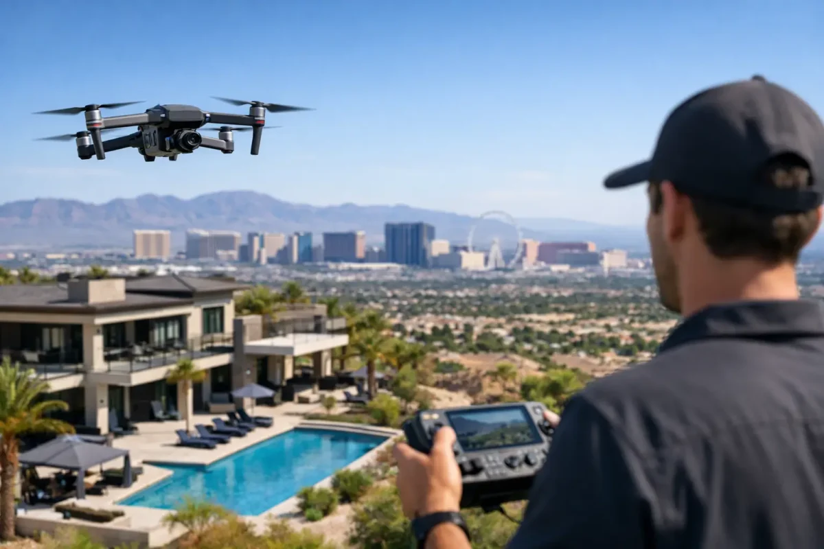
A property can have a strong address, generous acreage, mountain views, and easy freeway access – yet none of that is obvious in a standard ground-level photo set. In a market built on visual first impressions, the right drone service in Vegas makes the full story of a property visible before a buyer, tenant, or investor ever arrives.
For residential listings, commercial sites, land parcels, and active developments, aerial imaging is not a novelty. It is a practical way to show scale, access, surroundings, progress, and potential. The difference comes down to hiring a professional team that can deliver polished media while operating legally and reliably in one of the country’s more complex airspace environments.
What a Drone Service in Vegas Should Deliver
A professional aerial production should begin with the question, “What does this property need to communicate?” A luxury home may need a cinematic reveal of the pool, outdoor living areas, golf course proximity, and Strip views. A commercial property may need clear context around access roads, parking, neighboring businesses, and nearby transportation routes. A landowner may need images that establish parcel boundaries, topography, utilities, and development potential.
That is why a drone service should provide more than a few overhead shots. The strongest deliverables are tailored to the asset and the audience. High-resolution aerial stills can anchor a listing presentation or offering memorandum. Edited aerial video can create momentum for a listing campaign, social media promotion, or investor presentation. A 360-degree photo sphere can help viewers understand a location from a perspective ordinary photography cannot provide.
The best approach is rarely to film everything from directly overhead. Straight-down images are useful for rooftops, parcel layouts, and site planning, but they do not always create the most persuasive marketing image. Low-angle establishing shots, gradual elevation changes, and wide views that connect a property to its surroundings often carry more visual value. A qualified pilot and production team know how to build that variety into a flight plan.
Aerial Media Solves the Context Problem
Ground photography is essential, especially for interiors, finishes, and curb appeal. It has limits, though. It cannot efficiently show how a home sits at the end of a private cul-de-sac, how close a commercial site is to a major corridor, or how much usable land surrounds an industrial building.
Aerial imagery gives prospective buyers and decision-makers context quickly. For a residential property, that can mean showing the relationship between the home, neighborhood amenities, schools, trails, golf courses, or views. For commercial real estate, it can mean illustrating loading access, building footprint, surrounding retail, parking capacity, and visibility from nearby roads.
For vacant land and development sites, context is often the sale. Investors want to see the parcel in relation to adjacent development, road connections, utilities, terrain, and the broader growth pattern of the area. A well-composed aerial set helps them evaluate opportunity without relying on vague descriptions or trying to interpret a map alone.
There is a trade-off to consider. Aerial media can establish a compelling overview, but it should not replace the property details that move a transaction forward. Pair it with strong ground photography, clear floor plans where appropriate, and accurate property information. Drone imagery works best as part of a complete visual package, not as a standalone substitute for every other asset.
Why Las Vegas Airspace Experience Matters
Las Vegas is not a market where a pilot can simply arrive, launch, and hope for the best. Many properties fall near controlled or sensitive airspace associated with Harry Reid International Airport, Nellis Air Force Base, and other operational considerations. Flight restrictions, altitude limits, airspace authorizations, weather conditions, and site-specific safety concerns can affect what is possible on a given day.
This is where professional credentials become essential. An FAA Certified Drone Pilot understands the operational requirements for commercial flights, including airspace review, flight planning, safety procedures, and legal limitations. A fully insured operator also protects the client and project when work is being performed around valuable property, active construction sites, or populated areas.
Authorization is not a marketing phrase. It is part of the work. Depending on the location, a project may require advance planning and approval before a drone can legally operate. Anyone promising a guaranteed flight without reviewing the address, date, and project scope is overlooking the variables that matter most.
Weather is another practical factor. High winds, dust, extreme heat, and changing light can influence both flight safety and image quality. A professional service will make an informed call on whether conditions support a productive shoot. Rescheduling for the right conditions can be more valuable than forcing a flight that produces shaky footage, flat lighting, or unnecessary risk.
What to Ask Before Hiring a Drone Provider
Not every provider offering drone photos brings the same level of preparation. Before selecting a vendor, ask about FAA certification, liability insurance, experience with controlled airspace, and the process used to review a property location. These are baseline indicators of whether the operation is built for professional work.
Then ask about the actual production plan. How many finished images are included? Is video captured and edited for a specific use, such as a listing reel, website feature, or investor presentation? Will the pilot capture both wide context shots and closer property details? What is the expected turnaround time, and how will final files be delivered?
It is also smart to discuss the intended audience before the flight. A broker marketing a high-end residence may prioritize lifestyle and views. A developer may need repeatable angles for monthly construction documentation. A property manager may need updated exterior imagery that shows site condition and improvements. The same aircraft can support each project, but the flight plan and final edit should be different.
Price matters, but the lowest quote does not always represent the lowest real cost. An unprepared operator can create delays, produce unusable footage, miss important angles, or encounter airspace issues on site. Hiring a qualified specialist removes the burden of equipment ownership, maintenance, pilot training, compliance research, and post-production from your team.
From Consultation to Final Delivery
A dependable drone project starts with a focused consultation. Share the property address, desired shoot date, asset type, marketing goal, and any must-have views. If there are site access requirements, construction safety procedures, tenant concerns, or timing restrictions, identify them early. That information helps determine whether the requested flight is feasible and how the production should be organized.
The next step is airspace and site review. A professional pilot evaluates the location, identifies operational limits, and determines whether authorization or additional planning is needed. This stage protects the schedule and avoids the expensive surprise of discovering restrictions after a crew is already on site.
During the shoot, the goal is efficient capture rather than unnecessary flight time. The pilot should work from a shot plan while adapting to light, wind, activity on the property, and the strongest available angles. For construction work, coordination with the site superintendent is particularly valuable. It keeps the operation clear of workers and equipment while ensuring that documentation captures meaningful milestones.
Post-production is where raw capture becomes a business asset. Stills should be selected and edited for clarity, balanced color, and a consistent professional appearance. Video should have a purposeful sequence and pacing, not a collection of random flyovers. The finished media should make it easier for viewers to understand why the property deserves attention.
Strong Use Cases Beyond the Listing Launch
Aerial media continues to add value after a property first hits the market. Commercial teams can use updated footage to support leasing efforts, tenant outreach, investment packages, and redevelopment proposals. Construction teams can use recurring aerial imagery to document progress, communicate with stakeholders, and create a visual record of work completed.
Property owners can also use aerial imagery to support planning conversations before work begins. Seeing a building, lot, and surrounding area from above can clarify circulation, access, site layout, and the relationship between existing conditions and future plans. It is not a replacement for surveying, engineering, or legal boundary verification, but it can make early conversations more informed and productive.
Sky View LV approaches each assignment as a professional production and flight operation, combining high-impact visuals with FAA-certified pilots, insurance coverage, and the planning required for Las Vegas-area airspace.
The right aerial image does more than make a property look impressive. It gives the viewer a faster, clearer reason to understand its value – and that is where a well-planned drone project earns its place in your marketing or project workflow.
Popular Posts
August 13, 2026
August 12, 2026
August 11, 2026
August 09, 2026
August 09, 2026
August 08, 2026
Comments are closed.