Drones have become increasingly popular in the past ten years. Advancements in technology proved that everything is possible. They are now accessible and user-friendly for people of all skill levels. No matter your profession and interest, a drone exists for you. That is why this article will be helpful for everyone, from amateur photographers looking to capture beautiful aerial shots to hobbyists searching for new and exciting ways to spend their free time. With that in mind, today, we talk about top-rated drone models for beginners. Let us explore your options together and see what drones could be the best choice for the first buy!
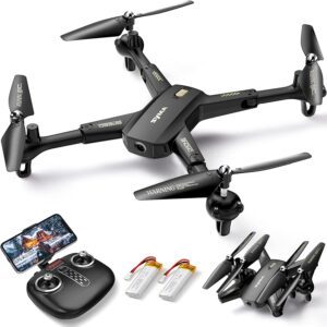
Syma X600W
Let’s start with a very affordable drone option for beginners. Besides the low price, the Syma X5C drone is also straightforward. It has a 2 MP camera that can take photos and record videos in 720p HD. As an additional benefit, the X600W also has increased ability thanks to the 6-axis gyro.
That is why this drone is so easy to fly and control. The average flight time is around seven minutes, and it can cover a distance of about 165 feet. The best thing about it is that the average price is around $70. We must agree that such a low price makes this drone a fantastic option for beginners. Syma Drone-Syma Drone
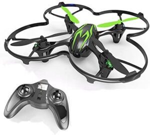
Hubsan X4 H107C
If you cannot find the Syma X5C model, look for the Hubsan X4 H107C. This small and easy-to-use drone has similar characteristics to the Syma X5C since it is also equipped with a 2 MP camera that can record in 720p HD and covers the same distance.
Furthermore, the price range is also around $40. We highly advise that, as a beginner, you try one of these two models. These are lesser-known brands, so you will not spend much money. However, you will have the option to experiment with this fantastic hobby. Hubsan Drone- HUBSAN-H107C
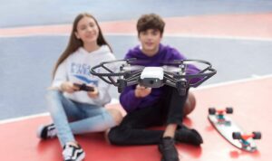
Tello
If you are willing to spend a little bit more money for a more advanced version of one of the best drone models for beginners, you can purchase the Tello model for around $100.
It is:
● A small and lightweight drone
● Easy to fly and maneuver
● Equipped with a 5 MP camera that records videos and photos in 720p HD.
● It has a range of up to 330 feet and a max flight time of 13 minutes.
If all of that is insufficient to make you purchase this bad boy, the Tello model comes with the Tello app. Because of that, this drone is also suitable for small businesses that require aerial inspection. Tello Drones – Tello Drone
The app functionality allows you to control the drone in a fun and interactive way. It supports hand gesture control, facial recognition, and more amazing features. This drone is compatible with an array of 3rd party software, which allows you to experiment with different ideas.
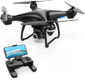
Holy Stone HS100D
The Holy Stone is a well-known and respected brand. Their HS100D model is a fantastic, budget-friendly option perfect for beginners.
With a higher resolution of 1080p HD, it can take high-quality photos and videos. The price of this model is around $170. It costs more than the other models we mentioned, but it has a fantastic feature. The HS100D has a GPS function that makes automatic return home possible. If you are concerned about keeping it safe, nycministorage.com suggests putting it in your storage unit, which will be headache-free until subsequent usage. Holy Stone Drone- Holy Stone Drone
Furthermore, you can hold altitude with it, making the flying experience more stable and straightforward for beginners. An added benefit is that it supports flight time of up to 15 minutes and a control distance of almost 1000 feet.
DJI Mini
Give the DJI Mini a chance if you want a beginner-friendly drone to make professional-looking footage. This compact, lightweight drone features a 12 MP camera and 1080p HD video capability. As a beginner, you don’t need higher quality than that. What makes this drone unique is the variety of intelligent flight modes. You will understand its value once you try this drone in some of the best locations. DJI Drones- DJI Drones
For example, the TapFly mode allows you to tap your phone’s screen and set a path for the drone. With the help of ActiveTrack, you can tap on a subject, and the drone will center the object and follow it. QuickShot mode helps capture cinematic shots on a pre-programmed flight path with a single tap. The drone also supports hand gesture control, part of its Gesture mode. The Sport mode allows the drone to develop a max speed of 31 mph and respond to your commands with increased agility. Now, you can even capture fast-paced action shots.
With a range of 1.2 miles, a flight time of up to 16 minutes, and a price of around $400, this drone delivers a lot of value. If you are willing to spend more money, this drone will be a wise purchase that will give you many good memories.
A piece of advice before flying drones.
Before you fly your first drone, understand the drone rules and regulations. This is very important because you could easily break the law if you do not follow these rules. You don’t need that negative experience, whether a beginner or a professional. This is our list of top-rated, cheaper drone models for beginners.
We hope you are satisfied with our list of top-rated drone models for beginners. We tried to cover a variety of options and price ranges, perfect for every beginner. Suppose you are looking to invest more money and purchase a professional, more expensive drone one day. In that case, one of these models will be an excellent way to start and gain some experience in flying drones. Keep in mind that the price might vary and that it also might depend on your location.
Additionally, we also suggest that you research other models. Before you spend your money, be 100% sure that the model you picked has everything you need. Best of luck finding a drone that fits your needs, and we hope you have lots of fun. Welcome to the world of drones! Be safe out there.
Drones, also known as unmanned aerial vehicles (UAVs), have revolutionized various industries with their versatility and advanced capabilities. In recent years, drones have become increasingly prevalent in mapping applications due to their ability to capture high-resolution aerial imagery and collect geospatial data. From agriculture to construction, surveying to urban planning, drones have proven valuable tools for creating accurate and detailed maps. In this article, we will explore why drones are widely used in mapping and their impact on various industries.
Introduction
Mapping plays a crucial role in understanding and representing our physical environment. It involves creating maps that provide a visual representation of geographical features, landforms, and other spatial information. Traditionally, mapping was conducted using ground-based methods, which were often time-consuming, expensive, and limited in coverage. However, with the advent of drone technology, mapping processes have been transformed, offering new possibilities and advantages.
Importance of mapping
Mapping serves as a fundamental tool for a wide range of industries and applications. Accurate and up-to-date maps are essential for planning, decision-making, and resource management. They enable organizations and individuals to understand their surroundings better, optimize operations, and improve overall efficiency. Let’s explore some of the critical reasons why mapping is crucial in various fields:
Accurate representation of geographic data: Maps visually represent geographic features, boundaries, and spatial relationships. They allow us to understand the physical characteristics of an area and its environmental attributes.
Agriculture: Mapping is essential in the agriculture industry for crop monitoring, precision agriculture, and yield optimization. By analyzing maps generated from drone data, farmers can identify areas of concern, track crop health, and implement targeted interventions.
Construction and infrastructure: Construction projects require precise measurements and surveys. Drones equipped with cameras, LiDAR (Light Detection and Ranging), or thermal sensors can capture detailed aerial imagery, generate 3D models, and monitor construction progress.
Surveying and mapping: Traditional surveying methods often involve manual measurements and are time-consuming and labor-intensive. Drones provide an efficient alternative by rapidly capturing aerial data and generating accurate maps. They can be used for topographic mapping, creating elevation models, and conducting detailed surveys.
Environmental monitoring: Drones with specialized sensors can contribute to ecological monitoring efforts. They can be deployed to assess ecosystems, track changes in vegetation, monitor wildlife habitats and identify areas prone to natural disasters such as floods or forest fires.
Urban planning and development: Drones offer valuable insights for urban planning and development projects. They can capture high-resolution aerial imagery, create 3D models of cities, and assist in infrastructure planning. Drone data can also benefit traffic analysis and management, helping improve transportation systems.
Introduction to drones in mapping
Drones used in mapping, often called mapping drones or surveying drones, are specifically designed to collect geospatial data. These drones are equipped with advanced cameras, sensors, and GPS technology to accurately capture aerial imagery and georeferenced data. Integrating drones into mapping workflows has revolutionized the industry, offering several advantages over traditional methods.
Mapping drones typically have high-resolution cameras capable of capturing detailed aerial images. They can capture images from different angles and heights, allowing for the creation of orthomosaic maps and 3D models with remarkable accuracy. In addition, drones can be equipped with LiDAR sensors, which use laser pulses to measure distances and create exact 3D point clouds.
Applications of drones in mapping
Drones have found diverse applications in mapping across various industries. Let’s explore some of the key areas where drones are extensively used:
Agriculture
Agriculture benefits significantly from drone mapping. Drones can capture detailed imagery of crops, enabling farmers to monitor plant health, detect pest infestations, and assess crop yield. With the help of specialized software, drone data can be used to generate vegetation indices, such as NDVI (Normalized Difference Vegetation Index), allowing farmers to identify areas that require specific attention or treatment.
Precision agriculture, a farming technique that optimizes inputs and resources, heavily relies on drone mapping. Farmers can reduce costs, minimize environmental impact, and maximize crop productivity by targeting irrigation, fertilization, and pesticide application.
Construction and infrastructure
Drones have become invaluable in the construction industry, aiding in surveying, site inspections, and project monitoring. Traditional surveying methods often involve manual measurements and can be time-consuming. Drones can quickly capture aerial data, creating accurate 2D and 3D maps of construction sites. Mapping Drones in Construction
Site inspections can also be conducted more efficiently using drones. Drones can be equipped with cameras and thermal sensors to identify structural issues, monitor construction progress, and ensure compliance with safety regulations. Drones give project managers a comprehensive view of the site, saving time and improving decision-making.
Surveying and mapping
Drones have transformed the field of surveying and mapping by streamlining data collection and processing. Traditional land surveying methods often require teams of surveyors to measure distances and capture detailed information manually. On the other hand, drones can cover large areas quickly and collect data with high accuracy.
Topographic mapping, the creation of detailed maps that represent the physical features and contours of the land, has become more efficient with the use of drones. By capturing aerial imagery and employing photogrammetry techniques, drones can generate highly accurate topographic maps in a fraction of the time compared to traditional methods.
Drones are also used for 3D modeling and photogrammetry in mapping. By capturing multiple images of an object or area from different angles, drones can create detailed 3D models. This technology is beneficial in various fields, including architecture, archaeology, and urban planning.
Environmental monitoring
Drones play a crucial role in environmental monitoring and conservation efforts. They can assess and monitor ecosystems, track changes in land cover, and gather data on wildlife populations. Because they can access remote and difficult-to-reach areas, drones provide a valuable tool for environmental researchers and conservationists.
For example, drones equipped with thermal cameras can help identify and monitor animal populations, including endangered species. They can detect heat signatures and track animal movements, providing valuable insights for conservation initiatives. Drones can also be used to monitor the health of forests, detect illegal logging activities, and assess the impact of natural disasters on ecosystems.
Mapping disaster-prone areas is another important application of drones in environmental monitoring. By capturing aerial images before and after a disaster, such as a hurricane or an earthquake, drones can help identify affected areas, assess the damage, and support disaster response and recovery efforts.
Urban planning and development
Drones have become increasingly valuable in urban planning and development projects. With their aerial perspective and high-resolution imagery, drones can capture detailed data about cities and metropolitan areas. This information is crucial for infrastructure planning, transportation analysis, and the development of smart cities.
Using drones for city mapping, planners can obtain accurate measurements, assess land use, and analyze population density. This data aids in making informed decisions regarding infrastructure placement, optimizing transportation networks, and improving urban development strategies.
Drones also contribute to traffic analysis and management. They can capture real-time data on traffic flow, identify congestion points, and monitor transportation patterns. This information helps urban planners and authorities make informed decisions to improve traffic management and optimize road networks.
Benefits of using drones in mapping
The use of drones in mapping offers numerous benefits compared to traditional methods. Some of the key advantages include:
Cost-effectiveness: Drones are a cost-effective alternative to traditional mapping methods, as they require fewer resources and can cover larger areas in less time. This makes mapping projects more accessible and affordable, especially for small businesses and organizations.
Time-saving: Drones can rapidly capture aerial data, significantly reducing the time required for mapping projects. This allows for quicker decision-making and more efficient planning processes.
Safety and accessibility: Drones can access hazardous or hard-to-reach areas, such as steep terrains or disaster zones, without putting human surveyors at risk. They provide a safe and efficient means of collecting data in challenging environments.
Enhanced accuracy and detail: Drones with high-resolution cameras and advanced sensors can capture detailed imagery and geospatial data. This leads to more accurate maps, 3D models, and measurements, enabling better decision-making and analysis.
Challenges and considerations
While drones offer significant advantages in mapping, several challenges and considerations need to be addressed:
Regulatory and legal framework: The use of drones is subject to regulations and restrictions imposed by aviation authorities. Operators must comply with airspace regulations, obtain necessary permits or licenses, and ensure safe and responsible drone operation.
Privacy concerns: Drones with cameras, mainly in urban areas or near residential properties, raise privacy concerns. Clear guidelines and ethical practices must be in place to protect individuals’ privacy.
Weather conditions and flight restrictions: Drones are sensitive to weather conditions like strong winds or rain. Flight restrictions may be imposed in certain areas or during specific times, limiting drone operation for mapping purposes.
Future trends in drone mapping
The field of drone mapping continues to evolve, with several exciting trends and advancements on the horizon:
Advancements in drone technology: Drone technology is rapidly advancing, with improvements in flight stability, battery life, and payload capacity. This enables drones to carry more sophisticated sensors and capture higher-quality data.
Integration with AI and machine learning: The integration of drones with artificial intelligence (AI) and machine learning (ML) algorithms is set to revolutionize mapping capabilities. AI-powered image processing and data analysis algorithms can automatically extract valuable information from drone-collected data, such as object recognition, vegetation health analysis, and anomaly detection.
Expansion of drone applications: Drones in mapping continually expand into new industries and sectors. Drones, from archaeological surveys to wildlife conservation, are utilized in diverse fields to gather valuable data and provide unique perspectives.
Improved data analytics and visualization: With the advancement of data analytics and visualization tools, the interpretation and utilization of drone-collected data will become more accessible and user-friendly. Interactive maps, 3D visualizations, and data-driven insights will empower decision-makers to extract maximum value from drone mapping.
Miniaturization and swarm technology: Miniaturized drones and swarm technology, where multiple drones work together collaboratively, hold the potential for more efficient and agile mapping operations. Smaller drones can access tighter spaces, while swarms can cover larger areas simultaneously, further enhancing mapping capabilities.
Conclusion
Drones have become indispensable tools in mapping, revolutionizing how we collect geospatial data and create accurate and detailed maps. From agriculture and construction to surveying and environmental monitoring, drones offer numerous advantages over traditional mapping methods. They provide cost-effective, time-saving, and safe solutions for capturing high-resolution imagery and collecting geospatial data.
Drone mapping applications will expand as drone technology advances and integrates with AI and machine learning. The future holds promising advancements in data analytics, visualization, and the use of miniaturized drones and swarm technology.
The potential of drones in mapping is vast. They offer improved efficiency, accuracy, and accessibility for industries and organizations that rely on accurate spatial data. Embracing drone technology and harnessing its capabilities will unlock new possibilities for innovation and informed decision-making.
FAQs (Frequently Asked Questions)
1. Are drones only used for aerial photography?
No, drones have a wide range of applications beyond aerial photography. They are used in various industries, such as agriculture, construction, surveying, and environmental monitoring, to collect geospatial data, create maps, and gather valuable insights.
2. How accurate are drone-generated maps?
Drone-generated maps can achieve a high level of accuracy, depending on the quality of the equipment and the data processing techniques used. With advanced sensors and software, drones can capture detailed imagery and generate maps with centimeter-level accuracy.
3. Are there any legal restrictions on flying drones for mapping purposes?
Yes, the use of drones for mapping purposes is subject to regulations and restrictions imposed by aviation authorities. It is critical to comply with local laws, obtain necessary permits or licenses, and follow safety guidelines when operating drones for mapping.
4. Can drones be used in adverse weather conditions?
Drones are sensitive to adverse weather conditions such as strong winds, rain, or fog. Before operating drones for mapping, it is important to consider weather conditions and flight restrictions. Flying drones in unfavorable weather conditions can pose risks to the drone and compromise data quality.
5. What is the future of drone mapping?
The future of drone mapping looks promising, with technological advancements and expanding applications. Integration with AI and machine learning, improved data analytics and visualization, and the development of miniaturized drones and swarm technology are some trends that will shape the future of drone mapping, offering even greater capabilities and efficiency. Drone predictions for 2023.
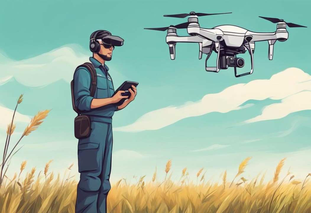
Drones have become increasingly popular in recent years, captivating hobbyists, photographers, and technology enthusiasts alike. These uncrewed aerial vehicles offer exciting opportunities for aerial exploration and photography. If you’re considering getting your first drone, there are several factors to consider and steps to take before making a purchase. In this article, we’ll guide you through choosing the suitable drone for your needs and provide essential tips for flying, capturing incredible footage, and staying safe.
Understanding Drones
What is a drone?
Drones, also known as uncrewed aerial vehicles (UAVs), are remotely piloted aircraft that can fly autonomously or be controlled by a human operator. They come in various sizes, from small toy-like models to professional-grade drones with advanced features and high-resolution cameras.
Different types of drones
There are several categories of drones, each designed for specific purposes:
Toy drones: These small, inexpensive drones are ideal for beginners and children. Although they usually lack advanced features, they provide a fun introduction to flying.
Camera drones are popular among aerial photographers and videographers because they can be equipped with built-in cameras or mount cameras.
FPV racing drones: Designed for high-speed racing, these drones prioritize agility and speed over photography capabilities.
Professional drones offer advanced features such as obstacle avoidance, longer flight times, and high-quality cameras. They are used for commercial purposes like aerial mapping, inspection, and filmmaking.
Factors to Consider Before Buying a Drone
Before purchasing a drone, it’s crucial to consider the following factors:
Purpose and usage
Determine how you plan to use your drone. Are you interested in aerial photography, racing, or simply flying for fun? Understanding your purpose will help you narrow down the required features and specifications.
Budget
Set a budget for your drone purchase. Drones range in price from affordable entry-level models to high-end professional drones. Consider additional expenses such as spare batteries, accessories, and maintenance costs.
Skill level
Assess your skill level as a drone pilot. Starting with a user-friendly drone that offers stability and easy maneuverability is advisable if you’re a beginner. Experienced pilots may opt for more advanced models.
Camera capabilities
Consider the drone’s camera capabilities if you’re interested in aerial photography or videography. Look for features like high-resolution cameras, adjustable gimbals for stabilized footage, and the ability to shoot in RAW format.
Flight time and range
The flight time and range of a drone are essential factors to consider. Longer flight times allow for more extended aerial exploration, while a more excellent range will enable you to fly your drone over more considerable distances.
Safety features
Ensure your drone has essential safety features such as GPS stabilization, return-to-home function, and obstacle avoidance sensors. These features help prevent accidents and protect your investment.
Drone Pilot
Researching and Comparing Drones
When researching and comparing drones, consider the following resources:
Online resources and reviews
Visit websites that specialize in drone reviews and comparisons. These resources provide in-depth analysis and user feedback, helping you make an informed decision.
Manufacturer websites
Visit the official websites of drone manufacturers. They provide detailed specifications and product descriptions and often include sample footage captured with their drones.
User forums and communities
Join online communities and forums dedicated to drones. These platforms allow you to ask questions, share experiences, and gain insights from fellow drone enthusiasts.
Spec comparisons
Compare the specifications of different drone models to identify the ones that best suit your requirements. Pay attention to flight time, camera capabilities, and stability features.
Choosing the Right Drone for Beginners
Choosing a drone that offers ease of use and a gentle learning curve is crucial for beginners. Consider the following factors when selecting your first drone:
Entry-level models
Opt for entry-level drones designed for beginners. These drones often have simplified controls, stability features, and intuitive flight modes to help you get started quickly.
Ready-to-fly (RTF) vs. do-it-yourself (DIY) kits
RTF drones come fully assembled and ready to fly out of the box, making them ideal for beginners. DIY kits require assembly and may be more suitable for those interested in drones’ technical aspects.
Built-in flight assistance features
Look for drones with built-in flight assistance features such as altitude hold, headless mode, and auto takeoff/landing. These features make flying more accessible and more intuitive, especially for beginners.
Controller options
Consider the type of controller that comes with the drone. Some drones use dedicated controllers, while others can be flown using smartphones or tablets. Choose the option that feels most comfortable to you.
Drone Laws and Regulations
Before taking to the skies, it’s essential to familiarize yourself with the drone laws and regulations in your country or region. Here are some key considerations:
Understanding local regulations
Research the laws and regulations specific
Understanding local regulations
Research drone usage laws and regulations specific to your country or region. Familiarize yourself with guidelines related to airspace restrictions, flight altitudes, and any required permits or licenses.
Registering your drone
In some countries, you must register your drone before flying it. Check with the relevant authorities for the registration process and associated fees.
Restricted airspace and no-fly zones
Be aware of restricted airspace and designated no-fly zones in your area. These can include airports, military installations, and national parks. Avoid flying your drone in these areas to ensure safety and compliance with regulations.
Safety guidelines and best practices
Adhere to safety guidelines and best practices when operating your drone. This includes maintaining a visual line of sight with your drone, flying during daylight hours, and avoiding crowded areas or gatherings.
Learning to Fly Your Drone
Learning to fly a drone is an exciting experience. Follow these steps to ensure a smooth learning process:
Basic controls and maneuvers
Start by understanding the basic controls of your drone, including throttle, yaw, pitch, and roll. Practice basic maneuvers such as takeoff, landing, hovering, and simple forward and backward movements.
Practicing in open spaces
When starting, choose open spaces such as parks or fields for practice flights. Avoid flying in crowded areas or near obstacles to minimize the risk of accidents.
Mastering flight modes
Explore the different flight modes available on your drone, such as GPS mode, altitude hold, or follow-me mode. Please familiarize yourself with their functions and practice using them in controlled environments.
Safety precautions and troubleshooting
Always prioritize safety when flying your drone. Be aware of weather conditions and avoid flying in strong or adverse winds. Additionally, familiarize yourself with troubleshooting techniques for common issues like loss of signal or battery warnings.
Essential Accessories for Drone Owners
As a drone owner, several accessories can enhance your flying experience and protect your investment:
Spare batteries and chargers
Invest in additional batteries and a charger to extend your flight time. This ensures you can make the most of your drone without interruptions.
Carrying cases and backpacks
Purchase a carrying case or backpack specifically designed for drones. These protect your drone during transportation and make it convenient to carry all your accessories.
Propeller guards and landing gear
Propeller guards and landing gear provide added protection to your drone during takeoff and landing. They help prevent damage to the propellers and other sensitive components.
Memory cards and storage
Invest in high-quality memory cards with ample storage capacity to store your aerial photographs and videos. Consider backing up your files to external storage devices or cloud services.
ND filters and lens accessories
Consider using ND filters to control exposure and reduce glare for aerial photography and videography. Lens hoods and lens cleaning kits can enhance image quality and protect your camera lens.
When framing your shots, pay attention to composition. Use the rule of thirds, leading lines, and exciting perspectives to create visually appealing images.
Understanding camera settings
Familiarize yourself with the camera settings on your drone. Adjust parameters such as exposure, white balance, and image format to achieve the desired results.
Capturing smooth footage
Use slow and smooth movements when recording videos to avoid shaky footage. Experiment with different flight speeds and gimbal settings to achieve cinematic results.
Post-processing and editing
Once you’ve captured your aerial footage, consider post-processing techniques to enhance the final output. Use editing software to adjust colors, contrast, and apply effects if desired. Drone
Maintenance and Upkeep of Your Drone
Regular maintenance is essential to keep your drone in optimal condition. Follow these guidelines:
Cleaning and inspection
Regularly clean your drone, especially the propellers and camera lens, to remove dust and debris. Inspect the drone for any signs of wear or damage before each flight.
Firmware updates
Keep your drone’s firmware updated with the latest releases from the manufacturer. Firmware updates often include bug fixes, improved features, and enhanced performance.
Propeller maintenance and replacement
Check the condition of your drone’s propellers regularly. Replace any damaged or worn-out propellers to ensure safe and stable flight.
Battery care and storage
Follow the manufacturer’s guidelines for battery care and storage. Properly charge and discharge the batteries, and store them in a cool, dry place away from flammable materials.
Ensuring Drone Safety and Etiquette
To ensure a positive experience for yourself and others, follow these safety and etiquette guidelines:
Privacy concerns and respecting others’ space
Be mindful of people’s privacy when flying your drone. Avoid capturing footage of private property or individuals without their consent. Respect people’s space and avoid flying your drone too close to others.
Flying responsibly and within limits
Adhere to local regulations and flight restrictions. Maintain a safe distance from people, vehicles, and wildlife. Be mindful of noise pollution and avoid flying in residential areas during quiet hours.
Insurance and liability coverage
Consider obtaining liability insurance to protect yourself against potential accidents or damage caused by your drone. Check with insurance providers for specialized policies catering to drone owners.
Joining Drone Enthusiast Communities
To connect with like-minded individuals and expand your knowledge, consider joining drone enthusiast communities:
Local drone clubs and meetups
Research local drone clubs or meetup groups in your area. Participating in these communities allows you to learn from experienced pilots, share experiences, and participate in group flights or events.
Online forums and social media groups
Join online forums and social media groups dedicated to drones. These platforms offer a wealth of information, troubleshooting assistance, and the opportunity to connect with a global community of drone enthusiasts.
Participating in drone events and competitions
Look for drone events or competitions in your area. Participating in such events can be a great way to showcase your skills, learn from others, and immerse yourself in drone technology.
FAQs
Can I fly a drone without any prior experience?
Yes, you can fly a drone without prior experience. However, starting with a beginner-friendly drone and learning the basics of flight control and safety guidelines is advisable.
How much does a reasonable beginner drone cost?
The cost of a good beginner drone can vary. Entry-level models can range from $100 to $500, depending on the features and specifications. Consider your budget and desired capabilities when making a purchase.
Do I need a license to fly a drone?
In many countries, a license or certification is not required for recreational drone flying. However, depending on local regulations, commercial use may require licensing or certification. Check with the relevant authorities in your region.
Are there any restrictions on flying drones in public parks?
Restrictions on flying drones in public parks can vary depending on the park and local regulations. Some parks may have designated areas or specific rules for drone flying. Always research and adhere to the guidelines of the park you plan to fly in.
Conclusion
Getting your first drone opens up exciting possibilities, from capturing breathtaking aerial photographs to exploring new perspectives. By understanding the different types of drones, considering essential factors before buying, and following safety guidelines, you can embark on an enjoyable and rewarding drone flying experience. Remember to improve your skills continuously, keep up with regulations, and share your passion with the vibrant drone community.
Additional Tips
1. Do your research extensively before buying your first drone, and you should follow the fundamentals of the drone purchase guide. Consult with someone you know who flies drones already and get their advice. If a local store in your area sells drones, chat them up on the essential features you might require. Are you flying for fun or looking to start a business?
2. For your first drone, don’t buy one that’s too cheap. It will be a waste of money. Commit yourself to spending at least several hundred dollars at least. That way, you can skip the trials and tribulations of buying and crashing cheap drones. I have been there and done that. Starting with a better drone will give you more confidence in your flying ability right from the start.
3. When you get the drone, review the owner’s manual. It’s fundamental to the drone purchase guide. It won’t make much sense at first, but read it through. You might have to read the manual a few times until it sinks in. These new drones have tons of features.
4. Find an ample, flat, open space devoid of nearby trees or power lines and away from people for your first time flying. Flying in urban areas
5. Learn to lift off and fly experimental routes not too far off the ground. Learn to return to base and do a controlled landing. Do not fly too far off to a point where you can’t see the drone, and understand its change of direction from your joystick controls.
6. When you are flying, unsure of your direction or position, always take your hands off the joysticks and let the drone pause and hover. Then, slowly start moving it again so you know its orientation or position. Practice engaging the return to the home button to see how the drone returns home.
7. Do not fly over water, over crowds of people, or too close to trees or other fixed objects. It’s straightforward to end up misjudging distances and crashing the drone. Fly at night
8. The drone receives its commands through a Wi-Fi channel link to your controller. If you make the mistake of flying in an area with a lot of RF interference, like dense urban areas or hilly topography, you may lose line-of-sight communication. In that event, your drone may suddenly cease to respond to your joystick commands and continue to fly onward, eventually getting lost or crashing in some inaccessible area or, worse, doing some damage to something or somebody.
9. Be careful and cautious, practice a lot, and learn before your enthusiasm overwhelms your desire to create great aerial images and videos. Practice, Practice, Practice.
10. And one last thing: Do not fly close to wildlife. Drones can disturb them and may be illegal. Good luck! Fly Safe and have a good Safety Plan.
If you’re a drone pilot, having the right tools is essential for success. Whether capturing stunning aerial footage or ensuring your equipment is safe, the right gear can make a big difference. Here are ten must-have tools that every drone pilot should consider adding to their toolkit.
Key Takeaways
Always carry extra batteries to avoid interruptions during flights.
A reliable carrying case protects your drone and gear while traveling.
Using ND filters helps create better video quality in bright conditions.
An external monitor can help clients see live footage and give directions.
Having insurance provides peace of mind against accidents and damages.
1. MicroSD Card
Every drone pilot knows that having enough storage is essential for capturing high-quality images and videos. A good microSD card allows you to record without worrying about running out of space. Here are some key points to consider:
Storage Capacity: Look for cards with high storage, like 1TB or more, to keep your recordings safe over time.
Speed: Choose cards with fast write speeds (at least 100 MB/s) to avoid interruptions while recording.
Compatibility: Ensure the card fits your drone model, as most drones use microSD cards.
Feature
Recommended Value
Storage Capacity
1TB or more
Write Speed
100 MB/s or higher
Type
microSD
A reliable microSD card is a must-have for every drone pilot, ensuring you can capture and store your aerial adventures without hassle.
With a large microSD card, you can keep the recording running and collect it over the weeks and months, so it’s there when you need it!
2. External Hard Drive
An external hard drive is essential for drone pilots who need to store large amounts of data. As you capture stunning aerial footage, you will quickly find that your storage needs grow. Here’s why having a reliable external hard drive is crucial:
Long-term storage: Unlike microSD cards, which are great for immediate use, external hard drives provide a safe place for your files over time.
High capacity: Look for drives that can hold much data, especially since drone footage can take up significant space.
Fast transfer speeds: Choose a drive that allows quick uploads and downloads, making it easier to manage your files.
Feature
Recommended Specs
Storage Capacity
1TB or more
Transfer Speed
100 MB/s or higher
Portability
Lightweight
Having a dependable external hard drive gives you peace of mind, knowing that all your valuable footage is safe and accessible whenever you need it.
3. Extra Batteries
Having extra batteries is essential for extending your flight time when flying a drone. Running out of power mid-air can be frustrating and can even lead to accidents. Here are some key points to consider:
Always carry fully charged spares: Keeping a few extra batteries ready ensures you can continue flying without interruptions.
Invest in high-capacity batteries: Look for rechargeable drone batteries suitable for your model, like the one designed for model K610, which focuses on durability and performance.
Use a multi-battery charger: This lets you charge several batteries simultaneously, minimizing downtime between flights.
Battery Type
Capacity (mAh)
Flight Time (minutes)
Standard Battery
3000
20
High-Capacity Battery
5000
30
Having extra batteries not only enhances your flying experience but also ensures you capture all the stunning shots you desire without the worry of running out of power.
4. Drone Carrying Case
A drone carrying case is essential for pilots who want to keep their equipment safe. It protects your drone from damage during transport and helps you stay organized. Here are some key features to look for:
Shock Absorption: Look for cases that can absorb impacts to protect your drone from drops.
Water Resistance: A waterproof case protects your gear from rain and spills.
Customizable Compartments: This lets you snugly fit your drone and accessories, preventing movement inside the case.
Feature
Importance
Shock Absorption
Protects against drops
Water Resistance
Keeps gear safe from moisture
Custom Compartments
Organizes accessories effectively
A good carrying case not only protects your drone but also shows professionalism to clients. Investing in a quality case can make a big difference in your flying experience.
5. ND Filters
Neutral Density (ND) filters are like sunglasses for your drone’s camera. They help control the amount of light that enters the camera, which is important for capturing clear and smooth footage, especially in bright sunlight. Here are some key points about ND filters:
Improved Exposure: ND filters reduce light, allowing for better exposure in bright conditions.
Cinematic Quality: They help achieve your videos’ smooth, cinematic look.
Variety of Options: Different strengths are available, so you can choose the right one for your shooting conditions.
Filter Strength
Light Reduction
Best For
ND4
2 stops
Cloudy days
ND8
3 stops
Partly cloudy
ND16
4 stops
Bright sunny days
Using ND filters can make a big difference in the quality of your aerial shots. They are essential for any serious drone pilot looking to enhance their footage.
In summary, ND filters are a must-have for drone pilots who want to take their aerial cinematography to the next level. They help achieve the correct exposure and ensure your footage looks professional and polished. Don’t forget to experiment with different filters to find what works best for your style!
6. External Monitor
An external monitor is crucial for drone pilots, especially when working with a team. It allows the pilot and crew to see what the drone sees in real time, making it easier to capture the perfect shot. Here are some key benefits of using an external monitor:
Improved Visibility: An external monitor provides a larger screen, making it easier to see details and adjust shots.
Live Feedback: Directors or clients can view the live feed, allowing them to give immediate feedback and direction.
Enhanced Control: Pilots can adjust their flight and camera angles more precisely with a better view.
Key Features to Look For
When choosing an external monitor, consider the following features:
Feature
Description
Screen Size
A larger screen (7 inches or more) is ideal.
Resolution
Look for at least 1080p for clear images.
Brightness
High brightness levels help in sunny conditions.
An external monitor can significantly enhance your filming experience, ensuring you capture the best footage possible.
In summary, having an external monitor is essential for drone pilots who want to improve their filming quality and work efficiently with a team. It not only helps in achieving better shots but also enhances communication and collaboration during shoots.
7. GPS Tracker
A GPS tracker is essential for drone pilots, providing peace of mind during flights. This device helps you locate your drone if it goes missing or crashes. Here are some key benefits of using a GPS tracker:
Real-time tracking: You can see your drone on your smartphone or tablet.
Easy attachment: Most trackers can easily be attached to your drone without hassle.
Prevention of loss: Investing in a GPS tracker can save you time and money by helping you recover your drone quickly.
Why You Need a GPS Tracker
Having a GPS tracker is crucial for both hobbyists and professionals. It ensures that you can always find your drone, especially in case of a flyaway. Here’s an overview of why it’s important:
Feature
Benefit
Real-time updates
Know where your drone is at all times
Alerts for flyaways
Get notified if your drone goes out of range
Compact design
Lightweight and easy to carry
A GPS tracker is not just a luxury; it’s a necessity for anyone serious about flying drones. It enhances your flying experience by ensuring you can always keep track of your equipment, making it a must-have tool for every drone pilot.
8. Multi-Tool for Repairs
When flying drones, having a multi-tool for repairs is crucial. This handy tool can help you fix minor issues on the spot, ensuring you can keep flying without interruptions. A good multi-tool often includes various screwdrivers, pliers, and hex wrenches, making it versatile for different tasks.
Why You Need a Multi-Tool
Convenience: It’s convenient and easy to carry.
Versatility: Can handle various repairs and adjustments.
Preparedness: Helps you avoid downtime during flights.
Recommended Features
Feature
Description
Screwdrivers
Different sizes for various screws
Pliers
Useful for gripping and bending
Hex Wrenches
Essential for tightening drone parts
A multi-tool can be a lifesaver in the field, allowing you to tackle unexpected repairs quickly and efficiently.
Investing in a quality multi-tool is an intelligent choice for any drone pilot. It ensures you are ready for minor repairs, keeping your drone in the air and your projects on track. Don’t let minor issues ground your drone!
9. Landing Pad
A landing pad is essential for drone pilots, providing a clean and stable surface for takeoffs and landings. This is especially important when flying in dirt, grass, or uneven ground. Here are some key benefits of using a landing pad:
Protects your drone from dirt and debris that can damage propellers.
Easy to spot with reflective markings, making it useful in low-light conditions.
Portable and foldable, allowing for quick setup in various locations.
Why You Need a Landing Pad
A landing pad can help you avoid potential damage to your drone, mainly when operating in challenging environments. It creates a designated area for your drone, ensuring it lands safely without picking up unwanted materials.
A landing pad is a simple yet effective way to keep your drone safe and in good condition, especially when flying in nature.
Choosing the Right Landing Pad
When selecting a landing pad, consider the following:
Size: Ensure it’s large and for your drone model.
Material: Look for durable materials that can withstand outdoor conditions.
Portability: A lightweight and foldable design is ideal for easy transport.
In summary, a landing pad is a must-have for any drone pilot. It helps maintain the integrity of your equipment while enhancing your flying experience.
10. Insurance
Having insurance is a must for every drone pilot. Accidents can happen, and having the right coverage can help protect you from financial losses due to damage, loss, or liability to others. Here are some key points to consider:
Peace of Mind: Knowing you are covered allows you to focus on flying without worrying about potential accidents.
Liability Protection: Insurance can cover damages to property or injuries to people caused by your drone.
Customizable Plans: Many companies offer plans tailored to your specific needs so you can choose what works best for you.
Insurance Type
Coverage Details
Cost Estimate
Basic Liability
Covers third-party damages
$200 – $500/year
Full Coverage
Covers damage to your drone and liability
$500 – $1,200/year
Event-Specific Coverage
Short-term coverage for specific events
Varies
Having a solid insurance plan not only protects you but also shows your commitment to safety and professionalism in your drone operations.
Investing in insurance is a smart move for any drone pilot, whether you’re a hobbyist or a professional. It ensures that you can enjoy flying while being prepared for the unexpected.
Final Thoughts
In conclusion, having the right tools is super essential for drone pilots. Whether you are just starting or have been flying for a while, these ten tools can help you do your job better. From storage devices to extra batteries, each item plays a crucial role in making sure you can capture amazing photos and videos. Remember, being prepared means you can focus on flying and getting the best shots without worrying about problems. So, gear up with these essentials and take your drone flying to the next level!
Frequently Asked Questions
What is a microSD card, and why do I need it for my drone?
A microSD card is a small device in your drone that stores photos and videos. This is because drones take high-quality images and videos that require a lot of space.
How do I choose the right external hard drive for storing my drone footage?
When picking an external hard drive, look for one with much storage space and fast transfer speeds. This way, you can keep all your important videos and photos safe.
Why should I carry extra batteries while flying my drone?
Extra batteries are essential because they let you fly longer without interruptions. If your battery runs out, you could miss capturing great moments.
What features should I look for in a drone carrying case?
A good drone carrying case should be firm, waterproof, and have enough space for your drone and accessories. This keeps everything safe during transport.
What are ND filters, and how do they help me with drone photography?
ND filters are special lenses that reduce the amount of light hitting your camera. They prevent overexposure and help you take better pictures and videos in bright sunlight.
Why do I need insurance for my drone?
Drone insurance protects you in case of accidents or damage. It gives you peace of mind, knowing that something has gone wrong.
Drones have revolutionized how we capture stunning aerial footage, allowing us to explore perspectives that were once out of reach. Whether you’re a professional videographer or a hobbyist, creating impressive videos with your drone requires more than just flying around and pressing the record button. In this article, we’ll share some valuable tips to help you create better videos that stand out from the crowd.
1. Introduction
Drone videography has gained immense popularity in recent years, thanks to the advancement of technology and the availability of affordable drones. However, you need to consider various factors and techniques to maximize your drone’s capabilities. Let’s dive into the details and explore how you can elevate your aerial videography skills. Top Tips for Drone Footage
2. Choosing the Right Drone
Selecting a suitable drone is crucial for capturing high-quality videos. Here are some key factors to consider when choosing a drone:
2.1. Consider the Purpose
Before buying a drone, determine the purpose of your videos. Are you shooting landscapes, action sports, or weddings? Different drones offer various features and capabilities suited for different purposes.
2.2. Look for Essential Features
Ensure your drone has essential features such as high-resolution cameras, gimbal stabilization, and GPS. These features contribute to the overall quality and stability of your footage.
2.3. Check Flight Performance
Consider the drone’s flight performance, including flight time, maximum speed, and maneuverability. These factors determine the smoothness and versatility of your shots.
3. Understanding Camera Settings
You must understand your drone’s camera settings well to capture breathtaking footage. Here are some settings you should be familiar with:
3.1. Adjusting Exposure
Experiment with exposure settings to achieve your videos’ desired brightness and contrast. Understanding exposure compensation and histogram readings can help avoid overexposed or underexposed shots.
3.2. Setting the White Balance
White balance affects the overall color temperature of your videos. Different lighting conditions require different white balance settings to ensure accurate colors in your footage.
3.3. Utilizing Manual Focus
While most drones offer autofocus capabilities, manual focus gives you greater control over the focus point, allowing you to emphasize specific subjects in your videos.
4. Mastering Composition Techniques
Composition plays a vital role in creating visually appealing videos. Here are some composition techniques to consider:
4.1. Rule of Thirds
The rule of thirds divides your frame into nine equal sections with two horizontal and two vertical lines. Positioning your main subjects along these lines or at their intersections creates a more balanced and aesthetically pleasing composition.
4.2. Leading Lines
Using leading lines such as roads, rivers, or buildings to guide the viewer’s eyes through the frame adds depth and visual interest to your videos.
4.3. Symmetry and Patterns
Symmetry and patterns can create captivating visuals. Look for natural or
A1. The best drone for aerial videography depends on your specific needs and budget. Some popular options include the DJI Mavic Pro, DJI Phantom 4 Pro, and the Autel Evo II. These drones offer high-resolution cameras, advanced flight features, and excellent stability, making them suitable for professional videography.
Q2. How can I ensure smooth and stable footage with my drone?
A2. There are a few key factors to ensure smooth and stable footage. First, make sure your drone has a gimbal stabilization system. This feature helps eliminate unwanted camera movements and vibrations, resulting in smoother footage. Flying in optimal weather conditions with minimal wind can improve stability. Lastly, practicing gentle and precise control inputs while drone piloting can contribute smoother footage.
Q3. Are there any specific camera settings I should use for different lighting conditions?
A3. Adjusting camera settings based on lighting conditions is important for achieving optimal video quality. Consider using a lower ISO setting and faster shutter speed in bright daylight to avoid overexposure. In low-light situations, increase the ISO to capture more light, but be mindful of potential noise in the footage. Experimenting with different settings and understanding exposure will help you find the right balance for various lighting conditions.
Q4. Can I edit drone footage on my computer?
A4. You can edit drone footage on your computer using video editing software such as Adobe Premiere Pro, Final Cut Pro, or DaVinci Resolve. These programs offer a wide range of editing tools, including color correction, transitions, and effects, allowing you to enhance your footage and create professional-looking videos.
Q5. Are there any specific regulations about flying a drone for videography purposes?
A5. Yes, it is crucial to be aware of and comply with the regulations in your area when flying a drone for videography. Regulations may include restrictions on flight altitude, no-fly zones around airports, and privacy considerations. Familiarize yourself with the rules and guidelines set by your local aviation authority or regulatory body to ensure safe and legal drone operations.
Now that you have a solid understanding of the tips and techniques for creating better videos with your drone, it’s time to put your knowledge into practice. Remember to choose the right drone, master camera settings, focus on composition, capture dynamic shots, enhance footage in post-production, and prioritize safety. You can take your aerial videography skills to new heights with dedication, creativity, and practice.
There are many uses for drones aside from photography and mapping. If you have ever watched movies or documentaries that had some scenes being shot at angles focused not only on the actors but also on detailed areas within the environment, then it might interest you to know that drones are used in creating these awesome videos. If you want your videos to be different from any other, then you should apply a few tips to create better videos with your drone. Also, if you’re going to edit drone videos, video editors like FlexClip make it easy to turn camera drone footage into attractive videos.
Aerial photography might be popular in Las Vegas. However, you need a team of skilled professionals who have carved a niche in aerial photography and making videos for various purposes.
Videos taken from an elevated position can be helpful in real estate, construction, music videos, films, or even personal videos. Here are some essential tips for creating better videos with drones. 10 Must-Have Tools for Drone Pilots
Fly Along the Drone’s Flight Path
Once the drone is set up for the flight, avoid unordered movements that might affect the overall quality of your video. Instead, make sure camera movements align with the drone’s flight path, which creates smooth movement and makes it easier to navigate the drone’s paths.
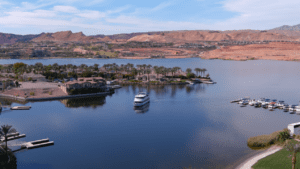
Lake Las Vegas View
Emphasize Natural Objects
Nowadays, nobody gets excited watching video footage of drones flying without any image in focus. Shooting from different altitudes or areas and flying close to natural objects such as trees, rivers, and mountains always adds depth and motion to your video footage.
Flying backward can also help to reveal details within the desired landscape rather than focusing on just one specific detail.
Adhere to Instructions in the Country/Region/State
Every state, country, or region has rules that drone pilots must adhere to during, before, and after flying. Las Vegas Drone businesses, for example, need to ensure that their pilots are FAA-certified and can operate within the specifications and rules outlined by Federal and Nevada law.
Pick a Specific Time for Shoots
Just like making regular videos, timing is also very important in making great videos. Depending on what you might be trying to achieve, sometimes shooting just before sunset or after dawn might give that dramatic view aimed at bringing out detail, colors, and specifications.
Use Filters
A neutral density filter is a must-have, especially if filming is done for long hours under sunlight. ND filters regulate the light entering your camera and sometimes make slower shutter speeds possible.
Pay Attention to the Weather
The last thing we want to happen is to lose video footage or drone equipment when flying. Before scheduling an appointment, checking weather forecasts for weather information helps one either reschedule or continue the appointment. If the weather changes during filming, one can take a break to resume under stable conditions.
Take Multiple Shots
Taking multiple shots reduces the risk of losing footage or having low-quality versions. It even helps in the editing process. After compiling all the videos, your client chooses which is best.
Creativity
The vital tip that separates you from other aerial videographers is your unique creativity when making videos for different clients. This helps to show clients your skills and a new perspective that is different from other service providers.
Need someone to capture Aerial Videos in Vegas? Skyview Las Vegas’s services are not limited to aerial mapping or photography. We provide aerial videography services to esteemed clients looking to create videos of exceptional quality with our team members. Send us an email at sk*******@***il.com for a free quote and consultation to capture videos from different, unique angles that will keep your clients coming back for more.
Drones have completely transformed the world of commercial aerial photography. Once limited to expensive methods like helicopters and hot air balloons, aerial photography is now accessible to many thanks to drones. This article explores how drones have changed this field, highlighting their advantages, applications, challenges, and future trends.
Key Takeaways
Drones have made aerial photography cheaper and more accessible for everyone.
They allow photographers to capture unique angles and perspectives.
Drones are widely used in various industries like real estate and construction.
Safety risks have decreased significantly with drone usage.
The future of aerial photography looks bright with ongoing technological advancements.
The Evolution of Commercial Aerial Photography
Traditional Methods and Their Limitations
In the past, capturing images from the sky was mainly done using helicopters, airplanes, and hot air balloons. These methods were not only expensive but also had several limitations:
High operational costs
Safety risks for the crew
Limited accessibility to certain areas
The Advent of Drone Technology
The introduction of drones has completely changed the game. Drones, or uncrewed aerial vehicles (UAVs), are small, remote-controlled aircraft that can take stunning aerial photos. They are:
More affordable than traditional methods
Easier to operate
Accessible to photographers of all skill levels
Impact on the Photography Industry
Drones have made aerial photography available to many more people. This has led to a rise in freelance photographers and small businesses specializing in aerial shots. The use of drones has also:
Increased demand for aerial imagery in various sectors
Allowed for quicker delivery of high-quality images
Enhanced the creativity and storytelling in photography
The rise of drone technology has not only made aerial photography more accessible but has also transformed how businesses showcase their offerings, such as sky view las vegas which utilizes innovative aerial photography services to enhance visual storytelling.
Advantages of Drones in Commercial Aerial Photography
Cost-Effectiveness and Accessibility
Drones have made aerial photography much cheaper. They remove the need for expensive planes and pilots, making it easier for small businesses and hobbyists to take stunning aerial shots. This shift has opened up opportunities for many new photographers.
Enhanced Flexibility and Maneuverability
Drones are incredibly agile. They can fly low, hover, and reach tight spots that traditional aircraft can’t. This means photographers can capture unique angles and perspectives that were once hard to get. Here are some key points about their flexibility:
Low-altitude flying allows for detailed shots.
Hovering capabilities enable perfect framing.
Access to restricted areas opens new possibilities.
High-Resolution Imaging Capabilities
Modern drones come with high-quality cameras that can take sharp, clear images. This is crucial for businesses that need top-notch visuals. The ability to capture high-resolution photos is a game-changer in many fields, including real estate and construction.
Improved Safety and Reduced Risks
Drones have made aerial photography safer. Photographers can operate them from a distance, avoiding dangerous locations. This reduces the risks associated with capturing images in harsh environments, such as:
Rugged terrains
Hazardous sites
Crowded events
Drones have truly transformed the world of commercial aerial photography, making it more accessible, safe, and versatile than ever before. Their advantages are reshaping how we capture and view the world from above.
Applications of Drones in Various Industries
Drones have opened up new possibilities in many fields, making them essential tools for various industries. The versatility of drone applications has transformed how businesses operate and engage with customers.
Revolutionizing Real Estate Marketing
Drones provide stunning aerial views of properties, helping buyers see the entire layout.
They can capture unique angles that traditional photography cannot achieve.
Aerial images enhance property listings, attracting more potential buyers.
Transforming Construction and Infrastructure Projects
Drones are used for surveying and mapping construction sites, providing real-time data.
They help monitor progress and identify issues early, improving project management.
Safety is enhanced as drones can access high-risk areas without putting workers in danger.
Innovations in Film and Media Production
Filmmakers use drones to create breathtaking aerial shots for movies and documentaries.
Drones allow for dynamic filming that was once only possible with expensive equipment.
They have become a cost-effective solution for capturing high-quality visuals.
Environmental Monitoring and Conservation Efforts
Drones are used to monitor wildlife and track environmental changes.
They can cover large areas quickly, providing valuable data for conservation projects.
Drones help researchers study ecosystems without disturbing wildlife.
Drones are changing the way we see the world, offering perspectives that were once out of reach. Their applications are vast and continue to grow, making them invaluable in today’s industries.
Challenges and Considerations in Drone Photography
Navigating Legal and Regulatory Frameworks
Using drones in photography can sometimes lead to legal issues, especially when capturing images over private properties without permission. Operators must be aware of the specific regulations set by aviation authorities. This includes obtaining necessary permits and following guidelines for safe drone operation. Understanding these rules is crucial to avoid potential legal problems.
Skill and Expertise Requirements for Operators
Flying a drone for aerial photography isn’t as simple as it seems. Pilots must understand how to control the drone, frame their shots, and capture high-quality images. Here are some important skills:
Drone control: Mastering the basics of flying a drone.
Framing shots: Knowing how to compose a good photograph.
Post-processing: Understanding how to edit images for the best results.
Battery Life and Flight Time Limitations
Drones have limited battery life, affecting how long they fly. Most consumer drones can only stay in the air for about 20-30 minutes before recharging. This can be a challenge for larger projects. Here’s how to manage this:
Plan: Know how long you need to shoot.
Charge batteries: Always have extra batteries ready.
Monitor usage: Keep track of flight time to avoid mid-air shutdowns.
Weather Conditions and Flight Restrictions
Weather can significantly impact drone photography. Strong winds, rain, or fog can make flying difficult or unsafe. Additionally, some areas have no-fly zones due to security or privacy concerns. It’s essential to check the weather and any restrictions before flying to ensure a successful shoot.
In summary, while drones have opened up new possibilities in aerial photography, they also come with challenges that operators must navigate carefully.
These improvements allow for more complex aerial photography missions, making drones even more helpful.
Integration with AI and Emerging Technologies
Drones are not just flying cameras anymore. They are now being combined with other technologies like AI and 5G. This integration can:
Automate flight planning
Enhance object detection
Improve image recognition
These features make aerial photography smoother and help analyze images more effectively.
Market Growth and Increased Adoption
The use of drones in commercial aerial photography is on the rise. More businesses are realizing the benefits of using drones, leading to:
Increased demand for aerial photography services
More freelance photographers entering the market
A more comprehensive range of industries utilizing drone photography
The future looks bright for drone photography, with many new opportunities on the horizon.
In summary, technological advancements, integration with AI, and a growing market will shape the future of commercial aerial photography. Drones will continue to play a vital role in capturing stunning images from the sky.
The Changing Landscape of Photography Businesses
Rise of Freelance Photographers and Small Businesses
The introduction of drones has led to a surge in freelance photographers and small businesses. With drones being more affordable and accessible, many individuals are starting their aerial photography ventures. This shift allows for a broader range of services and creativity in the market.
Impact on Traditional Photography Methods
Drones have changed traditional photography. They provide unique perspectives that were hard to achieve before. For example, aerial shots can now be taken from low altitudes, giving a fresh view of landscapes and properties. This has made traditional methods less common, as drones can do the job faster and often at a lower cost.
New Opportunities in the Photography Market
The growth of drone technology has opened up new opportunities in various sectors. Here are some areas where drones are making a difference:
Real Estate: Drones capture stunning aerial views of properties, attracting more buyers.
Construction: They help monitor progress and provide updates from above.
Tourism: Drones create captivating promotional videos for travel destinations.
The rise of drones in photography is not just a trend; it’s a revolution that is reshaping the industry.
Overall, the landscape of photography businesses is evolving rapidly, with drones playing a vital role in this transformation.
The world of photography businesses is changing fast! With new technology like drones, photographers can now capture stunning images from the sky. If you want to elevate your photography game, visit our website for more information on how we can help you stand out. Don’t miss out on the chance to impress your clients!
Conclusion
Drones have completely changed the game in commercial aerial photography. They make it easier and cheaper for anyone to take stunning aerial photos and videos. With drones, photographers can capture high-quality images from unique angles that are hard to reach. This has opened up new opportunities in many fields, such as real estate, construction, and wildlife photography.
While some challenges remain, like understanding the rules for flying drones and learning how to use them properly, the benefits are clear. Drones are becoming a must-have tool for photographers everywhere. As technology keeps improving, we can expect even more exciting developments in aerial photography.
Frequently Asked Questions
Are drones hard to use for aerial photography?
Drones are generally easy to operate, making them accessible for beginners.
How does drone photography compare in quality to traditional methods?
Drones can capture high-quality images that are often on par with traditional methods.
What safety tips should I follow when using drones for photography?
Always check local laws, avoid flying near people or obstacles, and keep your drone within sight.
Can I use drones for indoor photography?
Drones are mainly designed for outdoor use, but some can be adapted for indoor settings.
How has drone usage impacted job opportunities for photographers?
Drones have opened new job opportunities for freelance photographers and small businesses.
What are some common challenges when using drones for photography?
Challenges include regulations, battery life, weather conditions, and the need for skilled operators.
Aerial photography and drone services are changing how we see the world from above. These modern tools provide unique benefits that help various industries improve their work. This article will discuss five significant advantages of aerial photography and drone services, showing how they can make tasks easier, safer, and more creative.
Key Takeaways
Aerial photography and drone services save time and money by speeding up data collection and reducing the need for expensive Equipment.
Using drones keeps people safe by allowing inspections in dangerous areas without putting anyone at risk.
Drones provide accurate and detailed data, helping businesses make better decisions and understand their projects.
Aerial images capture stunning views that grab people’s attention, making them great for marketing and promotions.
Drones cut down on survey costs and field time, allowing for quicker results and smaller teams.
1. Increased Efficiency and Cost Savings
Aerial photography and drone services bring significant efficiency and savings to various industries. Businesses can collect data quickly and accurately using drones, reducing time spent on projects. Here are some key points:
Faster Data Collection: Drones can cover large areas quickly, making data collection much quicker than traditional methods.
Lower Costs: Using drones eliminates the need for expensive Equipment like helicopters, which can save money.
Less Labor: Drones require fewer people to operate, lowering labor costs.
Method
Time Required
Cost
Traditional Survey
10 days
$10,000
Drone Survey
2 days
$2,000
Drones not only save time and money but also make aerial photography more accessible to everyone.
In summary, using drones for aerial photography increases efficiency and significantly reduces costs, making them an essential tool for modern businesses.
2. Enhanced Safety and Risk Mitigation
Drones are crucial in improving safety and reducing risks in various industries. Businesses can avoid dangerous situations by sending people into hazardous areas using drones. Here are some key benefits of using drone services for safety:
Access to Dangerous Areas: Drones can reach hard-to-reach places, like tall buildings or remote locations, without putting anyone in danger.
Detailed Inspections: They provide clear images of structures, helping to spot potential problems before they become serious.
Reduced Human Risk: Drones allow workers to stay safe on the ground while drones do the risky work.
Benefit
Description
Access to Hazardous Areas
Drones can safely inspect dangerous locations without human presence.
Improved Inspection Quality
High-resolution images help identify issues that might be missed otherwise.
Cost-Effective Solutions
Using drones reduces the need for expensive Equipment and personnel.
Drones are changing the way we think about safety in the workplace. They allow for thorough inspections without the risks associated with human involvement.
In summary, using drone services enhances safety and helps businesses manage risks effectively, making it a smart choice for many industries.
3. Improved Data Collection and Analysis
Aerial photography and drone services have transformed how we gather and analyze data. Drones provide accurate and real-time information that can be used for various purposes, such as mapping and monitoring environmental changes. Here are some key benefits of using drones for data collection:
High-Resolution Imagery: Drones capture detailed aerial views that traditional methods cannot match.
Rapid Data Acquisition: Aerial surveys can be completed much faster than ground-based methods, saving time and resources.
Diverse Data Formats: The data collected can be represented in various formats, including Digital Terrain Models (DTM) and orthomosaics.
Benefit
Description
Increased Accuracy
Drones enhance the precision of data collected.
Cost-Effective
Reduces the need for expensive Equipment and labor.
Comprehensive Coverage
Thousands of data points can be captured in one flight.
Using drones allows for a broader perspective, making it easier to track changes over time and make informed decisions.
In summary, using drones in data collection improves accuracy and efficiency, making it a valuable tool for various industries.
4. Creative and Engaging Visual Content
Aerial photography offers a unique way to create eye-catching visuals that can elevate your marketing efforts. By capturing images from above, businesses can showcase their products, services, or locations in a way that grabs attention. Here are some key benefits of using aerial photography:
Unique Perspectives
Dramatic Angles: Aerial shots provide views that are impossible to achieve from the ground.
Vast Landscapes: Capture expansive areas, making it easier to highlight large projects or events.
Detailed Overviews: A comprehensive look at properties or developments, showcasing their scale and features.
Enhanced Storytelling
Visual Narratives: Aerial images can tell a story, engaging viewers and drawing them into the content.
Creative Marketing: Use stunning visuals to enhance your marketing strategy and attract customers.
Brand Identity: Unique aerial shots can help establish a strong brand presence in a crowded market.
Cost-Effective Content Creation
Affordable Options: Unlike traditional photography, drone services can be more budget-friendly.
Quick Turnaround: Aerial photography can be done faster, saving time and resources.
Versatile Applications: Use aerial images for various purposes, from social media to promotional materials.
Aerial photography is a powerful tool that can help businesses elevate marketing with drone photography. It transforms visuals and strategies, making them more engaging and effective.
5. Reduced Survey Costs and Field Time
Using drones for surveying can significantly lower costs and save time. Drone surveys can be up to 80% faster than traditional methods, which means less time spent on-site and fewer resources needed. Here are some key benefits of using drones for surveys:
Faster Data Collection: Drones can cover large areas quickly, reducing the time needed for surveys.
Lower Labor Costs: Fewer workers are required for aerial surveys than traditional methods.
Less Equipment Needed: Drones eliminate the need for expensive ground control points (GCPs), which can be costly and time-consuming.
Benefit
Traditional Method
Drone Method
Time to Complete Survey
5 days
1 day
Number of Workers Required
5
2
Cost of Equipment
High
Low
Drones not only speed up the surveying process but also provide accurate and comprehensive data in a single flight, making them a valuable tool for various industries.
Final Thoughts
In conclusion, aerial photography and drone services offer numerous benefits that can significantly enhance various industries. They save time and money, improve safety, and provide detailed data that helps make better decisions. The stunning visuals captured from above can also make marketing efforts more effective and engaging. As technology advances, the potential for aerial photography and drone services will only grow, making them an essential tool for businesses looking to stand out and succeed.
Drones are transforming how construction projects are managed in Las Vegas, Nevada. This article will explore why drone photography should be part of your construction toolkit. Aerial photography is a game-changer for construction and real estate, offering expansive views that improve how buildings are built, marketed, and sold.
Key Takeaways
Aerial photography boosts project monitoring and safety on construction sites.
Choosing the right drone services in Las Vegas involves considering cost, value, and top providers.
Drones are useful for site surveys, progress tracking, and construction marketing.
Understanding FAA regulations, insurance, and best practices is crucial for safe drone operations.
Future trends include advancements in drone technology, AI integration, and a focus on sustainability.
The Impact of Aerial Photography on Construction Projects
Enhancing Project Monitoring
Aerial photography has revolutionized how construction sites are monitored. Project managers can now capture high-quality aerial imagery with drones, providing a comprehensive site view. This helps track progress and identify potential issues early on. Drones offer a bird’s-eye view that traditional methods can’t match.
Improving Safety Standards
Safety is a top priority on construction sites. Drones can help improve safety standards by providing real-time data and visuals. This allows for better planning and risk assessment. For instance, drones can inspect hard-to-reach areas, reducing the need for workers to be in dangerous situations.
Streamlining Communication
Effective communication is crucial for the success of any construction project. Aerial photography aids in streamlining communication among stakeholders. By providing clear and detailed images, everyone can better understand the project’s status. This leads to more informed decision-making and fewer misunderstandings.
Leveraging aerial photography and drones in construction can significantly enhance project efficiency and safety.
https://www.youtube.com/embed/90sfzgCbByw
Choosing the Right Drone Services in Las Vegas
Factors to Consider
When selecting aerial photography services in Las Vegas, it’s important to look at several factors. First, check if the drone operators are FAA Part 107 certified. This ensures they are legally allowed to fly drones for commercial purposes. Next, consider the type of equipment they use. Advanced drones can capture high-quality images and videos, which is crucial for construction projects. Lastly, look at their experience and past projects to gauge their expertise.
Top Providers in the Area
Las Vegas has several top-notch drone service providers. Companies like We Fly offer various services, including real estate marketing, event coverage, and construction site monitoring. They use advanced drones and have a team of experienced pilots. Another notable provider is Extreme Aerial Las Vegas, which is known for its high-quality imaging and quick turnaround times.
Cost and Value Analysis
The cost of drone services can vary widely. It’s essential to compare prices and the value offered. Some providers may offer package deals that include both aerial photography and videography. Others might provide additional services like 3D mapping or in-house editing. Get quotes from multiple providers to find the best deal for your project.
Choosing the right drone service can significantly impact the success of your construction project. Make sure to do your research and select a provider that meets all your needs.
Applications of Aerial Photography in Construction
Site Surveys and Mapping
Aerial Photography is a game-changer for site surveys and mapping. Drones can quickly capture detailed images of large areas, making it easier to create accurate maps. This helps in planning and ensures that every part of the site is accounted for. Contractors and building owners use drones to collect real-time project data and understand what happens on-site.
Progress Tracking
Keeping track of a construction project’s progress is crucial. With Construction Site Aerial Photography, you can get a bird’s-eye view of the entire site. This makes it simple to see what has been done and what still needs to be completed. Regular aerial photos can be compared over time to monitor progress and make adjustments as needed.
Marketing and Promotion
Aerial photos and videos are perfect for showcasing your construction project. They highlight the construction company’s positive aspects and give images featuring the project site, workers, machinery, and beautiful architectural design. This is especially useful in places like Las Vegas, known for its bright lights and vast views. Stunning aerial imagery can make your project stand out and attract potential clients.
Legal and Safety Considerations for Drone Use
FAA Regulations
Flying drones in the United States requires following specific rules set by the Federal Aviation Administration (FAA). All commercial drone operations must comply with FAA Part 107 regulations. This includes obtaining a Part 107 license for the pilot and registering any drone that weighs 250 grams or more. Additionally, waivers are needed for special operations like flying at night or over people.
Insurance Requirements
Insurance is crucial for drone operations, especially in construction. Policies typically include aviation liability, invasion of privacy, and general liability coverage. For instance, many companies carry a $5 million aviation liability policy to cover potential risks. Ensuring proper insurance helps protect both the operator and the client from unforeseen incidents.
Best Practices for Safe Operations
To maintain safety, drone operators should follow best practices such as conducting pre-flight inspections, keeping a visual line of sight, and avoiding no-fly zones. It’s also important to stay updated on local laws and regulations, as they vary by location. Regular training and certification updates for pilots can further enhance safety standards.
Drones provide unique aerial views that highlight property features and surroundings, making them invaluable for construction projects.
Case Studies: Successful Projects in Las Vegas
T-Mobile Arena
The T-Mobile Arena is one of the most significant construction projects in Las Vegas. Construction site drone photography in Las Vegas played a crucial role in monitoring the progress of this massive project. Drones provided aerial views that helped track the construction stages, ensuring everything stayed on schedule.
Raiders Stadium
Another significant project, the Raiders Stadium, greatly benefited from drone technology. Aerial photography allowed for detailed progress tracking and site surveys, making the construction process more efficient and cost-effective. This technology also enhanced safety measures on-site.
Circa Casino
Circa Casino is a prime example of how drones can revolutionize construction projects. Using drones for aerial mapping and progress flights ensured that the project stayed on track. Choosing certified providers for drone services guaranteed high-quality results, effectively showcasing the project’s advancement to clients.
Future Trends in Construction Aerial Photography
Advancements in Drone Technology
The future of construction site aerial photography in Las Vegas is set to be revolutionized by rapid advancements in drone technology. Newer drones are becoming more efficient, with longer flight times and better image quality. These improvements will make capturing detailed images of construction sites easier, enhancing project management and site inspection.
Integration with AI and Machine Learning
Artificial Intelligence (AI) and Machine Learning (ML) are starting to play a significant role in aerial photography. By integrating AI and ML, drones can analyze images in real time, identifying potential issues and providing actionable insights. This technology helps make quicker decisions, ensuring projects stay on track and within budget.
Sustainability and Environmental Impact
Drones are also contributing to more sustainable construction practices. They reduce the need for physical site visits, reducing fuel consumption and emissions. Additionally, drones can monitor environmental impact, ensuring construction activities comply with local regulations and sustainability goals.
The future of aerial photography in construction is not just about capturing stunning images; it’s about leveraging technology to build smarter, safer, and more sustainable projects.
How to Get Started with Aerial Photography for Your Project
Initial Planning and Consultation
Before diving into aerial photography, it’s crucial to start with initial planning and consultation. This step helps you understand your project’s needs and how aerial imaging can meet them. Consider booking a free consultation to learn how aerial imaging can help you and your business.
Selecting the Right Equipment
Choosing the right equipment is essential for capturing high-quality images. You’ll need to decide on the type of drone and camera that best suits your project. Here are some factors to consider:
Camera Quality: Ensure the camera can capture high-resolution images.
Flight Time: Longer flight times allow for more extensive coverage.
Stability: A stable drone ensures more explicit images.
Hiring Professional Drone Pilots
Hiring professional drone pilots can make a significant difference in the quality of your aerial photos. Experienced pilots know how to navigate complex environments and capture the best angles. Look for services that offer flexible solutions to adapt to any project’s needs and deliver professional footage no matter the place.
Getting started with aerial photography involves careful planning, selecting the right equipment, and hiring skilled professionals. This ensures your project is documented in the best possible way.
Conclusion
In conclusion, aerial photography using drones is transforming the construction industry in Las Vegas. These high-flying cameras capture stunning images that help builders, realtors, and inspectors see their projects from a new perspective. Whether for marketing, progress tracking, or inspections, drone photography offers a clear advantage. As technology advances, drones in construction will only grow, making them an essential tool for anyone involved in the industry. So, if you’re in Las Vegas and haven’t yet explored the benefits of drone photography, now is the perfect time to start.
Frequently Asked Questions
What is construction site aerial photography?
Construction site aerial photography involves using drones to capture images and videos of construction sites from the air. This helps monitor progress, ensure safety, and promote the project.
Why should I use drones for my construction project in Las Vegas?
Using drones for construction projects in Las Vegas provides detailed, expansive site views. This technology helps improve project monitoring, safety, and communication among stakeholders.
What are the legal requirements for using drones in construction?
To use drones in construction, you must follow FAA regulations, obtain necessary insurance, and adhere to best practices for safe operations. It’s crucial to hire certified drone pilots to ensure compliance.
How do I choose the right drone service provider in Las Vegas?
When choosing a drone service provider, consider their experience, certifications, and customer reviews. It’s also essential to compare costs and the value they offer to ensure you get the best service for your project.
Yes, drone photography is excellent for marketing construction projects. It provides stunning visuals that can be used in promotional materials, helping to showcase the project’s progress and attract potential clients.
What are some successful construction projects in Las Vegas that used drone photography?
Some notable construction projects in Las Vegas that used drone photography include the T-Mobile Arena, Raiders Stadium, and Circa Casino. These projects benefited from enhanced monitoring and impressive marketing visuals.
Contact Sky View Las Vegas – https://skyviewlv.com/
Las Vegas is known for its vibrant nightlife and stunning landscapes, and now it’s also becoming famous for top-notch drone services. Whether you’re looking to capture breathtaking aerial photos, produce cinematic videos, or get a birds-eye view of your construction site, drone services in Vegas have you covered. With expert pilots and cutting-edge technology, the possibilities are endless.
Key Takeaways
Las Vegas offers various drone photography services, including real estate, event, and commercial advertising photography.
Professional drone videography in Vegas includes 4K HD videos, cinematic footage, and live event coverage.
Expert drone pilots in Las Vegas are FAA-certified, prioritize safety and compliance, and have insurance coverage.
Innovative uses of drone technology in Vegas span construction, agriculture, and architectural design.
Vegas has excellent locations for flying drones, such as Cornerstone Park, Red Rock Canyon, and Lake Las Vegas.
Top Drone Photography Services in Las Vegas
Las Vegas offers some of the best drone services in Vegas, especially regarding aerial photography. Whether you’re looking to capture stunning real estate images or unforgettable moments at events, the city has you covered.
Professional Drone Videography in Vegas
4K HD Promotional Videos
4K HD promotional videos are a game-changer for businesses looking to stand out. These high-quality videos can showcase your products or services in stunning detail, making them perfect for marketing campaigns. Whether for a new product launch or a company overview, these videos grab attention and leave a lasting impression.
Cinematic Drone Footage
Cinematic drone footage adds a touch of Hollywood to any project. This type of videography is ideal for film production, commercials, and even personal projects. The smooth, sweeping shots captured by drones can transform ordinary scenes into extraordinary visuals, making your content more engaging and memorable.
Live Event Coverage
Live event coverage with drones offers a unique perspective that traditional cameras can’t match. From concerts to sports events, drones can capture the action from otherwise impossible angles, enhancing the viewer’s experience and providing comprehensive coverage of the event.
Utilizing aerial photography services in Las Vegas by top providers like We Fly can significantly enhance marketing and site analysis. Whether it’s for real estate, events, or film production, drones offer unparalleled versatility and quality.
Expert Drone Pilots in Las Vegas
Expert pilots are crucial when it comes to Las Vegas Drones. Our team consists of FAA-certified pilots who ensure every flight is safe and compliant with regulations. These pilots are skilled and carry significant insurance coverage, providing peace of mind for all clients.
FAA Certified Pilots
Our pilots are FAA Part 107 certified, meaning they have passed rigorous tests and meet all federal requirements. This certification ensures they can handle any project, big or small, with the highest level of professionalism.
Safety and Compliance
Safety is our top priority. We follow strict FAA regulations and local ordinances to ensure every flight is conducted safely. Our pilots are trained to handle various scenarios, ensuring the security of both the drone and its surroundings.
Insurance Coverage
All our drone pilots are covered by a minimum $1 million insurance policy, which can be increased to $10 million if needed. This extensive coverage mitigates potential risks, allowing clients to focus on their projects without worry.
Innovative Uses of Drone Technology in Vegas
Construction and Land Surveying
Drones are changing the game in construction and land surveying. They can quickly map out large areas, providing detailed images and data. This helps planners monitor projects more efficiently.
Agricultural Monitoring
Farmers are using drones to monitor their crops. Drones can spot problems like pests or diseases early, helping farmers take action before it’s too late. This technology is making farming smarter and more productive.
Architectural and Engineering Design
Drones offer new ways to visualize and design projects in architecture and engineering. They can capture high-quality images and videos, giving professionals a better understanding of the site. This leads to more accurate and creative designs.
Best Locations to Fly Drones in Las Vegas
Las Vegas offers some fantastic spots for drone enthusiasts. Cornerstone Park is a favorite among locals. It’s located in an area with fewer airspace restrictions, making it a great place to practice your flying skills. The park is spacious and has plenty of open areas, perfect for capturing stunning aerial shots.
Red Rock Canyon is another excellent location. The canyon’s natural beauty provides a breathtaking backdrop for any drone footage. Just remember to follow all local regulations and avoid flying in restricted areas.
Lake Las Vegas is also a top pick. The serene waters and surrounding landscapes offer a unique setting for drone photography and videography. It’s a bit further from the city, but the views are worth the trip.
Comprehensive Drone Training Programs
Las Vegas drone services offer a range of comprehensive training programs to help you become a skilled drone pilot. Whether you’re a beginner or looking to advance your skills, there’s something for everyone.
Beginner Drone Courses
For those just starting out, beginner courses cover the basics of drone operation, safety, and regulations. You’ll learn how to fly your drone confidently and responsibly.
Advanced Flight Techniques
Once you’ve mastered the basics, advanced courses teach you more complex flight maneuvers and techniques. These classes are perfect for those looking to advance their skills.
Regulatory Compliance Training
Understanding and following the rules is crucial for any drone pilot. Regulatory compliance training ensures you know the laws and regulations that apply to drone flying, helping you stay compliant and safe.
Custom Drone Solutions for Businesses
Tailored Aerial Photography
Businesses in Las Vegas can benefit from customized aerial photography services. These services capture unique perspectives of properties, events, and landscapes. Whether you need high-resolution images for marketing or detailed shots for inspections, tailored solutions ensure your specific needs are met.
Custom Video Production
Custom drone video production is the way for companies looking to create engaging video content. From promotional videos to detailed project documentation, drones can capture stunning footage that traditional cameras can’t. This service is ideal for showcasing your business dynamically and visually appealingly.
Specialized Inspection Services
Drones offer a safe and efficient way to conduct inspections. They can access hard-to-reach areas and provide real-time data, making them invaluable for construction, agriculture, and infrastructure industries. With specialized inspection services, businesses can ensure safety and compliance while saving time and resources.
Utilizing drone technology can significantly enhance operational efficiency and provide a competitive edge in various industries.
Conclusion
In conclusion, Las Vegas Drones offers top-notch drone services that cater to a wide range of needs. Whether you’re in real estate, construction, or just looking to capture stunning aerial footage, their experienced team has you covered. With cutting-edge technology and a commitment to safety, they ensure high-quality results every time. So, if you’re in Vegas and need drone services, look no further than Las Vegas Drones.
Frequently Asked Questions
What types of drone services are available in Las Vegas?
In Las Vegas, you can find various drone services, including aerial photography for real estate, event and wedding photography, commercial advertising, and more.
Are the drone pilots in Las Vegas certified?
Yes, most professional drone pilots in Las Vegas are FAA-certified, ensuring they meet all safety and regulatory standards.
Can drones be used for live event coverage in Vegas?
Absolutely! Drones often provide live coverage of events, offering unique aerial views that traditional cameras can’t capture.
What are some popular locations to fly drones in Las Vegas?
Some popular spots include Cornerstone Park, Red Rock Canyon, and Lake Las Vegas. These locations offer incredible scenery and are generally drone-friendly.
Do drone services in Las Vegas include insurance?
Many professional drone services in Las Vegas have insurance coverage to protect against potential accidents or damages.
Comprehensive training programs are available, ranging from beginner courses to advanced flight techniques and regulatory compliance training.
We at Sky View Las Vegas offer professional drone services to many customers, including construction project managers and commercial realtors. Contact us today to experience the power of drone services and receive many benefits like high-resolution images, custom aerial videos, site inspections, aerial mapping, and so much more! So, what are you waiting for? Reach us at 702- 670-1967 or email us at sk*******@***il.com for a free quote and consultation to showcase your property with stunning imagery and videos and bring your dreams to life.
Planning a drone flight isn’t just about pressing ‘take off.’ It involves a series of necessary steps to ensure safety and compliance with regulations. This article explores the essential parts of the drone pre-flight planning process, helping you understand what goes into preparing for a successful drone operation.
Key Takeaways
Pre-flight planning is crucial for safe drone operations.
Researching airspace and local laws is essential before flying.
Weather conditions can significantly impact flight safety.
Equipment checks ensure the drone is ready for flight.
A final checklist helps confirm all safety measures are in place.
Understanding the Drone Pre-Flight Planning Process
Pre-flight planning is essential for ensuring a safe and successful drone operation. A well-structured pre-flight plan can significantly reduce risks associated with flying. Here are some key aspects to consider:
Importance of Pre-Flight Planning
Safety Assurance: Helps identify potential hazards before takeoff.
Regulatory Compliance: Ensures adherence to local and federal regulations.
Operational Efficiency: Streamlines the flight process, saving time and resources.
Critical Components of the Planning Process
Research: Gather information about the flight area, including airspace restrictions and weather conditions.
Equipment Check: Inspect the drone and all related equipment to ensure they are in good working order.
Final Checklist: Review a comprehensive pre-flight checklist to confirm all necessary steps have been completed.
Common Challenges in Pre-Flight Planning
Weather Variability: Sudden weather changes can impact flight safety.
Regulatory Changes: Keeping up with evolving regulations can be difficult.
Technical Issues: Equipment malfunctions can arise unexpectedly, affecting flight plans.
Effective pre-flight planning is not just a formality; it is a critical factor to consider in a drone pre-flight checklist. A pre-flight checklist will ensure you take into consideration every factor which may impact the safety of your flying time.
Research and Compliance in Drone Pre-Flight Planning
Conducting Airspace Research
Before flying a drone, it’s crucial to understand the airspace where you plan to operate. This involves checking for any restrictions that might affect your flight. Here are some steps to follow:
Identify restricted areas, such as military zones.
Check for temporary flight restrictions (TFRs).
Use sectional charts to visualize airspace classifications.
Understanding FAA Regulations
The Federal Aviation Administration (FAA) has specific rules for drone operations. For instance, most non-recreational drone flying falls under Part 107 regulations. Here are key points to remember:
Drones must weigh less than 55 pounds.
Pilots must be certified and follow operational guidelines.
Flights must be conducted during daylight hours unless otherwise authorized.
Ensuring Compliance with Local Laws
In addition to federal regulations, local laws may also apply. It’s essential to:
Research any local ordinances regarding drone use.
Obtain necessary permits for flying in certain areas.
Consult with community-based organizations if you are a recreational flyer.
Remember: Compliance with both federal and local regulations is essential for safe and legal drone operations. Ignoring these can lead to fines or other penalties.
Weather Considerations in Drone Pre-Flight Planning
Monitoring Weather Conditions
Before flying a drone, it’s essential to monitor weather conditions closely. Weather can change quickly, and it can significantly affect your flight. Here are some key factors to consider:
Wind Speed: High winds can make flying difficult and dangerous.
Precipitation: Rain or snow can damage the drone and affect visibility.
Temperature: Extreme temperatures can impact battery performance.
Impact of Weather on Drone Flights
Weather conditions can have a significant impact on drone flights. Here are some effects:
Wind: Strong winds can cause instability and affect control.
Rain: Wet conditions can lead to equipment failure.
Fog: Low visibility can make seeing the drone and its surroundings hard.
Tools for Weather Forecasting
Using the right tools can help you stay informed about the weather. Here are some valuable resources:
Weather Apps: Apps like Weather Underground provide real-time updates.
Local News: Check local news stations for weather forecasts.
Online Weather Services: Websites like NOAA offer detailed weather information.
Always remember, the weather is a critical factor in ensuring a safe flight. Planning ahead can help you avoid dangerous situations.
Equipment Checks and Preparations
Drone and Equipment Inspection
Before taking off, thoroughly inspecting your drone and equipment is essential. Here are some key points to check:
Look for any visible damage on the drone.
Ensure that all propellers are intact and securely attached.
Check that the distance sensor is clean and unobstructed.
Battery and Power Management
Proper battery management is crucial for a successful flight. Follow these steps:
Make sure all batteries are fully charged.
Carry at least one spare battery for longer flights.
Check the remote controller’s battery level to ensure it’s ready for use.
Software and Firmware Updates
Keeping your software up to date is vital for smooth operation. Ensure that:
The firmware for your drone and remote controller is the latest version.
Your mobile device has the latest versions of any necessary apps.
You have enough storage on your SD card for the flight data.
Remember: A pre-flight checklist will ensure you take into consideration every factor which may impact on the safety of your flying time.
Following these steps can help ensure a safe and successful drone flight.
Site Assessment and Safety Measures
Identifying Potential Hazards
Before flying a drone, it’s essential to identify potential hazards in the area. This includes:
Obstructions like trees, buildings, and power lines.
Weather conditions that could affect flight safety.
People and animals that may be nearby.
Establishing Safe Takeoff and Landing Zones
Choosing the right spots for takeoff and landing is crucial. Here are some tips:
Look for open spaces free from obstacles.
Ensure the area is clear of bystanders to avoid accidents.
Mark emergency landing zones in case of unexpected issues.
Ensuring Bystander Safety
Keeping everyone safe is a top priority. To do this:
Set up a safety perimeter around the flight area.
Communicate with bystanders about the flight plan.
Use visual signals to alert people when the drone is about to take off or land.
Safety is the most important part of flying a drone. Always take the time to assess the site and prepare for any situation that may arise.
Hazard Type
Description
Action Required
Obstructions
Trees, buildings, power lines
Identify and avoid
Weather Conditions
Rain, wind, fog
Monitor and adjust plans
Bystanders
People or animals nearby
Establish a safe perimeter
By following these steps, drone operators can ensure a safer flying experience for everyone involved.
Final Pre-Flight Checklist and Procedures
Reviewing the Pre-Flight Checklist
Before taking off, reviewing the pre-flight checklist is crucial to ensure everything is in order. This checklist helps prevent accidents and ensures a smooth flight. Here are some essential items to check:
Confirm that the weather conditions are suitable for flying.
Ensure all equipment, including the drone and remote controller, functions properly.
Check that all batteries are fully charged and ready for use.
Conducting a Final Safety Briefing
A final safety briefing is essential for all team members involved in the flight. This briefing should cover:
The flight plan and objectives.
Emergency procedures in case of unexpected events.
Roles and responsibilities of each team member during the flight.
Safety is the top priority when flying drones. Always ensure everyone is aware of their roles and the plan.
Executing the Takeoff Procedure
Once everything is checked and the briefing is complete, it’s time to execute the takeoff procedure. Follow these steps:
Position the drone on a flat, clear surface.
Power on the drone and remote controller.
Confirm GPS lock and check battery status.
Initiate the takeoff sequence and monitor the drone’s ascent closely.
Following these steps can ensure a safe and successful drone flight. Remember, pre-flight planning is critical to avoiding issues during your mission!
Post-Flight Analysis and Documentation
After a drone flight, conducting a thorough post-flight analysis is crucial to ensure everything goes smoothly and to learn from the experience. This process involves several key steps:
Reviewing Flight Data
Download the captured data from the drone.
Check the image quality and coverage to ensure all necessary footage is captured.
Analyze flight logs for any anomalies or issues that occurred during the flight.
Assessing Equipment Performance
Inspect the drone for any visible damage or wear after the flight.
Check battery levels and recharge as necessary.
Ensure all equipment is functioning correctly before the next flight.
Documenting the Flight for Future Reference
Keep a detailed flight log, including date, time, location, and purpose.
Note any challenges faced during the flight and how they were addressed.
Store all data securely for future analysis and reference.
Aspect
Details
Flight Date
[Insert Date]
Location
[Insert Location]
Weather Conditions
[Insert Weather]
Issues Encountered
[List Issues]
Proper documentation and analysis can help improve future flights and ensure compliance with regulations. Always prioritize safety and learning from each flight.
Final Thoughts on Drone Pre-Flight Planning
In conclusion, planning before a drone flight is crucial for safety and success. Every step matters, from researching the area to checking the weather and getting the correct permissions. A good pilot will take these steps seriously to ensure everything goes smoothly. If you’re thinking about hiring a drone operator, make sure they follow these essential steps. This way, you can feel confident that your aerial project will be done safely and effectively.
Frequently Asked Questions
What is drone pre-flight planning?
Drone pre-flight planning prepares for a drone flight to ensure safety and compliance with regulations. It includes checking the weather, airspace restrictions, and equipment.
Why is pre-flight planning important?
Pre-flight planning is crucial because it helps avoid accidents, ensures the flight meets all legal requirements, and prepares the operator for any unexpected issues.
What should I check before flying a drone?
Before flying, you should check the weather, inspect the drone for damage, ensure batteries are charged, and confirm that you have the necessary permissions to fly in that area.
How do weather conditions affect drone flights?
Weather conditions can significantly impact drone flights. High winds, rain, or low visibility can make flying dangerous, so monitoring the weather closely before taking off is essential.
What are some common challenges in pre-flight planning?
Common challenges include understanding airspace restrictions, obtaining necessary permits, and dealing with unpredictable weather conditions.
What is included in a final pre-flight checklist?
A final pre-flight checklist typically includes checking the drone’s condition, ensuring all equipment is functioning, confirming the flight path, and reviewing safety protocols.