Drones in Commercial Real Estate
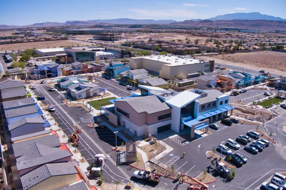
Drones in Commercial Real Estate: How Aerial Technology is Revolutionizing CRE
Executive Summary & Key Takeaways
Drone technology is rapidly reshaping the Commercial Real Estate (CRE) landscape. By delivering high-definition aerial perspectives, automated structural inspections, and immersive digital assets, drones allow developers, brokers, and property managers to operate faster, safer, and more cost-effectively.
-
Enhanced Property Marketing: Capture panoramic aerial photography, cinematic 4K video, and 3D maps that elevate listing visibility.
-
Streamlined Inspections: Execute fast, safe property evaluations on roofs and high-rise structures without high-risk manual labor.
-
Significant Cost & Time Savings: Replace expensive traditional aircraft shoots and reduce reliance on heavy physical inspection equipment.
-
Data-Driven Operations: Integrate drone captures with AI and spatial analytics for proactive maintenance and asset management.
The Evolution of Drone Technology in CRE
The commercial real estate market relies heavily on visual clarity and spatial context. Traditionally, capturing site-scale required hiring manned helicopters or relying on outdated satellite imagery.
Today, modern unmanned aerial vehicles (UAVs) offer sharp 4K imagery, thermal imaging, and LiDAR mapping at a fraction of the historical cost. Incorporating aerial drone services into your CRE strategy builds trust, speeds up decision-making, and creates a decisive competitive advantage.
3 Core Benefits of Drones in Commercial Real Estate
                       ┌──────────────────────────────────────────┐
                       │  Drones in Commercial Real Estate (CRE)  │
                       └────────────────────┬─────────────────────┘
                                            │
         ┌──────────────────────────────────┼──────────────────────────────────┐
         │                                  │                                  │
         ▼                                  ▼                                  ▼
┌─────────────────┐                ┌─────────────────┐                ┌─────────────────┐
│   Enhanced CRE  │                │    Efficient    │                │  Substantial    │
│    Marketing    │                │   Inspections   │                │  Cost Savings   │
└─────────────────┘                └─────────────────┘                └─────────────────┘
1. Enhanced CRE Marketing
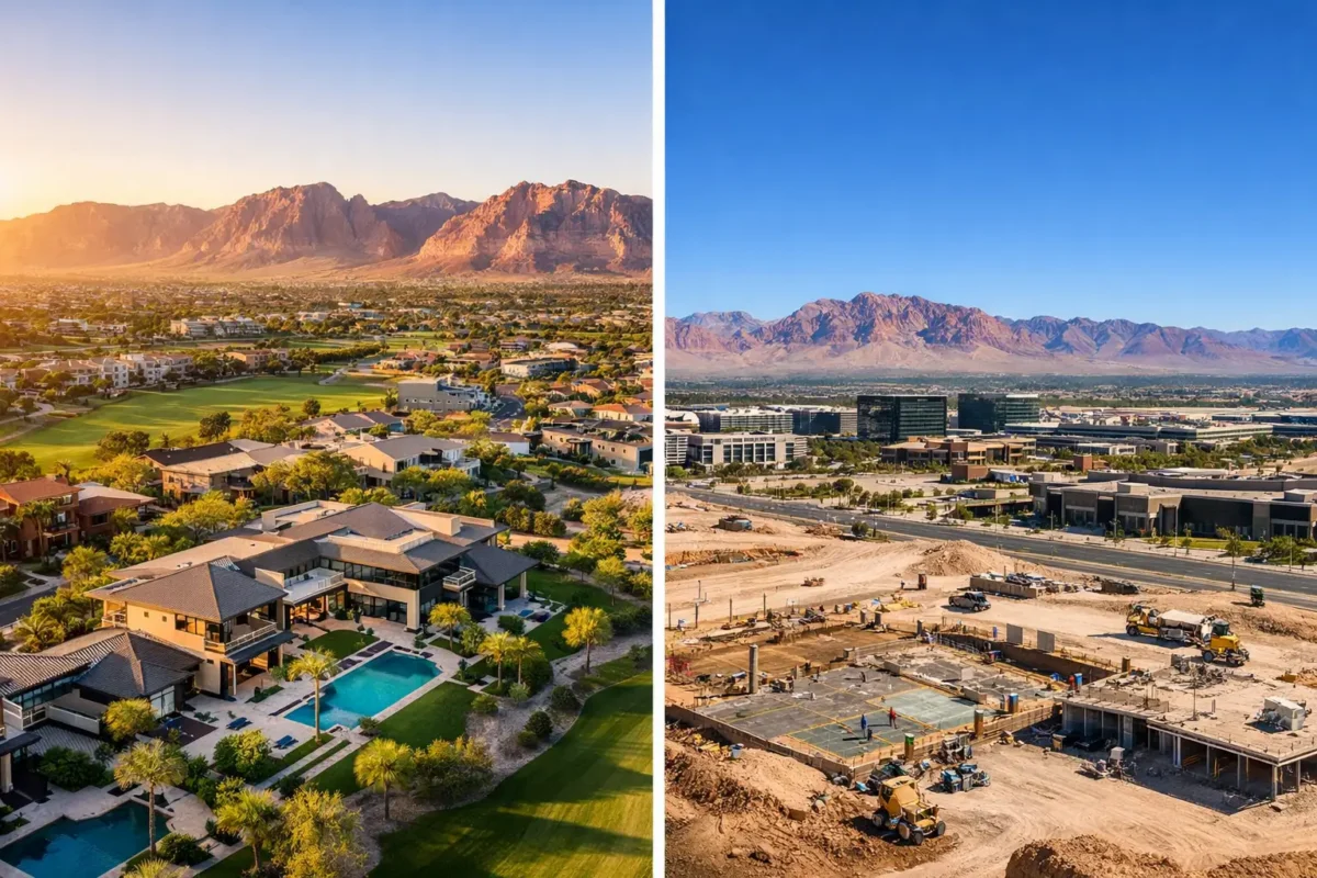
High-value commercial properties—such as industrial parks, retail centers, and multi-family complexes—require prospective buyers and tenants to understand scale and the surrounding location context. Drone videography reveals nearby transit routes, parking ratios, and adjacent commercial hubs seamlessly.
2. Efficient Property Inspections
Conducting routine structural audits on multi-story office buildings or large industrial roofs traditionally takes days. Drones equipped with high-resolution and thermal cameras spot structural flaws, roof degradation, and HVAC issues in minutes, minimizing human risk and liability.
3. Substantial Cost and Time Savings
Eliminating the need for boom lifts, scaffolding, and specialized climbing crews leads to immediate operational savings. Marketing campaigns can also be deployed in hours rather than weeks.
Practical Applications in Property Management
Beyond initial sales and leasing, drones serve as vital tools throughout the lifecycle of property management:
-
Routine Maintenance & Condition Assessments: Inspect hard-to-reach areas safely, capturing measurable visual data to track structural wear over time.
-
Regulatory Compliance & Safety Audits: Easily archive detailed visual records to prove code compliance and facilitate insurance documentation.
-
Emergency & Disaster Response: Following severe weather events, rapidly deploy drones to assess roof or facade damage without putting personnel in harm’s way.
How Drones Are Transforming Property Marketing
Modern CRE marketing relies heavily on storytelling through dynamic digital media. Incorporating drone footage into marketing packages and digital offering memorandums boosts buyer engagement and qualifies leads prior to on-site visits.
Key Marketing Collateral Enabled by Drones
-
Cinematic Aerial Flyovers: Provide sweeping context of lot boundaries, parking availability, and regional access points.
-
3D Photogrammetry & Virtual Walkthroughs: Combine aerial spatial data with interior digital twins to offer complete remote property tours.
-
High-Converting Social & Web Content: Produce short-form video clips optimized for LinkedIn, real estate portals, and digital campaigns.
Comparison: Traditional Marketing vs. Drone-Enabled Marketing
Regulatory and Legal Considerations for Drone Operations
To maximize the benefits of commercial drone deployment while avoiding regulatory penalties, businesses must address key compliance areas:
📌 Compliance Tip: Always verify that your commercial drone operator holds a valid FAA Part 107 Remote Pilot Certificate and maintains adequate aviation liability insurance before filming or inspecting commercial assets.
1. FAA Regulations (Part 107)
In the United States, commercial drone operators must comply with the Federal Aviation Administration (FAA) Part 107 rules. Key requirements include maintaining a visual line of sight, flying under 400 feet above ground level, and obtaining airspace authorizations when operating near controlled airports.
2. Privacy & Data Security
Capturing aerial visuals in dense commercial or residential corridors raises privacy considerations. Inform nearby property owners or tenants in advance, establish clear flight boundaries, and follow strict data-handling procedures.
3. Insurance & Risk Management
Commercial general liability policies generally exclude aviation activities. Ensure drone operators carry specialized aviation liability coverage to protect against accidental property damage or bodily injury.
Future Outlook: AI, Big Data & Sustainability
The intersection of drone technology and property management is expanding rapidly:
-
AI & Predictive Analytics: Machine learning algorithms can automatically process drone imagery to detect micro-cracks in concrete, water pooling on flat roofs, or thermal energy loss.
-
Sustainability & Green Building: Drones evaluate solar panel efficiency, monitor energy efficiency, and audit sustainable construction workflows.
-
Automated Drone-in-a-Box Solutions: Autonomous docking stations will enable scheduled, hands-free property perimeter patrols and structural audits.
Frequently Asked Questions (FAQ)
How are drones used in commercial real estate?
Drones are primarily used for aerial marketing photography, interactive virtual site tours, roof and facade inspections, boundary mapping, and ongoing asset management.
Do commercial drone operators need a license?
Yes. In the U.S., anyone operating a drone for commercial purposes must hold an FAA Part 107 Remote Pilot Certificate and follow official flight guidelines.
How do drones reduce property inspection costs?
Drones eliminate the need for costly equipment like scaffolding, cranes, or boom lifts while significantly reducing inspection time and labor hours.
Can drone footage be integrated into 3D virtual tours?
Yes. Modern aerial imagery can be blended with indoor 3D mapping platforms (such as Matterport) to create seamless, end-to-end interactive property experiences.
Popular Posts
August 30, 2026
August 29, 2026
August 28, 2026
August 27, 2026
August 26, 2026
August 25, 2026
Comments are closed.