How to Plan Aerial Listing Shoots That Sell
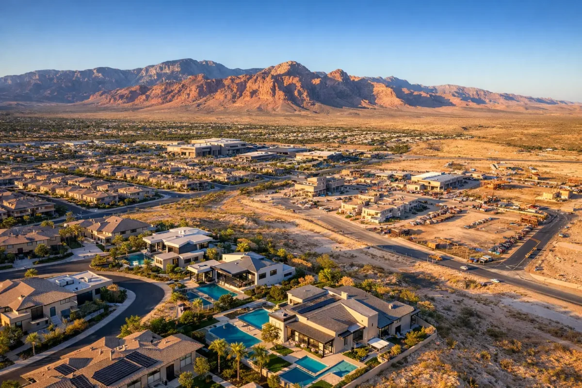
Aerial media earns its value before the drone ever leaves the ground. To plan aerial listing shoots well, you need more than a beautiful property and a clear morning. You need a visual strategy that shows buyers what ground-level photos cannot: lot scale, privacy, access, nearby amenities, views, surrounding development, and the property’s position in the market.
For Las Vegas real estate professionals, that planning also has an operational side. Controlled airspace, changing weather, construction activity, and neighborhood restrictions can all affect what is possible on shoot day. A professional aerial shoot should feel easy for the agent and impressive to the viewer because the flight planning, safety review, and production decisions have already been handled correctly.
Start With the Listing Story, Not the Drone
Every property has a selling angle. A luxury home may need to show a pool, mountain views, a golf course edge, or separation from neighboring homes. A land listing may need to establish parcel boundaries, road frontage, utilities, nearby development, and access routes. A commercial building may need to communicate its parking capacity, tenant visibility, proximity to freeways, or the scale of its surrounding trade area.
Before scheduling aerial media, decide what a buyer, tenant, or investor must understand within the first few seconds of viewing the listing. That answer should guide the flight path, the still-image composition, and the final video edit.
Aerial photography is not simply a high angle. A straight-down image can be excellent for a large lot, roof condition, or parking layout, while an oblique angle may better show elevation, landscaping, and the relationship between the home and its view corridor. The strongest deliverables incorporate multiple perspectives, each with a clear purpose.
Define the buyer’s questions
Ask practical questions early. Is the property’s value tied to its location near the Strip, Downtown Summerlin, a resort corridor, a school, or a major highway? Does the home have a rooftop deck or an oversized backyard that needs context? Is there a view that should be photographed at a specific time of day? Is a proposed development, construction milestone, or parcel layout the main story?
Those answers prevent a common mistake: collecting dramatic drone footage that looks polished but does not help a prospect evaluate the property.
Build a Shot List Around What Creates Value
A shot list keeps the production focused and gives every stakeholder a shared understanding of expectations. It does not need to be a rigid script. Conditions on site may reveal a stronger angle, or safety requirements may limit a planned route. Still, a clear shot list makes the difference between an intentional marketing asset and a collection of unrelated clips.
For most residential listings, plan for exterior establishing images, elevated three-quarter views, a property-and-neighborhood composition, a top-down image of key outdoor features, and selective views that show proximity to relevant amenities. If a home has an exceptional backyard, privacy wall, solar installation, detached garage, or lot depth, make that feature a priority rather than assuming it will appear naturally during the flight.
Commercial and land projects often require more context. The aerial plan may include site access, road connections, parking, adjacent businesses, nearby infrastructure, visibility from major corridors, and wide views that put the property within the larger development pattern. If boundaries, future phases, or property features need labels, discuss that before production so the image framing supports a clean graphic overlay later.
When planning a video, think in sequences rather than isolated clips. An opening reveal, a gradual approach, a controlled orbit, a feature pass, and a wider pullback can create a concise story. Faster movement is not automatically better. In real estate, smooth, measured camera motion usually conveys more confidence than a rapid, dramatic flight.
Choose Timing That Works for the Property
Light changes the appearance of a listing, especially in the desert. Midday can provide clean visibility and crisp site documentation, but it can also create harsh shadows and wash out exterior color. Early morning and late afternoon generally offer warmer tones, longer shadows, and more dimension across landscaping, architecture, and terrain.
The best time depends on the property’s orientation, the desired view, and the media’s use. A west-facing home may photograph beautifully earlier in the day, while a skyline-facing rooftop could call for later light. Twilight footage can add premium appeal to a luxury listing, but it also requires more precise planning and is not necessary for every property.
Weather matters as much as light. Wind can affect flight options, while haze, smoke, dust, and summer heat can reduce visibility at a distance. In Las Vegas, a clear day may be ideal for mountain views, but another day may be better for a close-range architectural shoot. A professional operator should evaluate conditions rather than promise the same creative result in every forecast.
Address Access, Occupancy, and Site Readiness
Aerial production moves quickly when the property is ready. Confirm access to the exterior, gates, rooftops, yards, common areas, and any adjacent areas needed for a safe launch position. Let occupants, tenants, property managers, security teams, or construction superintendents know when the crew will be on site.
For residential listings, clear vehicles from the driveway when possible, remove visible trash bins, secure pets, and prepare outdoor spaces just as carefully as interior rooms. Pool covers, patio furniture, landscaping equipment, and temporary signage can all affect the final images. If a property is occupied, make privacy expectations clear. The goal is to market the asset, not to capture neighboring homes, people, or personal activity without purpose.
Construction and commercial sites require additional coordination. Active equipment, deliveries, workers, cranes, and temporary hazards can change throughout the day. Provide the pilot with a current site contact and communicate any required check-in procedures, safety rules, or restricted areas before arrival.
Plan Aerial Listing Shoots With Airspace in Mind
Not every address is equally simple to fly to. Las Vegas-area properties can fall near controlled airspace associated with Harry Reid International Airport, Nellis Air Force Base, or other aviation-sensitive areas. FAA rules, local operating conditions, altitude limits, and airspace authorizations must be considered before a commercial drone flight takes place.
This is where hiring an FAA-certified drone pilot protects both the schedule and the listing. A qualified operator checks the airspace, determines whether authorization is available, plans an appropriate altitude and flight area, and adjusts the production approach if needed. Some flights may require advance approval, while others may be limited or not feasible under the conditions. Promising a drone shoot before that review creates avoidable risk.
Airspace compliance is not a creative limitation. It is a production requirement. The right pilot can often find safe, approved ways to capture useful visuals, but the final plan must comply with the rules applicable to that specific location and time.
Match the Deliverables to the Marketing Plan
Aerial content should be designed for where it will appear. A listing portal may benefit most from high-resolution stills that quickly communicate the property’s setting. Social media may call for a short vertical video with a strong opening frame. A commercial offering memorandum or investor presentation may need wide site imagery with room for labels and callouts. A development team may require repeatable viewpoints for construction documentation.
Discuss orientation, duration, file needs, and editing expectations before the flight. If you need both horizontal and vertical video, say so in advance. If you want 360-degree photo spheres, construction progress imagery, or a specific sequence for a property website, those needs affect how the shoot is structured.
There is also a budget trade-off. A focused shoot with a defined shot list can produce highly effective assets without overspending. Larger estates, multi-building commercial properties, land parcels, and projects requiring multiple light conditions may justify additional flight time and more extensive editing. The right scope is the one that supports the property’s marketing objective, not the one with the most footage.
Work With a Professional Who Can Execute the Plan
Aerial listing media involves more than operating a drone. It requires risk assessment, flight planning, camera control, awareness of people and property below, editing judgment, and dependable delivery. Internal teams can spend significant time on equipment management, training, maintenance, insurance, and regulatory requirements before producing a usable image.
Sky View LV provides that expertise through FAA-certified pilots, commercial insurance coverage, and experience operating in the Las Vegas market’s complex airspace. The process begins with a free consultation to identify the property’s strongest visual advantages and build a shoot plan around them.
A well-planned aerial shoot gives buyers a reason to pause, look closer, and understand why a property deserves their attention. Bring the property story, the access details, and the marketing goal to the conversation. The right aerial team can turn that preparation into imagery that presents the listing with authority from the first frame.
Popular Posts
August 28, 2026
August 27, 2026
August 26, 2026

August 25, 2026
August 24, 2026

August 23, 2026
Comments are closed.