How Drone Photography Helps Sell Homes Faster
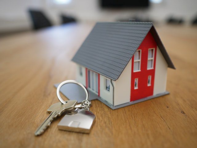
How Real Estate Drone Photography Helps Sell Your House Faster
Selling a house in today’s market requires more than just posting static photos online. Buyers expect interactive, high-definition, and immersive visual experiences when browsing listings.
Enter real estate drone photography. Unmanned aerial vehicles (UAVs) have revolutionized property marketing, giving sellers and real estate agents an edge over the competition. From showcasing expansive outdoor amenities to providing aerial neighborhood tours, here is how using a drone can help you sell your property faster and for top dollar.
1. Create High-Impact, Captivating Property Listings
Traditional ground-level photographs often fail to capture the full scope of a property. Drone photography fills this gap by delivering high-resolution aerial photos and videos that highlight the complete layout of your home and land.
Key Visual Benefits:
-
Bird’s-Eye Perspective: Capture sprawling backyards, pristine landscaping, swimming pools, and custom hardscaping from angles impossible to reach on foot.
-
Property Lines and Layout: Clear aerial shots give buyers an accurate understanding of lot size, property boundaries, and home placement.
-
Cinematic Video Content: High-definition aerial video reels immediately grab attention on listing sites like Zillow and Redfin, as well as on social media platforms.
2. Elevate Buyer Engagement with Virtual Tours
Drones enable smooth 360-degree virtual views and sweeping aerial fly-throughs, allowing remote buyers to explore your property from anywhere in the world.
-
Emotional Connection: Immersive aerial views create a sense of scale and luxury, helping buyers visualize living on the property before setting foot on site.
-
Broader Reach: Highlighting virtual drone tours attracts out-of-state buyers who rely on online listings to make purchasing decisions.
3. Highlight Neighborhood Amenities and Location Context
Location is often a buyer’s top priority. Real estate drones let you showcase not just your house but also the surrounding community.
-
Proximity to Key Landmarks: Fly up to highlight nearby parks, top-rated schools, golf courses, lakes, or ocean views.
-
Community Layout: Give potential buyers a clear view of cul-de-sacs, quiet streets, and neighborhood layout without requiring them to drive around the block.
4. Efficiently Tour Large Estates and Acreage
If your property includes significant acreage, equestrian facilities, or outbuildings, traditional walk-throughs can be time-consuming or weather-dependent.
-
Comfortable Viewing: A drone video allows buyers to take a complete, scenic tour of expansive land directly from a tablet or living room chair—no trekking through mud or overgrown terrain required.
-
Speed and Efficiency: Cover dozens of acres in minutes, highlighting key landscape features and travel access routes seamlessly.
5. Assist with Pre-Listing Inspections
Beyond marketing, drones serve as a practical tool for preparing your house for sale.
-
Roof and Exterior Scrutiny: Drones easily access roofs, high gutters, and multi-story facades to check for damage, loose tiles, or needed repairs prior to listing.
-
Proactive Preparation: Identifying exterior maintenance issues early prevents unexpected surprises during official buyer home inspections.
Key Considerations: Regulations, Safety, and Professional Drone Operators
While drones offer incredible marketing power, commercial real estate drone operations come with important responsibilities:
FAA Regulations and Legal Compliance
Commercial drone flights for real estate marketing are regulated by aviation authorities (such as the FAA under Part 107 in the United States).
-
Airspace Approvals: Operators must obtain official clearance for operations near airports or in controlled airspace.
-
Privacy Considerations: Flight paths must respect neighboring properties and maintain privacy standards.
Why Hire a Licensed Commercial Drone Pilot?
While consumer drones are widely available, hiring a certified professional drone operator ensures:
-
Legal Safety & Licensing: Professional operators carry proper Part 107 certification and commercial liability insurance.
-
Superior Image Quality: Experts utilize specialized lighting techniques, camera settings, and professional post-production video editing.
-
Advanced Flight Skills: Trained pilots navigate trees, power lines, and residential obstacles safely without risking property damage.
Frequently Asked Questions (FAQ)
Q: Do I need a license to use drone photos to sell my home?
A: Yes. In the United States, taking drone photos or video to promote a business or real estate listing is considered commercial use under FAA Part 107 rules and requires a licensed drone pilot.
Q: How much does hiring a real estate drone photographer cost?
A: Costs vary depending on property size, location, and whether you need photo-only packages or full-service edited aerial videos. Quotes typically range from standard listing packages to premium custom shoots for large estates.
Q: Can drones fly indoors for property tours?
A: Yes. Specialized micro-drones equipped with propeller guards and obstacle avoidance can capture smooth indoor fly-throughs, offering a seamless transition from aerial outdoor shots to interior rooms.
Q: What weather conditions affect a drone shoot?
A: High winds, heavy rain, low visibility, or extreme temperatures can impact flight stability and image quality. Professional pilots monitor weather forecasts to schedule shoots during optimal lighting and calm wind conditions.
Final Thoughts
Incorporating aerial photography into your property marketing strategy is one of the most cost-effective ways to stand out in a competitive real estate market. By offering high-impact visuals, immersive tours, and unique neighborhood perspectives, real estate drones help grab buyers’ attention and accelerate the sales process.
Popular Posts
August 09, 2026
August 09, 2026
August 08, 2026
August 07, 2026
August 05, 2026
August 05, 2026
Comments are closed.