When it comes to taking stunning drone photos, it’s not just about owning the latest drone with the most advanced camera; it’s about mastering the art and science of aerial photography. Let’s explore this fascinating world one step at a time.
Finding the Right Drone
Selecting the perfect drone for your photography needs can make or break your aerial shooting experience. Consider the following factors when choosing your drone:
Camera Quality: The camera’s resolution, sensor size, and image stabilization are crucial for capturing sharp and clear photos.
Flight Time: Longer flights allow you to explore more locations and capture a broader range of shots.
Portability: If you plan to travel with your drone, a compact and portable model is ideal.
Mastering Drone Flight
Before you start taking breathtaking photos, it’s essential to become a skilled drone pilot:
Practice Regularly: Spend time honing your flying skills to ensure you have complete control over your drone.
Know the Regulations: Familiarize yourself with local drone laws and regulations to avoid legal complications.
Fly Safely: Always maintain visual contact with your drone and be cautious around obstacles.
Planning Your Shots
A well-thought-out plan is the foundation of excellent drone photography:
Location Scouting: Identify the best locations for your shots, considering natural beauty, accessibility, and safety.
Golden Hours: Shooting during the golden hours of sunrise and sunset offers enchanting lighting conditions.
Check the Weather: Monitor forecasts to select days with favorable conditions.
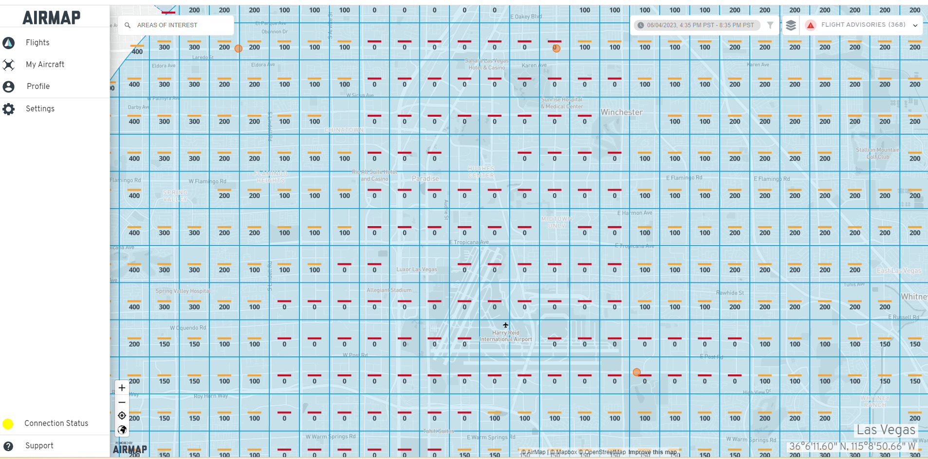
No-Fly Zones: Always check for no-fly zones in your area and respect them.
Visual Line of Sight: Maintain visual contact with your drone at all times to prevent accidents and ensure safe operation.
Battery Monitoring: Monitor your drone’s battery level to ensure a safe return to base.
Expert Tips and Tricks
Now that you’re well-versed in the essentials, let’s explore some expert tips from seasoned drone photographers:
Use ND Filters: Neutral-density filters help control exposure and shutter speed.
Bracketing: Taking multiple exposures can help capture details in challenging lighting conditions.
Image Overlays: Experiment with overlaying images to create unique compositions.
Frequently Asked Questions (FAQs)
How high can a drone fly for photography? Drones designed for photography typically operate at altitudes of 400 feet (120 meters), as regulated by the Federal Aviation Administration (FAA) in the United States. However, it’s essential to check local regulations, as altitude limits may vary by region.
Do I need special permission to fly a drone for photography? The need for special permission depends on your location and the purpose of your drone photography. In many cases, recreational drone flying for personal photography doesn’t require specific permission. However, if you plan to use your photos for commercial purposes, you may need to obtain a license or permit. Always research and adhere to local regulations.
What are the ideal settings for a drone camera in photography? The perfect settings can vary depending on your specific drone and the conditions in which you’re shooting. However, it’s generally advisable to film in RAW format for maximum post-processing flexibility. Adjust your ISO, shutter speed, and aperture settings according to the lighting conditions and desired effect. Experiment to find the perfect settings for your creative vision.
How can I prevent image blur in drone photography? Image blur can be a common issue in drone photography, especially when flying in windy conditions. To reduce blur, consider using a drone with a gimbal for stabilization. Additionally, shooting with a higher shutter speed can help freeze motion and reduce blur. It is an excellent location for drone photography. There are endless breathtaking locations for drone photography. Some popular options include:
National parks
Coastal cliffs and beaches
Mountain ranges
Cityscapes
Historical landmarks
Lakes and rivers
Remote islands
These locations offer diverse landscapes and unique perspectives, making for captivating photos.
Can I sell my drone photos online? Yes, you can sell your drone photos online through various stock photography platforms and marketplaces. Ensure that your photos meet the platform’s quality and licensing requirements. Selling your drone photos can be a rewarding way to share your work and potentially earn income from your hobby.
Conclusion
Mastering the art of drone photography is a rewarding journey filled with creativity, exploration, and the thrill of capturing breathtaking views from above. This includes finding a suitable drone, honing your flying skills, and understanding the nuances of photography. Our photography takes your drone photography to new heights.
In this guide, we cover the fundamentals and offer expert insights. As you embark on your drone photography adventure, always prioritize safety, follow local regulations, and let your creativity soar.
So, take to the skies, embrace the beauty of aerial photography, and create imagery that tells your unique story from above. Happy flying and happy shooting! Fly safe.
The aerial view offers a unique perspective, allowing us to see the world from a different angle. We can gain a better understanding of our surroundings by capturing images from above through satellite imagery or drone photography. The aerial view provides valuable insights into landscapes, urban areas, and natural wonders. It allows us to appreciate the scale and beauty of our planet and can also serve practical purposes, including urban planning, environmental monitoring, and disaster management. In this article, we delve into the fascinating world of aerial views, exploring their various applications and benefits.
Importance of the Aerial Perspective
The aerial perspective provides a unique and valuable viewpoint, allowing us to see the world from above. By taking to the skies, we gain a broader understanding of our surroundings and can appreciate the scale and beauty of landscapes, cities, and natural wonders. This perspective is critical in cartography, urban planning, and environmental science, providing crucial insights for the analysis and management of the planet. Additionally, aerial photography and videography have become powerful tools for capturing stunning visuals and documenting events from a bird’s-eye view. Overall, the aerial perspective significantly expands our knowledge, enhances creativity, and fosters a deeper connection with the world.
Historical Significance of Aerial Photography
Aerial photography has played a significant role in documenting historical events and landscapes. It has allowed us to capture a unique perspective from above, providing valuable insights into the past. From the early use of hot-air balloons and kites to modern drone technology, aerial photography has evolved and revolutionized our understanding of and perspective on history. It has been used to map archaeological sites, document wars, monitor environmental change, and support urban planning. The ability to view the world from above has expanded our knowledge and deepened our appreciation of the planet’s interconnectedness.
Advantages of the Aerial View
Enhanced Understanding of Geographic Features
The aerial view offers a more comprehensive understanding of geographic features. By observing the Earth’s surface from above, we can gain a broader perspective and see the relationships between different landscape elements. This perspective enables us to identify patterns, analyze spatial distributions, and make informed decisions regarding land use, resource management, and urban planning. Furthermore, the aerial view helps us to visualize the interconnectedness of natural and human-made features, such as rivers, roads, buildings, and vegetation. Overall, viewing the Earth from an aerial perspective enhances our understanding of Earth’s geography and enables us to appreciate its complexity and beauty.
Efficient Urban Planning and Development
Efficient urban planning and development are crucial in creating sustainable and livable cities. By carefully designing and organizing urban spaces, cities can optimize land use, reduce congestion, and improve residents’ overall quality of life. This includes strategically locating essential services, such as schools, hospitals, and public transportation, as well as creating green spaces and recreational areas. Additionally, efficient urban planning promotes connectivity and accessibility, facilitating more straightforward navigation of the city and access to amenities. By prioritizing efficient urban planning and development, cities can enhance their economic, social, and environmental sustainability.
Improved Disaster Management
The use of aerial view technology has dramatically enhanced disaster management efforts. By capturing images and videos from above, emergency response teams can quickly assess the extent of damage and identify areas that require immediate attention. This information helps mobilize resources and deploy rescue teams effectively. Additionally, aerial imagery technology enables real-time monitoring of disaster-affected regions, providing timely updates on the situation and facilitating coordination among response teams. Overall, aerial view technology has revolutionized disaster management by providing valuable insights and improving the efficiency of response efforts.
Applications of Aerial Photography
Mapping and Surveying
Mapping and surveying are essential tools for exploring the aerial view. They enable us to create accurate, detailed maps of the land from above. Using specialized equipment and techniques, we can gather data about the landscape’s topography, vegetation, and other features. This information is crucial for various industries, including urban planning, agriculture, and environmental conservation. Mapping and surveying enable us to understand the world in new ways and to make informed decisions based on aerial imagery.
Environmental Monitoring
The use of aerial view technology has revolutionized environmental monitoring. With the ability to capture high-resolution images and videos from above, researchers and scientists can quickly assess and analyze various ecological factors. Aerial imagery technology enables monitoring of land use, vegetation health, water quality, and pollution levels, among other variables. This valuable information enables informed decisions regarding environmental conservation and management. Using aerial imagery, we can gain a comprehensive understanding of Earth’s ecosystems and work toward their protection and preservation for future generations.
Archaeological Discoveries
Archaeological discoveries provide valuable insights into the past. Archaeologists can reconstruct past civilizations, cultures, and societies by studying ancient artifacts, structures, and remains. The aerial view is a powerful archaeological tool, allowing researchers to identify and map archaeological sites from above. This perspective offers a unique understanding of the landscape, enabling archaeologists to locate hidden ruins, burial sites, and other significant archaeological features. Using aerial photography and remote sensing technologies, archaeologists can explore and document archaeological sites in a non-invasive and efficient manner. These discoveries contribute to our understanding of human history and shed light on the mysteries of the past.
Technologies Used in Aerial Imaging
Uncrewed Aerial Vehicles (UAVs)
Uncrewed Aerial Vehicles (UAVs), also known as drones, have revolutionized access to aerial imagery. These remotely operated aircraft have opened up new possibilities for aerial photography, surveillance, and research. With their ability to fly at high altitudes and capture high-quality images and videos, UAVs have become indispensable across industries, including filmmaking, agriculture, and infrastructure inspection. Advances in UAV technology have made UAVs more accessible and affordable, enabling individuals and organizations to harness the aerial perspective as never before.
Satellite Imagery
Satellite imagery plays a crucial role in providing aerial views. It offers a unique perspective from above, enabling us to observe and analyze the Earth’s surface with great detail. Technological advancements have made satellite imagery more accessible and widely used across fields such as cartography, urban planning, and environmental monitoring. By capturing images from space, satellites enable us to study changes in land use, monitor natural disasters, and track animal migration patterns. The wealth of information provided by satellite imagery has revolutionized our understanding of the world and continues to inform scientific research and decision-making.
LiDAR Technology
LiDAR, which stands for Light Detection and Ranging, is a remote sensing technology that uses laser light to measure distances and create detailed 3D maps of the environment. It emits laser pulses and measures the time required for the light to reflect after striking an object. This data is then used to generate accurate high-resolution maps, which are particularly useful in aerial surveys and mapping applications. LiDAR technology has revolutionized aerial exploration by providing precise, detailed information on the topography, vegetation, and structures of the land.
Conclusion
The Power of the Aerial View
The aerial view offers a unique perspective that is both captivating and enlightening. By viewing the world from above, we can gain a deeper understanding of our surroundings and appreciate the beauty and complexity of the Earth’s landscapes. The aerial view allows us to see patterns, connections, and details that are often overlooked from ground level. It provides a sense of scale and context, revealing the vastness of our planet and the interconnectedness of its various ecosystems. Whether exploring cities, studying geography, or appreciating nature, the power of the aerial view is undeniable. It opens our eyes to new possibilities, inspires creativity, and fosters a sense of wonder and awe. Through aerial photography and satellite imagery, we can explore and discover the world in ways once unimaginable. The aerial view truly can change our perspective and broaden our horizons.
Uncovering New Perspectives
The aerial view provides a unique and captivating perspective, allowing us to see the world from a different angle. Exploring the world from above can reveal new perspectives and provide a deeper understanding of our surroundings. From the vantage point of the sky, we can observe the intricate patterns of cities, the vastness of landscapes, and the interconnectedness of natural and artificial structures. This aerial perspective offers stunning visuals and opens up new possibilities for exploration, research, and creativity. Whether for mapping, environmental studies, or simply admiring the beauty of our planet, the aerial view offers a fresh and inspiring way to experience and appreciate the world around us.
Continued Advancements in Aerial Imaging
In recent years, significant advancements in aerial imaging technology have revolutionized our ability to view and explore the world from above. With the development of high-resolution cameras and sophisticated drone systems, aerial photographers and videographers can capture stunning images and videos from unique perspectives. These advancements have improved the quality of aerial photographs and made aerial imaging more accessible to a broader range of industries and applications. From environmental monitoring to real estate marketing, aerial imaging has become essential for data capture and the provision of valuable insights. As technology continues to evolve, we can expect further advancements in aerial imaging, which will open up new possibilities for exploration and discovery.
Drone photography has revolutionized the way we capture images from the sky. Technological advancements have made drones more accessible and affordable, allowing photographers to explore new perspectives and angles. Whether capturing stunning aerial landscapes, documenting events from a unique vantage point, or creating captivating marketing materials, drone photography offers endless possibilities. This article explores drone photography, highlighting its benefits for visual storytelling.
Benefits of using drones for photography
Drones have revolutionized photography, particularly for capturing stunning aerial shots. One of the key benefits of using drones for photography is the ability to access unique perspectives and angles that were previously impossible or difficult to achieve. Drones allow photographers to capture breathtaking views from above, providing a fresh and captivating visual experience. Additionally, drones offer maneuverability, enabling photographers to navigate challenging terrain and capture shots from multiple vantage points. This flexibility and versatility make drones an invaluable tool for photographers, allowing them to capture the sky and create stunning imagery that was once only possible in dreams.
Market demand for drone photography services
The demand for drone photography services has steadily increased over the past few years. With technological advancements, drones have become more accessible and affordable, making it easier for individuals and businesses to incorporate aerial photography into their projects. Drone photography offers a unique perspective, allowing for stunning aerial shots that were once only possible with expensive equipment and helicopters. This has led to growing demand for drone photography services across industries such as real estate, construction, tourism, and event planning. As the popularity of drone photography continues to rise, the market for drone photography services is expected to expand even further.
The Rise of Drone Photography
Evolution of drone technology
Since their inception, drones have made significant advancements. Initially used for military purposes, drone technology has rapidly evolved and found applications in various industries. The advancements in drone technology have led to improved flight stability, longer battery life, and higher-quality cameras. Today, drones are widely used in aerial photography and videography, providing stunning perspectives and capturing breathtaking images. With their ability to fly in difficult-to-reach areas, drones have revolutionized the field of photography, allowing photographers to grab unique and mesmerizing shots from the sky.
Applications of drone photography
Drone photography companies have revolutionized various industries, opening up new possibilities for capturing stunning aerial images and videos. In the real estate industry, drone photography is widely used to showcase properties from unique perspectives, providing potential buyers with a comprehensive view of the surroundings. Additionally, drone photography is utilized in the construction industry to monitor project progress, inspect structures, and identify potential issues. Moreover, drone photography is used in the tourism and hospitality industries to create compelling promotional materials and showcase scenic locations. With its versatility and ability to capture breathtaking images, drone photography has become indispensable for many professionals and enthusiasts.
Advantages of drone photography over traditional methods
Drone photography offers several advantages over traditional methods. First, drones can capture images and videos from unique angles and perspectives that are impossible with ground-based photography. This enables more creative, visually appealing shots. Additionally, drones can access hard-to-reach or hazardous locations, such as high-rise buildings or rugged terrain, without risking human safety. Moreover, drone photography is often more cost-effective than traditional aerial photography, eliminating the need for helicopters or aircraft. Overall, drone photography provides a convenient and innovative way to capture stunning aerial visuals.
Challenges in Professional Drone Photography
Regulatory restrictions and compliance
Drone photography companies, such as Sky View Las Vegas, must adhere to strict regulatory restrictions and compliance measures. These regulations are in place to ensure the safety, privacy, and security of individuals and public spaces. For instance, companies must obtain the required licenses and certifications before operating drones for commercial purposes. They must also comply with airspace restrictions and adhere to guidelines established by aviation authorities. Additionally, drone operators must be familiar with privacy laws and obtain consent before capturing images or videos of individuals or private property. By adhering to these regulations and compliance measures, Capture the Sky maintains a high standard of professionalism and ensures the responsible use of drone technology.
Weather conditions and safety concerns
When operating a drone photography company, it is crucial to consider the weather conditions and safety concerns. Drones are sensitive to extreme weather conditions, such as strong winds, heavy rain, or snowfall, which can affect their stability and control. Therefore, monitoring the weather forecast before each flight and avoiding flying in unfavorable conditions is essential. Safety concerns should also be prioritized to protect drone operators and the public. This includes following local regulations, maintaining a safe distance from people and property, and conducting regular drone maintenance checks. By taking these precautions, a drone photography company can ensure operational safety and capture stunning aerial images.
Technical skills and equipment requirements
To successfully operate a drone photography company, it is crucial to possess the necessary technical skills and equipment. First and foremost, expertise in piloting drones is essential to ensure safe, precise aerial maneuvers. A thorough understanding of photography techniques, including composition, lighting, and framing, is critical for capturing stunning aerial shots. Furthermore, knowledge of post-processing software, such as Adobe Photoshop or Lightroom, is beneficial for enhancing and editing the captured images. In terms of equipment, high-quality drones with advanced cameras are indispensable for professional-grade aerial photography. Moreover, it is crucial to have backup batteries, memory cards, and other accessories to ensure uninterrupted shooting sessions. With the right technical skills and equipment, a drone photography company can deliver exceptional aerial imagery to its clients.
Building a Successful Drone Photography Company
Investing in high-quality drones and camera equipment
Capture the Sky: A Drone Photography Company understands the importance of investing in high-quality drones and camera equipment. Utilizing top-of-the-line technology, we capture stunning aerial images and videos that consistently exceed our clients’ expectations. Our experienced drone pilots and photographers use state-of-the-art equipment to ensure the highest precision and image quality. Whether capturing breathtaking landscapes, documenting special events, or conducting aerial surveys, our investment in high-quality equipment allows us to deliver exceptional client results.
Developing a solid portfolio and online presence
In today’s digital age, developing a solid portfolio and online presence is essential for any business, particularly in drone photography. A well-curated portfolio showcases a drone photography company’s skills and expertise, allowing potential clients to see the quality and creativity of its work. Additionally, having a solid online presence through a website and social media platforms helps to reach a wider audience and attract potential clients. A drone photography company can establish itself as a reputable and sought-after brand by regularly updating its portfolio with new projects and engaging with followers on social media.
Building relationships with clients and networking
Building strong client relationships is crucial to the success of any business, and the drone photography industry is no exception. At Capture the Sky, we understand the importance of establishing trust and rapport with our clients. We go above and beyond to deliver high-quality aerial photographs and provide exceptional customer service. By actively listening to our clients’ needs, we can tailor our services to meet their specific expectations. Additionally, we believe in the power of networking and actively participate in industry events and conferences to connect with potential clients and stay updated with the latest trends and innovations in the field. Through our commitment to building relationships and networking, we strive to meet our clients’ needs and exceed their expectations, earning their loyalty and referrals.
Future Trends in Drone Photography
Advancements in drone technology
Drone technology has advanced significantly in recent years, revolutionizing industries such as photography. With the ability to capture stunning aerial shots, drones have opened up new possibilities for photographers and videographers. The advancements in drone technology have made capturing breathtaking images from unique perspectives easier than ever. Features like high-resolution cameras, GPS tracking, obstacle avoidance, and intelligent flight modes have made drone photography more accessible and user-friendly. As a result, companies like Capture the Sky have emerged, specializing in drone photography services. These companies use the latest drone technology to deliver stunning aerial photos and videos that were once only possible with expensive equipment and helicopters. Advances in drone technology have transformed how we capture the sky.
Integration of artificial intelligence in drone photography
Integrating artificial intelligence (AI) in drone photography has revolutionized the industry. AI algorithms can now analyze drone-captured images, enabling advanced capabilities such as object recognition, automated editing, and intelligent image enhancement. This integration has significantly enhanced the efficiency and accuracy of drone photography, allowing photographers to capture stunning aerial shots with ease. With AI-powered drones, photographers can now focus on the creative aspects of their work while the technology handles the technical details. The seamless integration of AI and drone photography has opened up new possibilities and expanded the horizons of aerial photography.
Emerging applications and industries for drone photography
Drone photography has revolutionized various industries, opening up new possibilities for capturing stunning aerial images and videos. In the real estate industry, drones are used to showcase properties from unique angles, giving potential buyers a comprehensive view of the surroundings. In the construction industry, drones are used to survey and monitor construction sites, enabling more efficient planning and progress tracking. Additionally, drone photography has applications in agriculture, such as crop monitoring and yield estimation. Furthermore, drones are employed in the film and entertainment industry to capture breathtaking aerial shots for movies and commercials. With ongoing advances in drone technology, the applications and industries for drone photography are expected to expand further, offering endless creative possibilities.
Conclusion
The potential of drone photography in capturing unique perspectives
Drone photography has revolutionized how we capture images from unique and breathtaking angles. With the ability to fly high above the ground, drones offer photographers a new perspective that was once only accessible through expensive equipment or helicopters. This innovative technology has opened up a world of possibilities for capturing stunning aerial shots of landscapes, architecture, events, and more. Whether for professional purposes or personal enjoyment, drone photography offers a fresh and exciting way to document the world around us.
The growing market for drone photography services
The market for drone photography services has grown significantly in recent years. As technology advances, drones have become more accessible and affordable, making it easier for individuals and businesses to incorporate aerial photography into their projects. From real estate and construction to events and tourism, the demand for high-quality drone photography has skyrocketed. Drones offer a unique perspective and the ability to capture stunning aerial shots that were once only possible with expensive equipment. With the growing popularity of social media platforms like Instagram and YouTube, there is a rising demand for captivating visual content, and drone photography is well-suited to meet this need. As the market continues to expand, drone photography companies have the opportunity to thrive and carve out their niche in this exciting industry.
The importance of staying updated with industry trends
In the fast-paced world of drone photography, staying up to date with industry trends is crucial to success. As technology advances and new techniques emerge, a drone photography company must stay ahead of the curve. By visiting updated companies, companies can offer innovative services, adapt to changing customer demands, and maintain a competitive edge in the market. Additionally, staying up to date with industry trends enables companies to capitalize on new opportunities and expand their business. Therefore, a drone photography company must invest time and resources to stay updated with industry trends.
Sky View LV – Don’t hesitate to get in touch with us at 702.670.1967 for the Best Aerial Views in Las Vegas.
Elevate your Perspective: Professional Aerial Photography
What is professional aerial photography?
Professional aerial photography is a specialized form of photography that involves capturing images from an elevated perspective using drones or aircraft. It allows photographers to capture unique, breathtaking shots that would be impossible to achieve from the ground. Aerial photography is used in real estate, tourism, and environmental monitoring industries. It provides a different viewpoint and can showcase the scale, patterns, and beauty of landscapes and structures. Technological advancements have made professional aerial photography more accessible and affordable, enabling photographers to explore new creative possibilities and deliver stunning visuals.
Importance of professional aerial photography
Professional aerial photography is crucial for capturing stunning, unique perspectives that are impossible to achieve from ground level. Photographers can capture images from high altitudes using drones or aircraft, offering a bird’s-eye view of landscapes, buildings, and events. This perspective adds a wow factor to photographs and provides valuable industry insights. From real estate and construction to tourism and environmental monitoring, professional aerial photography helps businesses and organizations showcase their offerings, monitor progress, and make informed decisions. With its ability to capture detailed, expansive views, professional aerial photography has become an indispensable tool for visual storytelling and marketing.
Applications of professional aerial photography
Professional aerial photography has a wide range of applications in various industries. One of the critical applications is in real estate, where aerial photographs capture stunning views of properties and showcase them to potential buyers. Additionally, aerial photography is extensively used in the construction industry to monitor project progress and identify possible issues. In agriculture, aerial photography helps farmers analyze crop health, identify areas of concern, and optimize irrigation and fertilization. Another critical application is environmental monitoring, where aerial photographs can provide valuable insights into ecosystem health and support conservation efforts. Professional aerial photography offers a unique perspective and has proven invaluable in many industries.
Choosing the Right Equipment
Types of cameras for aerial photography
When capturing stunning aerial photographs, choosing the right camera is crucial. Several types of cameras are commonly used for aerial photography. One popular option is the DSLR camera, which offers high-quality images and the ability to change lenses. Another option is the mirrorless camera, which is more compact and lightweight, making it ideal for drone photography. Additionally, specialized cameras for aerial photography, such as medium-format models, deliver superior image quality and detail. Regardless of the camera type chosen, it is essential to consider factors such as resolution, image stabilization, and weather resistance to ensure optimal results.
Drones vs. helicopters: Which is better?
The debate between drones and helicopters is a hot topic when capturing stunning aerial photographs. Both options have advantages and disadvantages, making it difficult to determine which is better. Drones offer the convenience of being small, portable, and easy to maneuver, allowing photographers to capture unique angles and perspectives. On the other hand, helicopters provide a stable platform for capturing high-quality images with professional-grade cameras. Ultimately, the choice between drones and helicopters depends on the specific requirements of the photography project and the photographer’s preferences. Whether it’s the flexibility of drones or the reliability of helicopters, both options have their place in professional aerial photography.
Essential accessories for professional aerial photography
For professional aerial photography, the right accessories are crucial for capturing stunning shots from above. One essential accessory is a high-quality camera drone, which allows photographers to capture images and videos from unique perspectives. A reliable gimbal stabilizer is also crucial to ensure smooth, steady footage. Other essential accessories include extra batteries for extended flight time, a memory card with ample storage capacity, and a remote controller for precise drone control. With these crucial accessories, photographers can elevate their perspective and take their aerial photography to new heights.
Planning and Preparation
Researching the location
Before embarking on a professional aerial photography project, it is essential to thoroughly research the location. This includes studying maps, satellite imagery, and other resources to gain a comprehensive understanding of the area. By doing so, photographers can identify key landmarks, exciting features, and potential challenges that may arise during the shoot. Additionally, researching the location allows photographers to plan the best angles and perspectives to capture stunning aerial photographs. Researching the area is crucial to a successful, visually compelling aerial photography experience.
Checking weather conditions
Before embarking on a professional aerial photography shoot, it is crucial to thoroughly check the weather conditions. Weather plays a significant role in determining the shoot’s success, as it can affect the lighting, visibility, and overall safety. Photographers can plan their shoots by monitoring the weather forecast to ensure optimal conditions for capturing stunning aerial images. Factors such as wind speed, cloud cover, and precipitation should be considered to avoid potential risks or limitations. Additionally, real-time weather updates during the shoot can help photographers make informed decisions and adjust their strategies as needed. Therefore, paying close attention to weather conditions is essential to achieving high-quality, breathtaking aerial photographs.
Obtaining necessary permits and permissions
Obtaining the necessary permits and permissions is crucial before embarking on any professional aerial photography project. This is to ensure compliance with local regulations and to avoid any legal issues. Depending on the location and type of photography, permits may be required from the government, property owners, or aviation authorities. Researching and understanding the specific requirements and processes involved in obtaining these permits is essential. By doing so, photographers can ensure a smooth, hassle-free experience when capturing stunning aerial images.
Capturing Stunning Aerial Shots
Composition techniques for aerial photography
Aerial photography offers a unique perspective that can capture breathtaking images. To make the most of this perspective, it is crucial to understand and apply composition techniques tailored explicitly to aerial photography. One such technique is the rule of thirds, which involves dividing the frame into nine equal parts using two horizontal and two vertical lines. You can create a visually appealing composition by placing the main subject or points of interest along these lines or at their intersections. Another technique is leading lines, in which natural or artificial lines in the landscape guide the viewer’s eye toward the main subject. Incorporating patterns, textures, and contrasting colors can add depth and visual interest to your aerial photographs. Experimenting with different compositions and perspectives will help elevate your aerial photography skills and capture stunning images.
Using different angles and perspectives
When it comes to professional aerial photography, one critical element that can elevate your perspective is using varied angles. You can create unique, visually captivating shots by capturing images from different heights, distances, and angles. Whether it’s shooting from above to showcase the grandeur of a landscape or capturing a bird ‘ s-eye view of a cityscape, experimenting with different perspectives allows you to tell a story visually, stunningly, and thoughtfully. It adds depth and dimension to your photographs, making them stand out and leave a lasting impression on viewers. So, the next time you’re behind the lens, don’t be afraid to explore different angles and perspectives to elevate your aerial photography.
Utilizing natural lighting for dramatic effects
Natural lighting plays a crucial role in capturing stunning aerial photographs. By harnessing sunlight, photographers can create dramatic effects that enhance the overall composition of their images. The golden hour, which occurs at sunrise and sunset, provides soft, warm light that adds depth and dimension to aerial shots. Additionally, the interplay between light and shadow can create captivating patterns and textures, adding visual interest to the photographs. By using natural light effectively, aerial photographers can elevate their perspective and create truly breathtaking images.
Post-Processing and Editing
Choosing the right software for editing
When it comes to professional aerial photography, choosing the right editing software is crucial. The editing software you choose will significantly impact the outcome of your photos. It should have advanced features and tools specifically designed for aerial photography, such as correcting perspective distortion and enhancing details in high-resolution images. Additionally, the software should be user-friendly and intuitive, making the editing process easy to navigate. Some popular software options for aerial photography editing include Adobe Photoshop, Lightroom, and Capture One. Ultimately, the choice of software will depend on your specific needs and preferences, so it’s important to explore different options and consider their capabilities before deciding.
Enhancing colors and contrast
Enhancing color and contrast is essential in professional aerial photography to create stunning, captivating images. By adjusting color saturation and brightness, photographers can bring out the landscape’s vibrant hues and make details pop. Additionally, enhancing contrast creates depth and dimension, making the image more visually appealing. Whether it’s capturing the vibrant colors of a sunset or highlighting the intricate patterns of a cityscape, mastering the art of color and contrast enhancement is crucial for professional aerial photographers.
Removing unwanted objects or distractions
In professional aerial photography, one of the critical challenges is dealing with unwanted objects or distractions in the frame. These objects can include power lines, buildings, or even people. Removing these distractions is essential to creating a clean and visually appealing image. Several techniques and tools are available to achieve this, such as using photo-editing software to clone or heal unwanted objects or adjusting the composition to minimize their impact. By removing unwanted objects or distractions, aerial photographers can elevate the quality and impact of their images, allowing viewers to focus on the main subject and appreciate the beauty of the aerial perspective.
Conclusion
The impact of professional aerial photography
Professional aerial photography has revolutionized the way we see the world. With technological advancements, photographers can now capture breathtaking images from unique angles and perspectives. This form of photography has significantly impacted industries such as real estate, tourism, and environmental conservation. Aerial photographs provide a bird’s-eye view, allowing us to appreciate the scale and beauty of landscapes, architecture, and natural wonders. They also offer valuable insights for urban planning, infrastructure development, and disaster management. Professional aerial photography has genuinely elevated our perspective and opened new possibilities for visual storytelling.
Continuous learning and improvement
Continuous learning and improvement are essential in professional aerial photography. As technology and techniques evolve, photographers must stay updated and adapt to the latest advancements. This can be achieved by attending workshops, participating in online courses, and actively engaging with other industry professionals. By continuously learning and improving their skills, photographers can enhance their perspective and capture breathtaking aerial images that truly stand out.
Inspiring others through your work
Aerial photography can inspire others through its unique perspective. By capturing stunning images from above, professional aerial photographers can showcase the world in an often unseen way. Whether capturing breathtaking landscapes, architectural marvels, or vibrant cityscapes, aerial photography evokes emotions and ignites curiosity. Seeing the world from a different angle can inspire others to explore new perspectives and appreciate the beauty surrounding them. Professional aerial photographers can capture incredible images and help others see the world in a new light.
5 Reasons to Use Drone Photography for Real Estate Marketing
Improved Property Presentation
Capture stunning aerial views.
Using drone photography for real estate marketing allows you to capture stunning aerial views of the property and its surroundings. Drone photography is compelling for showcasing large properties, such as estates or commercial buildings, as it offers a unique perspective that cannot be achieved with traditional photography. Aerial shots also give potential buyers a better sense of the property’s location and proximity to nearby amenities, such as parks or shopping centers. Additionally, drone photography can highlight unique features of the property, such as a pool or outdoor living space, that may be less noticeable from ground-level shots. Overall, capturing stunning aerial views through drone photography can make your real estate marketing stand out and attract more potential buyers.
Highlight unique property features.
Drone photography allows real estate agents to capture unique property features that may not be visible from the ground. For example, a property may have a stunning rooftop terrace or a large backyard with a swimming pool. These features can be highlighted in ways traditional photography cannot. By showcasing these unique features, potential buyers can better understand the property’s value and potential. Additionally, drone photography can capture the surrounding area, including nearby parks and scenic views, enhancing the property’s appeal. Utilizing drone photography to showcase unique property features can help real estate agents differentiate themselves in a competitive market and attract more potential buyers.
Provide a comprehensive view of the property.
Drone photography provides a comprehensive view of the property that traditional methods cannot capture. With the ability to capture aerial shots, potential buyers can see the entire property, including the surrounding area and neighborhood. This enables them to understand better the property’s location, size, and features. Additionally, drone photography can showcase unique features of the property, such as a large backyard or a pool, that may not be visible from ground-level shots. By providing a comprehensive view of the property, drone photography can help attract more potential buyers and increase the chances of a successful sale.
Increased Marketing Potential
Stand out in a competitive market.
In today’s competitive real estate market, standing out is essential. Using drone photography can help you do just that. With stunning aerial shots of the property and its surroundings, you can showcase its unique features in a way traditional photography cannot. This can attract more potential buyers and lead to a quicker sale. By investing in drone photography, you’re not only staying ahead of the competition but also delivering a more comprehensive, visually appealing experience for your clients.
Attract more potential buyers.
Using drone photography in real estate marketing can attract more potential buyers to a property. Aerial shots can showcase the entire property and its surroundings, giving buyers a better understanding of the location and layout. This can be especially helpful for properties with large acreage or unique features that are difficult to capture with traditional photography. Additionally, drone footage can create excitement and intrigue among potential buyers, encouraging them to schedule a viewing and learn more about the property. Overall, incorporating drone photography into real estate marketing can attract a broader range of buyers and increase the chances of a successful sale.
Create engaging and shareable content.
Drone photography can help real estate agents create engaging, shareable content that attracts potential buyers. With aerial shots, agents can showcase the entire property and its surroundings, giving viewers a better sense of its location and features. These stunning visuals can be shared on social media platforms, websites, and other marketing materials, making it easier for agents to reach a wider audience. Using drone photography, agents can create content that stands out from the competition and captures potential buyers’ attention.
Cost-Effective Solution
Eliminate the need for expensive equipment.
One of the most significant advantages of drone photography for real estate marketing is that it eliminates the need for expensive equipment. Traditional aerial photography requires helicopters or airplanes, which can be costly and time-consuming. With drones, however, you can capture stunning aerial shots at a fraction of the cost. Drones are also more versatile than traditional aerial photography, allowing you to capture and showcase a broader range of angles and heights. You can showcase your way to a banker in a unique and visually appealing way, even in the simplest cases, to the bank.
Reduce the cost of traditional photography.
One of the most significant advantages of using drone photography for real estate marketing is that it can significantly reduce the cost of traditional photography. Traditional photography requires a professional photographer, equipment, and editing software, which can add to substantial expenses. In contrast, drone photography is relatively affordable and can capture stunning aerial shots that showcase the property’s unique features. Additionally, drone photography can save time and resources by eliminating the need to stage and rearrange furniture to capture the perfect shot. Using drone photography can help real estate agents and property owners save money while still producing high-quality marketing materials.
Save time and resources.
Using drone photography for real estate marketing can save significant time and resources. With traditional photography methods, capturing aerial shots of a property can be time-consuming and expensive. On the other hand, drones can capture high-quality aerial footage in a fraction of the time and at a lower cost. This means that real estate agents can spend less time coordinating with photographers and focus more on other aspects of their business. Additionally, drone photography can provide a more comprehensive view of a property, enabling potential buyers to better understand its layout and surroundings without requiring in-person visits. Using drone photography for real estate marketing can help agents save time and resources while providing potential buyers a more engaging and informative experience.
Efficient Property Inspection
Identify potential issues from a safe distance.
One of the most significant advantages of drone photography for real estate marketing is its ability to identify potential issues from a safe and distant perspective. Without needing a physical inspection, drones can capture high-quality images and videos of a property’s exterior, including the roof, gutters, and chimneys. This allows real estate agents and buyers to identify potential issues, such as roof damage or structural problems, before making an offer or scheduling an in-person inspection. Using drone photography, real estate professionals can save time and money while ensuring the safety of everyone involved.
Reduce the need for physical inspections.
One of the most significant benefits of using drone photography for real estate marketing is that it reduces the need for physical inspections. With drones, real estate agents can capture high-quality aerial images and videos of the property, including the roof, exterior, and surrounding areas. This means potential buyers can gain a comprehensive view of the property without visiting. As a result, real estate agents can save time and money on physical inspections, and buyers can make more informed decisions about which properties to see in person. Additionally, drone photography can help identify potential issues with the property, such as roof damage or structural problems, which can be addressed before a physical inspection.
Provide a detailed view of the property.
Drone photography offers a unique perspective, enabling potential buyers to view the entire property. With aerial shots, buyers can better understand the property’s layout, size, and surrounding area. This can be especially helpful for properties with large plots of land or unique features that are difficult to capture with traditional photography. Drone footage can also highlight the property’s proximity to nearby amenities, such as parks, schools, and shopping centers. By providing a detailed view of the property, drone photography can help buyers make informed decisions and increase the likelihood of a successful sale.
Versatile Marketing Tool
Suitable for all types of properties
Drone photography is a versatile tool that can effectively showcase properties of all sizes, from small apartments to sprawling estates. Whether you’re selling a cozy bungalow or a luxurious mansion, drone photography can capture your property’s unique features and give potential buyers a comprehensive view of the surrounding area. This is especially useful for properties with large outdoor spaces, such as gardens, pools, or expansive landscapes. Using drone photography, you can showcase your property’s beauty and potential, attracting a broader range of buyers.
It can be used for both residential and commercial properties.
Drone photography is a versatile tool for both residential and commercial properties. For residential properties, drone photography can capture stunning aerial views of the property and its surroundings, showcasing the home’s unique features and location. For commercial properties, drone photography can provide a comprehensive view of the property’s size, layout, and location, making it easier for potential buyers or tenants to visualize the space. Additionally, drone photography can capture footage of large commercial properties such as shopping centers or office buildings, providing a bird ‘s-eye view of the entire property and its surroundings. Overall, drone photography is a valuable tool for real estate marketing, regardless of the property type.
Ideal for showcasing large properties and estates
Drone photography is an ideal tool for showcasing large properties and estates. With their ability to capture aerial imagery, drones can provide a comprehensive overview of the entire property, including its size, layout, and surrounding landscape. This is especially useful for properties with unique features, such as extensive gardens, swimming pools, or expansive outdoor spaces. Drone photography can also effectively highlight a property’s location and proximity to nearby amenities, making it a valuable marketing tool for real estate agents seeking to attract potential buyers. Overall, drone photography can create a more immersive and engaging experience for potential buyers, allowing them to visualize themselves living in the property and increasing the likelihood that they will make an offer.
If you’re convinced that drone photography is the way for your real estate marketing, it’s time to take the next step. Contact Skyview LV today to schedule a drone photography session for your property. With their state-of-the-art equipment and experienced pilots, you can be sure that your property will be showcased in the best possible light. Seize the opportunity to stand out in a crowded market. Visit https://skyviewlv.com/ to learn more and book your session now.
Drone flying is a rapidly evolving field that offers exciting opportunities for exploration and creativity. The need for skilled drone operators is growing as the skies become more crowded. Whether you’re an enthusiast discovering the world from the air or a specialist looking to use drones across diverse fields, mastering drone piloting is a valuable skill. This piece will delve into the world of drone flying. Its advantages, hurdles, and essential steps to becoming a drone operator. Fasten your seatbelt and prepare to take off into the sky as we begin this adventure into flying drones.
The significance of drone technology
The use of drone technology has recently gained relevance across sectors. Drones have driven significant advances in functions such as photography, videography, surveying, and mapping. They offer a cost-effective way to capture images and videos from unique viewpoints. In agriculture, drones monitor crops and apply pesticides efficiently, helping farmers increase their crop yields while minimizing pesticide use. During search-and-rescue missions, drones locate missing individuals or assess disaster-stricken areas, enabling precise actions. Moreover, drones inspect infrastructure, protect wildlife, and deliver services. Given their nature and adaptability, drones enable progress and innovation across industries.
The expansion of the drone sector
The drone sector has experienced significant growth over the past few years, driven by technological advancements and rising demand for services such as aerial photography and surveillance. This expansion has created job openings, such as drone pilots, as more people are drawn to careers involving flying drones, and the industry is growing steadily as more individuals heed the call of the skies. Pursuing opportunities as drone pilots contributes to industry growth, with the potential for further advancements and the widespread use of drones across various fields, making the future of this industry look promising.
Training and Certification
Types of Drone Pilot Certifications
Several types of drone pilot certifications are available. One of the most common certifications is Part 107, which is required for commercial drone pilots in the United States. This certification involves passing a knowledge test and maintaining a Remote Pilot Certificate. Another certification is the Remote Pilot Certificate with a Small Unmanned Aircraft Systems (sUAS) Rating, which is required for public safety drone pilots. This certification involves additional training and knowledge specific to public safety operations.
Additionally, specialized certifications are available for specific industries, including aerial photography, agriculture, and inspections. These certifications often require additional training and knowledge in the respective field. Appropriate drone pilot certification is crucial for ensuring safe and lawful drone operations.
Training programs and courses
To become a skilled drone pilot, it is essential to undergo proper training programs and courses. These programs provide comprehensive knowledge and practical skills to operate drones safely and efficiently. Training courses cover a range of topics, including drone laws and regulations, flight planning, aerial photography and videography, emergency procedures, and maintenance. By enrolling in these training programs, aspiring drone pilots can gain the necessary expertise and confidence to navigate the skies with precision and professionalism.
Practical flight training
Gaining hands-on experience through flight training is vital to mastering drone piloting. The training covers controlling the drone in various environments and executing flight maneuvers, while also ensuring compliance with safety guidelines and emergency protocols to ensure responsible drone operation. This hands-on practice equips pilots with the skills to handle the complexities they may face during their missions.
Job Opportunities
Commercial drone pilot jobs
Demand for commercial drone pilot positions is rising as drones are increasingly used across industries. If you become a drone pilot, you could do many things, such as taking photos and videos, conducting surveys, and mapping for agricultural purposes and inspections. These jobs allow you to see things from a unique angle and capture amazing views from above! As drone technology continues to advance, demand for drone pilots is expected to grow. It’s a career choice for anyone who loves aviation and technology.
Applications of drones in agriculture
Agricultural drones have significantly transformed how farmers manage crop tasks by providing images that offer insights into plant health, pest issues, and irrigation needs. Farmers can use this information to select fertilizers and pesticides that boost crop yields and minimize waste. Moreover, drones can also be equipped with sensors to detect changes in soil moisture, temperature, and nutrient levels, thereby enhancing farming practices. Using drones in farming does not improve efficiency. It also lessens the ecological footprint of conventional agricultural methods.
Drone photography and videography
Drone photography and videography have revolutionized how we capture images and videos from an aerial vantage point. Drones now enable us to soar above the ground and offer a viewpoint that previously required costly gear or helicopters. Whether capturing breathtaking scenery, filming events from a unique perspective, or producing captivating shots for movies and advertisements, drone photography and videography have unlocked numerous artistic opportunities. Drone technology has become more accessible, making it easier for budding photographers and videographers to explore this captivating field of artistry. Many enthusiasts and experts are now drawn to the skies to experiment with innovative storytelling techniques and capture breathtaking moments. Being a drone pilot in Las Vegas.
Challenges and Risks
Regulatory restrictions and compliance
Drone operations follow rules and regulations to keep everyone safe and secure, including the drone pilot and the public. For instance, pilots must obtain certifications and licenses before operating a drone. Additionally, they must adhere to guidelines like flight altitude restrictions and respect areas designated as no-fly zones or privacy-sensitive locations. Failing to comply with these rules could result in penalties or repercussions, including loss of piloting privileges. Henceforth, drone operators should stay informed about regulations and adhere to them.
Safety considerations and risk management
As a drone pilot, safety should always be your top concern. With the rise in drone usage, it is essential to be aware of and comply with safety rules and regulations. This entails obtaining the necessary licenses and certifications and familiarizing yourself with relevant laws and airspace limitations. Additionally, you should conduct flight assessments and inspections, maintain proper maintenance and calibration of your drone, and ensure sufficient training and practice for safe, responsible drone operation. Moreover, safety management helps reduce the likelihood of accidents and hazards. It includes evaluating and mitigating risks, implementing emergency protocols, and establishing a contingency plan. By prioritizing safety and adhering to risk management practices, drone pilots can enjoy flying while ensuring their own safety and that of others.
Privacy concerns and ethical considerations
Given the growing prevalence of drones across sectors, privacy and ethical issues have become significant. The drones’ ability to capture images and footage from above has raised concerns about privacy breaches. Questions are being raised about the misuse of drones for surveillance, potentially infringing upon people’s privacy rights. Moral dilemmas arise when considering the deployment of drones in zones, such as areas or private lands. Balancing the advantages of drone technology with the need to safeguard privacy rights is crucial for responsible drone use.
Future of Drone Piloting
Advancements in drone technology have been remarkable.
Thanks to technological advances over the years and continuous improvements in drone technology since their creation, drones have evolved and gained capabilities each year. Drones have transformed numerous industries through their increasing sophistication and versatility across sectors such as aerial photography and videography. They have also played a pivotal role in revolutionizing fields such as package delivery and surveillance. The development of lighter drones has made them more user-friendly and maneuverable, while enhancing accessibility across a broader range of applications. Furthermore, improvements in battery life and flight duration have significantly expanded drones’ capabilities and endurance across various settings.
Integration of drones in various industries
The use of drones has quickly become widespread across sectors. It has brought about significant changes in the way work is done. In agriculture, drones monitor crops, assess their condition, and apply pesticides efficiently, helping reduce costs. In the construction industry, drones are utilized to conduct surveys and create maps, yielding accurate measurements and enhanced project planning. Even the entertainment industry, such as film and media, has benefited from drones, which offer perspectives and angles that enhance cinematography. Furthermore, drones are used in search-and-rescue missions to locate missing individuals and to assess disaster-affected areas. With their flexibility and ongoing technological advancements, drones are finding applications across industries, establishing them as a crucial tool for the future.
Emerging career opportunities
The advancement of drone technology has created promising job prospects for individuals looking to become pilots. As drones become more sophisticated and adaptable, photography, videography, agriculture, and surveying increasingly rely on pilots to capture images and gather information. The demand for drone pilots in search-and-rescue operations, infrastructure inspections, and environmental monitoring is increasing. Becoming a drone pilot is a viable career path for individuals seeking lucrative opportunities across various industries.
Conclusion
Summary of drone piloting
The realm of flying drones offers exciting opportunities for enthusiasts to explore new horizons as technology continues to advance. Drones are used across various sectors, including farming, construction, and film production. Drones pilots can pursue initiatives to discover applications for this evolving technology and help shape the growth of this rapidly advancing domain. As demand for drone pilots continues to rise, a promising future awaits those embarking on a career in this field, as regulations and safety standards improve in the skies, beckoning drone pilots to pursue an exciting and fulfilling adventure.
Please contact us if you require Aerial Photography in the Las Vegas Valley. Sky View LV https://skyviewlv.com/ 702.670.1967
Aerial Drone Photography: A New Perspective on the World has revolutionized our view of the world. By capturing images from the sky, drones provide a fresh perspective we couldn’t see before. This new perspective allows us to appreciate the beauty and complexity of our surroundings in a whole new way.
Understanding the legal and ethical considerations when using drones for photography is essential.
The right equipment, including drones and cameras, is essential for capturing high-quality aerial images.
Various industries, such as real estate and environmental monitoring, benefit significantly from drone photography.
Editing and post-processing techniques can enhance the quality and impact of aerial photos.
The Art of Aerial Drone Photography
Capturing Unique Perspectives
Drone Photography offers a fresh way to see the world. By flying high, you can capture impossible angles and views from the ground. This unique perspective can make even familiar places look new and exciting. Try tilting your drone camera to capture diagonal, vertical, or oblique images to get the best shots.
Techniques for Stunning Shots
Mastering the art of aerial photography requires considerable technical expertise. Here are some tips to help you get started:
Practice: The more you fly, the better you’ll get. Try shooting in different locations and conditions to improve your skills.
Composition: Use the rule of thirds, leading lines, and symmetry to create visually appealing shots.
Lighting: Golden hour, shortly after sunrise or before sunset, offers the best light for dramatic scenes.
Exposure: Experiment with shutter speed, aperture, and ISO to achieve optimal exposure.
The Role of Lighting in Drone Photography
Lighting is crucial in Drone Photography. The right light can turn a good photo into a great one. The Golden Hour provides a warm, soft light that is perfect for capturing stunning aerial scenes. Always pay attention to the direction and quality of light to enhance your shots.
Remember, the best way to improve is to fly. The more you practice, the more you’ll understand what works and what doesn’t.
Essential Equipment for Drone Photography
Choosing the Right Drone
Selecting an appropriate drone is crucial for capturing high-quality aerial shots. Consider factors such as flight time, camera resolution, and features such as obstacle avoidance. Some popular models include the DJI Phantom series and the EXO Recon Drone, which offer excellent performance and user-friendly controls.
Camera Specifications
The camera is the heart of your drone photography setup. Look for cameras with high resolution, good low-light performance, and manual controls. Many drones come equipped with built-in cameras, but you can also explore external options for greater flexibility.
Accessories to Enhance Your Shots
To make the most of your drone photography, consider investing in some essential accessories:
Spare Batteries: Drones have limited flight time, so carrying extra batteries is essential for extended sessions.
SD Card: A high-capacity SD card is crucial for storing photos and videos.
Remote Controller: Select a controller with a comfortable grip and intuitive controls to maneuver your drone easily.
Starting a drone photography company requires careful selection of high-quality equipment to achieve breathtaking aerial imagery.
Legal and Ethical Considerations
Understanding Drone Regulations
Flying drones requires following a set of rules. These rules are there to keep everyone safe. Breaking these rules can lead to fines or other penalties. Check the regulations in your area before you fly your drone.
Privacy Concerns
Drones with cameras can be intrusive and could violate an individual’s right to privacy. Always be mindful of where you’re flying and who might be in your shots. Respecting people’s privacy is not just a legal requirement but also an ethical one.
Ethical Photography Practices
When using drones for photography, it’s vital to follow ethical guidelines. This means not flying over private property without permission and avoiding restricted areas. Ethical practices ensure that drone photography remains a respected and accepted art form.
Applications of Aerial Drone Photography
Aerial drone photography has found its way into many fields, offering new ways to capture and present information. Here are some critical applications:
Real Estate Marketing
Drones provide breathtaking views of properties, making listings more attractive to potential buyers. This unique perspective helps showcase the full scope of a property, including its surroundings, which traditional ground-level photos cannot achieve.
Environmental Monitoring
Drones are invaluable for tracking environmental changes. They can monitor deforestation, track wildlife, and assess ecosystem health. This data is crucial for conservation efforts, helping scientists make informed decisions.
Event Coverage
From weddings to sports events, drones capture moments from angles that were previously impossible to achieve. They offer a bird’s-eye view of the event, making the footage more engaging and memorable.
Drones have revolutionized how we capture and experience events, providing a unique perspective that adds depth and excitement to the footage.
Challenges and Solutions in Drone Photography
Weather and Environmental Factors
Weather can be a significant challenge for drone photographers. Strong winds can make drone control difficult, while rain and snow can damage the equipment. To overcome these challenges, always check the weather forecast before heading out. If the weather is unpredictable, consider having a backup plan or an alternative location in mind.
Battery Life and Flight Time
Drones have limited battery life, which can limit the time available to capture your shots. To maximize your flight time, fully charge your batteries before each session and carry spare batteries as a precaution. Additionally, plan your shots to make the most efficient use of your time in the air.
Avoiding Obstacles and Hazards
Navigating obstacles such as trees, buildings, and power lines can be challenging. Drones with obstacle-avoidance technology can help mitigate this risk. Always keep a watchful eye on your drone and be aware of your surroundings to avoid potential hazards.
Editing and Post-Processing Techniques
Software Recommendations
Choosing the right software is crucial for editing drone photos. Adobe Lightroom and Photoshop are popular choices among professionals. They offer a wide range of tools to enhance your images. For those looking for free options, GIMP and Darktable are excellent alternatives.
Color Correction and Enhancement
Color correction can make a huge difference in your drone photos. Adjusting the white balance, contrast, and saturation can bring your images to life. Use the histogram to ensure your exposure is balanced. Remember, subtle changes often have the most impact.
Creating Panoramas and 3D Models
Creating panoramas and 3D models can add a unique perspective to your work. Use software such as PTGui to stitch panoramas. For 3D models, consider using DroneDeploy or Pix4D. These tools can help you create stunning visuals that stand out.
Post-processing is where your drone photos truly come to life. It’s the final step that can turn a good photo into a great one.
Future Trends in Aerial Drone Photography
AI and Automation
Artificial Intelligence (AI) is set to revolutionize aerial drone photography. AI advancements will enable drones to automatically adjust settings for optimal shots, recognize and track subjects, and avoid obstacles. This will make it easier for professionals and hobbyists to capture stunning images without extensive manual control.
Innovations in Drone Technology
The future of drone technology is bright, with continuous improvements in battery life, flight stability, and camera quality. Expect to see drones with longer flight times, better image stabilization, and higher-resolution cameras. These innovations will open up new possibilities for capturing breathtaking aerial views.
Expanding Creative Possibilities
As drone technology advances, so do the creative opportunities. Photographers and videographers are exploring new angles and techniques to capture unique perspectives. From drone light shows to innovative applications in wildlife conservation, the possibilities are truly endless. The resurgence of analog techniques combined with modern technology is also creating exciting new trends in the field. The future of aerial drone photography is not just about better technology, but also about unlocking new creative potential. Embrace the sky as your canvas, and let your creativity soar.
Conclusion
Aerial drone photography has fundamentally changed how we see the world. By capturing images from above, drones offer a fresh and exciting perspective that was once out of reach. Whether it’s the beauty of nature, the complexity of cities, or the hidden wonders of our planet, drone photography lets us appreciate our surroundings in a whole new way. As technology continues to improve, the possibilities for drone photography are endless. This new way of seeing the world inspires awe and encourages us to better explore and understand our environment. The sky is no longer the limit; it’s just the beginning.
Frequently Asked Questions
What is aerial drone photography?
Aerial drone photography involves using drones to take pictures and videos from the sky. It offers a bird ‘s-eye view that captures unique and unforgettable world perspectives.
Do I need a license to fly a drone for photography?
You need a license or certification to fly a drone in many places, especially for commercial purposes. Always check local regulations before flying.
What are the best drones for beginner photographers?
Some good drones for beginners include the DJI Mini 2, Holy Stone HS720, and Ryze Tello. These drones are user-friendly and offer high-quality cameras.
How can I improve the quality of my drone photos?
To improve your drone photos, focus on good lighting, use proper camera settings, and practice different angles and heights. Post-processing software can also enhance your images.
Is drone photography safe?
Drone photography can be safe if you follow the rules and guidelines, such as flying below certain altitudes, avoiding no-fly zones, and keeping the drone within sight.
What are common uses for aerial drone photography?
Aerial drone photography is utilized in real estate marketing, environmental monitoring, event coverage, and various other applications. It offers unique views that are valuable in many fields.
Drone Photography Company-Sky View LV is a top-tier drone photography and videography business in Las Vegas. They offer a range of services, including photography for marketing and promotional purposes, real estate imagery, construction snapshots, inspections, mapping, and videography.
Sky View LV is committed to providing exceptional customer support and high-quality services. The company’s seasoned, accredited drone pilots are skilled at capturing high-quality footage at any site. Sky View LV also provides a range of production services, including editing and color grading, to ensure clients receive the desired final product.
Why Choose Sky View LV?
There are many reasons why businesses and individuals choose Sky View LV for their drone photography and videography needs.
Experienced and licensed drone operators at Sky View LV have been certified by the Federal Aviation Administration (FAA). This guarantees that all company flights adhere to safety protocols and comply with FAA regulations.
Sky View LV utilizes cutting-edge drone technology to capture breathtaking footage. They use state-of-the-art equipment featuring high-resolution cameras that produce vivid images and videos.
Sky View LV drone photographers and videographers are known for their creativity and innovation in using drone technology to capture breathtaking footage that authentically tells a story.
Sky View LV ensures its services are priced competitively for all customers. With transparent pricing, clients can always expect top-notch products for their money.
Excellent customer service is a priority for Sky View LV. They strive to consistently deliver customer support, ensuring customers receive the assistance and guidance they need to maximize their drone photography and videography.
Here at Sky View, we excel at capturing breathtaking images for marketing purposes. Our team can provide perfect visuals of your business or property to enhance your marketing materials and advertising strategies.
Capture photos and videos of your real estate properties, and let Sky View enhance your listings to attract buyers or renters quickly.
Documenting your construction project’s progress, Sky View specializes in capturing photos and videos to keep stakeholders updated and effectively showcase progress.
Sky View LV can use drones to inspect roofs and buildings, assess damage, and identify safety issues.
Sky View LV can utilize drones to produce maps of your property or the surrounding area.
Sky View LV provides aerial videography services of the highest video quality for weddings, corporate events, and other special occasions.
Case Studies
Here are a few case studies of how Sky View LV has helped its clients achieve their goals:
Real-Life Examples
Here are some examples of how Sky View has helped its clients achieve their objectives.
The real estate firm enlisted Sky Views to capture images and videos of its high-end condominium project for marketing and advertising, resulting in a quick sellout within months.
A construction company engaged Sky View to capture photographs and videos of its highway construction project for documentation and to share updates with stakeholders, ensuring the project’s timely completion and cost-effectiveness.
An insurance firm enlisted Sky View to examine a roof damaged by a recent storm. Drones were used to capture photos and videos of the roof to help assess the extent of the damage and facilitate a claim for their customers.
The couple hired Sky View to capture their wedding ceremony from above, resulting in a video that will serve as a cherished memory for years.
Conclusion
Sky View LV is the ideal choice for those seeking a reliable, experienced drone photography and videography company in Las Vegas. The company offers a range of services, competitive pricing, and exceptional customer service.
Here are a few additional reasons why you should choose Sky View Las Vegas: Contact us at 702.670.1967
Sky View LV is a certified FAA Part 107 drone operator. This means the company has met all FAA requirements for drone operations and is authorized to operate drones commercially.
Sky View LV is insured. This means the company has insurance to protect its clients from accidents or damages.
Capturing Las Vegas in a Whole New Light: Aerial Photography by Sky View LV
Introduction to aerial photography
Aerial photography is a captivating art form that enables photographers to capture stunning images from a unique vantage point. Photographers can highlight landscapes, cityscapes, and architectural wonders in a new light by taking to the skies. In this article, we will explore the world of aerial photography through the lens of Sky View LV. With their expertise and state-of-the-art equipment, Sky View LV offers a breathtaking view of Las Vegas from above. Join us as we delve into the fascinating world of aerial photography and discover the magic of capturing Las Vegas in a new light.
Importance of aerial photography in capturing Las Vegas
Aerial photography plays a crucial role in capturing the essence of Las Vegas. With its towering skyscrapers, sprawling resorts, and iconic landmarks, Las Vegas is a city that demands to be seen from above. By capturing images from a bird’s-eye view, aerial photography provides a unique perspective that highlights the grandeur and vibrancy of this bustling metropolis. It provides a comprehensive view of the city’s architectural marvels, dazzling lights, and vibrant nightlife. Moreover, aerial photography enables photographers to capture the ever-changing landscape of Las Vegas, from the iconic Las Vegas Strip to the surrounding desert and mountains. Whether it’s capturing the city’s famous landmarks or documenting its ongoing development, aerial photography offers a compelling glimpse into the dynamic, ever-evolving city of Las Vegas.
Sky View LV plays a crucial role in aerial photography. With their state-of-the-art equipment and experienced team of photographers, they have revolutionized the way we capture the stunning beauty of Las Vegas from above. Their aerial photographs offer a unique perspective, allowing us to view the city in a new light. Whether capturing iconic landmarks or showcasing the vibrant nightlife, Sky View LV has consistently delivered breathtaking images that capture the essence of the city. Their dedication to excellence and passion for their craft make them the go-to choice for anyone seeking to capture the essence of Las Vegas from a unique perspective.
History of Aerial Photography
Invention of aerial photography
Aerial photography, the art of capturing images from an elevated vantage point, has revolutionized our perception of the world. The invention of aerial photography has opened new possibilities across fields including geography, urban planning, and entertainment. Photographers can now capture stunning images of landscapes, cities, and events from a bird’s-eye view by utilizing aircraft, drones, or satellites equipped with high-resolution cameras. This unique perspective offers a fresh and captivating way to experience familiar places, such as Las Vegas, in a new light. Sky View Las Vegas, a leading provider of aerial photography services, has been at the forefront of this innovative technology, capturing the vibrant, dynamic Las Vegas cityscape from above. With its skilled photographers and state-of-the-art equipment, Sky View Las Vegas has highlighted the city’s iconic landmarks, dazzling nightlife, and breathtaking natural beauty like never before. Whether capturing the famous Las Vegas Strip at dusk or showcasing the majestic beauty of the surrounding desert, Sky View’s aerial photography captures the essence of this vibrant city in an awe-inspiring, visually stunning way.
Early uses of aerial photography
Aerial photography has been used for various purposes throughout history. In the early days of aerial photography, they were primarily used for military reconnaissance and surveillance. During World War I, aerial photographs were used to gather intelligence about enemy positions and to plan military operations. Over time, aerial photography expanded to include mapping, urban planning, and scientific research. Today, aerial photography is widely used for capturing stunning images of landscapes, cities, and events. It offers a unique perspective, enabling us to view the world from a different angle. In Las Vegas, aerial photography by Sky View Las Vegas has revolutionized how we capture the city’s iconic landmarks and vibrant atmosphere.
Advancements in aerial photography technology
Advancements in aerial photography technology have revolutionized the capturing of stunning images of landscapes and cities. With the introduction of drones and high-resolution cameras, photographers can now take breathtaking aerial shots from unique perspectives. Sky View LV a leading aerial photography company, has been at the forefront of this technological revolution. Their state-of-the-art equipment and skilled photographers have enabled them to capture Las Vegas in a new light. From the iconic Strip to the mesmerizing cityscape, their aerial photographs capture the city’s vibrant energy and beauty like never before. Whether capturing dazzling nighttime lights or the sprawling desert during the day, Sky View Las Vegas has truly transformed the art of aerial photography.
Unique Perspectives of Las Vegas
Bird’s eye view of the Las Vegas Strip
The bird’s-eye view of the Las Vegas Strip offers a unique perspective on the iconic city. From high above, the bustling streets and dazzling lights of Las Vegas come to life in a whole new way. The aerial photography from Sky View Las Vegas showcases the vibrant energy and grandeur of the Strip, highlighting the famous hotels, casinos, and entertainment venues that have made Las Vegas a world-renowned destination. With its stunning visuals and breathtaking views, this collection of aerial photographs offers viewers a unique perspective on Las Vegas.
Capturing iconic landmarks from above
Sky View LV offers a unique city perspective, capturing iconic landmarks from above. Their aerial photography can capture Las Vegas in a whole new light. From the famous Las Vegas Strip to the iconic hotels and casinos, these photographs highlight the city’s grandeur and beauty from a bird’s-eye view. Whether it is the vibrant lights, architectural marvels, or bustling energy of the city, Sky View LV delivers stunning imagery that captures the essence of Las Vegas.
Revealing the hidden beauty of the desert landscape
Las Vegas, renowned for its vibrant nightlife and bustling casinos, also boasts a hidden beauty that can only be fully revealed from above. Through Sky View LV’s aerial photography, the desert landscape comes to life in a new light. From the sprawling red rock formations to the vast stretches of dunes, every corner of the desert is captured with precision and artistry. The aerial perspective offers a unique view of the landscape’s intricate patterns and textures, highlighting the raw beauty that often goes unnoticed. With a keen eye for detail and a passion for capturing the essence of Las Vegas, Sky View Las Vegas elevates aerial photography, highlighting the hidden beauty of the desert landscape like never before.
Challenges of Aerial Photography in Las Vegas
Dealing with intense winds and turbulence
Dealing with intense winds and turbulence is a common challenge for aerial photographers, especially when capturing images above Las Vegas. The city’s unique geographic location, between the desert and the mountains, creates a dynamic weather pattern that often features strong winds and turbulence. Sky View LV employs advanced stabilizing technology in its aerial photography equipment to overcome these obstacles, ensuring that every shot is steady and sharp. Additionally, their experienced pilots are trained to navigate through turbulent conditions, allowing them to capture stunning aerial images of the city from various angles and heights. By effectively navigating intense winds and turbulence, Sky View can showcase the beauty of Las Vegas in a whole new light through its aerial photography.
Air Map- Las Vegas
Navigating restricted airspace
Navigating restricted airspace is crucial to aerial photography, especially in a bustling, dynamic city like Las Vegas. Sky View LV, a renowned aerial photography company, has perfected the art of capturing the city from above while adhering to strict aviation regulations. With their expertise in restricted zones, they can navigate the airspace safely and legally, capturing stunning aerial shots of the iconic Las Vegas Strip and other landmarks. Whether it is capturing the vibrant lights of the casinos or the unique architectural designs of the hotels, Sky View Las Vegas offers a new perspective on the city, highlighting its beauty and grandeur in a captivating and awe-inspiring way.
Ensuring the safety of equipment and personnel
Ensuring the safety of both equipment and personnel is paramount in aerial photography. Sky View LV takes strict measures to ensure the safety of its equipment and personnel during every aerial photography session. Before each flight, thorough inspections are conducted to ensure that all equipment is in optimal condition and ready for use. Our team of experienced professionals is trained to manage any potential risks or emergencies that may arise during the photography process. Additionally, we adhere to all safety regulations and guidelines set by aviation authorities to ensure a safe and successful aerial photography experience for all involved. By prioritizing safety, Sky View LV aims to deliver exceptional aerial photographs while maintaining a safe, secure environment for everyone involved.
Techniques and Equipment Used by Sky View LV
High-resolution cameras and lenses
High-resolution cameras and lenses are crucial for capturing the beauty of Las Vegas from the sky. Sky View LV utilizes state-of-the-art equipment to capture every detail precisely and clearly. The high-resolution cameras enable stunning aerial photographs that highlight the city’s vibrant lights, iconic landmarks, and breathtaking landscapes. Coupled with top-of-the-line lenses, these cameras can capture even the most minor details, producing sharp, rich images. Whether it is the glitz and glamour of the Las Vegas Strip or the natural beauty of the surrounding desert, Sky View LV’s use of high-resolution cameras and lenses offers a new perspective on the city’s awe-inspiring scenery.
Stabilization and gimbal systems
Stabilization and gimbal systems are crucial components for capturing stunning aerial photographs. These systems ensure the camera remains steady and level, even when the drone is in motion or experiencing turbulence. For affordable drone services in Las Vegas, Sky View LV offers advanced stabilization and gimbal systems to deliver high-quality aerial photography. Their state-of-the-art equipment enables them to capture the city in a new light, offering breathtaking views of iconic landmarks and stunning landscapes. Whether for personal or commercial use, Sky View LV is the go-to choice for professional, affordable drone services in the Las Vegas area.
Drone technology for aerial photography
Drone technology has revolutionized aerial photography, enabling photographers to capture stunning images from a new perspective. With drones, photographers can now easily access and photograph areas previously inaccessible, such as rooftops and landscapes. This technology has opened a world of possibilities for photographers, enabling them to capture unique and breathtaking images of Las Vegas. Sky View LV is at the forefront of this technological advancement, offering aerial photography services that display the city in a new light. Using drones, Sky View Las Vegas captures the vibrant energy and iconic landmarks of Las Vegas, offering viewers a fresh, captivating perspective. Whether capturing the dazzling lights of the Las Vegas Strip or the natural beauty of the surrounding desert, drone technology has transformed aerial photography.
Conclusion
Impact of aerial photography on tourism and marketing
Aerial photography has significantly impacted tourism and marketing in Las Vegas. With the ability to capture stunning aerial shots of the city, Sky View LV has revolutionized how tourists and marketers view and promote the destination. The unique perspective provided by aerial photography allows visitors to see the city in a whole new light, highlighting its iconic landmarks, vibrant nightlife, and breathtaking architecture. These captivating images attract more tourists to Las Vegas and serve as powerful marketing tools for hotels, resorts, and other hospitality businesses. By providing an aerial view of the city, aerial photography has become essential to promoting Las Vegas as a world-class tourist destination.
Appreciation for the unique perspective of Las Vegas
Las Vegas is known for its vibrant, dynamic atmosphere. From the dazzling lights of the famous Las Vegas Strip to iconic landmarks like the Bellagio fountains and the Eiffel Tower replica, there is no shortage of things to see and experience. However, aerial photography by Sky View LV captures the essence of Las Vegas from a unique perspective. By taking to the skies, they can present the city in a new light, offering a breathtaking view of its sprawling cityscape and architectural wonders. The appreciation for this unique perspective on Las Vegas is evident in the stunning aerial photographs that capture the city’s energy and grandeur.
Future possibilities and advancements in aerial photography
Aerial photography has come a long way in recent years, and the possibilities and advancements are genuinely exciting. With the rapid development of drone technology, aerial photography has become more accessible and affordable for photographers and enthusiasts alike. We can expect to see even more advanced drones with enhanced camera capabilities, enabling higher-resolution, more detailed aerial photographs. Additionally, advancements in artificial intelligence and image processing algorithms will further improve the quality and accuracy of aerial photographs. This opens a world of possibilities for capturing stunning images from unique perspectives, whether for commercial purposes, artistic expression, or documenting landscapes and architecture. The potential for aerial photography is limitless, and we cannot wait to see what the future holds for this exciting field.
Aerial photography is an exciting way to see the world from above. It has a rich history and has undergone significant changes over time. With new technologies, especially drones, aerial photography is easier and more popular than ever. In this article, we will explore the fascinating journey of aerial photography, the tools used, its numerous applications, and its influence on our society. We will also examine future trends and provide tips for those who wish to start taking aerial photos.
Key Takeaways
Aerial photography has evolved from balloons to advanced drones, making it more accessible and affordable.
It plays a vital role in many fields, including real estate, conservation, and entertainment.
The use of drones has revolutionized how we capture aerial imagery.
Understanding the basics of flight and camera settings is crucial for great aerial shots.
Future technological advancements will likely create new opportunities for aerial photography.
The Evolution of Aerial Photography
Aerial photography has evolved significantly since its inception. From the early days of balloons to the modern use of drones, methods and technologies have evolved considerably.
From Balloons to Drones
In the 19th century, the first aerial photographs were taken from hot air balloons. This innovative approach enabled photographers to capture images from heights never previously seen. As technology progressed, airplanes became the primary tool for aerial photography, allowing photographers to cover larger areas and capture stunning landscapes.
Pioneers of Aerial Imagery
Several key figures have shaped the history of aerial photography. Notably, Julius Neubronner invented the pigeon camera in the early 1900s, enabling unique bird’s-eye views. Later, during World War I, aerial photography became crucial for military surveillance, changing how battles were fought.
Technological Advancements Over the Decades
The introduction of drones in the 21st century marked a significant turning point in aviation. Drones have transformed aerial photography by making it more accessible and affordable. They offer high-resolution imaging, flexibility to capture unique angles, and enhanced safety by minimizing human exposure in hazardous areas. The future promises further innovations in camera technology and battery life, expanding the potential applications of drone photography.
Aerial photography not only changes how we see the world but also influences various industries, from real estate to environmental conservation.
In summary, the evolution of aerial photography reflects our growing ability to explore and document the world from above, showcasing significant technological advancements over the years.
Techniques and Equipment in Aerial Photography
Choosing the Right Drone or Camera
Selecting the right equipment is essential for capturing stunning aerial images. Here are some key points to consider:
Budget: Determine how much you are willing to spend.
Camera Quality: Opt for drones equipped with high-resolution cameras for superior image quality.
Flight Time: Consider how long the drone can stay airborne before needing to recharge.
Mastering Flight Controls and Camera Settings
You must understand how to control your drone and camera settings to get the best shots. Here are some tips:
Practice flying in open areas to get comfortable with the controls.
Learn about key camera settings, including exposure and ISO.
Experiment with angles and heights to find the best perspectives.
Innovative Techniques for Stunning Shots
Using creative techniques can elevate your aerial photography. Here are some ideas:
Panoramas: Combine multiple images to create expansive views.
Follow Me Mode: Use this feature to capture moving subjects.
Time-lapse: Show changes over time by taking a series of shots.
Aerial photography opens up a new world of creativity, allowing you to capture breathtaking views that tell a story.
The right equipment and techniques are crucial for successful aerial photography. Whether you are a beginner or an experienced photographer, understanding your tools and practicing regularly will help you improve your skills and capture unique images from above.
Highlight advanced drone technology.
Applications of Aerial Photography
Aerial photography has numerous applications that enhance our understanding of the world. From real estate to environmental monitoring, the applications are diverse and have a significant impact.
Real Estate and Urban Planning
Aerial images help real estate agents showcase properties effectively.
They provide a unique perspective of the property and its surroundings.
Aerial views can attract more potential buyers and investors.
Environmental Conservation and Monitoring
Aerial photography is crucial for tracking ecosystem changes.
It helps in monitoring deforestation and habitat loss.
Aerial views provide valuable data for conservation efforts.
Filmmaking and Entertainment
Aerial shots add excitement and grandeur to films and shows.
They allow filmmakers to capture stunning landscapes and cityscapes.
Aerial cinematography enhances storytelling by providing unique perspectives.
Aerial photography not only captures beautiful images but also plays a vital role in various fields, helping us understand and protect our planet better.
In summary, aerial photography is a powerful tool that provides unique insights across various sectors, making it an essential component of modern visual storytelling and environmental monitoring.
The Impact of Aerial Photography on Society
Changing Perspectives and Paradigms
Aerial photography has transformed how we view our world. It offers a unique perspective that can change our understanding of landscapes, cities, and our environment. By capturing images from above, we can see patterns and relationships that are invisible from the ground.
Influence on Art and Culture
The impact of aerial photography extends into the realms of art and culture. Artists and filmmakers use aerial shots to create stunning visuals that captivate audiences. Here are some ways it influences art:
Enhances storytelling in films
Provides new inspiration for artists
Offers a fresh perspective on familiar subjects
Role in Historical Events and Warfare
Aerial photography has played a pivotal role in numerous historical events, particularly in warfare. It has been used for:
Surveillance to gather intelligence
Mapping battlefields for strategic planning
Documenting significant events from a unique viewpoint
Today, aerial photography is also used in urban planning and environmental management. It helps evaluate the impact of aerial photography on urban planning and environmental management practices in modern society.
Aerial photography not only captures images but also tells stories about our world, shaping how we perceive and interact with our environment.
Future Trends in Aerial Photography
Advancements in Drone Technology
The future of aerial photography is bright, especially with the rapid growth of drone technology. Drones are becoming increasingly advanced, featuring improved battery life, enhanced cameras, and increased stability. This enables photographers to capture more precise, detailed images of the sky.
Integration with AI and Machine Learning
Artificial Intelligence (AI) and machine learning are set to revolutionize aerial photography. These technologies can help analyze images, identify patterns, and even automate the editing process. This will make it easier for photographers to produce high-quality photos without spending hours post-processing.
Potential New Applications and Markets
As aerial photography continues to evolve, new applications are emerging. Here are some potential areas where aerial photography could make a significant impact:
Agriculture: Monitoring crop health and growth.
Disaster Management: Assessing damage and planning recovery efforts.
Tourism: Creating stunning promotional content for travel destinations.
The aerial photography market is projected to grow at an annual rate of 22 percent over the next decade as drone photography surges in popularity. This growth will open up new opportunities for photographers and businesses alike.
In conclusion, the future of aerial photography is not just about capturing beautiful images; it’s about using technology to enhance our understanding of the world around us. As we look ahead, the possibilities are endless!
Tips for Aspiring Aerial Photographers
Essential Safety Guidelines
Know the Rules: Always check local regulations on drone use. This includes understanding no-fly zones and altitude limits.
Pre-Flight Checks: Inspect your drone for damage before takeoff, and ensure the battery is fully charged.
Weather Awareness: Avoid flying in bad weather conditions. Windy or rainy days can make flying dangerous.
Best Practices for Capturing Images
Plan Your Shots: Scout locations in advance and consider the best angles and times to capture the perfect shot.
Use the Right Settings: Adjust your camera settings to achieve the best image quality, taking lighting conditions into account.
Experiment with Techniques: Try different methods, such as panoramas or time-lapse, to create unique shots.
Legal Considerations and Regulations
Licensing: Depending on your location, you may be required to obtain a license to operate a drone commercially.
Respect Privacy: Always be mindful of people’s privacy when capturing images from above.
Insurance: Consider getting insurance for your drone to protect against accidents or damage.
Aerial photography can be an exciting adventure, but safety and legality should always come first.
By following these tips, you can enhance your skills and enjoy the fascinating world of aerial photography. Remember, practice makes perfect!
If you dream of becoming an aerial photographer, start practicing as much as possible with your drone. Learn the basics of photography, such as lighting and angles, to make your shots truly stand out. Don’t forget to check local laws regarding the operation of drones. For more tips and to see our work, visit our website!
Conclusion
In summary, aerial photography has revolutionized our perception of the world, offering a fresh perspective from above. Over the years, technology has made it easier for everyone to capture stunning images, whether through drones or satellites. This art form not only helps us appreciate the beauty of our planet but also plays a vital role in fields such as real estate, environmental protection, and filmmaking. The next time you look at a breathtaking aerial shot, remember that it tells a story about our connection to the Earth and the incredible advancements that enable us to see it from such heights.
Frequently Asked Questions
What is aerial photography?
Aerial photography involves capturing images from above, typically using drones or aircraft. It gives a bird’s-eye view of places.
Do I need special training to take aerial photos?
While you don’t need to be a pro, it helps to learn how to fly a drone and use a camera properly for the best results.
Is aerial photography expensive?
It can be, but with many affordable drones and cameras now available, it’s easier for anyone to get started.
Can I use drones for aerial photography anywhere?
No, there are rules about where you can fly drones. It’s important to check local laws before taking photos.
What are the best times to take aerial photos?
The best times are early morning or late afternoon, when the light is softer and warmer, making the pictures look more appealing.
Can I sell my aerial photos?
Yes, you can sell your aerial photos online or to companies that need them for various projects.