Aerial photography is a captivating art form that enables photographers to capture stunning images from a unique vantage point. Photographers can highlight landscapes, cityscapes, and architectural wonders in a new light by taking to the skies. In this article, we will explore the world of aerial photography through the lens of Sky View Las Vegas. With their expertise and state-of-the-art equipment, Sky View Las Vegas offers a breathtaking glimpse into the beauty of Las Vegas from above. Join us as we delve into the fascinating world of aerial photography and discover the magic of capturing Las Vegas in a new light.
Importance of aerial photography in capturing Las Vegas
Aerial photography plays a crucial role in capturing the essence of Las Vegas. With its towering skyscrapers, sprawling resorts, and iconic landmarks, Las Vegas is a city that demands to be seen from above. By capturing images from a bird’s-eye view, aerial photography provides a unique perspective that highlights the grandeur and vibrancy of this bustling metropolis. It provides a comprehensive view of the city’s architectural marvels, dazzling lights, and vibrant nightlife. Moreover, aerial photography enables photographers to capture the ever-changing landscape of Las Vegas, from the iconic Las Vegas Strip to the surrounding desert and mountains. Whether it’s capturing the city’s famous landmarks or documenting its ongoing development, aerial photography offers a captivating glimpse into the dynamic and ever-evolving city of Las Vegas.
Sky View Las Vegas plays a crucial role in aerial photography. With their state-of-the-art equipment and experienced team of photographers, they have revolutionized the way we capture the stunning beauty of Las Vegas from above. Their aerial photographs offer a unique perspective, allowing us to view the city in a new light. Whether capturing iconic landmarks or showcasing the vibrant nightlife, Sky View Las Vegas has consistently delivered breathtaking images that capture the essence of the city. Their dedication to excellence and passion for their craft make them the go-to choice for anyone seeking to capture the essence of Las Vegas from a unique perspective.
History of Aerial Photography
Invention of aerial photography
Aerial photography, the art of capturing images from an elevated vantage point, has revolutionized our perception of the world. The invention of aerial photography has opened new possibilities in various fields, including geography, urban planning, and entertainment. Photographers can now capture stunning images of landscapes, cities, and events from a bird’s-eye view by utilizing aircraft, drones, or satellites equipped with high-resolution cameras. This unique perspective offers a fresh and captivating way to experience familiar places, such as Las Vegas, in a new light. Sky View Las Vegas, a leading provider of aerial photography services, has been at the forefront of this innovative technology, capturing the vibrant and dynamic cityscape of Las Vegas from above. Through its skilled photographers and state-of-the-art equipment, Sky View Las Vegas has been able to highlight the city’s iconic landmarks, dazzling nightlife, and breathtaking natural beauty like never before. Whether capturing the famous Las Vegas Strip at dusk or showcasing the majestic beauty of the surrounding desert, aerial photography by Sky View Las Vegas captures the essence of this vibrant city in an awe-inspiring and visually stunning way.
Early uses of aerial photography
Aerial photography has been used for various purposes throughout history. In the early days of aerial photography, they were primarily used for military reconnaissance and surveillance. During World War I, aerial photographs were used to gather intelligence about enemy positions and to plan military operations. Over time, aerial photography expanded to include mapping, urban planning, and scientific research. Today, aerial photography is widely used for capturing stunning images of landscapes, cities, and events. It offers a unique perspective, enabling us to view the world from a different angle. In the context of Las Vegas, aerial photography by Sky View Las Vegas has revolutionized how we capture the city’s iconic landmarks and vibrant atmosphere.
Advancements in aerial photography technology
Advancements in aerial photography technology have revolutionized the capturing of stunning images of landscapes and cities. With the introduction of drones and high-resolution cameras, photographers can now take breathtaking aerial shots from unique perspectives. Sky View Las Vegas, a leading aerial photography company, has been at the forefront of this technological revolution. Their state-of-the-art equipment and skilled photographers have enabled them to capture Las Vegas in a new light. From the iconic Strip to the mesmerizing cityscape, their aerial photographs display the vibrant energy and beauty of the city like never before. Whether capturing the dazzling lights at night or the sprawling desert during the day, Sky View Las Vegas has genuinely transformed the art of aerial photography.
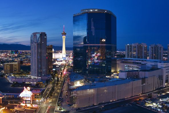
The bird’s-eye view of the Las Vegas Strip offers a unique perspective on the iconic city. From high above, the bustling streets and dazzling lights of Las Vegas come to life in a whole new way. The aerial photography captured by Sky View Las Vegas displays the vibrant energy and grandeur of the Strip, highlighting the famous hotels, casinos, and entertainment venues that have made Las Vegas a world-renowned destination. With its stunning visuals and breathtaking views, this collection of aerial photographs offers viewers a unique perspective on Las Vegas like never before.
Capturing iconic landmarks from above
Sky View Las Vegas offers a unique city perspective, capturing iconic landmarks from above. Their aerial photography can capture Las Vegas in a whole new light. From the famous Las Vegas Strip to the iconic hotels and casinos, their photographs highlight the grandeur and beauty of the city from a bird ‘s-eye view. Whether it is capturing the vibrant lights, the architectural marvels, or the bustling energy of the city, Sky View Las Vegas delivers stunning imagery that truly captures the essence of Las Vegas.
Revealing the hidden beauty of the desert landscape
Las Vegas, renowned for its vibrant nightlife and bustling casinos, also boasts a hidden beauty that can only be fully revealed from above. Through the lens of Sky View Las Vegas’ aerial photography, the desert landscape comes to life in a whole new light. From the sprawling red rock formations to the vast stretches of dunes, every corner of the desert is captured with precision and artistry. The aerial perspective offers a unique glimpse into the intricate patterns and textures of the landscape, highlighting the raw beauty that often goes unnoticed. With a keen eye for detail and a passion for capturing the essence of Las Vegas, Sky View Las Vegas takes aerial photography to new heights, highlighting the hidden beauty of the desert landscape like never before.
Challenges of Aerial Photography in Las Vegas
Dealing with intense winds and turbulence
Dealing with intense winds and turbulence is a common challenge for aerial photographers, especially when capturing images above Las Vegas. The city’s unique geographical location, situated between the desert and mountains, creates a dynamic weather pattern that often features strong gusts of wind and turbulence. Sky View Las Vegas employs advanced stabilizing technology in its aerial photography equipment to overcome these obstacles, ensuring that every shot is steady and sharp. Additionally, their experienced pilots are trained to navigate through turbulent conditions, allowing them to capture stunning aerial images of the city from various angles and heights. By effectively navigating intense winds and turbulence, Sky View Las Vegas can showcase the beauty of Las Vegas in a whole new light through its aerial photography.
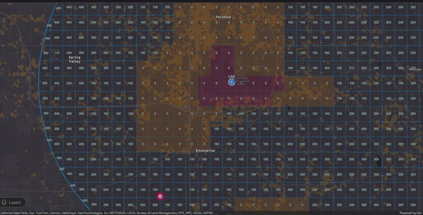
Air Map- Las Vegas
Navigating restricted airspace
Navigating restricted airspace is a crucial aspect of aerial photography, especially in a city as bustling and dynamic as Las Vegas. Sky View Las Vegas, a renowned aerial photography company, has perfected the art of capturing the city from above while adhering to strict aviation regulations. With their expertise and knowledge of restricted zones, they can navigate the airspace safely and legally, ensuring stunning aerial shots of the iconic Las Vegas Strip and other landmarks. Whether it is capturing the vibrant lights of the casinos or the unique architectural designs of the hotels, Sky View Las Vegas provides a whole new perspective of the city, highlighting its beauty and grandeur in a captivating and awe-inspiring way.
Ensuring the safety of equipment and personnel
Ensuring the safety of both equipment and personnel is of utmost importance in aerial photography. Sky View Las Vegas takes strict measures to guarantee the well-being of its equipment and personnel during every aerial photography session. Before each flight, thorough inspections are conducted to ensure that all equipment is in optimal condition and ready for use. Our team of experienced professionals is trained to manage any potential risks or emergencies that may arise during the photography process. Additionally, we adhere to all safety regulations and guidelines set by the aviation authorities to ensure a secure and prosperous aerial photography experience for all involved. By prioritizing safety, Sky View Las Vegas aims to provide our clients with exceptional aerial photographs while maintaining a safe and secure environment for everyone involved.
Techniques and Equipment Used by Sky View Las Vegas
High-resolution cameras and lenses
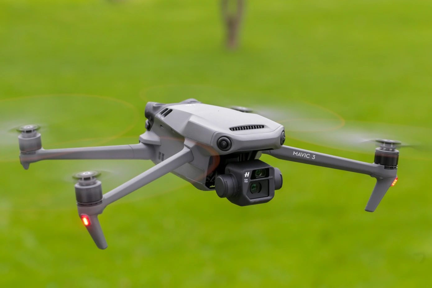
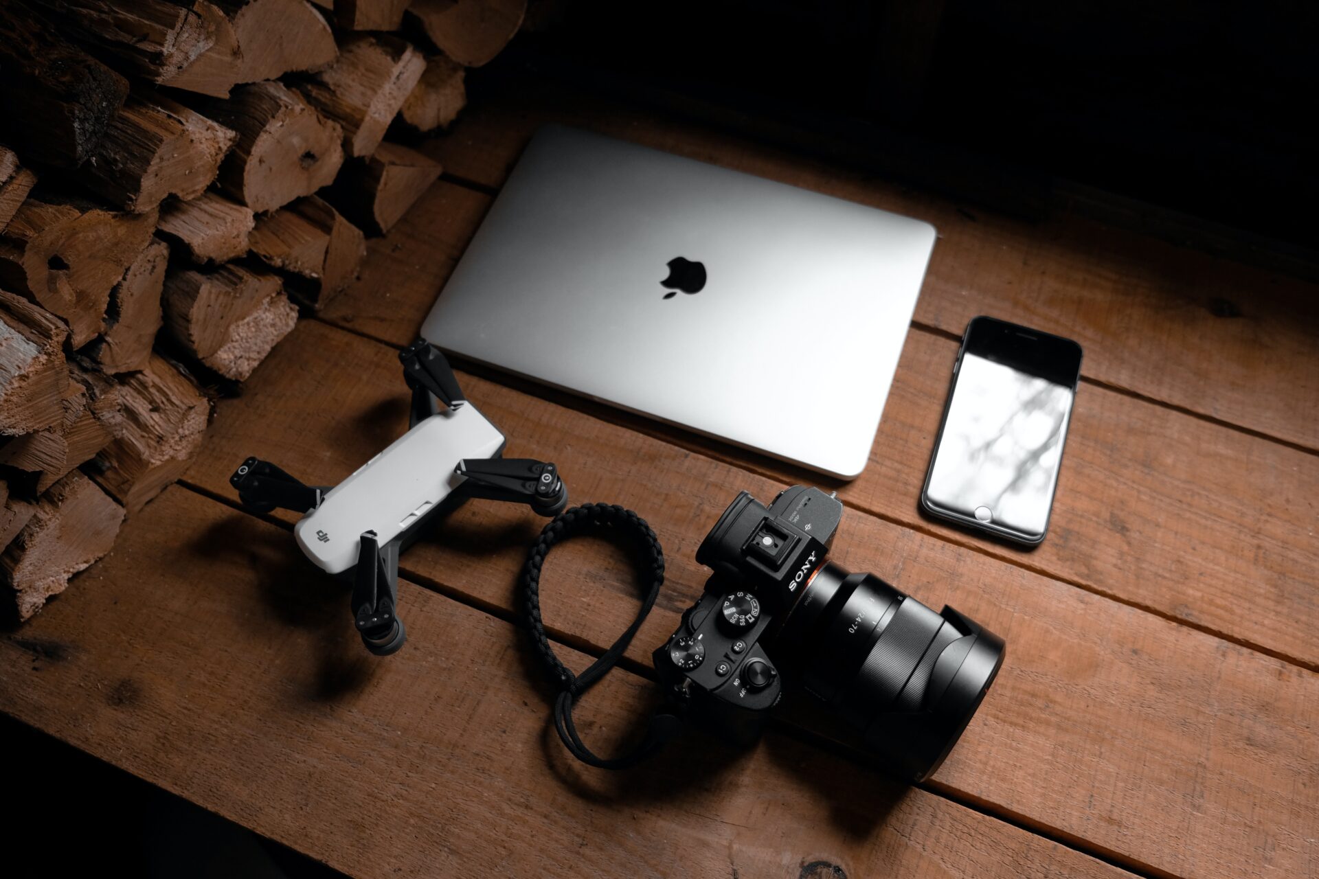
High-resolution cameras and lenses play a crucial role in capturing the beauty of Las Vegas from the sky. Sky View Las Vegas utilizes state-of-the-art equipment to capture every detail precisely and clearly. The high-resolution cameras enable stunning aerial photographs that highlight the city’s vibrant lights, iconic landmarks, and breathtaking landscapes. Coupled with top-of-the-line lenses, these cameras can capture even the most minor details, producing sharp, rich images. Whether it is the glitz and glamour of the Las Vegas Strip or the natural beauty of the surrounding desert, the use of high-resolution cameras and lenses by Sky View Las Vegas allows for a whole new perspective on the city’s awe-inspiring scenery.
Stabilization and gimbal systems
Stabilization and gimbal systems are crucial components for capturing stunning aerial photographs. These systems ensure the camera remains steady and level, even when the drone is in motion or experiencing turbulence. Regarding affordable drone services in Las Vegas, Sky View Las Vegas offers top-notch stabilization and gimbal systems, guaranteeing high-quality aerial photography. Their state-of-the-art equipment enables them to capture the city in a new light, offering breathtaking views of iconic landmarks and stunning landscapes. Whether for personal or commercial use, Sky View Las Vegas is the go-to choice for anyone seeking professional and affordable drone services in the Las Vegas area.
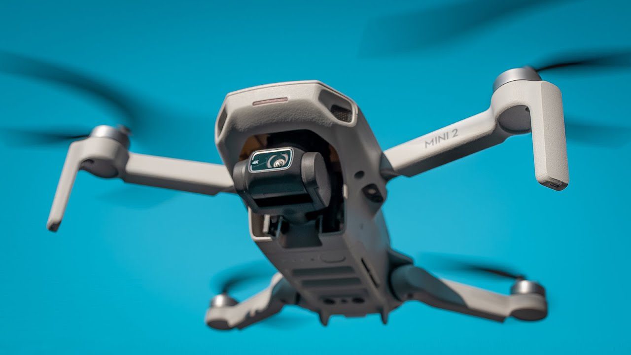
Drone technology for aerial photography
Drone technology has revolutionized the field of aerial photography, allowing photographers to capture stunning images from a whole new perspective. With drones, photographers can now easily access and photograph previously inaccessible areas, such as rooftops and landscapes. This technology has opened a world of possibilities for photographers, enabling them to capture unique and breathtaking images of Las Vegas. Sky View Las Vegas is at the forefront of this technological advancement, offering aerial photography services that display the city in a new light. With drones, Sky View Las Vegas captures the vibrant energy and iconic landmarks of Las Vegas, providing viewers with a fresh and captivating perspective. Whether capturing the dazzling lights of the Las Vegas Strip or the natural beauty of the surrounding desert, drone technology has genuinely transformed the art of aerial photography.
Aerial photography has significantly impacted tourism and marketing in Las Vegas. With the ability to capture stunning aerial shots of the city, Sky View Las Vegas has revolutionized how tourists and marketers view and promote the destination. The unique perspective provided by aerial photography allows visitors to see the city in a whole new light, highlighting its iconic landmarks, vibrant nightlife, and breathtaking architecture. These captivating images attract more tourists to Las Vegas and serve as powerful marketing tools for hotels, resorts, and other businesses in the hospitality industry. By displaying the city from above, aerial photography has become essential in promoting Las Vegas as a world-class tourist destination.
Appreciation for the unique perspective of Las Vegas
Las Vegas is a city known for its vibrant and dynamic atmosphere. From the dazzling lights of the famous Las Vegas Strip to iconic landmarks like the Bellagio fountains and the Eiffel Tower replica, there is no shortage of things to see and experience. However, aerial photography by Sky View Las Vegas has mastered capturing the essence of Las Vegas from a unique perspective. By taking to the skies, they can display the city in a new light, offering a breathtaking view of the sprawling cityscape and its architectural wonders. The appreciation for this unique perspective of Las Vegas is evident in the stunning aerial photographs that capture the city’s energy and grandeur from above.
Future possibilities and advancements in aerial photography
Aerial photography has come a long way in recent years, and the possibilities and advancements are genuinely exciting. With the rapid development of drone technology, aerial photography has become more accessible and affordable for photographers and enthusiasts alike. We can expect to see even more advanced drones with enhanced camera capabilities, enabling higher resolution and more detailed aerial photographs. Additionally, advancements in artificial intelligence and image processing algorithms will further enhance the quality and accuracy of aerial photographs. This opens a world of possibilities for capturing stunning images from unique perspectives, whether for commercial purposes, artistic expression, or documenting landscapes and architecture. The potential for aerial photography is limitless, and we cannot wait to see what the future holds for this exciting field.
Aerial photography is an exciting way to see the world from above. It has a rich history and has undergone significant changes over time. With new technology, especially drones, taking pictures from the sky is easier and more popular than ever. In this article, we will explore the fascinating journey of aerial photography, the tools used, its numerous applications, and its influence on our society. We will also examine future trends and provide tips for those who wish to start taking aerial photos.
Key Takeaways
Aerial photography has evolved from balloons to advanced drones, making it more accessible and affordable.
It plays a vital role in many fields, including real estate, conservation, and entertainment.
The use of drones has revolutionized how we capture images from above.
Understanding the basics of flight and camera settings is crucial for great aerial shots.
Future advancements in technology will likely open new opportunities for aerial photography.
The Evolution of Aerial Photography
Aerial photography has evolved significantly since its inception. From the early days of balloons to the modern use of drones, the methods and technologies have undergone significant evolution.
From Balloons to Drones
In the 19th century, the first aerial photographs were taken from hot air balloons. This innovative approach enabled photographers to capture images from heights never previously seen. As technology progressed, airplanes became the primary tool for aerial photography, allowing photographers to cover larger areas and capture stunning landscapes.
Pioneers of Aerial Imagery
Several key figures have shaped the history of aerial photography. Notably, Julius Neubronner invented the pigeon camera in the early 1900s, which allowed for unique bird’s-eye views. Later, during World War I, aerial photography became crucial for military surveillance, changing how battles were fought.
Technological Advancements Over the Decades
The introduction of drones in the 21st century marked a significant turning point in the field of aviation. Drones have transformed aerial photography by making it more accessible and affordable. They offer high-resolution imaging, flexibility in capturing unique angles, and enhanced safety by minimizing human involvement in hazardous areas. The future promises further innovations in camera technology and battery life, expanding the potential applications of drone photography.
Aerial photography not only changes how we see the world but also influences various industries, from real estate to environmental conservation.
In summary, the evolution of aerial photography reflects our growing ability to explore and document the world from above, showcasing the incredible advancements in technology over the years.
Techniques and Equipment in Aerial Photography
Choosing the Right Drone or Camera
Selecting the right equipment is essential for capturing stunning aerial images. Here are some key points to consider:
Budget: Determine how much you are willing to spend.
Camera Quality: Opt for drones equipped with high-resolution cameras for superior image quality.
Flight Time: Consider how long the drone can stay airborne before needing to recharge.
Mastering Flight Controls and Camera Settings
You must understand how to control your drone and camera settings to get the best shots. Here are some tips:
Practice flying in open areas to get comfortable with the controls.
Learn about various camera settings, such as exposure and ISO.
Experiment with angles and heights to find the best perspectives.
Innovative Techniques for Stunning Shots
Using creative techniques can elevate your aerial photography. Here are some ideas:
Panoramas: Combine multiple images to create expansive views.
Follow Me Mode: Use this feature to capture moving subjects.
Time-lapse: Show changes over time by taking a series of shots.
Aerial photography opens up a new world of creativity, allowing you to capture breathtaking views that tell a story.
The right equipment and techniques are crucial for successful aerial photography. Whether you are a beginner or an experienced photographer, understanding your tools and practicing regularly will help you improve your skills and capture unique images from above.
Highlight advanced drone technology.
Applications of Aerial Photography
Aerial photography has numerous applications that enhance our understanding of the world. From real estate to environmental monitoring, the applications are diverse and have a significant impact.
Real Estate and Urban Planning
Aerial images help real estate agents showcase properties effectively.
They provide a unique perspective of the property and its surroundings.
Aerial views can attract more potential buyers and investors.
Environmental Conservation and Monitoring
Aerial photography is crucial for tracking changes in ecosystems.
It helps in monitoring deforestation and habitat loss.
Aerial views provide valuable data for conservation efforts.
Filmmaking and Entertainment
Aerial shots add excitement and grandeur to films and shows.
They allow filmmakers to capture stunning landscapes and cityscapes.
Aerial cinematography enhances storytelling by providing unique perspectives.
Aerial photography not only captures beautiful images but also plays a vital role in various fields, helping us understand and protect our planet better.
In summary, aerial photography is a powerful tool that provides unique insights across various sectors, making it an essential component of modern visual storytelling and environmental monitoring.
The Impact of Aerial Photography on Society
Changing Perspectives and Paradigms
Aerial photography has transformed how we view our world. It offers a unique perspective that can change our understanding of landscapes, cities, and our environment. By capturing images from above, we can see patterns and relationships that are invisible from the ground.
Influence on Art and Culture
The impact of aerial photography extends into the realms of art and culture. Artists and filmmakers use aerial shots to create stunning visuals that captivate audiences. Here are some ways it influences art:
Enhances storytelling in films
Provides new inspiration for artists
Offers a fresh perspective on familiar subjects
Role in Historical Events and Warfare
Aerial photography has played a pivotal role in numerous historical events, particularly in warfare. It has been used for:
Surveillance to gather intelligence
Mapping battlefields for strategic planning
Documenting significant events from a unique viewpoint
In modern times, aerial photography is also used in urban planning and environmental management. It helps evaluate the impact of aerial photography on urban planning and environmental management practices in modern society.
Aerial photography not only captures images but also tells stories about our world, shaping how we perceive and interact with our environment.
Future Trends in Aerial Photography
Advancements in Drone Technology
The future of aerial photography is bright, especially with the rapid growth of drone technology. Drones are becoming increasingly advanced, featuring improved battery life, enhanced cameras, and increased stability. This means photographers can capture more precise and detailed images from the sky.
Integration with AI and Machine Learning
Artificial Intelligence (AI) and machine learning are set to revolutionize aerial photography. These technologies can help analyze images, identify patterns, and even automate the editing process. This will make it easier for photographers to produce high-quality photos without spending hours post-processing.
Potential New Applications and Markets
As aerial photography continues to evolve, new applications are emerging. Here are some potential areas where aerial photography could make a significant impact:
Agriculture: Monitoring crop health and growth.
Disaster Management: Assessing damage and planning recovery efforts.
Tourism: Creating stunning promotional content for travel destinations.
The aerial photography market is projected to grow at an annual rate of 22 percent over the next decade as drone photography surges in popularity. This growth will open up new opportunities for photographers and businesses alike.
In conclusion, the future of aerial photography is not just about capturing beautiful images; it’s about using technology to enhance our understanding of the world around us. As we look ahead, the possibilities are endless!
Tips for Aspiring Aerial Photographers
Essential Safety Guidelines
Know the Rules: Always check local regulations regarding the use of drones. This includes understanding no-fly zones and altitude limits.
Pre-Flight Checks: Inspect your drone for any damage before taking off and ensure the battery is fully charged.
Weather Awareness: Avoid flying in bad weather conditions. Windy or rainy days can make flying dangerous.
Best Practices for Capturing Images
Plan Your Shots: Scout locations ahead of time and consider the best angles and times to capture the perfect shot.
Use the Right Settings: Adjust your camera settings to achieve the best quality images, taking into account the lighting conditions.
Experiment with Techniques: Try different methods, such as panoramas or time-lapse, to create unique shots.
Legal Considerations and Regulations
Licensing: Depending on your location, you may be required to obtain a license to operate a drone commercially.
Respect Privacy: Always be mindful of people’s privacy when capturing images from above.
Insurance: Consider getting insurance for your drone to protect against accidents or damage.
Aerial photography can be an exciting adventure, but safety and legality should always come first.
By following these tips, you can enhance your skills and enjoy the fascinating world of aerial photography. Remember, practice makes perfect!
If you dream of becoming an aerial photographer, start practicing as much as possible with your drone. Learn the basics of photography, such as lighting and angles, to make your shots truly stand out. Don’t forget to check local laws regarding the operation of drones. For more tips and to see our work, visit our website!
Conclusion
In summary, aerial photography has revolutionized our perception of the world, offering a fresh perspective from above. Over the years, technology has made it easier for everyone to capture stunning images, whether through drones or satellites. This art form not only helps us appreciate the beauty of our planet but also plays a vital role in various fields like real estate, environmental protection, and filmmaking. The next time you look at a breathtaking aerial shot, remember that it tells a story about our connection to the Earth and the incredible advancements that enable us to see it from such heights.
Frequently Asked Questions
What is aerial photography?
Aerial photography involves capturing images from above, typically using drones or aircraft. It gives a bird ‘s-eye view of places.
Do I need special training to take aerial photos?
While you don’t need to be a pro, it helps to learn how to fly a drone and use a camera properly for the best results.
Is aerial photography expensive?
It can be, but with many affordable drones and cameras now available, it’s easier for anyone to get started.
Can I use drones for aerial photography anywhere?
No, there are rules about where you can fly drones. It’s important to check local laws before taking photos.
What are the best times to take aerial photos?
The best times are early morning or late afternoon, when the light is softer and warmer, making the pictures look more appealing.
Can I sell my aerial photos?
Yes, you can sell your aerial photos online or to companies that need them for various projects.
Clever Tips to Find a Lost Drone. The cutting-edge capabilities of drones have made them versatile tools across many industries. People are utilizing drones for a wide range of applications, including surveillance, airborne inspections, and videography. Due to their adaptability and ease of use, drones can be effectively utilized in a wide range of scenarios. However, while drones are helpful, they are also very fragile. In other words, you risk losing them if you don’t handle them properly. Considering the high price tag of drones, it’s easy to see how this could be an issue. Therefore, today, we will provide you with a few clever tips to help you locate a lost drone.
Tips to Find a Lost Drone
Drones have become increasingly popular gadgets, offering exciting aerial perspectives and a wide range of applications. However, the unfortunate reality is that sometimes drones can get lost or go missing. Losing a drone can be disheartening and financially burdensome, but there are steps you can take to improve your chances of finding it. In this article, we will provide you with valuable tips and strategies to help you find a lost drone.
1. Introduction
Drones have revolutionized various industries, including photography, videography, surveying, and delivery services. Their versatility and maneuverability have captivated enthusiasts and professionals alike. However, despite their advanced technology and safety features, drones can still go missing for various reasons, including strong winds, technical malfunctions, or pilot errors, especially when getting your first drone.
2. Preparing for a Drone Search
Before diving into the search process, it’s crucial to prepare adequately. Start by gathering all relevant information about the drone, including its make, model, serial number, and any distinctive features. This information will be valuable when contacting authorities or seeking assistance from others.
Additionally, please familiarize yourself with local regulations concerning drones and their operation. Some areas may have specific guidelines or restrictions affecting your search efforts. Once you have gathered the necessary information and are familiar with the regulations, you can assemble the equipment needed for the search, including binoculars, a flashlight, and a GPS tracker.
3. Conducting a Systematic Search
When searching for a lost drone, adopting a systematic approach is essential. The grid search method is an effective technique for systematically covering a large area. Divide the search area into smaller sections and search each section meticulously, marking the areas that have already been covered.
Utilize technology to your advantage by checking if your drone has any built-in tracking features. Some drones have GPS capabilities, allowing you to track their last known location. Alternatively, third-party apps and devices can help you locate your lost drone using GPS coordinates.
In addition, it’s crucial to utilize visual cues during the search. Look for visible signs of your drone’s presence, such as broken branches, disturbed vegetation, or unusual objects that may indicate a crash or landing. These visual cues can provide valuable clues and narrow down your search area. Keep a keen eye on the surroundings while conducting your systematic search, as these subtle indicators can significantly increase your chances of finding your lost drone. Furthermore, don’t forget to involve friends or fellow drone enthusiasts in the search, as their fresh perspectives and extra pairs of eyes can significantly assist in locating your drone.
4. Engaging the Community
The power of community involvement should not be underestimated when finding a lost drone. Reach out to locals in the area where the drone was lost and seek their assistance. They may have witnessed or encountered the drone and can provide valuable information. Online platforms and social media groups dedicated to drones and local communities are excellent resources for spreading the word about your lost drone.
Consider offering rewards for information leading to the recovery of your drone. Incentives can motivate individuals to actively participate in the search and increase the likelihood of finding your drone. You can offer a monetary reward, a gift, or any other valuable incentive that aligns with the significance of your drone’s loss. Incentivizing the search creates a sense of urgency and encourages people to watch for potential leads or sightings.
Providing clear and concise details about your lost drone is essential when engaging the community. Share information such as the drone’s make, model, and unique features or markings to help identify it. Including a recent photograph of the drone can be particularly helpful. The more accurate and detailed your description is, the higher the chances are that someone will recognize or come across your drone.
Remember to maintain regular communication with the community and update them on any progress or new information that may arise during the search. By fostering a collaborative effort, you increase the likelihood of finding your lost drone and demonstrate the power of community involvement in resolving such situations.
5. Contacting Authorities
In cases where a lost drone cannot be found through personal efforts, it is advisable to notify the local authorities. Please provide them with detailed descriptions of the drone, including its appearance, features, and any identifiable markings. This information will help the authorities identify and recover the drone if it is found or reported.
Cooperating with law enforcement agencies is crucial, as they often have access to valuable resources and databases that can aid in recovery. Stay in touch with them, providing any additional information or leads that may arise during the search.
6. Analyzing Data and Investigating Leads
Drone enthusiasts often keep flight logs and telemetry data, which can be valuable resources when searching for a lost drone. Reviewing this data can help pinpoint the approximate location where the drone was last seen or determine its flight path. Additionally, check online marketplaces and forums for any listings or discussions about a found drone matching your description.
Follow up on potential sightings reported by individuals or captured on security cameras. Investigate the leads diligently, which may lead you closer to your lost drone.
Having some form of screen capture is a great security feature for any drone. If you start losing control of your drone, you can quickly take a screenshot of the surrounding area to document the situation. Doing so will reveal the last known location of your drone. Assuming you have a rough idea of where your drone has crashed, you can use audio cues and visual ones to track it down. If you start losing control of your drone, try to take a picture of the ground to regain control. Everything from grass, gravel, and plant life to clusters of huge boulders or fallen trees. All of these things will help you locate your drone if you lose it.
7. Dealing with Challenging Scenarios
You may encounter different challenges during the search depending on where your drone was lost. If your drone went missing in a remote area, consider enlisting the help of experienced outdoor enthusiasts or professional search and rescue teams. They have the expertise and equipment to navigate challenging terrains effectively.
If your drone were lost in water, time is of the essence. Act swiftly and contact local authorities or professional divers specializing in underwater recoveries. Please provide them with accurate information about the last known location of the drone to expedite the search.
In densely populated areas, reaching out to local authorities, community groups, or even drone enthusiasts can help maximize your chances of finding your lost drone. Their familiarity with the area and regional networks can provide valuable leads and support.
8. Preventing Future Losses
While losing a drone can be distressing, taking preventive measures can reduce the likelihood of such incidents in the future. Invest in a GPS tracker specifically designed for drones, which can help you locate your drone in case it goes missing. Additionally, consider using anti-loss devices that emit a loud alarm when the drone moves out of a specific range.
Implement failsafe mechanisms and configure your drone to return to its takeoff location automatically if the signal is lost or the battery is running low. Regularly update and maintain your drone’s firmware and software to ensure optimal performance and stability.
Enhancing your pilot skills and knowledge is another essential aspect of preventing drone losses. Familiarize yourself with flight regulations, weather conditions, and safe operating practices. Enhancing your piloting skills will decrease the likelihood of accidents or incidents that could result in the loss of your drone.
Use the Return Home Function on Your Drone
Using the “return home” button and waiting a few minutes before going out to look for your drone is the first step if you lose connection with it due to bad weather or a crash. Depending on the drone’s model, this process will vary. However, most models display telemetry data at thebottom of the remote control screen. In addition to distance, it will indicate the direction in which your drone is flying. If the readouts are decreasing, the drone is getting closer to you. However, if the values on the screen don’t shift, you have either lost the connection to your drone or the drone is stuck somewhere. If this happens to you, it’s time to consider alternative options for locating a lost drone.
Verify the Last Known Location by Consulting Flight Records
This is usually the first thing professional drone pilots do if they need to find a lost drone. Additionally, it is helpful for drone pilots whose drones have crashed due to a dead battery. At the very least, the drone’s last known coordinates before the drone disconnected will help you and your search team focus your efforts. In addition to the last known coordinates, you can use the data at the end of the previous flight log, which is accessible for some drones. Then, you can start your search at the given location using the global positioning system (GPS) equipment or your smartphone’s GPS. You’ll still have to put in some extra work, but at least you’ll focus your efforts where they’ll be most fruitful.
Scan the Area with Another Drone
If you can access another drone with a working camera, you can save time looking for the lost drone. You can use another drone to survey the surrounding area and see if you can find your drone that way. If the missing drone still has battery life when night falls, another drone could also be used to spot its lights from above.
Ask Around the Neighborhood
If you’re settling into a new community and lose your drone while trying to get to know the area, consider asking your neighbors for help. Some of them might have witnessed your drone crash and can help point you in the right direction. It’s a good idea to let them know where you fly so that you can return to the ground safely in the event of an emergency.
How To Prevent Losing Your Drone
1. Purchase a Tracker or an App
Most people don’t think with trackers, even though they can be instrumental after a drone crash. You should use tracking software whenever possible to find your missing drone. Numerous GPS-based drone trackers are available and will serve their purpose well. For example, you can use the TK102 model. This handy device costs around $30 and functions with a SIM card. So, if you ever misplace your drone, you can dial TK1TK102’s number to get a text message with its current location. There are many different types of trackers available.
2. Always Fly Your Drone Within Visual Range
When you can see your drone, the chances of it crashing or disappearing drastically decrease. In fact, according to FAA regulations, pilots must always have their UAVs in clear sight. To fly safely, it is essential to stay within sight of the ground. Remember that relying only on a live video feed to protect your drone is terrible. If you do this, you will have no idea what’s occurring behind or to the sides of your drone.
3. Set the Right Height to the Proper Level
Although newer drones have vision systems that enable them to avoid or fly over objects during Return to Home (RTH), setting an RTH Altitude is still beneficial. RTH relies on natural lighting. Therefore, it may fail to detect issues in environments with little to no shadows, such as those involving clear glass or water. Miamimoversforless.com has experienced RTH issues when conducting drone property surveys. They found that the sensors designed to prevent collisions may overlook thin objects, such as tree branches and power cables.
FAQs
Can I fly my drone at night? Most countries have specific regulations regarding drone flights at night. It’s essential to familiarize yourself with the local rules and adhere to them to avoid legal issues.
Is it possible to track a lost drone without GPS? While GPS tracking is the most reliable method for locating a lost drone, alternative methods are available. Some drones may have built-in features, such as signal beacons or visual markers, that can assist in finding them.
Should I file a police report for my lost drone? Filing a police report is recommended, as it helps create an official record of the incident and provides law enforcement with essential information to aid recovery.
Can I use a drone tracker on any drone? Drone trackers are designed to be compatible with a wide range of drone models. However, it’s essential to check the specifications and compatibility of the tracker with your specific drone before making a purchase.
Are there any insurance options available for lost drones? Some insurance providers offer coverage for lost or stolen drones. Research and consider purchasing drone insurance to protect your investment and ease the financial burden of loss or theft.
Conclusion
Hopefully, you will find some valuable tips for finding a lost drone. If you follow them closely, you will have no trouble keeping your drone safe and secure, so you can spend more time flying and less time worrying about crashes and damage. An article on finding your DJI drone- Find My Drone -https://www.droneblog.com/find-my-drone-dji/
Losing a drone can be a frustrating experience, but following the tips and strategies outlined in this article can increase your chances of finding your lost drone. Prepare adequately, conduct a systematic search, engage the community, and cooperate with authorities. Analyze data, investigate leads, and take preventive measures to minimize future losses. With persistence and the right approach, you may be able to reunite with your drone.
Drone Pilot in Las Vegas: Expert Aerial Services. There are many highly skilled and reputable pilots in Las Vegas, each with their specialties and areas of expertise. It is recommended to research and compare different pilots based on their experience, client reviews, and portfolio to find the best one that suits your specific needs.
Are you looking for an expert drone pilot in Las Vegas? Look no further! In this blog, we will introduce you to our team of skilled and experienced drone pilots who provide expert aerial services in the Las Vegas area. Whether you need stunning aerial photography, high-quality video productions, or mapping and surveying services, our drone pilots have got you covered. We will also discuss the benefits of hiring a professional drone pilot and how they ensure safety in Las Vegas.
An experienced UAV operator in Las Vegas brings expertise and years of experience to provide exceptional aerial services. With in-depth knowledge of drone laws and FAA Part regulations, the UAV pilot ensures safety and compliance for all operations. Serving clients in Las Vegas, Nevada, California, and beyond, the skilled pilot offers services such as mapping, videography, and aerial photography using advanced DJI drones. Whether it’s capturing stunning footage of the Las Vegas Strip, conducting pipeline inspections, or contributing to environmental research, the UAV pilot delivers high-quality results. Choose a UAV pilot with a firm insurance policy, proper certification, and a passion for creating seamless aerial experiences.
The Plane has landed
The Benefits of Hiring a Professional Drone Pilot
When you enlist the services of a professional drone pilot in Las Vegas, you gain access to a wide array of benefits. Safety is a top priority, with trained and experienced pilots ensuring accident-free operations. They have the necessary skills and cutting-edge equipment to capture high-quality footage and photos, giving your marketing materials a remarkable edge. Professionals also have a deep understanding of FAA regulations, ensuring legal compliance throughout your operations. By hiring a professional, you save valuable time and resources, avoiding the pitfalls associated with inexperienced operators. Additionally, their expertise in aerial photography techniques enables them to create breathtaking visuals that will genuinely elevate your project or business. Don’t settle for anything less than the best – hire a professional drone pilot for your aerial needs in Las Vegas.
Aerial Services for Various Industries
UAV Pilots in Las Vegas offer a wide range of aerial services for various industries, catering to the unique needs of each sector. From drone photography and videography for real estate listings to aerial surveys and inspections in the construction industry, these skilled pilots provide invaluable support. They also assist in agriculture with crop monitoring, field mapping, and precision agriculture techniques. Their expertise encompasses capturing cinematic aerial shots for filmmaking, delivering unique perspectives for event coverage, and maintaining infrastructure and equipment.
How Drone Pilots Ensure Safety in Las Vegas
Drone pilots undergo extensive training and certification to prioritize safety and comply with aviation regulations. Their commitment to safety begins with thorough pre-flight inspections to ensure optimal drone conditions. Additionally, they strictly adhere to operational procedures and guidelines to minimize risks and prevent accidents.
Maximizing Efficiency with Drone Technology
Using the latest advancements in UAV technology, businesses in Las Vegas can maximize efficiency and productivity. Drones offer a wide range of benefits across various industries, including construction, real estate, agriculture, and more. By utilizing drones for aerial inspections, surveys, and mapping, companies in Las Vegas can save valuable time and resources. The expertise of skilled pilots with years of experience ensures that drone services in this vibrant city deliver high-quality results.
The Role of FAA Regulations in Drone Operations
Drone operations in the United States are governed by the Federal Aviation Administration (FAA) to ensure the safety of aerial activities. With Las Vegas being a prominent hub for drone pilots, it is crucial to understand the role of FAA regulations in maintaining safety and compliance. Professional drone pilots in Las Vegas undergo rigorous training and certification to adhere to specific rules and guidelines set by the FAA.
Mapping and Surveying Services in Nevada
Leveraging advanced technology and the expertise of experienced drone pilots in Nevada, professional mapping and surveying services are available. These services provide accurate and detailed data for various industries, including land surveying, construction site monitoring, and agricultural analysis. By implementing drone mapping and surveying, projects can benefit from improved efficiency and decision-making.
The Advantages of DJI Drones in Aerial Photography
DJI drones bring numerous advantages to aerial photography. With their advanced stabilization technology, these UAVs capture smooth and stable footage, delivering high-quality images of the stunning landscapes in Las Vegas. Equipped with intelligent flight modes, such as Follow Me and waypoint navigation, DJI drones offer versatility for mapping and surveying projects in Nevada and beyond. Their high-resolution cameras ensure detailed data collection, providing valuable information for accurate mapping and surveying purposes. Skilled UAV pilots in Las Vegas utilize DJI drones to maximize efficiency, combining years of experience with cutting-edge technology to capture breathtaking footage.
Capturing Stunning Aerial Images of Las Vegas
Capturing stunning aerial images of Las Vegas allows for the detailed mapping and surveying of this vibrant city. With years of experience as a skilled drone pilot in Las Vegas, our expert captures breathtaking footage using advanced technology. Operating within FAA regulations, we ensure safety while delivering high-quality aerial photography, videography, and mapping and surveying services. From the iconic Las Vegas Strip to the stunning landscapes of Nevada, our UAV services provide detailed data for construction planning, real estate development, and land management.
Delivering High-Quality Video Productions with Drones
Looking for expert aerial services in Las Vegas? Experience the top-notch videography skills of our skilled UAV pilots in the vibrant city of Las Vegas. The United States boasts some of the best drone operators in the industry, and our team is proud to be a part of this elite group. We specialize in capturing high-quality video productions using state-of-the-art DJI drones.
FAA certification, we ensure safety and compliance with drone laws, including FAA Part 107 regulations. Our team is well-versed in the intricacies of Las Vegas airspace, from the famous Las Vegas Strip to the city’s bustling urban landscape. When you choose us for your aerial videography needs, you can rest assured that your projects will be in capable hands.
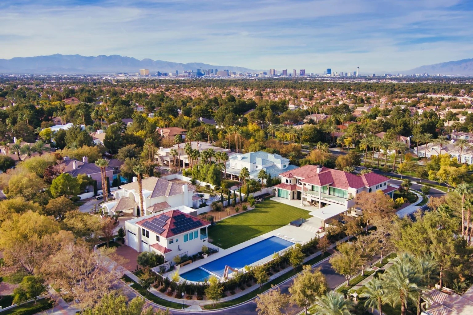
Enhancing Real Estate Marketing with Drone Services
In today’s competitive Las Vegas real estate market, drone services have become an essential tool for enhancing marketing efforts. By utilizing skilled pilots and capturing aerial footage and images, real estate agents and developers can create compelling visual content that sets their properties apart from the competition. With comprehensive views and stunning aerial shots, these visuals effectively highlight the unique selling points of the properties, contributing to their attractiveness to potential buyers.
Conclusion
In conclusion, if you require expert aerial services in Las Vegas, look no further than our professional drone pilot team. With their expertise and state-of-the-art equipment, they can deliver stunning aerial images and high-quality video productions for a wide range of industries. Our drone pilots prioritize safety and abide by FAA regulations to ensure smooth operations. Whether you’re in real estate, need mapping and surveying services, or want to explore the thrilling world of drone racing, our team has got you covered. Don’t just take our word for it – read testimonials from satisfied customers who have experienced the benefits of hiring our professional drone pilots. If you want to enhance your marketing efforts or conduct environmental research, drones can make a significant impact. And if you’re in Las Vegas, our pilot Bill can recommend his favorite flying locations for breathtaking shots. Contact us today to schedule a consultation and see how our expert aerial services can elevate your projects. https://skyviewlv.com/
In today’s fast-paced digital world, businesses continually seek innovative ways to differentiate themselves from the competition. One such method that has gained significant popularity is drone photography. Drone photography offers a unique perspective and can capture stunning aerial shots that were previously impossible or prohibitively expensive. In this article, we will explore how your business can benefit from drone photography and gain a competitive edge.
1. The Power of Aerial Imagery
Aerial imagery provides a unique perspective that cannot be achieved with traditional ground-level photography. It allows businesses to showcase their products, services, or locations in a visually captivating and engaging way. With drone photography, you can capture sweeping panoramic shots, highlight intricate details, and create a sense of scale that leaves a lasting impression on your audience.
In the competitive real estate industry, visually appealing listings can make all the difference. Drone photography enables real estate agents to capture stunning aerial shots of properties, giving potential buyers a comprehensive view of the location, the surrounding landscape, and the amenities. These captivating visuals help properties stand out, attract more potential buyers, and ultimately lead to quicker sales.
3. Elevating Event Coverage with Aerial Shots
Whether it’s a wedding, concert, or sports event, aerial shots can add a dynamic and exciting element to event coverage. Drone photography allows event organizers and photographers to capture unique perspectives, highlight the scale of the event, and showcase the energy and excitement from above. These aerial shots can be used for promotional materials, social media content, and creating lasting memories for attendees.
4. Unleashing Creativity in Advertising Campaigns
Advertising campaigns aim to capture attention and leave a lasting impression on viewers. Drone photography offers endless creative possibilities by providing unique angles and perspectives that are visually striking. From showcasing products in stunning outdoor settings to capturing the grandeur of a location, drone photography adds a wow factor to advertising campaigns, making them more memorable and effective.
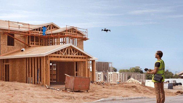
5. Improving Construction Site Inspections and Surveys
Construction projects require thorough inspections and surveys to ensure quality, compliance, and progress tracking. Drone photography simplifies these processes by providing a bird’s-eye view of construction sites. It allows project managers and inspectors to identify potential issues, monitor progress, and make informed decisions based on accurate and up-to-date visual data.
6. Enhancing Environmental Monitoring and Research
Environmental monitoring and research often require extensive data collection over vast areas. Drones equipped with specialized sensors and cameras can efficiently gather data on vegetation, land cover, wildlife habitats, and other environmental features. This data can be analyzed to gain insights into ecological changes, support conservation efforts, and inform decisions for sustainable development.
7. Revolutionizing Agriculture and Land Management
Drones have transformed the agricultural industry by providing valuable data for precision farming. Equipped with advanced imaging technology, drones can monitor crop health, identify areas of concern, and optimize resource allocation. They enable farmers to make data-driven decisions, increase crop yield, reduce costs, and minimize environmental impact.
8. Boosting Tourism and Hospitality Promotion
Tourism and hospitality businesses thrive on captivating visuals that entice travelers. Drone photography offers a unique way to showcase popular tourist destinations, resorts, and recreational facilities. It enables companies to showcase the beauty of their locations, provide virtual tours, and produce promotional videos that spark wanderlust in potential visitors.
9. Streamlining Filmmaking and Video Production
Filmmakers and video producers are embracing drone technology to capture breathtaking aerial shots for their productions. Drones equipped with high-quality cameras can capture smooth and cinematic footage, adding a new dimension to storytelling. Whether it’s a feature film, documentary, or music video, drone photography provides filmmakers with the tools to unleash their creativity and capture awe-inspiring visuals.
10. Expanding Opportunities in Industrial Inspections
Industrial inspections often involve complex and hazardous environments that can be challenging for humans to navigate. Drones equipped with cameras and sensors can access confined spaces, inspect infrastructure, and identify potential issues without putting human lives at risk. They offer a safer and more efficient alternative to traditional inspection methods, thereby reducing downtime and enhancing overall operational efficiency.
FAQs (Frequently Asked Questions)
FAQ 1: Can drone photography be used for indoor inspections?
Yes, drone photography can be used for indoor inspections, especially in large warehouses, factories, or structures where accessibility is challenging. With the right equipment and piloting skills, drones can navigate tight spaces and capture high-resolution images or videos for inspection purposes.
FAQ 2: Is drone photography legal for commercial use?
Yes, drone photography is legal for commercial use; however, it is subject to regulations and guidelines established by aviation authorities in each country. It is essential to comply with local laws, obtain necessary permits or licenses, and follow safety protocols to ensure responsible and legal drone operations.
Using drones for aerial photography offers several advantages. It provides a cost-effective alternative to traditional methods such as helicopters or planes. Drones can access remote or hard-to-reach areas, capture unique perspectives, and provide real-time visuals for monitoring or analysis.
FAQ 4: What are some key considerations when hiring a professional drone photographer?
When hiring a professional drone photographer, it is crucial to consider their experience, expertise, and licensing. Look for individuals or companies with a track record in aerial photography, proper certifications, and a portfolio that aligns with your specific requirements. Also, ensure they have liability insurance to cover potential damages or accidents.
FAQ 5: Can drones capture high-quality images and videos?
Yes, drones can capture high-quality images and videos. Professional-grade drones are equipped with advanced cameras capable of capturing high-resolution images and shooting videos up to 4K resolution. However, the quality of the final output also depends on factors such as lighting conditions, camera settings, and post-processing techniques.
FAQ 6: Are there any limitations to using drone photography?
While drone photography offers numerous benefits, it does have certain limitations. Weather conditions, battery life, and flight restrictions can affect drone operations. Additionally, privacy concerns and regulations regarding airspace usage may limit where and when drones can be flown.
Conclusion
In conclusion, drone photography has become invaluable for businesses seeking to differentiate themselves in today’s visually driven world. It offers a fresh perspective, captures breathtaking shots, and provides a unique storytelling opportunity. Embracing this technology can unlock new opportunities, engage your audience, and showcase your business in a way that was previously unimaginable.
Contact us at Sky View Las Vegas if you require aerial footage in Las Vegas.
Las Vegas, known as the “Entertainment Capital of the World,” is famous for its bright lights, iconic landmarks, and breathtaking scenery. From the world-famous Las Vegas Strip to the natural beauty of Red Rock Canyon, there is no shortage of stunning sights to capture. And what better way to capture them than through the lens of a drone camera?
Aerial photography has become increasingly popular, and it’s not hard to see why. A drone camera’s unique perspective can create stunning and memorable images that are impossible to capture with traditional photography techniques. This is especially true in Las Vegas, where the city’s famous landmarks and natural beauty are best appreciated from above.
If you’re looking for an aerial photography company in Las Vegas, look no further than a drone photography company. These companies capture stunning aerial images and video footage using drone cameras. They have the equipment, expertise, and experience to capture the perfect shot every time.
There are many benefits to using a drone photography company in Las Vegas. First and foremost, drone cameras can capture images from angles and heights that are impossible to achieve with traditional photography techniques. This means you can capture breathtaking views of the Las Vegas Strip, Red Rock Canyon, and other landmarks you wouldn’t be able to see from the ground.
Additionally, drone cameras are incredibly versatile. They can be used to capture images and video footage for a wide range of purposes, including real estate listings, promotional materials, and social media content. Whether you’re a business owner looking to showcase your property or a social media influencer looking to create eye-catching content, a drone photography company can help you achieve your goals.
Of course, it’s important to choose the right drone photography company for your needs. Look for a company with a proven track record of success and one that specializes in the types of images and video footage you’re looking to capture. Additionally, make sure that the company has all the necessary permits and insurance to operate legally in Las Vegas.
In conclusion, drone photography is an incredible way to capture the unique beauty of Las Vegas. Whether you’re a business owner looking to promote your property or an individual looking to create stunning images and video footage, a drone photography company can help you achieve your goals. So why wait? Contact Sky View Las Vegas today and start capturing the beauty of Las Vegas from a whole new perspective.
What is Drone Photography?
Drone photography refers to the art of capturing photographs and videos using unmanned aerial vehicles (UAVs) equipped with high-resolution cameras. These drones allow photographers to capture unique and captivating images from various angles and heights, providing a fresh and mesmerizing perspective on familiar landscapes. The use of drones has revolutionized the field of photography, offering both professionals and enthusiasts the ability to capture stunning aerial shots that were once only possible with expensive equipment or from helicopters or airplanes.
Benefits of Drone Photography in Las Vegas
Drone photography in Las Vegas presents numerous benefits, making it an appealing choice for photographers looking to explore new creative avenues. Let’s explore some of the advantages that drone photography brings to the table:
1. Unique Perspective
By taking to the skies, drones provide photographers with a unique perspective of Las Vegas. Capturing images from above offers a fresh viewpoint on the city’s iconic landmarks, allowing photographers to present a different side of Las Vegas that is not easily seen from the ground. The aerial vantage point reveals patterns, shapes, and symmetries that are often hidden when viewing the city from eye level.
2. Capturing Landscapes and Architecture
Las Vegas boasts a diverse range of landscapes and architectural marvels, from the glittering Strip with its towering hotels and resorts to the surrounding natural beauty of Red Rock Canyon and the Mojave Desert. Drone photography allows photographers to capture the grandeur of these landscapes and the intricate details of the city’s architecture, creating visually stunning images that showcase the unique blend of man-made and natural wonders that Las Vegas has to offer.
3. Flexibility and Maneuverability
Drones offer unparalleled flexibility and maneuverability, enabling photographers to capture images from virtually any angle and position. With the ability to hover, ascend, descend, and move laterally, drones provide photographers with precise control over their compositions. This freedom allows photographers to experiment with different perspectives, resulting in captivating and eye-catching images that stand out from the crowd.
4. Time-Lapse and Video Capabilities
In addition to capturing still photographs, drones equipped with video capabilities allow photographers to create stunning time-lapse sequences and cinematic footage. Las Vegas, with its vibrant nightlife, bustling streets, and mesmerizing light displays, provides the perfect canvas for creating captivating videos that showcase the city’s energy and excitement.
The Legal Landscape of Drone Photography in Las Vegas
Before embarking on any drone photography adventure in Las Vegas, it is crucial to understand the legal considerations and regulations surrounding drone usage. The Federal Aviation Administration (FAA) has established guidelines to ensure the safe operation of drones and protect the privacy and security of individuals. Here are some key points to keep in mind when engaging in drone photography in Las Vegas:
1. Registering Your Drone
In the United States, all drones weighing over 0.55 pounds must be registered with the FAA. This process involves providing your contact information and paying a small registration fee. By registering your drone, you comply with federal regulations and help promote safe and responsible drone operations.
2. Understanding Airspace Restrictions
Las Vegas is home to several airports, including McCarran International Airport, which has strict airspace regulations. It is essential to familiarize yourself with the FAA’s B4UFLY app or website to determine the restricted areas and obtain the necessary permissions if you plan to fly your drone in controlled airspace.
3. Following FAA Guidelines
The FAA provides guidelines for drone operations to ensure safety and respect for privacy. These guidelines include flying below 400 feet, maintaining visual line-of-sight with the drone, avoiding flying over people, and refraining from flying near emergency response efforts or restricted areas. It is essential to review and adhere to these guidelines to ensure a safe and enjoyable drone photography experience in Las Vegas.
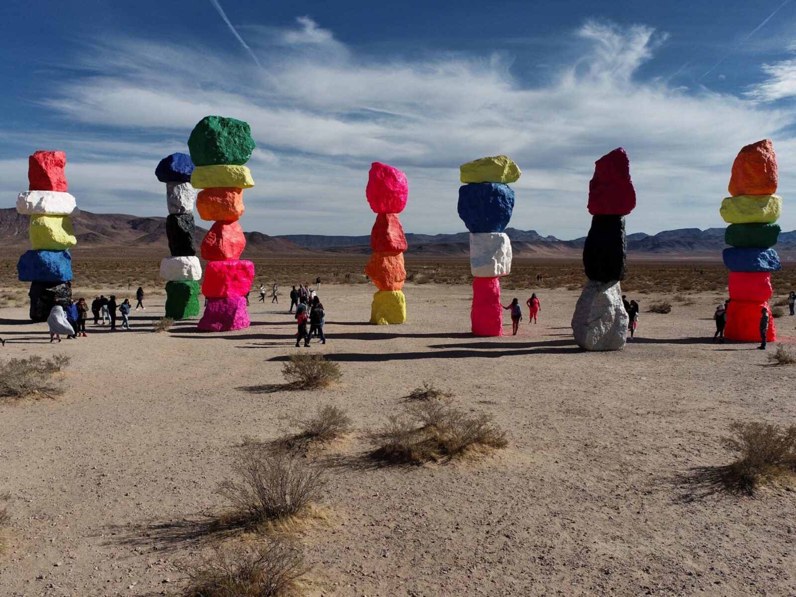
Top Spots for Drone Photography in Las Vegas
Las Vegas offers an abundance of visually stunning locations that are perfect for capturing mesmerizing aerial photographs. Whether you’re a professional photographer or an enthusiast, exploring these top spots will allow you to showcase the city’s beauty from a unique perspective. Here are some of the best locations for drone photography in Las Vegas:
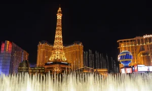
1. The Las Vegas Strip
The Las Vegas Strip is the epitome of glitz and glamour, lined with iconic hotels, casinos, and entertainment venues. From the air, the Strip transforms into a breathtaking tapestry of lights and colors. Capture the vibrant energy of the Strip by flying your drone above the towering hotels and capturing the bustling streets below.
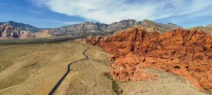
2. Red Rock Canyon National Conservation Area
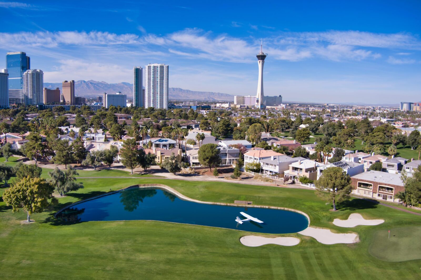
Located just west of Las Vegas, Red Rock Canyon National Conservation Area is a natural gem that offers a stark contrast to the city’s bright lights. The rugged cliffs, stunning rock formations, and vibrant desert flora provide a picturesque backdrop for aerial photography. Fly your drone above the canyon to capture the sweeping vistas and intricate geological formations that make Red Rock Canyon a must-visit destination for drone enthusiasts.
3. Hoover Dam
A marvel of engineering, Hoover Dam is an impressive sight that showcases human ingenuity against the backdrop of the Colorado River. Fly your drone above the dam to capture its massive scale and intricate architectural details. The aerial perspective will highlight the contrast between the immense concrete structure and the surrounding natural beauty, creating a visually striking image.
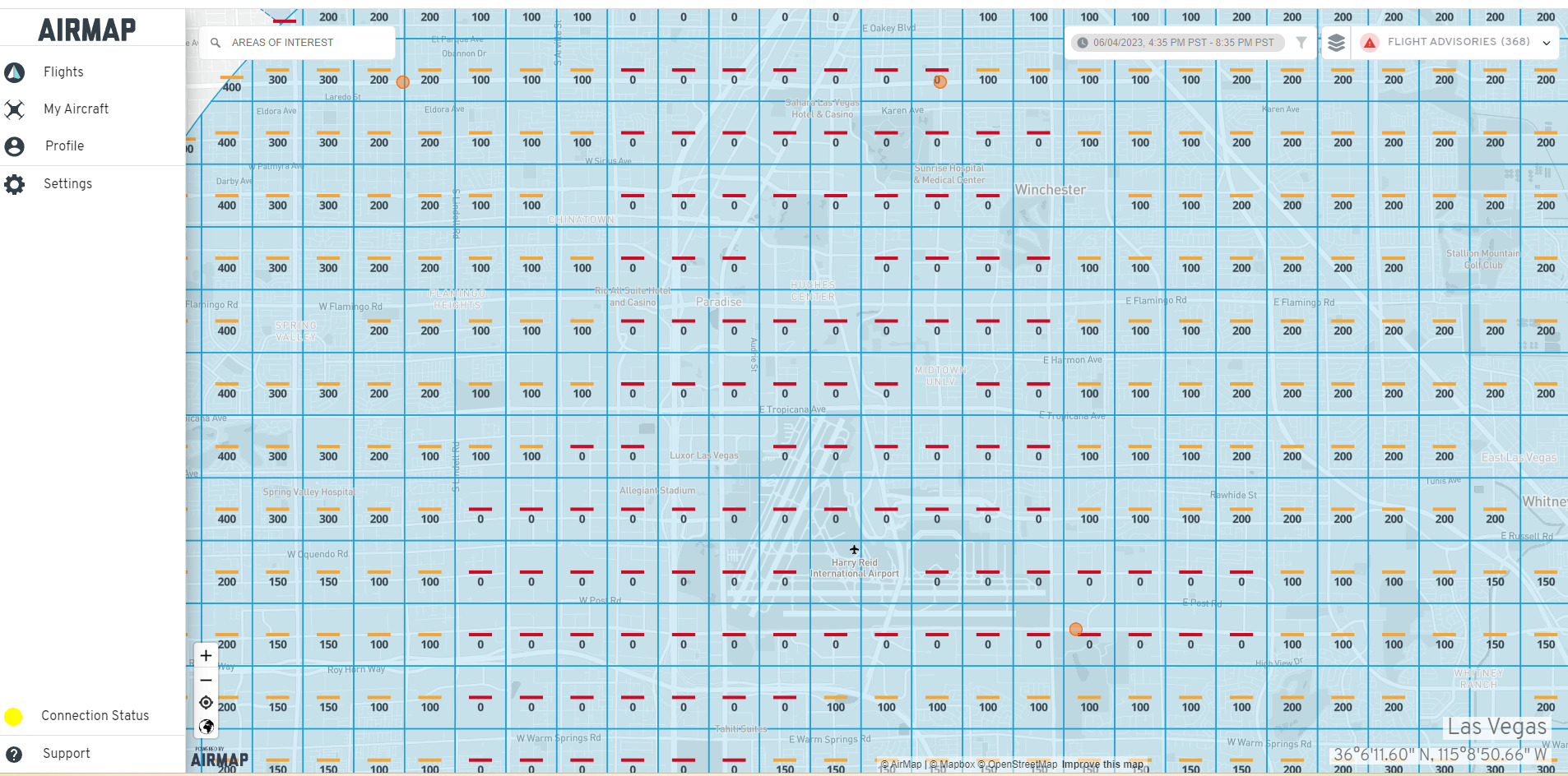
Make sure to check on Air Map before you fly.
4. The Neon Boneyard
For a unique and nostalgic drone photography experience, head to the Neon Boneyard. This outdoor museum showcases a collection of retired neon signs from Las Vegas’ iconic hotels and businesses. Fly your drone above the boneyard to capture the colorful, weathered signs from an aerial perspective, resulting in captivating images that transport viewers back in time.
Make sure to check with Neon before you fly here.
5. Valley of Fire State Park
Venture outside of Las Vegas to the Valley of Fire State Park, where stunning sandstone formations, ancient petroglyphs, and vibrant desert landscapes await. From above, the park transforms into a tapestry of reds, oranges, and yellows, creating a mesmerizing sight. Explore the park’s various hiking trails and find the perfect spot to launch your drone for breathtaking aerial shots.
Frequently Asked Questions about Drone Photography in Las Vegas
Q1: Do I need a license to fly a drone in Las Vegas?
Yes, if you are using your drone for commercial purposes, such as selling the photographs or videos you capture, you will need to obtain a Remote Pilot Certificate from the FAA. However, if you are flying recreationally and not profiting from your drone photography, a license is not required.
Q2: Can I fly my drone at night in Las Vegas?
While the FAA allows drones to be flown at night, there are additional safety measures and considerations that need to be taken into account. You must ensure your drone is equipped with proper lighting to remain visible, and you should always exercise caution and follow local regulations when flying at night.
Q3: Are there any restrictions on flying drones in national parks near Las Vegas?
Yes, national parks have specific regulations regarding drone usage to protect the natural environment and ensure visitor safety. It is crucial to familiarize yourself with the rules of the specific national park you plan to visit and obtain any necessary permits or permissions before flying your drone.
Q4: Can I use my drone to capture aerial photographs of the Las Vegas Strip at night?
Capturing aerial photographs of the Las Vegas Strip at night can yield stunning results. However, it is important to be aware of the airspace restrictions and potential limitations imposed by the FAA. Ensure that you have the necessary permissions to fly at night and always prioritize safety.
Q5: What are some tips for capturing great drone photographs in Las Vegas?
To capture great drone photographs in Las Vegas, consider the time of day and lighting conditions. Golden hour (just after sunrise or before sunset) provides a beautiful soft light that enhances the city’s features. Additionally, experiment with different angles and compositions to create unique and captivating images.
Q6: Are there any photography workshops or tours focused on drone photography in Las Vegas?
Yes, several photography workshops and tours in Las Vegas cater specifically to drone photography enthusiasts. These workshops provide valuable guidance, tips, and the opportunity to explore the city’s top spots under the guidance of experienced photographers. Joining a workshop or tour can enhance your drone photography skills and provide you with memorable experiences.
Conclusion
Drone photography in Las Vegas offers a unique and captivating way to capture the city’s beauty from above. By taking advantage of the flexibility and maneuverability of drones, photographers can create stunning aerial images that showcase Las Vegas’ iconic landmarks, landscapes, and architecture. However, it is crucial to understand the legal considerations and follow FAA guidelines to ensure safe and responsible drone operations. With its vibrant cityscape, diverse landscapes, and architectural wonders, Las Vegas provides endless opportunities for photographers to explore and capture breathtaking aerial shots. So, grab your drone, take to the skies, and discover the city of lights from a whole new perspective!
Las Vegas is very restricted-lots of No-Fly Zones. Make sure to check on Air Map before you fly.
In recent years, the world of photography has witnessed a revolutionary breakthrough with the advent of drone technology. Drone photography has taken the art of capturing images to new heights literally! With the ability to soar through the skies and capture breathtaking aerial perspectives, drones have become an essential tool for photographers, videographers, and enthusiasts alike. This comprehensive guide will delve into the fascinating world of drone photography, exploring its techniques, equipment, creative possibilities, and legal considerations. So, fasten your seatbelts and prepare to take off on an exhilarating journey through the skies!
What is Drone Photography?
Drone photography, or aerial photography, involves capturing images or videos from an unmanned aircraft system (UAS) equipped with a camera. Drones, remotely controlled by ground operators, provide a unique vantage point that was once only accessible to pilots or specialized aircraft. Their versatility and maneuverability make them ideal for capturing stunning shots from various angles, heights, and locations.
With the advancements in drone technology, professionals and hobbyists can now explore the world of aerial photography like never before. Whether capturing majestic landscapes, documenting events, conducting aerial surveys, or inspecting infrastructure, drones have expanded photography’s creative possibilities and applications.
Advantages of Drone Photography
Drone photography offers a multitude of advantages that have revolutionized the field of visual storytelling. Let’s explore some of the key benefits:
Unique Perspectives: Drones allow photographers to capture images from high above, offering unique and breathtaking perspectives that were once unimaginable. Drones unlock a new world of visual possibilities, from towering skyscrapers to sprawling landscapes.
Ease of Access: Unlike traditional aerial photography methods that require expensive helicopters or planes, drones are cost-effective and accessible to many users. A drone can achieve stunning aerial shots without breaking the bank.
Flexibility and Maneuverability: Drones are nimble and agile, allowing photographers to maneuver them into tight spaces or fly them over challenging terrains. This flexibility lets photographers capture shots from diverse angles and positions, creating dynamic and visually striking compositions.
Time Efficiency: In the past, capturing aerial shots involved meticulous planning, coordination, and considerable time investments. With drones, photographers can quickly launch their aircraft and capture stunning visuals within minutes, saving valuable time without compromising quality.
Safety: Drones have significantly reduced the risks associated with aerial photography. Photographers no longer need to put themselves in harm’s way by climbing tall structures or hanging out of helicopters. Instead, they can safely operate the drone from the ground while enjoying a bird’s-eye view.
Real-Time Monitoring: Many drones come equipped with live video streaming capabilities, allowing photographers to view the footage in real time on their remote controllers or smartphones. This feature enables them to adjust on the fly and ensures they capture the perfect shot every time.
Innovative Applications: Drone photography is not limited to traditional still photography. It has found applications in various industries, including filmmaking, real estate, land surveying, environmental monitoring, search and rescue operations, and more. The possibilities are endless!
Choosing the Right Drone
Selecting a suitable drone is crucial to embarking on your drone photography journey. With an overwhelming array of options in the market, it’s essential to consider your specific requirements and budget. Here are some factors to consider when choosing a drone:
Purpose: Determine the primary purpose of your drone photography. Are you capturing landscapes, events, or commercial projects? Different drones offer varying features and capabilities to cater to specific needs. For example, if you’re focused on aerial videography, look for a drone with excellent stabilization and video quality.
Camera Specifications: The camera is the heart of your drone photography setup. Consider the camera’s resolution, image quality, sensor size, and stabilization capabilities integrated into the drone. Look for drones that can shoot in RAW format for maximum post-processing flexibility.
Flight Time and Battery Life: Check the drone’s flight time and battery life to ensure it aligns with your shooting requirements. Longer flight times allow for extended aerial exploration without frequent battery changes. Additionally, consider investing in spare batteries for uninterrupted shooting sessions.
Range and Control: Assess the drone’s range and control capabilities. A more extended range allows you to explore vast areas, while responsive controls offer precise maneuverability for capturing critical shots.
Portability: If you plan to travel extensively with your drone, portability becomes crucial. Look for lightweight, foldable drones that are easily transported without compromising performance and image quality.
Obstacle Avoidance and Safety Features: Advanced drones have obstacle avoidance sensors and intelligent flight modes to ensure safe operations. These features help prevent collisions with objects, buildings, or even wildlife during flight, minimizing the risk of accidents.
Essential Accessories for Drone Photography
To enhance your drone photography experience and take your shots to the next level, consider investing in these essential accessories:
Additional Batteries: Extend your shooting sessions with spare batteries to maximize your flight time and capture more stunning imagery.
Neutral Density (ND) Filters: ND filters reduce the light entering the camera, allowing you to achieve more balanced exposures in bright conditions. These filters are handy for capturing long exposures or reaching smooth cinematic footage.
Polarizing Filters: Polarizing filters help reduce glare and reflections, especially when shooting over water or in highly reflective environments. They enhance color saturation and increase contrast, producing vibrant and visually pleasing images.
Memory Cards: Invest in high-quality, high-capacity memory cards to accommodate the large file sizes generated by drone cameras. Look for fast write speeds to ensure smooth and uninterrupted recording.
Carrying Case or Backpack: Protect your drone and accessories while on the go with a sturdy and well-padded carrying case or backpack. This ensures that your equipment remains safe during transportation and allows for convenient organization.
Tablet or Smartphone Mount: Mounting your tablet or smartphone on the drone’s remote controller provides a larger, more detailed screen for monitoring the live feed and adjusting camera settings. It offers better visibility, especially in bright sunlight.
Propeller Guards: Propeller guards add a layer of protection to your drone during flights, minimizing the risk of damage in case of collisions with objects or accidental bumps.
Mastering Drone Flight Control
Flying a drone is an exhilarating experience, but it requires practice and an understanding of the controls to achieve smooth and stable flights. Here are some tips to master drone flight control:
Read the Manual: Familiarize yourself with the drone’s user manual and understand its features, flight modes, and safety guidelines. This will help you operate the drone effectively and avoid any mishaps.
Start in Open Spaces: Begin your drone flying journey in open spaces with minimal obstacles to give yourself ample room to practice and build confidence. Avoid crowded areas, trees, power lines, and other potential hazards until you have gained more experience.
Learn the Flight Modes: Most drones offer different flight modes, such as GPS, altitude hold, and follow-me mode. Understand each mode’s functionality and practice flying in various ways to understand how the drone responds to other inputs.
Take It Slow: When starting, it’s essential to take it slow and gradually move with the drone. Jerky or sudden maneuvers can destabilize the flight and lead to shaky footage. Practice smooth and gentle movements to achieve cinematic results.
Pay Attention to Wind Conditions: Wind can significantly impact your drone’s stability and maneuverability. Be mindful of the wind speed and direction before taking off. Avoid flying in strong winds, as they can affect the drone’s strength and compromise image quality.
Practice Hovering and Basic Maneuvers: Spend time practicing hovering the drone at a fixed position and performing basic maneuvers such as ascending, descending, rotating, and flying in a straight line. These fundamental skills are essential for capturing well-composed and steady shots.
Use the Joysticks Responsibly: Control the drone’s movement using the Joysticks on the remote controller. Be gentle with your inputs and avoid sudden or exaggerated movements. Develop a delicate touch to achieve precise and controlled flights.
Composition Techniques for Aerial Photography
Composition plays a crucial role in creating visually appealing drone photographs. Here are some composition techniques to consider when framing your aerial shots:
Rule of Thirds: The power of thirds is a classic composition technique for drone photography. Imagine dividing your frame into a grid of nine equal sections with two horizontal and two vertical lines. Position critical elements of interest, such as buildings, landscapes, or subjects, along these lines or at the intersections to create a visually balanced and engaging composition. Capturing better videos with your drone.
Leading Lines: Look for natural or man-made lines in the landscape that can guide the viewer’s eyes through the frame. Roads, rivers, or even patterns in fields can serve as effective leading lines, adding depth and a sense of direction to your photographs.
Foreground Interest: Incorporating an exciting foreground element in your aerial shots can add depth and create a sense of scale. This could be a tree, a rock formation, or any other object that grabs the viewer’s attention and provides context to the overall composition.
Symmetry and Patterns: Aerial photography often presents captivating symmetrical patterns from above. Look for balanced elements like geometric shapes, architectural structures, or natural formations like lakes or islands. These symmetries create visually striking compositions that draw the viewer in.
Point of Interest: Identify a critical subject or point of interest in your aerial shots to serve as the focal point. It could be a solitary tree in a vast landscape, a vibrant umbrella on a beach, or a boat sailing in a river. By highlighting a single point of interest, you add visual impact and give the viewer a focal point to explore the image.
Negative Space: Negative space refers to your composition’s empty or unoccupied areas. Embracing negative space in drone photography can create a sense of solitude, vastness, or simplicity. Experiment with minimalist designs that allow the subject or landscape to breathe within the frame.
Vertical and Horizontal Perspectives: Drones offer the freedom to capture images from various perspectives. Explore both vertical and horizontal compositions to showcase the grandeur of landscapes or the symmetry of architectural structures. This variety adds visual interest and expands the storytelling potential of your photographs.
Camera Settings and Exposure
Proper camera settings are essential for capturing well-exposed and sharp aerial photographs. Here are some camera settings to consider when shooting with a drone:
Shooting Mode: Set your camera to manual mode (M) for maximum control over exposure settings. This allows you to manually adjust the aperture, shutter speed, and ISO, ensuring consistent results in different lighting conditions.
Aperture: Selecting the correct aperture depends on the desired depth of field and the amount of light available. In landscape photography, a higher aperture (smaller aperture value), such as f/8 or f/11, is often preferred to ensure a more significant depth of field, keeping the entire scene focused. However, adjust the aperture to match the specific requirements of your shot.
Shutter Speed: The shutter speed determines when the camera’s sensor is exposed to light. It affects the overall exposure and the motion blur in your images. When shooting aerial photography, aim for a faster shutter speed to freeze any movement and ensure sharp details. Experiment with different rates to find the optimal balance between exposure and motion blur.
ISO: The ISO setting controls the camera’s sensitivity to light. Keep the ISO as low as possible to minimize noise and maintain image quality. However, you may need to increase the ISO to achieve proper exposure in low-light situations. Test different ISO settings to find the balance between image quality and direction.
Metering Mode: Select the appropriate mode based on the lighting conditions and the scene you capture. Evaluative or matrix metering mode is a common choice, as it considers the overall set to determine the exposure settings. However, spot metering may be more effective in challenging lighting situations, such as high-contrast scenes, to ensure the correct exposure for the subject.
RAW Format: Whenever possible, shoot in RAW format rather than JPEG. RAW files contain uncompressed and unprocessed data, allowing for greater flexibility during post-processing. They retain more details and offer a more comprehensive dynamic range, which is beneficial when dealing with challenging lighting conditions.
Bracketing: Bracketing is a technique where the camera takes multiple shots at different exposures. This ensures you capture a range of exposures, from shadows to highlights, which can later be blended in post-processing to create a well-exposed final image. Bracketing is particularly useful in high-contrast situations where the dynamic range exceeds the camera’s capabilities.
Post-Processing and Editing Tips
Post-processing is vital in fine-tuning your drone photographs and achieving their full potential. Here are some post-processing and editing tips to enhance your aerial images:
Choose the Right Software: Select a photo editing software that suits your needs and skill level. Popular options include Adobe Photoshop and Lightroom, Capture One, or Skylum Luminar. These software tools offer a wide range of editing capabilities and robust features tailored for professional photographers.
Crop and Straighten: Use the cropping tool to refine the composition and remove any distracting elements from the edges of your frame. Straighten the horizon if needed to ensure a level and balanced design.
White Balance: Adjust the white balance to correct any color cast in your images. Depending on the lighting conditions, you may need to adjust the temperature (warmer or cooler) or tint to achieve accurate and pleasing colors.
Exposure and Contrast: Fine-tune the exposure and contrast to enhance the overall tonal range and highlight the details in your image. Increase the exposure for darker images or reduce it for brighter images. Adjust the contrast to add depth and make the image pop.
Saturation and Vibrance: Use the saturation and vibrance adjustments to control the intensity of colors in your image. Be careful not to overdo it, as overly saturated images can look unnatural. Aim for a balance that brings out the richness of the scene while maintaining a realistic look.
Sharpening and Noise Reduction: Apply appropriate sharpening to enhance details and make the image appear crisp. Adjust the level of noise reduction to minimize any digital noise present, especially in low-light situations. Find the right balance to maintain a natural and clean-looking image.
Selective Adjustments: Utilize local adjustment tools, such as brushes or gradients, to make selective adjustments in specific areas of your image. This allows you to target particular elements or correct localized issues, such as exposure, color, or sharpness, without affecting the entire picture.
Can anyone fly a drone for photography purposes?: While anyone can fly a drone, you must familiarize yourself with the local regulations and guidelines governing drone usage. Different countries and regions have specific rules regarding drone flights, including permits, no-fly zones, and altitude restrictions. Ensure you follow these regulations to fly safely and legally.
What safety precautions should you consider when flying a drone? Safety should always be a top priority when operating a drone. Some essential safety precautions include flying in open spaces away from people and obstacles, maintaining a visual line of sight with the drone, avoiding flying in adverse weather conditions, and keeping a safe distance from airports and restricted areas. Regularly inspect and maintain your drone to ensure it is in proper working condition.
How can I capture smooth and stable aerial footage?: To achieve smooth and stable aerial footage, consider investing in a drone with built-in stabilization features, such as a gimbal. Additionally, practice gentle and soft movements with the drone’s controls, avoid abrupt maneuvers, and utilize post-processing tools for further stabilization.
Are there any specific drone photography techniques for capturing landscapes?: When capturing landscapes, it’s important to emphasize the scale and depth of the scene. Utilize compositional techniques such as the rule of thirds, leading lines, and foreground interest. Experiment with different angles and heights to showcase unique perspectives of the landscape.
What are the legal and ethical considerations when photographing with a drone?: When photographing with a drone, it’s crucial to respect the privacy of individuals and abide by local laws and regulations. Avoid flying over private property without permission, and be mindful of people’s personal space. Additionally, be considerate of wildlife and natural habitats and maintain a safe distance to avoid disturbance.
Are there any tips for capturing drone photography during golden hour? Golden hour provides beautiful soft light and warm tones just after sunrise or before sunset. Plan your flights accordingly and experiment with different compositions to capture stunning drone photography during this time. Take advantage of the long shadows and warm hues to create captivating, atmospheric images. Tips for capturing drone landscape photography.
Conclusion
Drone photography offers a unique and captivating perspective, allowing photographers to capture breathtaking aerial images and videos. You can elevate your drone photography and create stunning visuals by understanding the essential equipment, mastering flight control, employing composition techniques, optimizing camera settings, and utilizing post-processing techniques.
Remember always to prioritize safety, respect local regulations, and fly responsibly. With practice and experimentation, you can unlock the full creative potential of drone photography and capture images that inspire and amaze you. Fly Safe. Getting the perfect shot- Drone Pilots in Las Vegas.
Flying a drone in Las Vegas became trickier in 2024. The FAA’s new drone-flying regulations made it illegal to fly drones recreationally in 90% of the Las Vegas Valley.
The good news is that recreational flyers can still fly drones legally in Las Vegas, but only in uncontrolled airspaces, as long as you fly under 400 feet.
With that in mind, we at Sky View Las Vegas have compiled a list of the four best spots to fly your drone here in Sin City. Even better, these locations have uncontrolled airspace! So, what are you waiting for? Check them out below:
Red Rock Canyon
Red Rock Canyon is just 30 minutes from the city center and is one of Nevada’s most popular hiking destinations. Featured in this list of things to do in Las Vegas, the Red Rock Canyon Conservation Area is a great place to unwind, especially after a night of partying on The Strip, a tough time at the poker tables, or an unfortunate spin on the slots.
The canyon’s gorgeous scenery — towering cliffs, red-colored rock formations, and fossilized dunes — is perfect for a relaxing hike, so why not take your drone with you, too? The desert offers an expansive area for unimpeded flight, while the rock formations will test your piloting skills. You can also capture a panoramic view of one of Nevada’s premier tourist attractions. Just stay away from no-fly zone wilderness areas! Flying your drone at Red Rock is so beautiful.
Gold Strike Hot Springs
The Gold Strike Hot Springs is one of Vegas’s better-kept secrets. Reaching the springs will require hiking on what All Trails describes as an arduous trail. The six-mile hike descends some 1,500 feet through narrow crevasses.
If you can handle the trail, the reward is a drone pilot’s paradise: crystal-clear water surrounded by canyon walls and wildflowers. Try to go in the springtime, when the wildflowers turn gold and red, and the canyon walls are covered with colorful algae.
Seven Magic Mountains
The Seven Magic Mountains art installation, created by Swiss artist Ugo Rondinone, is another popular attraction in Vegas. It is a septet of towering columns made of multihued rocks placed one on top of another. This art installation is an excellent spot for flying drones because the backdrop of Rondinone’s towers is the Jean Dry Lake and the surrounding Mojave Desert. This means a large area to fly around and many scenic views to capture.
The area is also relatively flat, allowing you to apply the pointers we shared in our ‘7 Tips for Excellent Drone Landscape Photography’ post here. One tip is to look to fly and shoot during the golden hour, aim for symmetry, and keep your drone as low to the ground as possible. Just make sure to visit soon, as rumor has it that Seven Magic Mountains will only be on display until the end of 2021.
Potosi Mountain
On the outskirts of Vegas is the 8,517-foot Potosi Mountain. It’s less popular than Red Canyon, but it’s worth checking out if you’re looking to challenge yourself. The climb will be difficult – once you reach the top, however, you’ll be greeted by picture-perfect views and plenty of open space to fly your drone.
Just watch out for and stay clear of the FM radio towers on the adjacent peak, as flying near them is hazardous and can lead to trouble. Other than that, you’ll enjoy flying here.
Cornerstone Park in Henderson, NV
We can all agree that the 90-plus-acre Cornerstone Park is one of Henderson’s most scenic locations. The primary focus is on Railroad Lake, with great mountains in the background. The park also features well-maintained walking trails around the lake, offering beautiful views and encounters with local wildlife. Other attractions include a sports area, picnic spots, and an exercise area. The open grass area is ideal for safely launching and landing drones.
Do you know any other great drone-flying spots in Vegas that we missed? If so, let us know in the comments section below.
Flying Your Drone Safely in Las Vegas –
Fly Safe in Las Vegas– https://www.lasvegasnevada.gov/Government/Public-Safety-Services/FLYSAFE
WARNING- The Las Vegas Strip area is a Restricted Flight Area. You can only fly here with an FAA waiver.
FAA Flight Restricted Area by Height
1. Are there any restrictions on flying drones in Las Vegas?
Yes, there are specific restrictions regarding the operation of drones in Las Vegas. It is crucial to familiarize yourself with the Federal Aviation Administration (FAA) regulations and guidelines for recreational and commercial drone flights. Additionally, be aware of any specific rules imposed by the local authorities or the places you intend to fly your drones, such as national parks or private properties.
2. Are there any designated areas for drone flying in Las Vegas?
Las Vegas does not have specifically designated areas solely for drone flying. However, various locations mentioned in this guide offer excellent opportunities for aerial photography and videography. When choosing a location to fly your drone, always prioritize safety, respect private property, and comply with local regulations.
The ideal times of day to fly a drone in Las Vegas are during the golden hours, the first hour after sunrise, and the last hour before sunset. These times offer soft, warm lighting that adds a magical touch to your aerial shots. Additionally, flying early in the morning or late in the evening helps avoid the intense heat and harsh sunlight that can affect both the quality of your footage and the performance of your drone.
4. Can my drone capture footage of the famous Las Vegas fountains?
Capturing drone footage of the famous Las Vegas fountains is only permitted with an FAA Waiver. The FAA regulations prohibit flying drones over crowds of people, and the fountains on the Strip attract large gatherings. Respecting these regulations and prioritizing safety when flying your drone in public areas is essential. The Vegas Strip area is a Restricted Flight Area; no flying is allowed unless you have an FAA waiver.
Conclusion
With its dazzling lights, iconic landmarks, and stunning natural wonders, Las Vegas offers many opportunities for drone enthusiasts. From soaring above the glitz and glamour of the Strip to capturing the serenity of Red Rock Canyon or the ethereal beauty of Valley of Fire State Park, the best spots to fly a drone in Las Vegas promise unforgettable aerial adventures. Remember to abide by the regulations, prioritize safety, and respect the environment and the privacy of others. So, pack your drone, charge your batteries, and get ready to capture the aerial wonders of Las Vegas.
Flying a drone. Drones, also known as unmanned aerial vehicles (UAVs), have become increasingly popular in recent years. They are not only used for professional purposes but also for recreational activities. If you are new to drones, you might feel overwhelmed by the variety of models and features. However, learning to fly a drone is not as complicated as you might think. In this article, we will guide you through the basics of flying a drone safely and enjoyably.
Table of Contents
What is a drone?
Legal requirements for flying a drone
Types of drones
Basic components of a drone
Pre-flight checklist
Takeoff and landing
Hovering and altitude control
Moving the drone
Avoiding obstacles
Battery life and management
Flying in different weather conditions
Best practices for safe and responsible drone flying
Troubleshooting common issues
Storing and maintaining your drone
Conclusion
FAQs
1. What is a drone?
A drone is a flying machine that is controlled by a remote or a smartphone app. It can take photos and videos, perform aerial surveys, inspect buildings, deliver packages, and much more. Drones are becoming increasingly popular due to their versatility, affordability, and ease of use.
2. Legal requirements for flying a drone
Before you start flying a drone, you need to know the legal requirements. In the United States, the Federal Aviation Administration (FAA) regulates the use of drones. The FAA requires all drones that weigh more than 0.55 pounds to be registered. You also need to pass a knowledge test and obtain a Remote Pilot Certificate to fly a drone commercially.
Moreover, you need to follow certain guidelines while flying a drone. For example, you must keep the drone in your line of sight, fly below 400 feet, and avoid flying near airports or other restricted areas.
3. Types of drones
Drones come in various shapes and sizes, and each type has its own features and capabilities. The most common types of drones are:
Camera drones: These drones are equipped with high-quality cameras that can capture stunning aerial footage and photos.
Racing drones: These drones are designed for speed and agility, and they are often used in drone racing competitions.
Toy drones: These drones are small and inexpensive, and they are perfect for beginners who want to learn how to fly a drone without investing a lot of money.
4. Basic components of a drone
To understand how a drone works, you need to know its basic components. These include:
Frame: The frame is the skeleton of the drone, and it holds all the other components together.
Motors: The motors are responsible for the drone’s movement and propulsion.
Propellers: The propellers spin to create lift and thrust, allowing the drone to move up, down, forward, or backward.
Battery: The battery provides power to the drone’s motors and other components.
Controller: The controller is used to pilot the drone and control its movements.
5. Pre-flight checklist
Before you start flying your drone, you need to perform a pre-flight checklist to ensure that everything is working properly. Here are some of the items that should be on your checklist:
Charge the battery fully.
Check the propellers for damage or wear.
Check the controller’s batteries.
Check the drone’s camera (if it has one).
Calibrate the compass and GPS (if applicable).
Check the weather conditions.
6. Takeoff and landing
To take off, you need to push the throttle stick forward slowly. The drone will start to ascend. Keep pushing the throttle stick forward until the drone reaches the desired altitude.
To land, slowly decrease the altitude by pulling the throttle stick backward. When the drone is close to the ground, reduce the throttle to zero, and the drone will land gently.
7. Hovering and altitude control
Hovering is an essential skill to master when flying a drone. To hover, you need to keep the drone in a stationary position in the air. Use the left stick on the controller to control the drone’s altitude, and the right stick to control the drone’s position.
8. Moving the drone
Once you have mastered hovering, you can start moving the drone. To move the drone forward, push the right stick forward. To move it backward, pull the right stick backward. To move it left or right, push the right stick to the left or right.
9. Avoiding obstacles
Obstacle avoidance is crucial to prevent crashes and collisions. Most modern drones have sensors that can detect obstacles and adjust the flight path accordingly. However, it is still important to be aware of your surroundings and avoid flying near trees, buildings, or people.
10. Battery life and management
Battery life is one of the most critical factors to consider when flying a drone. Most drones have a flight time of 15-30 minutes, depending on the model and conditions. To maximize your flight time, you should:
Use a fully charged battery.
Fly in optimal weather conditions.
Avoid heavy payloads.
Avoid flying too fast or aggressively.
11. Flying in different weather conditions
Weather conditions can significantly affect your drone’s performance and safety. To fly your drone safely in different weather conditions, you should:
Avoid flying in strong winds or rain.
Fly in clear skies and good visibility.
Be aware of temperature changes that can affect the battery’s performance.
12. Best practices for safe and responsible drone flying
To ensure safe and responsible drone flying, you should:
Follow all legal requirements and guidelines.
Respect other people’s privacy and property.
Avoid flying over crowds or public events.
Fly in designated areas only.
Be aware of your surroundings and avoid distractions.
13. Troubleshooting common issues
If you experience any issues while flying your drone, you should:
Check the battery level and replace it if necessary.
Check the propellers for damage or wear.
Calibrate the compass and GPS.
Reset the drone to its default settings.
Check the manufacturer’s website for troubleshooting tips.
14. Storing and maintaining your drone
Proper storage and maintenance can prolong your drone’s lifespan and performance. To store and maintain your drone properly, you should:
Keep it in a cool and dry place.
Remove the battery when not in use.
Clean the drone regularly.
Check the propellers for damage or wear.
Update the firmware and software regularly.
15. Conclusion
Flying a drone can be an exciting and rewarding experience, but it also requires knowledge, skill, and responsibility. By following the guidelines and best practices outlined in this article, you can fly your drone safely and enjoyably.
16. FAQs
Do I need a license to fly a drone?
It depends on the weight of the drone and the purpose of the flight. In the United States, you need to register your drone if it weighs more than 0.55 pounds and obtain a Remote Pilot Certificate to fly it commercially.
How far can I fly my drone?
The range of your drone depends on the model and conditions. Most drones can fly up to 1-2 miles, but it is important to stay within visual line-of-sight and follow local regulations.
Can I fly my drone at night?
It is generally not recommended to fly drones at night due to safety concerns and limited visibility. However, if you do decide to fly at night, make sure your drone has proper lighting and follows local regulations.
What should I do if my drone loses connection with the controller?
If your drone loses connection with the controller, try to regain control by moving closer to the drone and checking the signal strength. If the drone is out of range, it may return to its home point automatically or initiate a failsafe landing.
How can I improve my drone flying skills?
The best way to improve your drone flying skills is to practice regularly in a safe and controlled environment. You can also watch tutorials and join online communities to learn from other drone enthusiasts.
Las Vegas is famous for its bright lights, bustling casinos, and vibrant nightlife. However, there is more to this city than what meets the eye. Las Vegas is home to some of the most stunning architectural marvels, vast deserts, and mountains. These breathtaking sights are best experienced from a bird ‘s-eye view. Drone photography has become increasingly popular in recent years, enabling photographers to capture stunning aerial views of Las Vegas from a unique perspective.
Drone photography is the art of capturing photographs and videos from uncrewed aerial vehicles, also known as drones. Drones have revolutionized photography, enabling photographers to capture once impossible images. Drones equipped with high-resolution cameras can capture stunning aerial views of Las Vegas from a height that was once only accessible by helicopter.
The aerial view of Las Vegas is truly breathtaking. The city is a hub of architectural wonders, featuring iconic structures such as the Bellagio Fountains, the Stratosphere Tower, and a replica of the Eiffel Tower at Paris Las Vegas. The drone’s vantage point captures these structures, offering a unique perspective on the city.
The Las Vegas Strip is another spectacle that is best viewed from above. The 4.2-mile-long stretch of road is home to some of the world’s most iconic casinos, hotels, and resorts. The drone’s camera can capture bright lights, neon signs, and bustling crowds, offering a stunning and surreal view.
However, Las Vegas is not just about the bright lights and towering structures. The surrounding desert and mountains offer a stunning contrast to the city’s urban landscape. The drone’s camera can capture the vast expanse of the desert and the rugged mountains, offering an awe-inspiring and humbling perspective.
Drone photography offers a unique and captivating perspective when capturing aerial views of Las Vegas. The city’s vibrant skyline, iconic landmarks, and dazzling lights create an ideal setting for breathtaking aerial imagery. To ensure successful drone photography in Las Vegas, here are some key points to consider:
Drone photography has revolutionized the way we capture images, offering a unique perspective that was once only accessible to professionals with access to helicopters or airplanes. With advancements in drone technology, aerial photography has become more accessible and affordable for both enthusiasts and professionals. In this article, we delve into the art of drone photography, exploring how it is utilized to capture breathtaking aerial views of Las Vegas, a city renowned for its vibrant energy and iconic landmarks.
1. Introduction
Recently, drone photography in Las Vegas has gained immense popularity, enabling photographers to capture stunning images from the sky. Drones, also known as uncrewed aerial vehicles (UAVs), are equipped with cameras that provide a bird’s-eye view, enabling photographers to explore unique angles and perspectives that were previously inaccessible. This technology has opened up a whole new world of creative possibilities. With its captivating cityscape and picturesque surroundings, Las Vegas is an ideal location for drone photography enthusiasts.
2. What is Drone Photography?
Drone photography involves using small remote-controlled aircraft equipped with high-resolution cameras to capture images and videos from the sky. These drones are piloted manually or autonomously, allowing photographers to explore different altitudes, angles, and compositions. The resulting photographs showcase a unique perspective that adds a sense of awe and wonder to the captured scenes.
3. Benefits of Drone Photography
Aerial Perspective
One of the main advantages of drone photography is the ability to capture scenes from a higher vantage point. By taking to the skies, photographers can showcase landscapes, architecture, and cityscapes from an entirely new perspective, revealing patterns, shapes, and details often hidden from view from the ground.
Unique Angles and Compositions
Drones offer the flexibility to position the camera at various angles and heights, allowing photographers to experiment with different compositions and create visually striking images. The ability to fly closer to buildings, bridges, and other structures provides a fresh and captivating view that is not readily achievable through traditional photography.
Accessibility and Flexibility
Unlike traditional aerial photography methods that require expensive equipment and specialized aircraft, drones are relatively affordable and accessible to a broader range of photographers. Drones can be easily transported and deployed in different locations, allowing photographers to capture stunning aerial views wherever they go.
Cost-Effective Solution
Drone photography eliminates the need for hiring helicopters or airplanes for aerial photography, making it a cost-effective alternative. Photographers can invest in a high-quality drone and capture breathtaking images without breaking the bank. This affordability has opened up new opportunities for photographers of all levels to explore the world of aerial photography.
VegasSign
4. Drone Photography in Las Vegas
Las Vegas as a Vibrant Cityscape
Las Vegas, known as the “Entertainment Capital of the World,” is renowned for its vibrant nightlife, iconic landmarks, and opulent architecture. The city’s lively atmosphere and unique skyline make it an ideal location for capturing stunning aerial photographs.
Iconic Landmarks and Architecture
Las Vegas boasts numerous iconic landmarks, including the world-renowned Las Vegas Strip, featuring grand hotels and casinos, the High Roller Observation Wheel, and the Stratosphere Tower. These architectural marvels provide excellent subjects for drone photography, showcasing their grandeur and intricacies from a fresh perspective.
Dramatic Landscape Surroundings
Beyond the glitz and glamour of the city, Las Vegas is surrounded by breathtaking natural landscapes. The nearby Red Rock Canyon, with its vivid red rock formations and stunning desert vistas, stands in stark contrast to the city’s urban sprawl. The Las Vegas area provides scenic backdrops for capturing unique aerial shots.
5. Legal Considerations for Drone Photography in Las Vegas
Before embarking on a drone photography adventure in Las Vegas, it is essential to be aware of the legal regulations and restrictions governing drone operations. The Federal Aviation Administration (FAA) has set guidelines to ensure the safe and responsible use of drones.
FAA Regulations and Licensing
To fly a drone for recreational purposes, you must adhere to the FAA’s rules, which include flying below 400 feet, keeping the drone within line of sight, and avoiding flying near airports or other restricted areas. Operators must obtain a Part 107 Remote Pilot Certificate from the FAA for commercial drone photography.
Restricted Areas and No-Fly Zones
Las Vegas has certain areas where drone flights are restricted or prohibited due to safety and security concerns. Researching and identifying these areas beforehand is essential to avoid any legal issues or compromising public safety.
Safety Measures and Precautions
Operating a drone safely is paramount to prevent accidents and protect people and property. Before flying, ensure that your drone is in good working condition, be mindful of weather conditions, and follow safe practices, such as maintaining a safe distance from people, buildings, and wildlife.
Capturing captivating aerial photographs of Las Vegas requires careful planning, technical skills, and artistic vision. Here are some tips to help you make the most out of your drone photography adventure:
Planning and Preparation
Before photographing Las Vegas from above, plan your flight path, identify key locations, and research the best time to capture optimal lighting conditions. Check weather forecasts and ensure you have all the necessary permits and authorizations, if required.
Equipment and Camera Settings
Invest in a reliable drone with a high-resolution camera that suits your photography needs. Experiment with different camera settings, such as shutter speed, aperture, and ISO, to achieve the desired effects. Consider using filters to control exposure and enhance colors.
Composition and Framing
Pay attention to the composition and framing of your shots to create visually appealing images. Experiment with different angles, perspectives, and framing techniques to add depth and interest to your photographs. Use leading lines, symmetry, and patterns to guide the viewer’s eye through the frame.
Lighting and Time of Day
The lighting quality can significantly impact the overall mood and aesthetics of your aerial photographs. Plan your flights during the golden hours of sunrise and sunset when the soft, warm light enhances the colors and textures of the cityscape. Avoid harsh midday sunlight that can create strong shadows and high contrasts.
BelagioFountainView
7. Showcasing Las Vegas through Drone Photography
Drone photography offers a unique opportunity to showcase the beauty and vibrancy of Las Vegas from a fresh perspective. Here are some key aspects to focus on when capturing aerial views of the city:
Nighttime Illumination and Glittering Lights
Las Vegas comes alive at night with its dazzling lights and neon signs. Capture the vibrant nightlife by photographing the city’s iconic landmarks, hotels, and casinos when they are beautifully illuminated. Long-exposure techniques can create stunning light trails, emphasizing the city’s dynamic energy.
Dynamic Skyline and Architecture
The Las Vegas skyline is an architectural marvel, dotted with iconic structures. Capture the city’s grandeur by framing its unique skyline against the vast desert backdrop. Experiment with different angles and compositions to highlight the architectural details and the juxtaposition of modern and traditional designs.
Vast Deserts and Mountain Ranges
Beyond the city limits, Las Vegas is surrounded by breathtaking natural landscapes. Use your drone to explore the vast deserts, rugged mountain ranges, and picturesque canyons that contrast with the urban environment. Showcase the raw beauty of these landscapes from a bird’s-eye view.
Drone photography has a wide range of professional applications in Las Vegas. Here are a few industries that can benefit from the unique perspectives offered by aerial imagery:
Real Estate and Property Marketing
Drones are widely used in the real estate industry to capture stunning aerial shots of properties, showcasing their size, location, and surrounding amenities. Aerial views can give potential buyers a comprehensive understanding of the property’s layout and help agents market listings more effectively.
Tourism and Hospitality Industry
Las Vegas is a popular tourist destination, and drone photography plays a vital role in promoting the city’s attractions and hotels. Aerial images and videos can highlight the city’s vibrant atmosphere, iconic landmarks, and luxurious resorts, enticing tourists to visit and experience Las Vegas firsthand.
Event Coverage and Advertising
Drone photography is increasingly used in event coverage and advertising campaigns. Aerial shots of large-scale events, such as concerts, sports games, or conventions, can capture the energy and excitement from a unique perspective. In advertising, drone photography helps create captivating visuals that grab the viewer’s attention.
To further inspire your drone photography journey in Las Vegas, here are a few examples of stunning aerial views that you can aim to capture:
The Strip from Above
Capture the bustling energy of the Las Vegas Strip from above, showcasing the iconic hotels, casinos, and attractions that line the vibrant boulevard. Experiment with long-exposure techniques to capture the trails of car lights and the city’s glittering nightlife.
Red Rock Canyon
Experience the stunning landscapes of Red Rock Canyon from above. Capture the vibrant red rocks, dramatic cliffs, and winding trails that make this area a haven for outdoor enthusiasts and nature lovers.
Familiarize Yourself with Local Drone Regulations: Before taking your drone to the skies, it’s crucial to understand and adhere to the local regulations set by the Federal Aviation Administration (FAA) and any specific rules implemented by the city of Las Vegas. Ensure you obtain the necessary permits or licenses required for commercial drone operations, if applicable.
Plan Your Flight Route: Identify the locations and landmarks in Las Vegas you want to capture from the air. Research the areas you intend to photograph and determine the best vantage points. Popular spots for aerial photography include the Las Vegas Strip, Fremont Street, Red Rock Canyon, and the Hoover Dam.
Timing is Key: Consider the time of day and weather conditions for your drone photography session. The “golden hour” (shortly after sunrise or before sunset) provides soft, warm lighting that can enhance the beauty of the city’s architecture and landscape. Avoid windy or stormy weather, which can negatively impact your drone’s stability and image quality.
Safety First: Prioritize safety while operating your drone. Ensure you have a clear line of sight and maintain a safe distance from people, buildings, and restricted airspace. Be mindful of flight restrictions, such as those near airports or stadiums. Keep an eye on your drone’s battery life and always have a backup plan in emergencies.
Composition and Framing: Experiment with different angles, heights, and perspectives to capture stunning compositions. Take advantage of the symmetrical patterns created by the city’s architecture, the contrast between the vibrant lights and the surrounding desert, and the dynamic nature of Las Vegas’s bustling streets.
Post-processing: After capturing your aerial photographs, consider post-processing techniques to enhance the final results. Adjustments to contrast, saturation, and exposure can help bring out the vibrant colors and details of Las Vegas’s unique scenery.
FAQs
Can anyone fly a drone in Las Vegas?
While recreational drone flying is permitted in Las Vegas, adhering to FAA regulations and guidelines is crucial. Ensure you fly below 400 feet, maintain a visual line of sight, and avoid restricted areas.
The golden hours of sunrise and sunset offer the best lighting conditions for capturing stunning aerial views of Las Vegas. The soft, warm light enhances the colors and textures of the cityscape.
Are there any legal restrictions on drone photography in Las Vegas?
Yes, there are legal restrictions for drone photography in Las Vegas. Researching and complying with FAA regulations, obtaining necessary licenses for commercial flying, and being aware of restricted areas or no-fly zones are essential.
What are some safety precautions when flying a drone in Las Vegas?
Safety is crucial when operating a drone. Ensure your drone is in good working condition, be mindful of weather conditions, maintain a safe distance from people and structures, and follow safe flying practices to prevent accidents.
How can drone photography benefit different industries in Las Vegas?
Drone photography has various professional applications in Las Vegas, including real estate marketing, tourism and hospitality promotion, event coverage, and advertising. Aerial imagery offers unique perspectives that can enhance marketing efforts and captivate audiences.
Conclusion
Drone photography has revolutionized how we capture aerial views, allowing photographers to explore unique angles and perspectives that were once reserved for professionals with access to helicopters or airplanes. Las Vegas, with its vibrant cityscape, iconic landmarks, and picturesque surroundings, is ideal for capturing stunning aerial photographs. By adhering to legal regulations, planning your flights, and utilizing composition and lighting techniques, you can create breathtaking images that showcase the beauty and energy of Las Vegas from a bird’s-eye view.
Always remember to respect the privacy and security of others when flying your drone. Be mindful of the locations you operate in and seek permission when necessary. By following these guidelines, you can create awe-inspiring aerial photographs that showcase the beauty and energy of Las Vegas from a whole new perspective.
The Las Vegas Strip area is a Restricted Zone; do not attempt to fly there without an FAA Waiver.
In conclusion, drone photography has revolutionized the way we view and capture the world around us. The aerial view of Las Vegas is a stunning example of how drones can capture the beauty of our world from a unique perspective. The resulting images are breathtaking and offer a unique perspective on the city. If you have the opportunity to visit Las Vegas, be sure to bring a drone and capture the stunning aerial views of this iconic city. A drone can help you sell your house.