Are you thinking about becoming a drone operator? It’s an exciting field with numerous opportunities, but several factors should be considered before making a decision. Whether you’re interested in flying drones for fun or pursuing a career as a drone operator, understanding what it takes to become certified is crucial. From learning the skills needed to operate drones safely to navigating the legal landscape, this guide will help you get started.
Key Takeaways
Drone operators are in demand across the real estate, agriculture, and film industries.
To fly drones commercially, you must pass the FAA Part 107 exam and get certified.
The average salary for drone operators can be quite lucrative, with top earners making over $100,000.
Legal regulations and public perception are significant challenges in the drone industry.
Investing in the right equipment and engaging in continuous learning can significantly boost your success as a drone operator.
Understanding the Role of a Drone Operator
Key Responsibilities of a Drone Operator
Being a drone operator is not just about flying a cool gadget; it’s a job with essential tasks. Operators are responsible for ensuring that flights are safe and comply with regulations. This means they must conduct pre-flight checks, plan their routes, and monitor weather conditions. They also operate the drone’s cameras and other equipment to capture the necessary data or footage.
Operators must also fly, keep detailed flight logs, and perform routine drone maintenance. Troubleshooting technical issues is also part of the job, so a strong problem-solving skill set is crucial. Lastly, they must communicate effectively with clients or property owners, especially when flying over private land.
Skills Required for Successful Drone Operation
To be successful, a drone operator needs a mix of technical and soft skills. On the technical side, it is essential to understand how to operate various drone models and their software. Familiarity with airspace regulations and the ability to analyze weather forecasts are also necessary.
Soft skills include strong communication abilities and the capacity to work independently. An eye for detail is crucial, especially when capturing images or videos. Problem-solving skills are essential, as operators frequently need to think on their feet to resolve unexpected issues during flights.
Common Industries Employing Drone Operators
Drone operators are in demand across various industries. In real estate, drones capture stunning aerial shots of properties. In agriculture, they help monitor crop health and manage fields more efficiently. The film and entertainment industry relies on drones for dynamic shots that add a new dimension to storytelling.
Other sectors include law enforcement, where drones support surveillance and search operations, and construction, where they support site inspections and progress tracking. The environmental industry uses drones for wildlife monitoring and conservation efforts. As technology advances, the list of sectors embracing drone technology continues to grow.
“Operating a drone isn’t just about flying; it’s about understanding the technology, the regulations, and the needs of your client.”
Steps to Becoming a Certified Drone Operator
Preparing for the FAA Part 107 Exam
Are you considering a career as a drone operator? The first step is to prepare for the FAA Part 107 exam. This isn’t just any test; it’s your ticket to commercial drone flight. You don’t need a formal ground school for this, but taking a preparatory course is a smart move. These courses encompass a broad range of topics, including federal regulations and emergency procedures. You’ll learn about airspace classifications, weather effects, and even how to handle night operations. Once prepared, you must obtain an FAA Tracking Number and register for the test. The exam consists of 60 questions; to pass, you must score at least 70%.
Obtaining Your Remote Pilot Certificate
After taking the FAA test, the next step is to get your Remote Pilot Certificate. This involves filling out FAA Form 8710-13 and passing a TSA background check. Once the paperwork is complete and the FAA has processed it, you’ll receive your certificate by mail. This certificate is your official badge, distinguishing you from hobbyists. It’s essential for any professional drone work and opens up opportunities.
Continuing Education and Training
Even after you receive your certificate, learning doesn’t stop. The drone industry is constantly changing with new technology and regulations. To stay on top, consider ongoing education. This can be achieved through online courses, in-person workshops, or by joining drone communities to share knowledge and expertise. Keeping your skills sharp keeps you competitive and prepared for any challenges the future may bring.
Becoming a certified drone operator is more than just passing a test; it’s about committing to continuous learning and adapting to an ever-evolving field.
Exploring Career Opportunities for Drone Operators
High-Demand Industries for Drone Operators
Drone operators are finding opportunities in various industries. The real estate sector, for instance, is heavily utilizing drones for aerial photography and video tours. In construction, drones are used for site inspections and progress tracking. Newer fields, such as insurance, also utilize drone technology for damage assessments.
The demand isn’t just limited to these fields. Drones are also making waves in journalism, filmmaking, and education. While these roles might often be freelance or contract-based, they offer unique creative opportunities.
As the use of drones continues to expand, so does the need for skilled operators across diverse sectors.
Freelance vs. Full-Time Drone Operator Roles
For drone operators, deciding between freelance and full-time roles can be challenging. Freelance work offers flexibility and the chance to work on varied projects, but it might require a significant investment in equipment and insurance. On the other hand, full-time positions offer stability and benefits but may limit creative freedom.
Freelancers often need to hustle for gigs, while full-time operators might focus on routine tasks. Weighing the pros and cons of each option is crucial before making a decision.
Salary Expectations and Job Growth
The pay for drone operators can vary widely. While some earn around $25.73 per hour, others in top-tier positions can make up to $100 per hour. However, the average salary for many remains below the national median.
Here’s a quick look at potential earnings:
Experience Level
Hourly Rate
Entry-Level
$10 – $41.21
Mid-Level
$25.73 – $74
Senior-Level
$82,000+ annually
Despite the challenges, the field is experiencing rapid growth. More industries are recognizing the benefits of drones, creating more job opportunities. For those passionate about flying, the future looks promising.
Navigating the Challenges of Drone Operation
Legal and Regulatory Considerations
Operating a drone isn’t as simple as just taking to the skies. There are several legal hurdles to overcome. Understanding airspace regulations is crucial. In the United States, the Federal Aviation Administration (FAA) sets the rules, and it is essential to be thoroughly familiar with them. Depending on your route, you may need special permission, especially near airports or in densely populated areas. Keep in mind that laws can change, so staying up to date is key.
Technical Challenges and Equipment Maintenance
Drones are tech-heavy gadgets; like all tech, they come with quirks. Signal loss, battery issues, and software glitches are just a few things that can go wrong. Regular maintenance is a must. Check your drone before each flight by inspecting the propellers, battery, and camera. A little time spent on upkeep can save a lot of headaches later. Technology is constantly evolving, so keeping your equipment up to date is essential.
Public Perception and Privacy Concerns
Not everyone is thrilled about drones buzzing overhead. Some worry about their privacy, and some find them annoying. Respect and consideration are essential. Always ask for permission before flying over private property, and be transparent about your intentions. Educating the public about the positive uses of drones can also help ease tensions and improve their perception.
Maximizing Your Success as a Drone Operator in Las Vegas
Building a Professional Portfolio
Creating a compelling portfolio is essential for showcasing your skills and attracting potential clients. Highlight your best work with high-quality images and videos that demonstrate your diverse capabilities. Consider these drone photography tips:
Capture a variety of shots, including landscapes, urban settings, and events.
Use photo and video editing software to enhance your photos and videos.
Include before-and-after shots to show your editing skills.
A well-rounded portfolio not only displays your technical skills but also your creative vision, helping you stand out in a competitive market.
Networking and Community Engagement
Engaging with the drone community can open doors to new opportunities. Attend industry events, join online forums, and participate in local meetups to connect with other drone operators. Here are some ways to enhance your network:
Join drone-related social media groups.
Attend workshops and conferences.
Collaborate on projects with other operators.
Staying Updated with Industry Trends
The drone industry is rapidly evolving, with new technologies and regulations emerging frequently. Staying informed is crucial for maintaining your competitive edge. Consider these strategies:
Subscribe to industry newsletters and magazines.
Follow influential figures and organizations on social media.
Participate in webinars and online courses to continue your education.
Keeping up with the latest advancements and trends ensures that your skills and knowledge remain relevant and in demand.
Investing in the Right Equipment for Drone Operation
Choosing the Best Drone for Your Needs
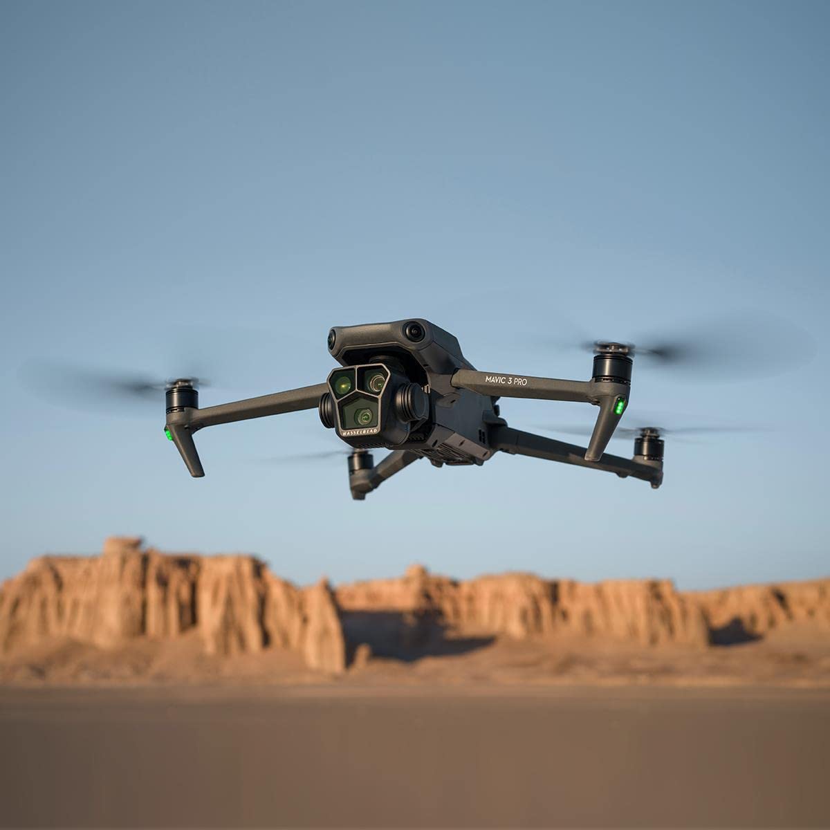
When diving into the world of drones, picking the right one is like choosing a car. You need to consider how you’ll use it. Are you into photography or maybe mapping? Different drones serve different purposes, so understanding your specific needs is crucial. For instance, if you’re into aerial photography, you’ll want a drone with a high-quality camera. On the other hand, you may need one with advanced GPS capabilities for surveying purposes.
Here’s a quick comparison of some popular DJI drones:
Drone Model
Camera Quality
Flight Time
Price Range
DJI Mavic 3 Pro
20 MP
43 mins
$2000-$2,400
DJI Air 2 S
20 MP
45 mins
$1400-$1500
DJI Mini 4 Pro
48 MP
34-45 mins
$750-$1100
Essential Accessories for Drone Operators
Once you’ve acquired your drone, you’ll need accessories to go with it. Extra batteries are essential because flight time is typically limited. Propeller guards can save your drone from damage. A good carrying case will help you transport your drone safely and securely. Don’t forget to consider a decent tablet or smartphone to control your drone and view footage.
Consider these essential accessories:
Extra batteries for extended flying sessions
Propeller guards to prevent damage
A high-quality carrying case
A reliable tablet or smartphone for control
Maintaining and Upgrading Your Equipment
Taking care of your drone is like maintaining a car. Regular check-ups are key. Clean your drone after every flight, especially the camera lens and propellers. Also, monitor software updates, as they can improve performance and add new features.
“A well-maintained drone is a reliable drone. Consistent care ensures longevity and optimal performance.”
Upgrading is another aspect to consider. You may want to consider investing in better cameras or longer-lasting batteries as technology advances. Keeping your equipment up to date ensures you’re always ready for any job.
In conclusion, investing in the right equipment is essential for any drone operator. Each step is vital to your success, from choosing the right drone to maintaining and upgrading your gear.
When flying drones, having the right gear is super important. High-quality equipment can significantly enhance your drone’s performance and help you capture stunning images. If you’re serious about drone flying, check out our website for tips on what to buy and how to get started. Don’t miss out on the chance to elevate your drone game! Visit us at Sky View LV today!
Wrapping It Up: Your Journey to Becoming a Drone Operator
So, you’re thinking about becoming a drone operator, huh? It’s a fascinating field with considerable potential. Whether you’re drawn to the tech side or the creative possibilities, there’s something for everyone. But remember, it’s not just about flying a cool gadget. You’ll need to obtain your Part 107 license, which involves studying and passing the FAA test. And don’t forget about the ever-changing rules and tech updates. It’s a lot to keep up with, but it can be a rewarding career if you’re passionate about it.
Additionally, as the industry grows, numerous opportunities are available. Be prepared to adapt and continue learning. You might be in a high-paying gig or even starting a drone business. The sky’s the limit, literally!
Frequently Asked Questions
Do I need a license to fly a drone?
You don’t need a license to fly a drone for recreational purposes. However, if you want to use it to make money, you need a Remote Pilot Certificate from the FAA.
How can I become a drone pilot?
To become a drone pilot, you must pass the FAA’s aeronautical knowledge test, be at least 16 years old, and be able to read, write, and speak English.
What is the average salary for drone pilots?
The average annual salary for drone pilots in the U.S. is approximately $68,966, though this can vary by experience and industry.
What kind of jobs can drone pilots get?
Drone pilots can work in various fields, including real estate, filmmaking, agriculture, and law enforcement. Some jobs are freelance, while others are full-time.
What equipment do I need to start as a drone operator?
You’ll need a drone, extra batteries, and a high-quality camera. Some jobs might provide this equipment.
Are there any challenges in operating drones?
Challenges include adhering to legal regulations, resolving technical issues, and addressing public privacy concerns.
The drone photography industry is booming, and several companies are leading the way. DJI is probably the most well-known, offering a range of drones for hobbyists and professionals. Parrot and Autel Robotics are well-known names recognized for their innovative designs and cutting-edge technology. These companies constantly push the limits and develop new ways to make drones more user-friendly and versatile. It’s an exciting time to be in the world of drone photography, with numerous options and advancements constantly emerging.
Choosing the Right Drone Photography Company
Factors to consider whenseeking drone photography: there’s a lot to consider, but this isn’t the only factor. You should consider the company’s experience, equipment, and reputation. A reputable drone company should offer high-quality drones and cameras, including those with exceptional imaging performance. To be safe, verify that they have the required licenses and insurance.
Questions to Ask Potential Companies
Before you hire it, it’s wise to ask a few questions. How long have they been in the business? What kind of projects have they worked on before? Can they show you a portfolio of their work? These questions can help you determine if they’re genuine. Don’t forget to ask about their safety measures and what happens if something goes wrong during a shoot.
Evaluating Portfolio and Experience
Taking a company’s portfolio is an excellent way to get to know them. Are their photos what you’re looking for? Have they worked on projects similar to yours? Experience is essential, but so is creativity. You want a company that can bring something unique to the table. A good portfolio will show a range of work, from stunning landscapes to detailed close-ups.
Finding the right drone photography company isn’t just about picking the first one you find. It’s about finding someone who gets your vision and can make it happen.
Innovative Uses of Drone Photography
Capturing Stunning Landscapes
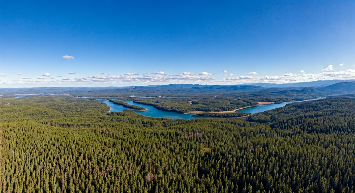
Drones have changed how we see landscapes. They can fly high above mountains, rivers, and forests, providing us with what we couldn’t have before. Aerial shots make landscapes appear like art, revealing details and patterns that are difficult to see from the ground. Drones can hover over a waterfall or glide along a coastline, capturing the beauty of nature in a uniquely stunning way.
Drones can capture events like weddings, concerts, and sports games in a new light. Aerial views add a sense of scale and excitement to event videos and photos. Drones can capture the entire venue, showing how the event is laid out and how the crowd interacts. They can also follow the action, whether a bride walking down the aisle or a runner crossing the finish line, providing dynamic footage that traditional cameras can’t match.
The Art and Science Behind Drone Photography
Mastering Drone Controls for Perfect Shots
Flying isn’t just about pushing a jet sick. It’s like learning to ride a bike; it’s wobbly, and you might crash a few times. But once you get the hang of it, the sky is your playground. Mastering drone controls is key to capturing those breathtaking shots. You need to understand how your drone moves, how it reacts to wind, and what each button on your controller does. Practice makes perfect, so spend time flying in open spaces before heading to more challenging locations.
The Role of Weather and Lighting
Weather and lighting can make or break your drone photography. Imagine planning a shoot only to find it’s too windy or the light is poor. It’s frustrating! Weather conditions such as wind speed and direction can affect the drone’s stability, while lighting determines the mood and clarity of your photos. Early morning or late afternoon often provides the best natural light, giving your images a warm, glowing effect. Always check the weather forecast and plan your shoots accordingly.
Post-Processing Techniques for Aerial Photography, you’ve got your shots, and it isn’t over. Post-processing is where your images indeed come to life. Editing software can help you adjust colors, remove unwanted objects, and sharpen details. Think of it as the digital darkroom. Here are a few steps to consider:
Color Correction: Adjust the white balance and enhance colors to make your images pop.
Cropping: Focus on the most interesting parts of your photo by cropping out distractions.
Sharpening: Enhance the details to ensure your images are crisp and clear.
Drone photography is a blend of art and science, requiring both creative vision and technical skill. It’s not just about flying a drone but using it to capture the world in a way that tells a story.
For more on how drone photography offers unique perspectives, explore how this technology enhances visual storytelling and creativity.
Legal and Ethical Considerations in Drone Photography
Understanding Airspace Regulations
Flying drones isn’t just about capturing stunning views from above; it’s also about understanding the rules that govern the skies. Adhering to regulations is crucial to ensure the safety of others. Many countries have specific laws regarding where and how high you can fly your drone. For instance, maintaining altitude limits and avoiding no-fly zones are standard requirements. It’s essential to stay up to date on these regulations, as they can change frequently.
Respecting Privacy and Property
When flying, it’s easy to forget that you’re not just in the air but also on people’s property. Respecting privacy is a big no. You wouldn’t want someone peeking into your backyard. The same goes for drone pilots. Always be mindful of where your camera is pointed and avoid capturing images in private spaces without permission. This helps you avoid legal trouble and fosters good relations with the community.
Ensuring Safety and Compliance
Safety should always be a top priority when operating a drone. Ensure your equipment is in top condition before each flight. Conduct pre-flight checks, including battery levels and signal strength. It’s also wise to have a checklist to ensure nothing is overlooked. Here’s a simple pre-flight checklist:
Check battery levels
Inspect propellers for damage
Confirm the GPS signal
Verify camera settings
Flying a drone responsibly means being aware of your surroundings and potential risks. It’s not just about getting the perfect shot; it’s about doing so safely and ethically.
Check out drone photography safety guidelines for more information on maintaining safe operations.
Future Trends in Drone Photography
Advancements in Drone Technology
Drones are getting more advanced than ever. They’re not just flying cameras, but are also becoming more innovative and efficient. With AI integration, drones can now make on-the-fly decisions, such as adjusting their path to capture the best shot. This means less manual control and more focus on creativity. Drones are becoming lighter and faster, creating new possibilities for photographers.
Film and TV: Creating dynamic shots that were once impossible.
Potential Challenges and Opportunities
While the future looks bright, there are hurdles to overcome. Regulations are tightening, and pilots need to stay informed about airspace rules. Privacy concerns are also on the rise, with people wary of drones invading their personal space. But these challenges also bring opportunities. Drone photographers who can navigate these issues will stand out. They can offer clients peace of mind by ensuring compliance and protecting privacy.
The drone photography field is constantly evolving, with new tech and ideas emerging all the time. Staying ahead means embracing change and being ready to adapt.
Looking ahead, drone photography is poised to change how we capture images. With new technology, drones will capture higher-quality photos and videos, making it easier to showcase properties and events. Don’t miss out on this exciting trend! Visit our website to learn more about how we can help you with stunning aerial photography.
Wrapping It Up
So, there you have it. Drone photography is like a bird ‘s-eye view without things. It’s a game-changer for capturing those hard-to-reach places and seeing the world from a new angle. Whether you’re snapping shots for fun or trying to get that perfect picture for a project, drones make it all possible. Remember, practice makes perfect, and don’t forget to check the local rules before you fly. Happy snapping!
Frequently Asked Questions
What is drone photography?
Drone photography involves taking pictures or videos from the sky using a flying drone, providing a bird ‘s-eye view of scenes.
Why is drone photography popular?
Drone photography is popular because it captures unique views and angles that are hard to get from the ground. It makes photos and videos look more exciting.
How do I choose a good drone photography company?
To select a reputable company, review its past work, inquire about its experience, and verify that it adheres to safety guidelines. It’s also important to read reviews from other customers.
What can drones photograph?
Drones are highly versatile, capable of capturing images of landscapes, houses for sale, significant events, and even sports games.
Are there any rules for flying drones?
Yes, there are rules. Drone pilots must adhere to airspace regulations to protect individuals’ privacy and safety.
What future changes are expected in drone photography?
In the future, drones may have better cameras and longer flight times. More people and businesses will likely use them for different purposes.
Key Tips for Safe Drone Flights. Flying drones is a blast, but you’ve got to be smart about it. There are rules to follow, spots to choose from, and gear you may need. It’s not just about getting that perfect shot or having fun; it’s about doing it safely. Whether you’re a novice or an experienced pilot, keeping safety in mind makes every flight safer and more enjoyable. Let’s dive into key takeaways for safe drone flights.
Key Takeaways
Stay informed about drone rules and regulations to avoid fines and accidents.
Always select a safe and legal spot to fly your drone, keeping it away from restricted zones.
Use safety gear, such as glasses and controller grips, to ensure a safer, more enjoyable flying experience.
Run through a pre-flight checklist to ensure your drone is in top shape.
Keep your drone within sight and be prepared for emergencies.
Understanding Drone Regulations for Safe Flights
Stay Informed About FAA Guidelines
Flying a drone isn’t just about fun and games; it’s a responsibility. The Federal Aviation Administration (FAA) lays down the rules of the sky. Knowing these guidelines is crucial to keep your flights safe and legal. The FAA’s Part 107 regulations cover everything from altitude restrictions to where you can fly. It’s like the rulebook for drone pilots. Understanding these rules is necessary if you’re flying for fun or commercially. Remember, it’s not just federal laws; local laws matter, too. Each area may have its own rules, so be aware of them.
Know the Altitude Restrictions
Altitude restrictions are a big deal. Generally, you’re supposed to keep your drone below 400 feet. This keeps your drone away from other aircraft, ensuring a safe flight. It’s not just about following rules; it’s about keeping everyone safe. Adhering to key regulations such as these is crucial to a hazard-free experience. Also, be aware of temporary flight restrictions that may be imposed. These may change due to special events or emergencies, so it’s essential to stay up to date.
Obtain Necessary Certifications
Obtaining certification is essential if you’re serious about flying drones, especially for commercial purposes. The Part 107 certification is your ticket to flying legally in commercial settings. It shows you know your stuff when it comes to airspace and safety. Additionally, you may require extra permissions if you’re flying in restricted zones or engaging in unusual activities. It’s all about ensuring you’re prepared and know how to handle your drone.
Flying drones is more than just a hobby; it’s about understanding and respecting the skies. By staying informed and following the rules, you ensure not just your safety but the safety of everyone around you.
Choosing the Right Location for Safe Drone Flights
Avoid Restricted Zones and Airports
Flying a drone isn’t just about picking a cool spot and taking to the skies. Avoiding restricted zones, especially near airports or government facilities, is crucial. These areas have specific rules to ensure everyone’s safety. Using flight planning apps can help you avoid these no-fly zones. They make it easy to see where you can and can’t fly, so you don’t get a hefty fine or worse.
Select Open Spaces for Beginners
If you’re starting, find a large, open area to practice. Think parks or fields with plenty of room to maneuver without the risk of crashing into something. Grass can be a beginner’s best friend since it offers a softer landing if things go sideways. Avoid crowded areas or places with a high concentration of people and animals.
Consider Weather Conditions
Weather can make or break your flying experience. Drones are not well-suited for handling rain or substantial winds, so always check the forecast before heading out. Moisture is a drone’s enemy, and high winds can make control tricky. Weather apps are super handy for this, informing you what to expect. If the weather looks dicey, waiting for a clear day is better.
Essential Safety Gear for Drone Pilots
Proper safety gear is like having a trusty sidekick when piloting a drone. It makes your flights smoother and keeps you and your drone safe. Here’s a look at some must-have gear for every drone enthusiast.
Invest in Quality Safety Glasses
Flying a drone may seem harmless, but hazards such as flying debris and propeller blades can pose significant risks. Safety glasses are crucial—they’re your first line of defense against these hazards. You can choose from:
Impact-resistant glasses: These can handle high-speed debris or accidental hits.
Polarized lenses: Ideal for reducing glare, especially on sunny days.
UV-protected glasses shield the eyes from harmful rays during bright outdoor activities.
Prices range from budget-friendly options, such as the Dewalt Protector, to pricier picks, like the Flying Eyes Golden Eagle Sport Sunglasses. Choosing the right pair depends on your flying conditions and budget.
Use Remote Controller Grips
Have you ever had your controller slip out of your hands mid-flight? It’s not fun. Remote controller grips help prevent accidents by providing a better hold on your controller. Some grips also feature straps for added security, ensuring your controller stays in place even if your hands become sweaty.
Consider Fire-Resistant Battery Bags
Drones run on powerful batteries, and while they’re generally safe, they can be a fire hazard if not handled properly. Fire-resistant battery bags are a simple way to store and transport your batteries safely. They offer peace of mind by containing potential fires and protecting your gear and surroundings.
Remember, each piece of gear plays a role in making your drone flights not only safer but also more enjoyable. Investing in quality safety equipment means you’re serious about flying responsibly. Always gear up and fly smart!
Pre-Flight Checklist for Safe Drone Operations
Inspect the Drone for damage.
Before taking off, thoroughly check your drone. Look over the body, propellers, and camera for signs of wear or damage. Even a tiny crack can lead to big problems mid-flight. If you spot anything unusual, it’s better to fix it before you fly. Don’t forget to check that the registration number is visible and legible.
Calibrate Compass and Check Batteries
Calibration of your drone’s compass is vital for accurate navigation. Ensure this is done before each flight. Also, check that your batteries are fully charged. It’s wise to pack extra batteries, just in case. Firmware updates should also be installed to avoid any glitches.
Verify GPS and Satellite Signals
Before launching, verify that your drone has locked onto a sufficient number of GPS satellites. This ensures stable flight and precise location tracking. Aim for a connection with at least six satellites. Take a moment to ensure your remote control and drone communicate properly.
Proper pre-flight checks are the cornerstone of safe drone operations. By taking the time to prepare and inspect your equipment, you minimize risks and ensure a smoother flight experience.
Quick Pre-Flight Checklist:
Inspect the drone for physical damage.
Calibrate the compass and check battery levels.
Ensure firmware is up-to-date.
Verify GPS and confirm satellite connections.
Check remote control connectivity.
For more detailed steps, consider incorporating elements of effective drone pre-flight planning into your routine.
Maintaining Visual Line of Sight During Flights
Keeping your drone within visual line of sight is crucial for safe, smooth flight. Let’s dive into some key practices.
Avoid Flying Behind Obstacles
One of the first rules of thumb is never to let your drone disappear behind buildings, trees, or large structures. These obstacles can block your view and cause you to lose control. It’s like driving with your eyes closed—not a great idea!
Keep the Drone Within Direct Vision
Always ensure your drone is in direct view. This means you should be able to see it without using binoculars or cameras. Direct vision helps you react quickly to unexpected situations, such as sudden wind gusts or birds becoming too curious.
Monitor Drone Parameters
You should monitor the drone’s parameters displayed on your controller. These include battery life, altitude, and GPS signal strength. If any of these parameters look suspect, it’s time to return the drone.
“Flying a drone is about balance—keeping it in sight ensures you can enjoy the journey without unexpected surprises.”
For those adventurous enough to fly a drone at night, remember that additional precautions, such as position lighting, are required to maintain visibility.
Responding to Emergencies and Accidents
Know How to Shut Off the Power
Knowing how to cut the power quickly is essential when your drone malfunctions. It might sound simple, but even the most straightforward tasks can become a challenge in a panic. Ensure you know where and how to use the power switch. This can prevent further damage to your drone and minimize the risk of harm to people or property.
Report Incidents to Authorities
If something serious happens, such as your drone crashing into a building or injuring someone, it’s essential to notify the authorities. This isn’t just about following the rules—it’s about keeping everyone safe. Record what happened and report it as soon as possible. This helps prevent future incidents and ensures all drone operations stay safe and responsible.
Practice Emergency Procedures
Like in a fire drill, practicing what to do in a drone emergency can make a real difference. Run through emergency scenarios regularly so you’re not caught off guard. This includes knowing how to respond to sudden weather changes or to losing control of your drone. By practicing, you’ll react more quickly and efficiently when something unexpected happens.
“In emergency scenarios, your preparedness can make all the difference. A well-rehearsed plan can turn a potential disaster into a manageable situation.”
Regular Maintenance for Safe Drone Performance
Check for Wear and Tear
Before every flight, inspect your drone for scratches, dents, or loose parts. Regular inspections can prevent accidents. If you notice anything unusual, fix it before flying. A tiny crack can become a big problem in the air.
Ensure All Parts Function Properly
Always double-check that everything is working correctly. The motors, propellers, and camera should all be in top shape. Test the controls to ensure they respond well. If something feels off, it’s better to resolve it on the ground than in the sky.
Store Drone Safely When Not in Use
Don’t just toss your drone in a corner when you’re done flying. Proper storage is key. Please keep it in a safe, dry place, away from dust and moisture. Consider investing in a sturdy case to protect it from bumps and falls. A little care goes a long way in preparing your drone for action.
Taking care of your drone isn’t just about keeping it flying. It’s about making sure every flight is a safe one. Treat it well, and it’ll serve you well.
Regular maintenance is key to keeping your drone flying safely. This involves regularly checking the battery, propellers, and other components. Visit our website for helpful tips and services on caring for your drone!
Wrapping It Up: Safe Drone Flying
Alright, so there you have it. Flying drones is a blast, but safety must be your number-one priority. It’s not just about knowing the rules; it’s also about adhering to them. Monitor the weather, avoid no-fly zones, and keep your safety gear on hand. Remember, a little prep goes a long way. Whether you’re capturing stunning landscapes or just having fun, ensure every flight is safe. So, gear up, plan, and enjoy the skies responsibly. Happy flying!
Whether you are flying for fun or work, get the rules, resources, and tools to help you fly safely. Check out the FAA Drone Resources- FAA Drone Resources
Frequently Asked Questions
What safety gear should every drone pilot have?
Drone pilots should wear safety glasses to protect their eyes, use remote controller grips to improve handling, and store their batteries in fire-resistant bags.
How can I keep my drone safe in adverse weather conditions?
Avoid flying in rain, fog, or strong winds. Before your flight, always check the weather forecast using reliable apps.
What rules should I follow when flying my drone?
Stay up to date on FAA guidelines, keep your drone below the allowed altitude, and avoid flying near airports or restricted areas.
How do I make sure my drone is ready to fly?
Check your drone for damage, ensure the batteries are charged, and calibrate the compass before takeoff.
What should I do if my drone crashes or has an emergency?
Learn how to quickly shut down your drone’s power, report any incidents to the authorities, and regularly practice emergency procedures.
How do I keep my drone in good condition?
You should regularly inspect your drone for wear and tear, ensure all parts are functioning correctly, and store it safely when not in use.
How to Choose the Right Drone Service for Construction Projects. Picking the exemplary drone service for your construction project can be daunting. As drones become a standard tool on construction sites, knowing what to look for when choosing a service is essential. You want to ensure you get the most out of the technology without breaking the bank or facing legal issues. This guide will help you determine what to consider, from drone types to service providers’ experience.
Key Takeaways
Understand the benefits and uses of drones in construction to make informed decisions.
Consider key factors such as experience, cost, and technology when selecting a drone service.
Ensure regulatory compliance and prioritize safety on construction sites.
Integrate drone services seamlessly into existing construction workflows to maximize efficiency.
Stay informed about emerging trends and technologies to stay ahead of the curve with your projects.
Understanding the Role of Drone Services in Construction
Benefits of Using Drones in Construction
Drones are revolutionizing the construction site experience. They provide a bird’s-eye view of the entire project, making it easier to monitor progress and identify potential issues before they become significant problems. Drones also provide real-time data to enhance decision-making, reduce costs, and expedite project timelines. By reducing the need for workers to be in dangerous areas, drones are making construction sites safer.
Quick site surveys without the need for traditional surveying equipment.
Improved safety by minimizing the need for workers to access hazardous areas.
Real-time monitoring and data collection for better project management.
Typical Applications of Drones on Construction Sites
Drones are like the Swiss Army knife of modern construction. They can do a bit of everything:
Site Mapping: Creating detailed maps and 3D models of the construction site.
Progress Tracking: Regular flyovers to capture the current state of the project.
Inspection: Checking hard-to-reach areas, such as rooftops and tall structures.
With drones, you can capture as-built conditions from various angles, which is crucial for enhancing project monitoring and management.
How Drones Enhance Project Efficiency
By integrating drones into construction workflows, companies can streamline processes and reduce wasted time. Drones can cover large areas quickly, providing valuable insights without disrupting on-the-ground work. This results in less downtime and more efficient resource utilization.
With the ability to gather comprehensive data quickly and safely, drones are becoming an indispensable tool in the construction industry. They help teams stay on track and within budget, turning potential setbacks into manageable tasks.
In short, drones are not just an incredible piece of tech; they’re a vital part of modern construction projects, helping to keep everything running smoothly and efficiently.
Evaluating Drone Service Providers
Key Factors to Consider When Choosing a Provider
When searching for the ideal drone service provider, experience is your best ally. You want a team that knows the ropes and has a solid track record in construction projects. Review their portfolio to see if they have experience working on projects similar to yours.
Another consideration is the range of services they offer. Some providers offer aerial photography only, while others provide 3D mapping and thermal imaging. Ensure their capabilities align with your needs.
Remember pricing and packages. It is essential to understand what you’re paying for and whether it fits your budget. Some services may appear inexpensive upfront, but they often have hidden costs, so be sure to read the fine print.
Questions to Ask Potential Drone Service Companies
Before you sign on the dotted line, here are some questions you should ask:
What kind of projects have you completed before? This will give you an idea of their experience and help you determine whether they’re a good fit for your project.
How do you handle data security and privacy? With drones collecting a significant amount of data, you want to ensure the security and safety of your information.
What are your response times and availability? Knowing how quickly they can reach your site and how often they can fly is crucial to planning.
Comparing Costs and Services Offered
When comparing drone service providers, laying out their offerings side by side is helpful. Here’s a simple table to help you compare:
Provider
Services Offered
Cost Estimate
Additional Fees
Company A
Aerial Photography
$700/day
Travel Expenses
Company B
Thermal Imaging, Video Editing
$700/day
Data Processing
Company C
Inspection Services, Surveying
$600/day
Equipment Rental
Choosing the right drone service can make or break your construction project. It’s not just about price, but finding a provider that fits your specific needs and can deliver quality work on time. Make sure you do your homework and ask the right questions.
Assessing Drone Technology and Equipment
Types of Drones Used in Construction
In the construction industry, drones are making a significant impact by providing specialized equipment for specific tasks. Choosing the right drone can significantly impact a project’s success. There are primarily three types of drones used:
Fixed-wing drones are ideal for covering large areas because they can fly longer distances without needing to recharge. They’re often used for surveying large construction sites.
The most common type is the multirotor drone, which is ideal for aerial photography, capturing detailed images and videos. It is also ideal for monitoring progress and inspecting hard-to-reach areas.
Hybrid Drones combine the features of fixed-wing and multirotor drones, offering versatility in range and maneuverability.
Importance of Advanced Drone Features
When picking out a drone, it’s not just about the type; the features matter, too. Advanced features can include GPS precision, obstacle avoidance, and high-resolution cameras. These elements are crucial for aerial photography. Photography quality and accuracy are key. As technology advances, these features become more accessible and affordable.
Evaluating Drone Software and Data Capabilities
The software that runs a drone is just as essential as the hardware. Good software can help plan flights, capture data, and analyze images. Here are some things to consider:
Flight Planning Software: This software helps plan the drone’s path and ensures it covers all required areas.
Data Analysis Tools: Software that processes and interprets drone-collected data is essential for making informed decisions.
Integration Capabilities: Integrating existing construction management systems can streamline workflows and improve efficiency.
In the fast-paced construction industry, keeping up with the latest drone technology and equipment is not just a luxury—it’s a necessity. Choosing the right tools can lead to safer, more efficient projects, saving time and money in the long run.
Ensuring Compliance and Safety Standards
Understanding Regulatory Requirements for Drone Use
Flying drones in construction is not just about getting incredible aerial shots. There are rules—lots of them. Regulations help keep everyone safe and prevent drones from becoming a nuisance or hazard. In the U.S., the Federal Aviation Administration (FAA) is the lead agency for drone regulations. Ensure your drone service provider is knowledgeable and adheres to all applicable guidelines. You don’t want to find out at the last minute that your project has been delayed by overlooked paperwork.
Safety Protocols for Drone Operations on Construction Sites
Safety first, right? Drones can be super helpful, but they also come with risks. To maintain a safe construction site, it is essential to have clear protocols in place. Here’s a quick list to consider:
Pre-flight checks: Ensure all equipment is in top condition before takeoff.
Pilot training: Ensure operators are well-trained and certified.
Emergency procedures: Have a plan in place in case something goes wrong.
These steps help minimize accidents and maintain a smooth workflow.
Insurance and Liability Considerations
Accidents happen, even with the best precautions. That’s why having the right insurance is a must. Verify that the drone service provider has liability insurance to protect against potential mishaps. Knowing what your company’s insurance covers regarding drone operations is also a good idea. You wouldn’t want to be caught off guard if something unexpected were to happen.
Taking the time to understand the compliance and safety aspects of drone use can save you from headaches down the road. It’s about being prepared and proactive.
Integrating Drone Services into Construction Workflows
When adding drones to your construction workflow, the first step is planning and coordination. You can’t simply add a drone and expect it to work. Proper planning ensures that drone operations align with project goals and timelines. Here’s how you can make that happen:
Set clear objectives: Before anything, define what you want to achieve with the drone. Is it for site surveying, progress monitoring, or something else?
Coordinate schedules: Collaborate with your drone service team to schedule flights that minimize disruptions to other site activities.
Communicate with all stakeholders: Ensure that everyone is aware of what to expect from the drone operations.
Training Construction Staff to Work with Drones
Integrating drones isn’t just about the technology; it’s also about the people who will use the data they provide. Training your staff is crucial. They need to understand how to interpret drone data and how it fits into their daily tasks. Consider the following steps:
Identify training needs: Determine which team members need drone operations training.
Provide hands-on training: Let them get familiar with drone technology and data interpretation.
Encourage continuous learning: As drone tech evolves, so should your team’s skills.
Maximizing the Benefits of Drone Data in Project Management
Drones can provide a wealth of data, but it is only valid if you know how to use it effectively. Here’s how to get the most out of the data collected by drones:
Integrate data into existing systems: Ensure it integrates seamlessly with your current project management software.
Utilize data for informed decision-making: Analyze drone data to make informed decisions that enhance project outcomes.
Share insights with stakeholders: Keep everyone informed with regular updates and reports generated from drone data.
Drones are transforming construction progress monitoring by providing aerial views that enhance efficiency, safety, and communication. They enable real-time data collection, allowing project managers to track progress and identify issues quickly. Selecting the right equipment and hiring certified drone pilots are crucial for effective monitoring. As technology advances, drones will continue to play a vital role in modern construction projects.
Case Studies of Successful Drone Service Implementations
Real-World Examples of Drone Use in Construction
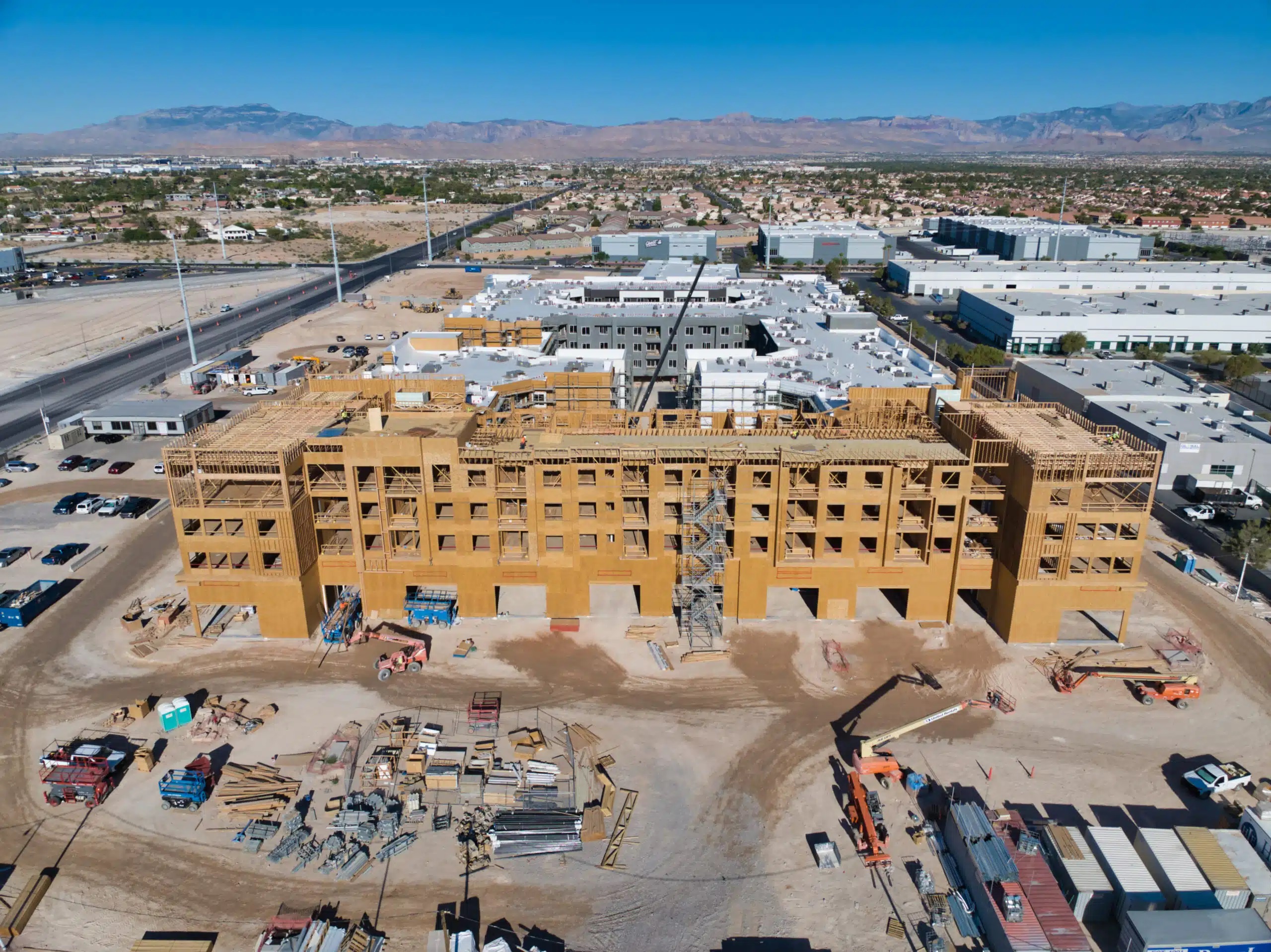
Drones have been game-changers on construction sites. Look at a few real-world examples where drones made a significant difference. A large-scale commercial building was constructed in a bustling city center as part of a single project. Drones were used to conduct regular site surveys, capturing high-resolution images and videos. This meant the project managers could monitor progress without physically navigating the busy site, saving time and resources. Another case involved a highway construction project where drones were used to map the terrain. These aerial views provided engineers with critical data, ensuring accurate planning and execution.
Lessons Learned from Drone Service Projects
Several lessons emerged from these projects. First, having a licensed and insured drone operator is crucial. This ensures regulatory compliance and enhances on-site safety. Second, integrating drone data into project management systems can improve decision-making processes. Lastly, flexibility in drone operations was key. On some days, weather conditions weren’t ideal, and having a backup plan was crucial.
Innovative Applications of Drones in the Industry
Innovation is at the heart of drone technology. In the construction industry, drones are used for more than just site surveys. For instance, thermal-imaging drones detect heat leaks in buildings, thereby improving energy efficiency. Another innovative use is safety inspections. Drones can access hard-to-reach areas, reducing the need for workers to operate in potentially hazardous conditions. This not only reduces risk but also enhances construction site safety protocols.
The integration of drone services into construction projects is reshaping how the industry operates. By providing real-time data and improving safety, drones are not just tools but pivotal partners in construction management.
Future Trends in Drone Services for Construction
Emerging Technologies in Drone Services
Drones are no longer just flying cameras. They’re evolving into sophisticated tools equipped with AI and machine learning capabilities. This means they can analyze data in real time, making informed decisions that affect construction site operations. Imagine drones identifying structural weaknesses or monitoring progress without human intervention. It’s like having an intelligent assistant in the sky.
Predicted Developments in Drone Regulations
Regulations are crucial for drones. As technology advances, so do the rules that govern it. Expect more streamlined approval processes and, potentially, automated systems for flight permissions. This could make it easier for construction companies to integrate drones into their daily operations without getting bogged down in paperwork.
The Growing Impact of Drones on the Construction Industry
The impact of drones on the construction industry is growing rapidly. They’re not just for aerial shots anymore. Drones are becoming increasingly essential for a wide range of applications, from site surveys to safety inspections. As technology improves, their role will continue to expand. Expect them to become a staple in project planning and execution, saving time and reducing costs. Here’s a quick look at some of the key trends:
AI and machine learning integration
Streamlined regulatory processes
Enhanced data analysis capabilities
For more information on how drones are transforming construction, see our comprehensive guide.
Drone services are set to transform the construction industry. Capturing detailed aerial views can enhance project planning and monitoring. If you’re curious about how these advancements can benefit your construction projects, visit our website for more information!
Wrapping It Up
Choosing the right drone service for your construction project isn’t as complicated as it might seem. Just keep in mind what you need. Consider the scope of your project, the type of data you require, and how frequently you’ll need it. Don’t forget to check whether the service has good reviews and is knowledgeable. It’s all about finding the right fit for your project. Once you do, you’ll see how drones can make things much easier and maybe even save you some cash. Happy building!
Drones can help save time and money by providing a bird ‘s-eye view of the construction site. They can quickly survey large areas and collect data to inform project planning and monitoring.
How do drones make construction projects more efficient?
Drones can capture detailed images and videos that help track progress and identify issues early. This enables faster decision-making and reduces the likelihood of delays.
What should I consider when selecting a drone service provider?
Consider the provider’s experience, the types of drones they use, and the services they offer. It’s also essential to check their safety record and customer reviews.
Are there specific regulations governing the use of drones on construction sites?
Yes, aviation authorities have rules that must be followed. These include registering the drone, getting proper permissions, and ensuring its safe operation.
How can drones be integrated into existing construction workflows?
Drones can be used for site surveys, progress tracking, and safety inspections. Coordinating with the drone service team and training staff to use the data effectively is essential.
What are some future trends in drone services for construction?
In the future, drones might be used more for automated tasks and real-time data analysis. Technological advances could also lead to better drones with improved features.
The city of Las Vegas, famous for its casino lights, is also a hub for drone photography. The town offers beautiful landscapes alongside dynamic scenes, making it perfect for aerial and drone photography. Companies specializing in these fields capitalize on this to offer fresh perspectives on cities.
Key Takeaways
Drone photography is ideal in Las Vegas because of its distinctive natural environment. The drone industry in Las Vegas has specialized businesses that serve the city’s busy areas with customized drone services. Your drone photography project in Las Vegas will be handled by experts who understand all local regulations. Drone photography has become a fundamental requirement for both real estate professionals and event organizers in Las Vegas. Las Vegas drone photography is showing promising growth due to advancing drone technology.
Exploring the Las Vegas Drone Photography Scene
The Rise of Drone Photography in Las Vegas
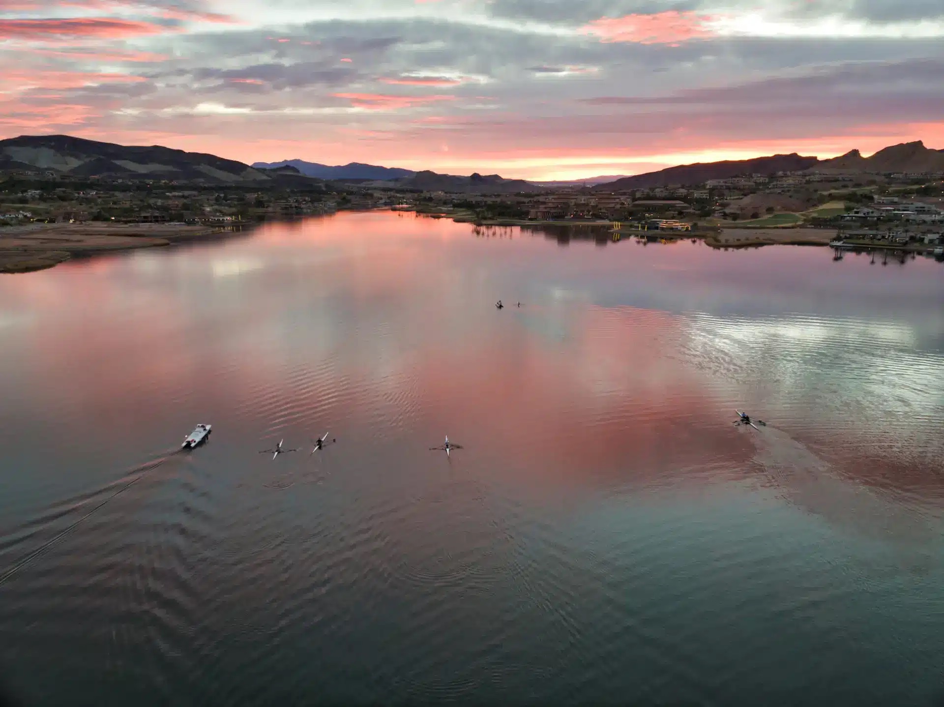
The city of Las Vegas has evolved past its traditional association with casinos and nightlife. Drone photography in Las Vegas has experienced rapid growth over the past few years. The urban-desert combination of Las Vegas makes it an ideal place for photographers to capture aerial views. The growing accessibility of drones, along with declining prices, enables photographers and hobbyists to obtain opinions that were previously unattainable. The Strip’s neon lights and the Mojave Desert’s vast open spaces create endless possibilities for drone photography.
Key Players in the Las Vegas Drone Market
The drone scene in Las Vegas is buzzing, with several companies leading the charge. Sky View LV stands out. They offer a range of services, from real estate to event coverage, and their reputation is built on delivering high-quality aerial footage. Sky View LV is known for its innovative approaches and cutting-edge technology. This company is pushing the boundaries of what drone photography can accomplish in the city.
Innovative Uses of Drones in Las Vegas
The people of Las Vegas utilize drones in innovative ways that no one could have predicted. The cameras capture breathtaking images, while real estate agents use them to showcase properties from unique angles, helping potential buyers better understand the property. Event planners use drones to record weddings and concerts because they provide better views than traditional cameras. Drone technology serves the construction industry and inspection purposes by providing precise aerial imagery that supports planning and safety evaluations.
Why Choose a Las Vegas Drone Photography Company
Benefits of Hiring Local Drone Experts
Selecting a drone photography service based in Las Vegas can transform your project into something exceptional. Local experts, familiar with the area’s unique landscape and lighting conditions, will capture stunning aerial shots for your project. They have knowledge of local regulations, which means you avoid the difficulties of dealing with intricate drone legislation. When you choose a local company, you gain community support and access to its established network of local connections.
Understanding the Las Vegas Landscape
Las Vegas is more than just the Strip. From the stunning Red Rock Canyon to the sprawling desert landscapes, a local drone company captures the essence of the city. They can provide unique perspectives that only a local would know, making your images stand out. Understanding the landscape is crucial for capturing the best shots for real estate, events, or promotional materials.
Client Testimonials and Success Stories
Testimonials from past clients provide significant reassurance for those selecting drone photography companies. Multiple Las Vegas companies share positive testimonials from satisfied clients who praise both their professional approach and high-quality work. The company’s ability to fulfill urgent deadlines and create impressive visuals is typically showcased through its success stories. Review testimonials to learn what to expect when working with a local drone photography service.
Finding a company that meets experience and permit requirements is essential to achieving optimal results. Sky View LV provides professional drone photography services that capture Las Vegas cityscapes from aerial perspectives.
Services Offered by Las Vegas Drone Photography Companies
Aerial Photography and Videography
Las Vegas drone companies specialize in capturing magnificent aerial images by providing perspectives that standard photography equipment cannot achieve. The services deliver exceptional results for displaying both the size and aesthetics of significant properties or events. Professional drones capture images of the famous Strip, expansive desert panoramas, and active events. The drone service offers customizable package options to help clients capture the footage they need for their projects.
Real Estate and Commercial Projects
Drone photography revolutionized the real estate market through its innovative approach. Real estate agents use dynamic presentation methods that showcase a property’s location, layout, and surrounding features. Drones serve dual purposes in commercial projects: monitoring construction progress and serving as marketing tools. These services provide a standard set of features which include:
High-resolution images and videos
360-degree panoramas
Detailed mapping and surveying
Event Coverage and Special Occasions
Drone technology has a dramatic impact on event recording by enabling photographers to capture footage from positions that ground-based operators cannot access. The wedding, concert, and sports event sectors represent only a few of the many areas where drones create a substantial visual impact. Drone hovering capabilities enable complete area coverage by allowing smooth movement between locations, ensuring every critical moment is recorded. Live streaming enables people worldwide to experience events in real time.
The Technology Behind Las Vegas Drone Photography
Advanced Drone Equipment and Features
Drone photography in Las Vegas requires sophisticated technology to capture city views, as it goes beyond basic sky-camera operation. The drone cameras used in Las Vegas capture 4K-resolution images, providing sharp, high-quality visuals for properties and events. Some drones are equipped with thermal imaging functionality, which benefits construction projects and real estate applications.
Safety and Regulations in Drone Operations
The practice of flying drones in Las Vegas is subject to specific rules rather than offering unrestricted access. Every drone operator in the FAA-mandated system needs to adhere to its detailed set of regulations. Before flying, pilots must hold Part 107 certification and understand airspace rules to operate their drones safely. Companies maintain significant insurance policies that protect their clients from potential accidents during operations.
The Role of Editing in Drone Photography
Once the footage is captured, the process continues. The editing process is vital, transforming raw footage into visually stunning output. This process involves adjusting colors and adding music, occasionally incorporating graphical elements such as property boundaries or business symbols. The finished result becomes a refined product that serves as either marketing material or a personal treasure.
How to Select the Right Las Vegas Drone Photography Company
Evaluating Experience and Expertise
When choosing a drone photography service in Las Vegas, consider the company’s experience. Look for providers with a proven track record, as experienced pilots are more likely to capture high-quality images. Experience matters significantly in drone photography, often making the difference between an average and a fantastic shot. Ensure the company has a solid portfolio of past work, preferably across various settings and projects.
Comparing Pricing and Packages
Drone photography services can vary widely in price. It’s essential to compare different packages to understand what you’re getting for your money. Consider what’s included: the number of photos or videos, editing services, and any additional features, such as 360-degree views or aerial maps. Create a list of your needs and budget to help you make a decision. Here is a simple way to compare:
Company
Basic Package
Premium Package
Extras
Company A
$200
$500
360-degree views
Company B
$250
$600
Aerial maps
Company C
$300
$750
Editing services
Checking Certifications and Insurance
Safety and legality are key to drone operations. Ensure that the company you choose has FAA-certified pilots. This certification indicates they are familiar with the rules and regulations governing drone operations. Additionally, verify that they have adequate insurance coverage. This protects you from liability in case something goes wrong during the shoot. A good drone photography company should be transparent about its certifications and insurance policies.
Selecting the right drone photography company in Las Vegas is all about balancing experience, cost, and safety. Don’t rush the decision; take your time to evaluate all aspects carefully.
The Future of Drone Photography in Las Vegas
Emerging Trends in Drone Technology
The rapid pace of technological advancements in drone systems significantly enhances our ability to capture aerial views of the world. The city of Las Vegas leads these technological developments because drones have evolved into advanced devices that serve multiple functions. Current drone technology features advanced, high-resolution cameras with thermal imaging capabilities, along with AI-powered autonomous flight systems that collect data. Technological advancements enable users to capture high-quality images and enhance data collection, thereby improving operational efficiency across multiple sectors.
Expanding Applications in Various Industries
In Las Vegas, drones are finding new roles beyond traditional photography. They are being used in construction, agriculture, and even emergency services. For example, drones are revolutionizing construction project management in Las Vegas, Nevada, making drone photography an essential tool for the industry. This technology enables real-time monitoring of construction sites, ensuring projects stay on schedule and within budget. In agriculture, drones help farmers monitor and manage crops, providing them with precise data to optimize yields.
The Impact of Drones on Las Vegas Tourism
The application of drone technology has substantially increased tourism activity in Las Vegas. Drone technology enables breathtaking aerial views of the Bellagio Fountains alongside Strip landmarks, providing new ways to discover the city. Aerial images produced by drones support both marketing promotions and virtual tour content, drawing visitors from around the world. The development of drone regulations will enable new, creative drone applications that showcase Las Vegas’s dynamic spirit.
Drone photography has revolutionized how people view Las Vegas. The city presents itself as beautiful through its stunning views and distinctive camera angles. Visit our website for additional information and to schedule your session. We want to help you achieve higher-quality photography.
Wrapping It Up
So, there you have it. Las Vegas offers exceptional conditions for drone photography in addition to its famous entertainment districts along the Strip. The drone’s aerial views provide unique perspectives that surpass traditional photography when capturing Bellagio’s architecture and desert landscapes. The city offers numerous experienced operators who tackle any aerial photography assignment. A bird’s-eye view of this vibrant city appeals to everyone because who wouldn’t want to see it from above? The aerial photography team at your service, based in Las Vegas, provides premium aerial photos as needed.
Frequently Asked Questions
What is drone photography?
Drone photography involves capturing images or videos from the sky using a flying camera, commonly called a drone. It’s like having a bird’s-eye view of everything below.
Why are drones popular in Las Vegas?
Las Vegas is full of bright lights and stunning buildings, making it an ideal location for drones to capture amazing pictures and videos from above.
Do I need a license to fly a drone in Las Vegas?
You require a special FAA license to operate a drone for commercial purposes in Las Vegas. This license is essential for safety and regulatory compliance.
What can drones be used for?
Drones can take pictures of houses for sale, film events like weddings, or even help make movies. They’re used for many creative projects.
Are drone services safe?
Yes, drone services are safe when trained pilots adhere to applicable rules and regulations. They carry insurance and follow guidelines to keep everything secure.
Las Vegas Drone Photography Services. Las Vegas isn’t just about bright lights and casinos; it’s also a hotspot for drone photography. With its unique landscapes and vibrant cityscape, capturing aerial views here is truly spectacular. Whether in real estate, construction, or media, drone photography in Las Vegas adds a whole new dimension to how you see and share the world around you.
Key Takeaways
Las Vegas offers unique opportunities for stunning drone photography, thanks to its distinctive cityscape and surrounding desert landscapes.
Drone services in Las Vegas are used across industries such as real estate, construction, and media.
Choosing the best drone service involves considering factors such as certification, experience, and your project’s specific needs.
The latest drone technology and software play a significant role in enhancing the quality of aerial photography.
Hiring professional drone pilots ensures compliance with FAA regulations and access to expert editing and post-production services.
Understanding Las Vegas Drone Photography Services
What Makes Las Vegas Unique for Drone Photography
Las Vegas isn’t just about bright lights and casinos. The city offers a unique blend of urban and natural landscapes, making it a fantastic playground for drone photography. Drones capture everything from the Strip’s glitz to the surrounding desert’s rugged beauty. The city’s skyline, with its iconic hotels and attractions, provides a dramatic backdrop for aerial shots. Plus, the weather is usually on your side, with plenty of sunny days perfect for flying.
Key Benefits of Drone Services in Las Vegas
Drone services in Las Vegas offer several advantages:
Unique Perspectives: Get angles and views that are impossible from the ground.
Cost-Effective: It is significantly less expensive than hiring a helicopter for aerial shots.
Versatility: Useful for various applications, from real estate to events.
With exceptional drone services, businesses can tailor their needs to meet marketing or operational efficiency goals.
Popular Applications of Drone Photography
Drones are being used in Las Vegas for a variety of purposes:
Real Estate: Showcasing properties with stunning aerial views.
Construction: Monitoring progress and inspecting hard-to-reach areas.
Events: Capturing large gatherings or festivals from above.
Las Vegas drone photography is transforming how industries view and utilize aerial imagery, offering innovative solutions across sectors.
Choosing the Right Drone Photography Service in Las Vegas
Factors to Consider When Hiring a Drone Service
When you’re on the hunt for a drone photography service in Las Vegas, there are a few things you need to keep in mind. First, verify whether the company is licensed and insured. This isn’t just a bureaucratic formality; it’s about ensuring your project is in safe hands. You may also want to check if they have experience in the specific type of photography you require, such as real estate, construction, or another field.
Another thing to consider is their portfolio. A quick look at their past work can give you a good idea of what to expect. And don’t forget about the tech. Ask about the types of drones and cameras they use to ensure the desired quality is delivered.
Questions to Ask Potential Drone Operators
Before signing any contracts, it’s wise to ask a few questions. Start by asking about their experience level—how long have they been flying drones? What kinds of projects have they worked on before? It’s also important to ask about their process for handling unforeseen issues, such as bad weather or technical malfunctions.
Don’t hesitate to inquire about their editing capabilities. Some companies offer comprehensive packages that include post-production work, which can be a big plus if you want polished, professional results. Lastly, ask about their turnaround time. Knowing how quickly they can deliver the final product can help you plan your project timeline more effectively.
How to Compare Different Drone Photography Packages
Comparing drone photography packages can be like comparing apples and oranges, but getting the best value is crucial. Begin by reviewing what each package includes. Does it cover just the shooting, or does it also include editing and revisions?
Pricing is another significant factor. While choosing the cheapest option is tempting, remember that you often get what you pay for. Check for hidden costs, such as travel fees or additional overtime charges.
Finally, consider the company’s reputation. A quick online search can reveal reviews and testimonials from previous clients, providing a clearer picture of their reliability and the quality of service.
Choosing the right drone service in Las Vegas is about more than just finding the lowest price. It’s about ensuring you get a team that can deliver the quality and professionalism your project deserves. Take your time to research and ask the right questions, and you’ll be flying high with the best in the business.
Top Industries Utilizing Drone Photography in Las Vegas
Drone photography has become a game-changer for the Las Vegas real estate industry. Using drones, real estate agents can capture breathtaking aerial views that highlight the property and its surroundings. This is especially important in Las Vegas, where location and views can significantly influence property value. Drones provide:
Aerial shots that showcase the property’s layout and landscape
Videos that can offer virtual tours from a bird’s-eye view
Photos that emphasize proximity to important landmarks or amenities
These features help potential buyers gain a comprehensive view of the property, making it easier to visualize what it would be like to live there.
In the construction sector, drones play a crucial role in monitoring project progress and ensuring everything is on track. They offer:
Real-time updates on construction sites
Precise measurements and data collection
Inspection capabilities that improve safety by reducing the need for human presence in hazardous areas
Drones help project managers make informed decisions, keeping projects on schedule and within budget.
Las Vegas is a hub for media and entertainment, and drones enhance production dynamics. They are used to film:
Dramatic aerial shots for movies and TV shows
Live events from unique angles
Music videos that require sweeping, cinematic visuals
Drones add creative flexibility to filming, capturing shots that would be impossible with traditional methods.
In a city that’s always pushing the boundaries of what’s possible, drone photography is not just a tool—it’s a necessity. From real estate to entertainment, drones are redefining how industries operate in Las Vegas.
The Technology Behind Las Vegas Drone Photography
Latest Drone Models and Equipment Used
Las Vegas’s drone scene is buzzing with the latest technology. Cutting-edge drone models are the backbone of aerial photography in this area. These drones feature 4K cameras, GPS stabilization, and obstacle avoidance systems. Some popular models include the DJI Phantom series and the Mavic Pro, known for their reliability and image quality. Las Vegas operators also utilize drones equipped with thermal cameras for specialized tasks, such as roof inspections and energy audits.
Advanced Techniques in Aerial Photography
Aerial photography in Las Vegas isn’t just about flying a drone and snapping pictures. Operators use advanced techniques to capture stunning visuals. Techniques such as panoramic stitching, where multiple images are combined to create a wide-angle view, and HDR imaging, which balances light and dark areas in a photo, are now standard. Drones use automated flight paths to ensure consistent, precise shots, especially on large-scale projects.
The Role of Software in Enhancing Drone Imagery
Software plays a huge role in transforming raw drone footage into breathtaking visuals. Post-production software, such as Adobe Premiere Pro and Final Cut Pro, is essential for editing and enhancing drone imagery. These programs enable color correction, stabilization, and the addition of effects such as slow motion. Mapping software, such as Pix4D, creates 3D models and maps that are invaluable to the construction and real estate industries.
In the heart of Las Vegas, drone technology isn’t just about flashy gadgets; it’s about precision, creativity, and innovation. With the right tools and techniques, drone photography transforms ordinary scenes into extraordinary visions.
Drone shows in Las Vegas exemplify how this technology creates visual spectacles. They capture the city’s vibrant nightlife with stunning aerial shots. For those interested in exploring this further, drone shows in Las Vegas offer a unique perspective on the city’s iconic neon signs and light trails.
Benefits of Hiring Professional Drone Pilots in Las Vegas
New Hotel
Certification and Experience Requirements
Hiring a professional drone pilot in Las Vegas means getting someone who knows their stuff. They hold all necessary certifications, including FAA Part 107, ensuring they can operate drones legally and safely. These pilots have spent countless hours honing their skills, capturing stunning aerial footage that amateurs might struggle to get. You don’t have to worry about the learning curve or the hassle of getting certified.
Safety and Compliance with FAA Regulations
Safety is a significant concern when flying drones, especially in busy airspace such as Las Vegas. Professional pilots are trained to navigate these skies safely and adhere to all FAA regulations. They know how to manage risks and ensure every flight proceeds without incident. This not only keeps everyone safe but also provides you with legal coverage. You won’t have to stress about compliance issues, which can be a headache if you’re unfamiliar with the rules.
Advantages of Professional Editing and Post-Production
Once the drone has done its job, the footage must be polished. Professional drone pilots often offer editing and post-production services that can turn raw footage into a masterpiece. Their experience shines here; they know how to enhance visuals to meet your needs. Whether for a real estate listing or a promotional video, the end product is bound to impress. Plus, you save time and effort by not having to do it yourself.
Case Studies: Successful Drone Photography Projects in Las Vegas
High-Profile Real Estate Shoots
Las Vegas is a hotbed for luxury real estate, and drone photography has become a game-changer in showcasing these properties—one standout project involved capturing aerial views of a high-end residential complex near the Strip. The footage showcased the property’s stunning architecture and expansive grounds, providing potential buyers with a unique perspective. This approach enhances the visual appeal and provides a comprehensive view that traditional photography can’t match.
Major Construction Monitoring Projects
Drones play a pivotal role in project monitoring in the bustling construction sector. A notable example is the use of drones to oversee the development of a new hotel-casino. The project managers utilized drone footage to track progress, identify potential issues, and ensure compliance with safety regulations. This real-time data collection helps keep projects on schedule and within budget, illustrating the practical benefits of drone photography businesses in Las Vegas.
Television and Film Production Highlights
Las Vegas’s vibrant landscape and iconic skyline make it a perfect backdrop for film and television productions. Drones have been used to capture dynamic shots for a popular TV series set in the city. The ability to shoot from diverse angles and heights adds a cinematic quality that traditional methods can’t achieve. This flexibility and creativity in capturing scenes have made drones indispensable in the media industry.
The integration of drone technology in various sectors in Las Vegas showcases not just innovation but also a commitment to enhancing visual storytelling and operational efficiency. As these case studies demonstrate, the sky is truly the limit when it comes to the applications of drone photography in this dynamic city.
Future Trends in Las Vegas Drone Photography Services
Emerging Technologies in Drone Photography
Emerging technologies are reshaping the drone photography landscape. Drones are becoming increasingly advanced, with capabilities including obstacle avoidance, extended flight times, and high-resolution cameras. Innovations such as AI-driven image processing and machine learning improve the quality of aerial imagery. Expect to see more drones equipped with 8K cameras, which provide breathtaking clarity and detail.
Predicted Growth in Drone Service Demand
The demand for drone photography services in Las Vegas is set to skyrocket. As more industries recognize the benefits of aerial imagery, from real estate to construction, the need for skilled drone operators will grow. According to industry experts, the drone services market is expected to double over the next five years, driven by technological advancements and greater accessibility.
Innovations in Drone Usage Across Industries
Drones are finding new applications across various sectors. In real estate, they offer potential buyers unique insights into properties. In construction, drones are used for site surveys and progress monitoring. The media and entertainment industries utilize drones to capture dynamic shots that were previously impossible to achieve. This versatility makes drones an indispensable tool for many businesses.
Las Vegas is not just about casinos and shows; it’s a city embracing technology and innovation. As drone technology continues to advance, the applications and benefits will only expand, making it an exciting time for businesses and photographers alike.
For more insights on the growing popularity of drone photography in Las Vegas, please read our detailed discussion of its diverse applications and tips for capturing stunning aerial images.
Looking ahead, the world of drone photography in Las Vegas is set to soar to new heights. Technological advancements and creative techniques will make capturing stunning aerial views more accessible. Don’t miss out on the chance to elevate your projects with our expert drone services. Visit our website today to learn more and schedule your free consultation!
Wrapping It Up
So, there you have it. Las Vegas isn’t just about the glitz and glamor; it’s also a hub for top-notch drone photography services. Whether in real estate or construction, or just want killer shots for your next project, a drone service here fits the bill. With skilled pilots and cutting-edge tech, these services offer a fresh perspective on capturing the world from above. So, next time you consider getting some aerial shots, remember that Sky View LV has got you covered. It’s not just a gamble; it’s a sure bet for quality and creativity.
Frequently Asked Questions
What kinds of drone services are available in Las Vegas?
In Las Vegas, drone services are available for a range of applications, including real estate, construction, media projects, events, and inspections. These services include capturing high-quality aerial photos and videos.
Why should I hire a professional drone pilot?
Professional drone pilots have the proper certification, experience, and equipment to ensure safe and high-quality results. They handle everything from flying the drone to editing the footage.
Are drone services in Las Vegas expensive?
The cost of drone services varies depending on the project’s size and complexity. Many companies offer various packages to suit different budgets and financial needs.
How do I choose the best drone service that fits my needs?
Consider factors such as the company’s experience, equipment quality, and customer reviews. Asking questions about their past projects can also help.
Is it safe to use drones for photography?
Yes, when operated by certified professionals, drones are safe. They comply with FAA regulations to ensure flight safety.
What are the benefits of drone photography for real estate?
Drone photography provides unique aerial views that can highlight a property’s features, making it more appealing to potential buyers.
Certified Drone Operators: Mastering the Skills. There is strong demand for skilled drone operators across industries, including real estate and aerial photography.
To work commercially with drones in the United States, you need an FAA Part 107 Remote Pilot Certificate. This shows your dedication to professionalism.
You will learn about the equipment you need to get started and discover resources to train and practice your skills.
We will explain the legal requirements, airspace rules, and best practices for safe and lawful drone flying.
Introduction
Drones, also known as unmanned aircraft systems (UAS), are proliferating and becoming increasingly relevant to many industries. This change creates new job opportunities for those who want to be remote pilots. The Federal Aviation Administration (FAA) establishes rules for drone flying to ensure our airspace remains safe. This article serves as your comprehensive guide to obtaining your remote pilot certificate. With this certificate, you can fly drones as a certified operator.
Understanding the Role of Certified Drone Operators
The Importance of Certification in Drone Operations
Obtaining certification is essential for individuals seeking to become professional drone pilots. The FAA’s Remote Pilot Certificate is necessary. It demonstrates that you possess the vital skills and follow safety rules to pass the test on the first attempt.
Having this certification builds trust with clients and employers. It proves you operate drones legally, setting you apart from hobbyist pilots and boosting your credibility. It can also lead to significant job opportunities in the growing drone industry.
Certification also helps you learn about airspace rules, weather conditions, and emergency procedures. This knowledge provides a solid foundation for flying drones safely and responsibly.
Overview of Drone Certification in the United States
In the United States, the FAA’s Rule (Part 107) outlines commercial drone operations regulations while distinguishing those flying drones for recreational purposes. To legally fly a drone commercially under the FAA’s Rule, you must obtain a Remote Pilot Certificate, demonstrating your knowledge of these regulations, operating requirements, and safe drone practices.
The certification process involves passing an aeronautical knowledge test administered by an Airman Certification Representative (ACR) at FAA-approved testing centers. The test assesses your understanding of key topics, including airspace classifications, the effects of weather on operations, emergency procedures, crew resource management, and radio communication protocols.
Certification Type
Description
Remote Pilot Certificate
Required for commercial drone operations in the United States.
Integrated Airman Certification and Rating Application (IACRA)
The online system used to manage pilot certifications, including drone pilot applications.
Getting Started as a Drone Operator in Las Vegas, NV
We will cover what equipment you will need. You will also learn about the airspace rules in and around Las Vegas. This guide will equip you to embark on your drone operations journey with confidence.
Essential Equipment for Aspiring Drone Operators
Before you start flying, getting the right tools for safe and successful drone operations is essential. The exact needs may change based on the drone services you choose. Here’s a checklist of necessary equipment for new drone operators:
Drones: Choose the proper trim, uncrewed aircraft for your needs. Compare different models and their features. Consider factors such as flight time, camera quality, and weight capacity.
Controller: The controller helps you pilot the drone. Learn how it works, ensure it feels good to use, and make it easy to control.
Spare Batteries and Charger: Having extra batteries is essential for extending flight time. A good charger keeps your batteries ready to use.
Maintenance Kit: A solid maintenance kit helps keep your drone running well. Keep spare propellers, cleaning tools, and other necessary items on hand for quick repairs.
Preflight Inspection Checklist: Always do a preflight inspection. Create a checklist of steps to follow and check your drone before each flight. This helps find problems that could affect safety.
Key Resources for Learning and Practice
Becoming a skilled drone operator means more than just having a drone. It takes commitment to learn and improve your skills. Luckily, there are many good resources to help you gain the knowledge and practical experience you need:
Online Courses: Many online sites offer detailed courses. These cover FAA rules, safety tips, and how to fly a drone. You can learn at your own speed and on your own time.
Training Courses: If you prefer a hands-on learning approach, consider in-person training courses. These classes provide guided assistance from experienced drone pilots. You can practice and get helpful feedback.
Flight Simulators: Drone flight simulators let you practice your flying skills safely. You can become familiar with different drone types without risk. These simulations are excellent for learning maneuvers and emergency procedures before flying in real-life situations.
Step-by-Step Guide to Becoming a Certified Drone Operator
Becoming a certified drone operator in the United States is a straightforward process regulated by the Federal Aviation Administration (FAA). Here are the steps you need to follow to complete the FAA Form 8710-13 using the rating application system and get your Remote Pilot Certificate:
First, you need to meet the eligibility criteria. Then, you must pass the required knowledge test. After that, please register your drone. We will cover all these steps to help you quickly earn your drone operator certification.
Step 1: Meeting the Eligibility Criteria
Before you start the certification process, you must check if you meet the FAA’s requirements for getting a drone license. These rules help keep drone operations safe:
Age Requirement: Applicants must be at least 16 years old to apply for a Remote Pilot Certificate. This rule ensures that pilots are mature and responsible.
Language Proficiency: You must be able to read, write, speak, and understand English. This is crucial for effective communication with air traffic control and understanding aviation regulations.
Physical and Mental Fitness: You should be physically and mentally fit to fly a drone safely. If you have any health issues, talk to an Aviation Medical Examiner (AME) to see if they will affect your ability to operate a drone.
Passing the FAA Part 107 knowledge test is crucial for becoming a certified drone pilot. This test checks what you know about drone operations.
Study Materials: There are many study materials to help you get ready for the exam. These include study guides, practice tests, and online courses that provide comprehensive explanations of the test material.
Knowledge Areas: The exam covers airspace rules, the impact of weather on drones, drone balancing and loading, emergency procedures, and radio communication protocols.
Test Format: The knowledge test typically consists of multiple-choice questions. To excel, you must understand drone rules and safe flying practices.
Once you obtain your FAA drone pilot license, the next important step is to register your drone with the FAA. Drone registration is required for all drones that meet specific weight rules:
Weight Rule: Any drone that weighs 0.55 pounds (250 grams) or more must be registered with the FAA. This helps authorities track drones and ensures operators are accountable.
Easy Online Registration: Register your drone on the FAA’s Drone Registration website. The process is simple and requires basic information about you and your drone.
Show Your Registration Number: You will receive a unique registration number after completing registration. You must display this number on the outside of your drone to facilitate easy identification.
Step 4: Passing the Aeronautical Knowledge Test
The aeronautical knowledge test is a crucial step in becoming a certified drone pilot, according to the Airman Certification Standards. This critical test assesses your knowledge of drone operations. It includes rules, safety steps, and practical knowledge.
Scheduling the Test: To take the test, you must schedule an appointment at an FAA-approved Knowledge Testing Center. These centers are easily accessible nationwide.
Test Day Essentials: Be Prepared for the Test Day. Arrive early and bring a government-issued photo ID to verify your identity.
Test Results: You typically receive your results immediately after completing the test. A passing score demonstrates that you possess the knowledge required by the FAA.
Step 5: Applying for FAA Certification
Once you pass the aeronautical knowledge test, you can apply for your Remote Pilot Certificate. The FAA has made this easy with an online system:
Required Information: Please be prepared to share personal details. You will need your FAA Tracking Number (FTN) to complete the registration. You may also be asked questions about your flying experience, if you have any.
Background Check: The FAA will conduct a security background check on all applicants as part of the application process. This helps ensure that only qualified individuals can obtain certification.
Navigating Legal Requirements and Airspace Authorization
To fly a drone safely and legally, you must understand the rules governing airspace and the type of drone you are using. The FAA has different classes of airspace, each with its own rules for operating drones. It’s essential to learn about these classes.
If you want to fly a drone for business, especially near airports or in controlled airspace where manned aircraft operate, you might also need official permission for recreational use. The FAA provides information and guidance on the steps to follow to obtain the necessary permissions.
Understanding Airspace Classes in Las Vegas
Navigating the airspace around Las Vegas, Nevada, is crucial for understanding the FAA’s airspace classifications. These classifications tell you where and how you can legally fly a drone:
Class G Airspace includes most areas outside controlled airspace near smaller airports. Typically, there are fewer rules governing drone operations in this airspace compared to other classes.
Restricted Areas: Certain locations, such as those near military sites or essential infrastructure, are subject to special regulations. You may need permission to fly your drone in that area. Always check Notices to Airmen (NOTAMs) to know about temporary flight limits.
Airspace Authorization: If you want to fly a drone in controlled airspace, you must first get airspace authorization from the FAA. This may involve submitting a request through the FAA’s Drone Airspace Authorization System (DAAS) or using the Low Altitude Authorization and Notification Capability (LAANC) system for expedited authorizations.
The type of approval you need depends on where you plan to fly and what you will do. If your work includes flying beyond your visual line of sight or at night, you may need to request a Part 107 waiver.
The FAA’s website and DroneZone portal offer a range of helpful resources. These resources can help you understand the approval process and ensure your commercial drone flights comply with all relevant rules.
Enhancing Your Skills and Marketability
As the drone industry expands, drone operators must keep improving their skills. Finding opportunities for advanced training helps you deepen your skills and demonstrates your commitment to continuous learning.
Meeting other drone professionals and staying up to date with industry trends can help you learn new skills. It also keeps you up to date on the latest developments in this exciting field.
Advanced Training and Workshops
Consider pursuing advanced training and workshops to enhance your drone operation skills. Many groups and schools offer special programs that focus on these topics:
Aerial Photography and Videography: Learn to capture great aerial photos and videos. Workshops cover camera settings, composition techniques, and post-production editing.
Drone Inspections: Become skilled at aerial inspections in different industries, like infrastructure, construction, and energy. You will learn about inspection methods, data collection, and reporting your findings.
Data Analysis and Mapping: Discover how to use data collected by drones. Training covers photogrammetry, 3D model creation, and data analysis. You will learn to create accurate maps and gain insights from the aerial data.
Networking in the drone industry is vital. It helps you stay up to date, find new opportunities, and connect with other pilots. You might think about joining professional groups and online communities like:
Drone Pilot Association Networks: These groups help you grow professionally, advocate for the needs of pilots, and facilitate networking with other drone pilots. They typically provide resources, training, and updates on industry regulations.
Online Forums and Social Media Groups: Many platforms and groups serve the drone community. They are great places to share ideas, seek help, and connect with other drone enthusiasts.
Local Drone Clubs: Joining local drone clubs allows you to meet in person, fly together, and share knowledge with other pilots near you.
Conclusion
In conclusion, becoming a skilled, certified drone operator is essential to maintaining a professional, legally compliant approach. Obtaining FAA certification allows you to comply with legal requirements, enhance your skills, and increase your attractiveness to employers. Understanding the various airspace classes and securing permission for commercial flights is crucial. These steps help ensure you fly your drone safely and legally. Continue learning, join professional organizations, and stay current with the latest regulations to succeed in this field. If you want to be a certified drone operator in Las Vegas, ensure you have the knowledge, skills, and resources to do well in this exciting industry.
Frequently Asked Questions
What is the first step to becoming a certified drone operator?
Start by learning the FAA’s Rule (Part 107). Ensure you meet the eligibility criteria outlined on the FAA website. You may want to consider taking an online training course to help prepare for the knowledge test.
How long does it take to receive FAA certification?
After you pass the knowledge test and finish the application, getting your FAA certification can take some time. Some people find it helpful to schedule a test date in advance to motivate themselves to study. You may receive your temporary remote pilot certification email promptly. However, the permanent remote pilot certificate usually comes a few weeks later.
Can I operate a drone commercially in Las Vegas without certification?
No. FAA rules require anyone seeking to be a commercial drone pilot in Las Vegas or anywhere in the United States to hold a valid Remote Pilot Certificate.
What are the ongoing requirements for maintaining certification?
FAA rules require certified drone pilots to maintain aeronautical knowledge recency every 24 calendar months. A flight review is not required, but it is essential to keep learning. Staying up to date on rule changes and practicing safe flying habits are critical.
Are there any restrictions on where I can fly my drone in Las Vegas?
Yes, Las Vegas has special rules for its airspace. You should always check for FAA restrictions with apps like B4UFLY. When flying, avoid airports and crowded areas. When working with residential real estate, be mindful of privacy issues.
Las Vegas is not just a city of lights and entertainment; it has also become a hotspot for drone photography. With its stunning landscapes and iconic landmarks, the demand for skilled drone pilots is rising. This article explores the journey of becoming a drone pilot in Las Vegas, covering essential skills, equipment choices, and the exciting opportunities in this growing field.
Key Takeaways
Drone photography is growing fast in Las Vegas.
Being a good drone pilot means knowing how to fly and capture high-quality images.
Choosing the right drone can make a big difference in your photos.
Las Vegas has many amazing places to take drone pictures.
Safety and following the rules are essential for drone pilots.
The Rise of Drone Photography in Las Vegas
Historical Background of Drone Usage
Drone photography has become popular in Las Vegas over the last decade. Initially, drones were primarily used for military purposes, but they now have applications across various fields, including photography. Today, they are a vital tool for capturing stunning city images.
Impact on the Photography Industry
The introduction of drones has changed the way photographers work. Here are some key impacts:
New Perspectives: Drones enable photographers to capture images from angles previously impossible.
Cost-Effective: Using drones can be cheaper than hiring helicopters for aerial shots.
Accessibility: More people, not just professionals, can now take aerial photos.
Legal Considerations for Drone Pilots
Before flying a drone in Las Vegas, pilots must understand the laws. Here are some essential points:
Registration: Drones weighing more than a certain threshold must be registered with the FAA.
Airspace Restrictions: Las Vegas has areas where flying is prohibited, especially near airports.
Privacy Laws: Pilots must respect individuals’ privacy and refrain from photographing individuals without their permission.
Being a drone pilot in Las Vegas comes with unique challenges. Pilots must navigate strict regulations, restricted airspace, and extreme weather. However, those who master these hurdles can create breathtaking aerial footage that showcases the city’s beauty. Aspiring pilots should learn about local laws to fly safely and effectively.
Essential Skills for a Drone Pilot
Technical Proficiency in Drone Operation
To be a successful drone pilot in Las Vegas, you must be skilled in operating drones. This includes:
Understanding how to control the drone in various conditions.
Knowing how to troubleshoot common issues.
Being familiar with different types of drones and their features.
Composing shots to highlight the beauty of Las Vegas.
Using editing software to enhance images after the shoot.
Knowledge of Local Regulations
It’s crucial to know the rules for flying drones in your area. Important regulations include:
Obtaining an FAA remote pilot license.
Understanding airspace restrictions in Las Vegas.
Following local laws to ensure safe and legal flying.
Being a drone pilot is not just about flying; it’s about combining technical skills with creativity and responsibility.
In summary, the skills needed to be a drone pilot in Las Vegas include technical operation, photography techniques, and knowledge of regulations. These skills help ensure pilots can capture breathtaking aerial footage while flying safely and legally.
Choosing the Right Drone for Photography
Factors to Consider When Selecting a Drone
When picking a drone for photography, there are several important factors to keep in mind:
Camera Quality: Look for drones with high-resolution cameras to capture stunning images.
Flight Time: Longer battery life means more time to shoot without interruptions.
Ease of Use: Choose a user-friendly drone, especially if you are a beginner.
Seven Magic Mountains: These stone sculptures are works of art intended for your visual enjoyment
Challenges of Urban Drone Flying
Flying a drone in a busy city like Las Vegas can be tricky. Here are some challenges you might face:
Air Traffic: Be aware of other aircraft in the area.
Crowds: Avoid flying over large groups of people.
Regulations: Follow applicable local laws to ensure safety and compliance.
Tips for Capturing Iconic Las Vegas Landmarks
To get the best shots of Las Vegas, consider these tips:
Plan Your Flight: Know when and where to fly for optimal lighting.
Use the Right Settings: Adjust your camera settings for clear images.
Be Respectful: Always respect privacy and property rights.
Hiring a professional drone pilot in Las Vegas allows you to capture the city’s beauty from above. Experienced pilots provide high-quality aerial footage for various industries, including real estate and construction, ensuring safety and compliance while delivering stunning visuals.
Building a Career as a Drone Pilot in Las Vegas
Networking Opportunities for Drone Pilots
Building connections is key in the drone photography world. Here are some ways to network effectively:
Join local drone clubs to meet other pilots.
Attend photography expos and trade shows.
Participate in online forums and social media groups.
Marketing Your Drone Photography Services
You must effectively promote your services to stand out in a crowded market. Consider these strategies:
Create a professional website showcasing your work.
Use social media to share your photos and connect with potential clients.
Offer special deals for first-time customers to attract business.
Continuing Education and Certification
Staying up to date is essential in this fast-changing field. Here are some steps to keep learning:
Enroll in training programs to improve your skills.
Prepare for the Part 107 exam to become a certified pilot.
Take advanced courses to learn new techniques and stay competitive.
The demand for certified drone pilots is growing, especially in fields like real estate and event coverage. Continuous skill development is essential for success in this exciting career.
Safety and Ethics in Drone Photography
Ensuring Safety During Drone Flights
When flying drones, safety is the top priority. Here are some key points to remember:
Always check the weather before flying.
Keep your drone in sight at all times.
Avoid flying near airports or crowded areas.
Following these rules helps prevent accidents.
Respecting Privacy and Property
Drone pilots must be aware of privacy issues. Here are some essential guidelines:
Do not fly over private property without permission.
Avoid capturing images of people without their consent.
Be mindful of local privacy laws.
Adhering to Ethical Guidelines
Ethics in drone photography is crucial. Here are some ethical practices:
Always be honest about your work.
Respect the environment and wildlife.
Share your images responsibly and give credit where it’s due.
Being a responsible drone pilot means understanding the impact of your actions.
In Las Vegas, professional drone services prioritize safety and quality. Companies like Sky View LV ensure their pilots are FAA-certified and follow strict operational guidelines. This commitment to safety helps manage risks and provides clients with peace of mind.
Future Trends in Drone Photography
Technological Advancements in Drones
The world of drone photography is changing fast. New technology is making drones smarter and easier to use. Some exciting advancements include:
Improved battery life, allowing for longer flights.
Better cameras that capture high-quality images and videos.
Advanced sensors that help drones avoid obstacles.
Emerging Markets for Drone Photography
As drone technology advances, new markets are emerging. Here are some areas where drone photography is becoming popular:
Real estate, where aerial views help sell properties.
Events like weddings and concerts capture unique angles.
Environmental monitoring, such as tracking wildlife and protecting ecosystems.
Predictions for the Industry in Las Vegas
Las Vegas is a unique place for drone photography. Experts believe that:
More people will start using drones for personal and business purposes.
Regulations will become more precise, making it easier for pilots to operate.
The demand for drone photography services will continue to grow, particularly in the tourism and entertainment sectors.
The future of drone photography looks bright, with endless possibilities for creativity and innovation.
As we look ahead, drone photography is set to change how we capture images. With new technology, drones will capture higher-quality photos and videos, making it easier to showcase beautiful places and events. To stay updated on these exciting changes, visit our website for more information!
Conclusion
In conclusion, being a drone photography pilot in Las Vegas is an exciting job that combines technology and creativity. With the stunning views of the city and its surroundings, pilots can capture incredible images that tell a story. As more people discover the beauty of drone photography, demand for skilled pilots will continue to grow. Whether you are a beginner or an expert, this field offers many opportunities to explore and express your artistic side. So, if you love photography and flying drones, Las Vegas might be the perfect place to start your journey.
Frequently Asked Questions
What is drone photography?
Drone photography involves capturing images from the sky using a drone, a small, remotely controlled aircraft.
Do I need a license to fly a drone in Las Vegas?
To fly a drone commercially in Las Vegas, you need a Remote Pilot Certificate from the FAA.
What are some good places to take drone photos in Las Vegas?
Some great spots include the Las Vegas Strip, Red Rock Canyon, and the Hoover Dam, but always check local rules first.
How much does a good drone for photography cost?
Depending on the features you want, a decent drone for photography can cost anywhere from $300 to over $1,000.
What skills do I need to be a successful drone pilot?
You should be able to operate the drone, capture high-quality aerial photos, and comply with drone laws.
Are there any ethical concerns when using drones for photography?
Respecting people’s privacy and not flying over private property without permission is essential.
Capture stunning aerial perspectives with professional drone photography.
Elevate your business with high-quality aerial images and videos.
Understand the technical aspects and legal considerations.
Explore various applications in real estate, events, and more.
Partner with a reputable drone photography company for exceptional results.
Introduction
In today’s world, where visuals are crucial, businesses continually seek new ways to capture attention. This is where drone services come in. Professional drone photography uniquely mixes art and technology. It provides stunning aerial photos that enhance brands and create lasting memories.
Exploring the World of Drone Photography
Drone photography has changed how we see the world from above. In the past, capturing high-quality aerial shots was expensive and complex. Now, anyone can access these beautiful views, which were once only featured in Hollywood films.
Drones are fast, can maneuver in tight spaces, and can fly high above buildings. This helps them capture compelling angles and present information in a new way. This technology enables businesses to enhance their marketing, gather valuable insights, and uncover innovative, creative ideas.
The Rising Popularity of Aerial Imaging
Aerial imaging has quickly become very popular. It has changed how we see and connect with our world. Drones show stunning views, from beautiful landscapes to impressive buildings. This unique perspective grabs people’s attention.
Social media has significantly helped by enabling drone enthusiasts and experts to share high-quality aerial photos and videos with a broader audience. These fantastic images have created a demand for new views. This pushes businesses and individuals to explore the many possibilities of drone technology.
His niche hobby has now turned into a valuable tool. It supports storytelling, marketing, data collection, and more. Aerial imaging is now an integral part of how we perceive the world.
Professional drone photography companies offer a range of unique services tailored to meet various needs. If you’re a realtor looking to showcase a beautiful property or an event planner seeking to capture a grand event, drones can help.
Here are some standard drone photography services:
Real estate photography: Show properties from exciting angles, highlighting special features.
Construction progress monitoring: Track construction projects and provide important information to stakeholders.
Event videography services: Capture the fun and excitement of weddings, concerts, and business events.
Businesses can utilize new technology and creative skills when collaborating with a reputable drone photography company. This helps create strong visuals that enhance their brand and attract their target audience.
The Technical Side of Drone Photography
Every stunning drone photo combines technical skill and artistic vision. To achieve great results, you need to understand the details of drone equipment and the factors that affect image quality.
Choosing the correct camera settings and learning to control the drone well are essential. Technical knowledge and creativity combine to provide stunning aerial views that make a lasting impression.
Understanding Drone Equipment and Technology
Modern drone technology has undergone significant improvements. It now offers intelligent features that help photographers take high-quality aerial imagery. Drones have high-resolution cameras, strong gimbals for stability, and intelligent flight modes. These tools give excellent control and accuracy.
Many top aerial systems feature interchangeable lenses, allowing photographers to capture a wide range of shots from different angles. Understanding which drone tools can and cannot do can help you choose the right gear for your project and achieve the best image quality.
Additionally, staying up to date on the latest developments in drone technology is crucial. The drone market is constantly evolving, and drone builders continually find new ways to innovate. Photographers who utilize these new tools can gain a competitive edge and explore even more creative possibilities.
Key Factors in Achieving High-Quality Drone Photos
Capturing high-quality aerial photos requires a combination of skills, creativity, and environmental awareness. The drone must be reliable, but the camera operator is crucial for capturing high-quality images.
Understanding how light works, how wind moves, and how light and shadow interact are essential to creating beautiful images. A talented camera operator can transform ordinary scenes into stunning aerial photos.
Post-processing, or editing photos, is also significant for better drone photography. Adjusting the color balance, contrast, and sharpness can enhance the appearance of aerial photos, making each shot even more appealing and creating eye-catching images.
Drone Photography in Action
The ways we can use drone photography are almost endless. It changes how businesses operate. In real estate, construction, farming, and even filmmaking, drone photography provides valuable insights and opens up creative opportunities we could not have imagined before.
Let’s explore some innovative ways to utilize drone photography. We can also see how companies can benefit from using this innovative technology in their operations.
Highlighting Unique Use Cases for Drone Photography
Drone photography is changing many industries, not just aerial projects. For instance, real estate drone photography is changing how homes are marketed. It provides buyers with a detailed view of properties and surrounding areas.
Golf course management also uses drone technology. Managers can use drones to inspect courses, identify areas for improvement, monitor renovations, and create promotional videos that showcase the course’s beauty and challenges.
Drones can provide new perspectives in various fields. Archaeologists can record excavation sites with great accuracy. Environmental scientists can monitor wildlife in remote areas. Filmmakers can create stunning aerial footage that takes viewers to exciting new places. The options are endless.
How Businesses Benefit from Aerial Imagery
In today’s challenging business world, standing out is crucial. Aerial drone images can help businesses expand their brand and enhance their marketing efforts, providing a competitive advantage.
Marketing videos that showcase properties from unique angles are viral in the commercial real estate industry. These videos enable buyers to view the property from different angles, highlight its key features, and showcase what it offers.
Many businesses across various industries also use drone photography and videos on their websites, social media, and marketing materials. This high-quality imagery impresses viewers and demonstrates a business’s professionalism and innovation. This helps improve their brand image and attract more customers.
Setting Up Your Drone Photography Session
Starting a drone photography session requires good planning and preparation. This helps to ensure a lovely and successful shoot. You should also consider the legal requirements and select the appropriate equipment. Paying attention to these critical points will help you get great results.
Here are some essential tips and tricks for preparing for a drone shoot. We will also discuss safety and legal steps in the United States.
Preparing for a Drone Shoot: Tips and Tricks
A well-planned drone shoot can help you take amazing aerial photos. Before flying, prioritize safety and ensure you have the right gear.
First, select a skilled, experienced drone pilot. They will keep things safe and follow the rules. Check the drone’s battery life and bring extra batteries to prevent delays during the shoot.
Look at the location before the shoot. This helps you identify the best angles and understand potential risks or trouble spots. Good communication with the drone pilot about your ideas for the shoot will help create a great experience and lead to satisfying results.
Safety and Legal Considerations in the United States
Operating drones in the United States requires compliance with strict safety and legal requirements set by the Federal Aviation Administration (FAA). Before flying a drone for commercial purposes, obtaining a Part 107 certification is mandatory.
Regulation
Description
Part 107 Certification
Required for commercial drone pilots; covers airspace regulations, weather conditions.
Registration
All drones weighing over 0.55 pounds need to be registered with the FAA.
Airspace Authorizations
Obtain permission before flying in restricted airspace near airports or other sensitive locations.
Adhering to these regulations ensures the safe integration of drones into the national airspace and minimizes the risk of accidents. Always prioritize safety and stay informed about the latest FAA guidelines before every drone flight.
Conclusion
Drone photography provides an excellent way to capture stunning aerial images. New technology and methods have changed how we see things and tell stories. Drone services offer numerous options for real estate, event planning, and exceptional visuals. Knowing the technical details and legal rules is essential to ensure your projects are safe and look great. Enhance your visuals with professional drone photography services tailored to your needs and ideas. Discover the world from a different angle – the sky is not the limit; it’s just the start.
Frequently Asked Questions
What are the best drones for photography in 2025?
Choosing the “best” drone depends on what you need and how much you want to spend. A high-quality camera, long flight time, and intelligent flying modes are essential. It’s a good idea to talk to a drone service company. They have experienced pilots and technical skills to help you find the suitable ones.
How do I choose a drone photography company?
Look for professional drone services with a proven track record of success.
Check for experience and high-quality drone videos.
Client testimonials are also important.
Video production companies that offer exceptional experiences and outstanding customer service will help your project succeed smoothly.
Can drone photography help in real estate marketing?
Real estate drone photography is an effective way to enhance marketing. It offers stunning aerial drone shots, showcasing properties from angles that can’t be captured from the ground. This provides potential buyers with a new perspective, increasing their interest in the listings.
Are there any privacy concerns with drone photography?
Privacy concerns about drone aerial photos are essential. In the United States, it is best not to take pictures of people on private property without their permission.
Las Vegas Aerial Photography- The View From Above. Las Vegas is renowned for its vibrant lights and breathtaking views. Aerial photography captures the beauty of this lively city from above. With drones and cameras, we can see Las Vegas in a new way. This article will examine Las Vegas aerial photography, including its techniques, challenges, and impact on the tourism industry.
Key Takeaways
Aerial photography uniquely shows Las Vegas, highlighting its famous lights and landmarks.
Using the right equipment and skills is crucial for capturing exceptional aerial photos.
Drones have revolutionized the way we capture images from above, making it easier and more accessible.
Weather and safety rules can make aerial photography challenging in Las Vegas.
Stunning aerial photos can attract more tourists and help promote the city.
The Allure of Las Vegas Aerial Photography
Las Vegas is known for its bright lights and stunning views; aerial photography captures this beauty like no other. The city’s vibrant skyline and famous landmarks look even more impressive from above. Here are some reasons why aerial shots are so unique:
Capturing the Neon Lights
The bright neon lights of the Strip create a magical scene at night.
Aerial views reveal how the lights illuminate the city.
Photographers can capture unique patterns and colors that are often invisible from the ground.
The Unique Perspective of the Strip
From above, the Strip’s layout reveals its grandeur.
You can see how the hotels and casinos are arranged, creating a stunning visual.
This perspective highlights the scale of the attractions.
Aerial images can showcase the city’s beauty in ways that ground-level photos cannot.
These shots often attract more attention on social media, making them popular among both tourists and photographers.
Aerial photography not only captures the beauty of Las Vegas but also tells a story about the city’s vibrant life and energy.
Techniques for Stunning Aerial Shots
Choosing the Right Equipment
To capture breathtaking aerial photos, selecting the right gear is essential. Here are some key points to consider:
Camera Quality: A high-resolution camera produces more detailed images.
Drone Type: Choose a drone that fits your needs for professional or hobbyist use.
Stabilization: Opt for drones with robust stabilization to minimize camera shake.
Mastering Drone Navigation
Navigating your drone effectively is crucial for great shots. Here are some tips:
Practice: Fly your drone in open areas to become comfortable.
Understand Controls: Familiarize yourself with the controls and settings to ensure optimal performance.
Plan Your Flight Path: Before takeoff, determine your destination and objectives.
Timing for Perfect Lighting
Lighting can make or break your aerial photos. Here’s how to get the best light:
Golden Hour: Shoot during the early morning or late afternoon for soft, warm light.
Avoid Harsh Midday Sun: Its brightness can create unwanted shadows.
Check Weather Conditions: Clear skies are ideal, but some clouds can add drama to your shots.
Aerial photography is not just about the equipment; it’s about understanding the environment and how to use it to your advantage. Use leading lines in your compositions to guide the viewer’s eye and add depth to your images.
By mastering these techniques, you can elevate your aerial photography and capture stunning views of Las Vegas from above.
Iconic Landmarks from Above
The Majestic Bellagio Fountains
The Bellagio Fountains are a must-see from the sky. These stunning water displays dance to music and lights, creating a magical scene. As shown above, you can see the intricate patterns in the water and how they interact with the surrounding gardens. The fountains are not just beautiful; they symbolize Las Vegas’s charm.
A Bird’s Eye View of the Eiffel Tower
The Eiffel Tower replica in Las Vegas offers a unique perspective when viewed from above. Standing at half the height of the original, it still captures the essence of Paris. Aerial shots reveal the tower’s intricate design and its seamless integration into the Las Vegas skyline. The surrounding area, with its vibrant colors and bustling activity, enhances the landmark’s appeal.
Exploring the Luxor Pyramid
The Luxor Pyramid is another iconic structure that looks amazing from the air. Its unique shape and the bright beam of light that shoots from its top are visible from miles away. Aerial photography captures the pyramid’s grandeur and place in the Las Vegas landscape. The contrast between the pyramid and the modern buildings around it creates a striking visual.
Aerial photography allows us to appreciate the beauty of Las Vegas landmarks in a way that ground-level views cannot. The unique angles and perspectives reveal details that are often missed, making each shot a work of art.
Landmark
Height (ft)
Unique Feature
Bellagio Fountains
N/A
Water shows synchronized to music
Eiffel Tower
540
The half-scale replica of the original
Luxor Pyramid
350
Distinctive triangular shape
In conclusion, capturing these iconic landmarks from above not only showcases their beauty but also highlights their significance in the vibrant tapestry of Las Vegas.
Challenges in Las Vegas Aerial Photography
Navigating Airspace Regulations
Flying drones in Las Vegas can be challenging due to the strict airspace regulations. Pilots must know where they can and cannot fly. Here are some key points to consider:
Restricted Areas: Certain areas, such as those near airports, have specific restrictions.
Local Laws: Always check local laws before flying.
Dealing with Weather Conditions
The weather in Las Vegas can change quickly, affecting aerial photography. Here are some common weather challenges:
High Winds: Strong winds can make flying difficult.
Heat: The heat can affect drone performance.
Rain: Wet weather can ruin a shoot.
Ensuring Safety and Privacy
Safety is a big concern when taking aerial photos. Here are some essential safety tips:
Avoid Crowds: Avoid large groups of people.
Respect Privacy: Don’t take pictures of private properties without permission.
Check Equipment: Always ensure your drone is in good working order.
Aerial photography in Las Vegas is not just about capturing stunning views; it also involves overcoming various challenges to ensure safety and compliance. Sky View LV specializes in this field, expertly navigating issues like intense winds and restricted airspace to showcase the city’s vibrant architecture and nightlife from unique perspectives.
By understanding these challenges, photographers can better prepare for successful aerial shoots in this exciting city.
The Impact of Aerial Photography on Tourism
Attracting Visitors with Stunning Visuals
Aerial photography plays a huge role in drawing tourists to Las Vegas. The breathtaking views above highlight the city’s unique attractions, making them irresistible to potential visitors. Here are some key points:
Eye-catching images of the Strip and its neon lights.
Unique perspectives of famous landmarks.
Engaging visuals for social media sharing.
Enhancing Travel Marketing Campaigns
Travel companies use aerial shots to promote Las Vegas. These images help create exciting advertisements that grab attention. Some benefits include:
Increased engagement on social media platforms.
Better storytelling through visuals.
Showcasing the city’s beauty in a new light.
Creating Memorable Experiences
Aerial photography attracts visitors and enhances their experiences. Tourists often seek out aerial tours to view the city from a unique perspective.
Aerial photography offers a fresh view of Las Vegas, making it a must-see destination for travelers.
In summary, aerial photography significantly impacts tourism by showcasing the city’s beauty, enhancing marketing efforts, and providing unforgettable experiences for visitors. It has transformed how people view and connect with Las Vegas, making it a vibrant and exciting place to explore.
Future Trends in Aerial Photography
Advancements in Drone Technology
The future of Las Vegas aerial photography is bright, thanks to new technology. Drones are getting better every day. They are now lighter, faster, and can fly longer distances. This means photographers can capture more stunning images from above. Some key advancements include:
Electric drones are quieter and more eco-friendly.
Drones are equipped with AI for better image processing.
Improved battery life for longer flights.
The Rise of Virtual Reality Tours
Virtual reality (VR) is transforming the way we experience places. With aerial photography, VR can take you on a tour of Las Vegas without leaving your home. This technology allows:
Immersive experiences that make you feel as though you are genuinely there.
The ability to explore places that are hard to reach.
Enhanced marketing for businesses, attracting more visitors.
Sustainability in Aerial Practices
As we look to the future, sustainability is becoming more critical. Photographers are finding ways to minimize their environmental impact. Some practices include:
Using solar-powered drones.
Following strict guidelines to protect wildlife.
Choosing eco-friendly materials for equipment.
The future of aerial photography in Las Vegas is not just about capturing beautiful images; it’s also about making sure we protect our planet while doing it.
With these trends, the world of aerial photography is evolving, making it more exciting and accessible for everyone!
As we look ahead, aerial photography is set to evolve in exciting ways. With advancements in drone technology, we can expect even more explicit images and more creative angles. This means better storytelling for real estate, events, and more. Don’t miss out on the future of photography! Visit our website to learn how we can help you capture stunning aerial views today!
Conclusion
In conclusion, aerial photography in Las Vegas provides a unique and striking perspective on this vibrant city. From the bright lights of the Strip to the natural beauty of the surrounding desert, capturing images from above reveals details that are often missed from the ground. Whether you’re a professional photographer or just someone who enjoys taking pictures, flying high above Las Vegas can inspire creativity and provide unforgettable views. So next time you’re in the area, consider looking at the city from a new angle—it might change how you see it!
Frequently Asked Questions
What is aerial photography?
Aerial photography captures images from above, typically using a drone or an airplane. It helps capture amazing views that you can’t see from the ground.
How do drones work for photography?
Drones are small, unmanned aircraft that can carry cameras. They can fly high in the sky and take pictures or videos from different angles.
Is it legal to take aerial photos in Las Vegas?
Yes, but there are rules. You must comply with local laws and regulations governing drone operations, particularly in areas with high traffic volumes.
What are the best times to take aerial photos in Las Vegas?
The best times are early in the morning or late in the afternoon. The light is softer, making the pictures look nice.
Can I hire someone to do drone photography for me?
Absolutely! Many photographers specialize in aerial shots and can help you capture the perfect view.
What landmarks can I see from the air in Las Vegas?
You can see famous landmarks such as the Bellagio Fountains, the Eiffel Tower, and the Luxor Pyramid from the sky.